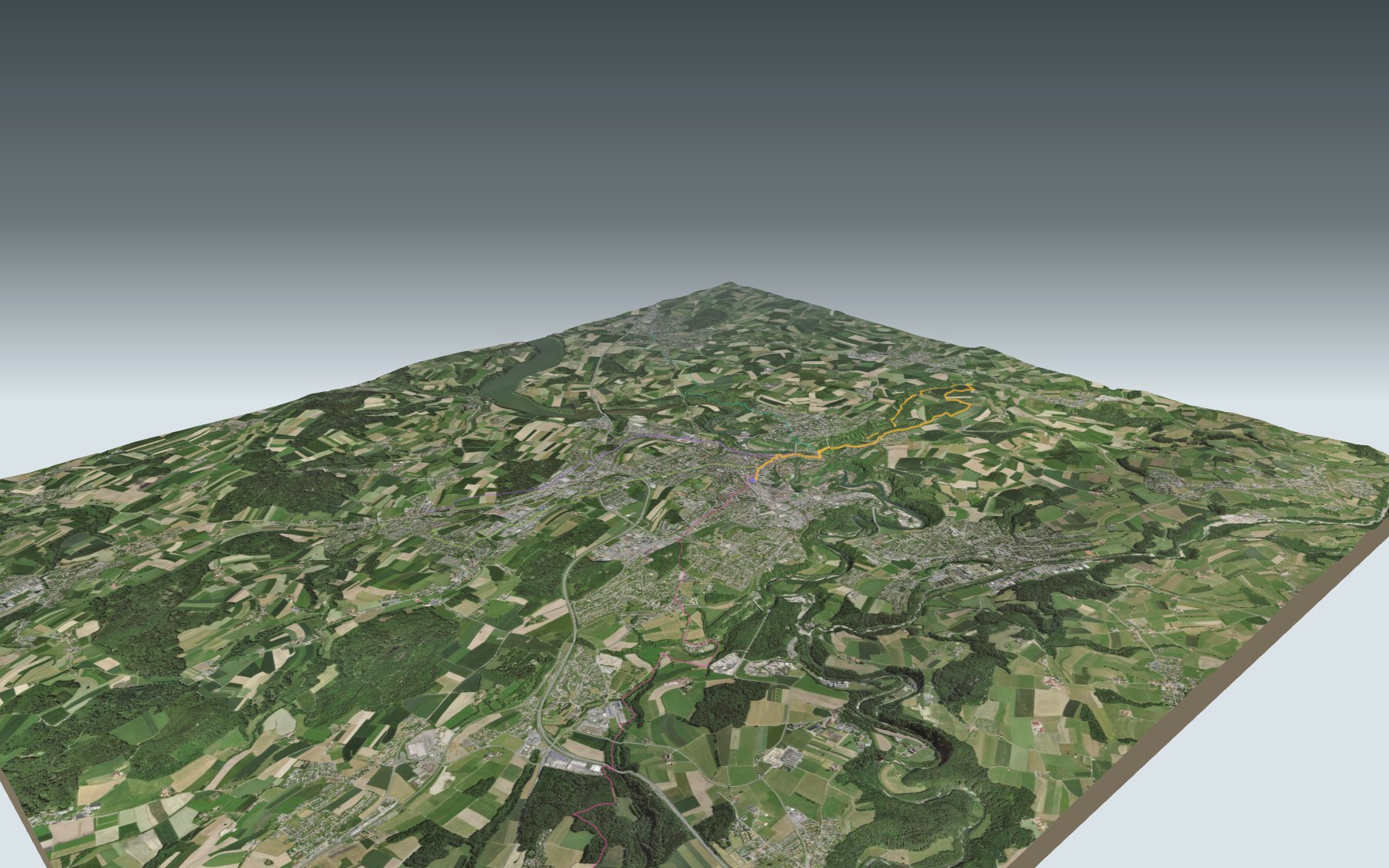

The Gottéron gorge, a short walk from the old town
A hike that starts in town: you leave Fribourg station, cross the old town and head down to the Sarine. Then you follow the Gottéron valley upstream, a wooded gorge between sandstone (molasse) cliffs, before coming back across the fields and through Bourguillon. The route is rated easy on technique and medium on fitness.
The path goes past St. Nicholas Cathedral, down the Stalden and across the Sarine on the Bern Bridge, the old covered wooden bridge. It follows the stream to the old Ameismühle mill, climbs to Schürmatt farm and returns over the high ground. The elevation profile shows you where it climbs.
The way back runs through Bourguillon, with its pilgrimage chapel, and past the Dürrenbühl Tower before you cross the Bern Bridge again. Before you set off, check on the Tafers (Tavel) municipality website whether the valley is open: in 2014 it was described as regularly threatened by rockfall.
For food, there's the old town at the start, the Pinte des Trois Canards in the valley and a restaurant in Bourguillon. Check the transport back and plan your day before you go. Fancy something else nearby? All the hikes around Fribourg.
Other starting points also lead to the Lower Town, by other paths: from Düdingen, Belfaux-Village, Belfaux CFF or Neyruz. Each one has its own colour on the 3D map and its estimated walking time in the list of starting points.
The story of the trail
What happened where you are going to walk, chapter by chapter.
From the station to the Lower Town
You start at 624 m, at Fribourg station, and finish at 539 m, on Place du Petit-Saint-Jean in the Lower Town. In between: 10.9 km, 320 m of climbing and 420 m of descent. The high point, at 716 m, is between Schürmatt and Bourguillon. Allow 3 h 00 of walking in this direction and 3 h 10 the other way.
The start is all town: Rue de Lausanne, St. Nicholas Cathedral, the Grand-Rue, then down the Stalden into the Lower Town. Via Rue de la Samaritaine and Place du Petit-Saint-Jean you reach the Bern Bridge and cross the Sarine.
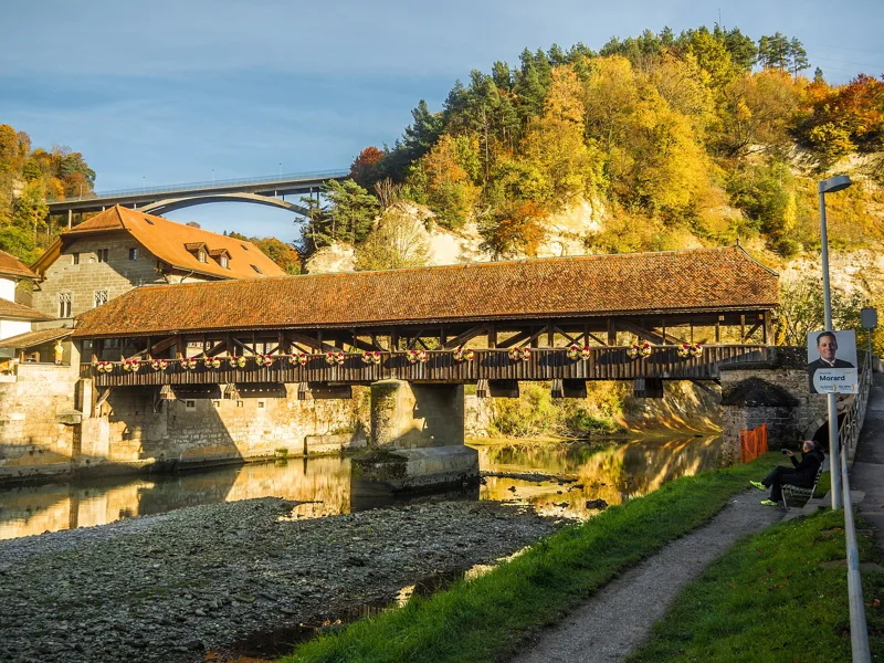
The Bern Bridge, the town's last covered wooden bridge
The Bern Bridge is one of the three Lower Town bridges built in the middle of the 13th century, along with the Pont du Milieu and the Pont de Saint-Jean. It went into service in 1250. In 1340, during an attack by the Bernese, it was sawn through to cut off the enemy's route.
Its present look dates from 1653. The sandstone central pier and the deck were rebuilt in 1853 and 1854, and the roof dates from 1855. You cross it twice: on the way out, into the Gottéron valley, and on the way back, just before the finish.
A valley of blacksmiths and millers
In the Middle Ages, people were wary of venturing into this dark valley: legend has it a dragon lived here. Blacksmiths and millers settled here all the same, a little apart from the town, close to the river. It's also where young people from the Lower Town founded Fribourg's first ice hockey club.
After Rue des Forgerons, the Chemin du Gottéron follows the stream through a wooded gorge. With a bit of luck you'll spot chamois, which live on the sandstone cliffs. The path passes the Pinte des Trois Canards and leads up to the old Ameismühle mill; in the gorge you also cross patches of mossy tufa and springs. In February 2014 the valley was described as regularly threatened by rockfall and landslides: before you set off, check on the Tafers (Tavel) municipality website whether it is open.
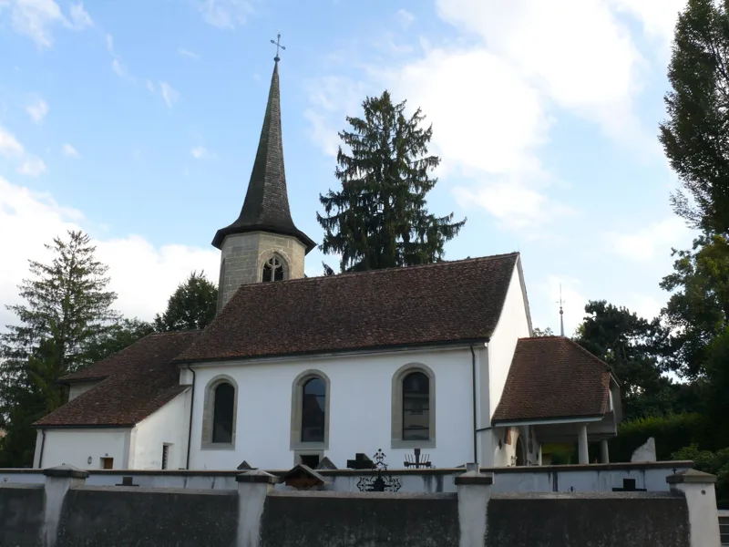
Bourguillon, from lepers to pilgrims
After Ameismühle, the path climbs to Schürmatt farm, then crosses fields and woods to Bourguillon. The hamlet is first recorded in 1252 as Burgillon; in German it's Bürglen. Its leper house, from 1275, later served as a hospital and a hospice. The building was demolished in 1838 and replaced by the Aux Trois-Tours inn; a restaurant called Des Trois Tours stands by the path.
The present chapel follows the plan of the one built from 1464 to 1466, whose choir survives; the nave was remodelled in Baroque style from 1759 to 1761. From the early 15th century at the latest, an increasingly popular pilgrimage grew up here, to Notre-Dame de Bourguillon.
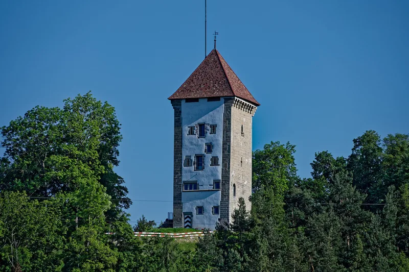
The Dürrenbühl Tower and back to the bridge
After Bourguillon, the path follows the Route de Bourguillon, then drops down the Sentier du Dürrenbuhl, close to the tower of the same name. The gate and tower were built in the 13th century to close the way between the Gottéron and the Sarine. Work on the four-storey tower began around 1370; it was raised and crowned with machicolations between 1398 and 1406. In 1840 the rampart was pulled down to build the Bourguillon road and the Gottéron Bridge.
That bridge was a suspension bridge over the valley. On 9 May 1919, a lorry carrying ten tonnes of timber instead of the six allowed broke through the deck and fell into the valley; the driver was killed. The accident put an end to suspension bridges in Fribourg. Today's bridge, a reinforced-concrete arch, opened in 1960: you saw it from below on the way out. The path then drops back to the Bern Bridge and ends on Place du Petit-Saint-Jean. Further down the page you'll find transport to get home.
Every way to Fribourg, Petit-Saint-Jean
5 starting points to reach Fribourg, Petit-Saint-Jean. Pick yours: the 3D view shows it and “My day” recalculates.
Walking times without breaks. “Estimated” times are calculated on the terrain profile with a model fitted to the official stages; the shortest path may differ from the one on the yellow signposts: on the ground, follow the signs. Gradient: the steepest over 200 m of trail. Profiles share the same scale (length and altitude). Stations and car parks within 500 m of the start.
In pictures
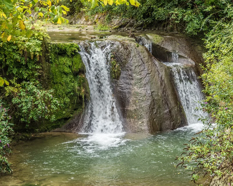
The Gottéron River, Fribourg
The Bern Bridge, a covered wooden bridge over the Sarine, Fribourg
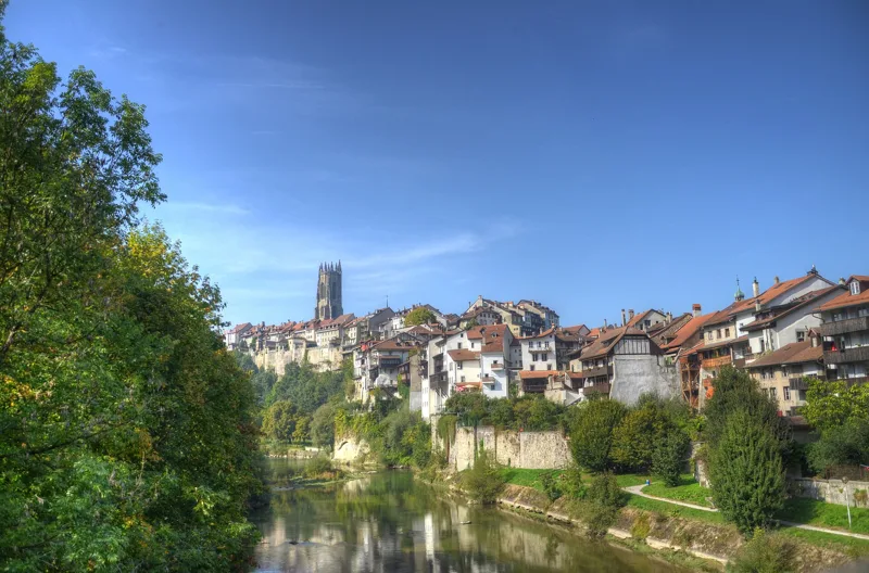
Fribourg cathedral seen from the Pont du Milieu, with the Sarine below
The covered fortification bridge over the Gottéron, Fribourg
The Gottéron stream, Fribourg
Notre-Dame de Bourguillon church, Fribourg
The Dürrenbühl Tower, Fribourg
The Gottéron Bridge, Fribourg
The Gottéron Bridge at top left, the Dürrenbühl Tower on the hill and the Bern Bridge below it
The Bern Bridge, Fribourg
What you see from the top
360° view from the highest point of the hike (716 m). 11 named peaks, including Lauteraarhorn, 75.2 km away. Swipe to look around.
Gorges du Gottéron: when to go
Public transport serves the start every day of the year, according to the official timetable. The latest time to set off ranges from 17:27 in June to 12:43 in December.
- Public transport to the start
- every day
- 755 to 973 arrivals a day
- first arrival 0:00, 0:01 or 1:30
- last 23:59
- Sun at the start, mid-January
- from 8:38
- rises at 8:12, hidden by the ridge
- Leave by, for 3 h 00 of walking
- 13:09
- arrive 1 hour before sunset, at 17:09
| Month | Sun at the start | Leave by | In the sun, leaving at 9:00 | Transport |
|---|---|---|---|---|
| December | 8:40 → 16:43 | 12:43 | 60 % | every day |
| January | 8:38 → 17:09 | 13:09 | 60 % | every day |
| February | 8:00 → 17:55 | 13:55 | 74 % | every day |
“In the sun”: the share of the path in sunlight under a clear sky, with the terrain worked out point by point. The path climbs to 716 m: today's snow and frost are in the weather and My day.
- Public transport to the start
- every day
- 775 to 908 arrivals a day
- first arrival 0:00
- last 23:59
- Sun at the start, mid-April
- from 7:00
- rises at 6:44, hidden by the ridge
- Leave by, for 3 h 00 of walking
- 16:19
- arrive 1 hour before sunset, at 20:19
| Month | Sun at the start | Leave by | In the sun, leaving at 9:00 | Transport |
|---|---|---|---|---|
| March | 6:56 → 18:36 | 14:36 | 88 % | every day |
| April | 7:00 → 20:19 | 16:19 | 94 % | every day |
| May | 6:09 → 20:59 | 16:59 | 98 % | every day |
“In the sun”: the share of the path in sunlight under a clear sky, with the terrain worked out point by point. The path climbs to 716 m: today's snow and frost are in the weather and My day.
- Public transport to the start
- every day
- 802 to 908 arrivals a day
- first arrival 0:00
- last 23:59
- Sun at the start, mid-July
- from 6:04
- rises at 5:52, hidden by the ridge
- Leave by, for 3 h 00 of walking
- 17:22
- arrive 1 hour before sunset, at 21:22
| Month | Sun at the start | Leave by | In the sun, leaving at 9:00 | Transport |
|---|---|---|---|---|
| June | 5:49 → 21:27 | 17:27 | 100 % | every day |
| July | 6:04 → 21:22 | 17:22 | 98 % | every day |
| August | 6:41 → 20:43 | 16:43 | 97 % | every day |
“In the sun”: the share of the path in sunlight under a clear sky, with the terrain worked out point by point. The path climbs to 716 m: today's snow and frost are in the weather and My day.
- Public transport to the start
- every day
- 802 to 968 arrivals a day
- first arrival 0:00 or 0:01
- last 23:59
- Sun at the start, mid-October
- from 8:07
- rises at 7:49, hidden by the ridge
- Leave by, for 3 h 00 of walking
- 14:45
- arrive 1 hour before sunset, at 18:45
| Month | Sun at the start | Leave by | In the sun, leaving at 9:00 | Transport |
|---|---|---|---|---|
| September | 7:21 → 19:44 | 15:44 | 91 % | every day |
| October | 8:07 → 18:45 | 14:45 | 77 % | every day |
| November | 8:00 → 16:58 | 12:58 | 67 % | every day |
“In the sun”: the share of the path in sunlight under a clear sky, with the terrain worked out point by point. The path climbs to 716 m: today's snow and frost are in the weather and My day.
The next few days
Local forecast, updated every hour
Reading the forecast…
My day
Pick your day and start time: everything updates.
- Arrival at Fribourg, Petit-Saint-Jean
- 11:30 3 h 00 of walking without breaks, starting at 08:30
The trail, kilometre by kilometre
From Fribourg
Places are listed under the kilometre where you pass them. Drag along the profile: the marker moves on the 3D view too.
- under 10 %
- 10 to 20 %
- 20 to 30 %
- over 30 %
- fountain or water point
- toilets
Around the trail (250 m): 60 restaurants, 20 cafés, 31 fountains and water points and 8 toilets. Estimated time: the official walking time spread by effort (1 km on the flat counts as 100 m of climbing), start time set in “My day”.
- under 10 %
- 10 to 20 %
- 20 to 30 %
- over 30 %
- fountain or water point
- toilets
Around the trail (250 m): 11 restaurants, 3 cafés, 16 fountains and water points and 4 toilets. Estimated time: the official walking time spread by effort (1 km on the flat counts as 100 m of climbing), start time set in “My day”.
- under 10 %
- 10 to 20 %
- 20 to 30 %
- over 30 %
- fountain or water point
- toilets
Around the trail (250 m): 33 restaurants, 9 cafés, 26 fountains and water points and 8 toilets. Estimated time: the official walking time spread by effort (1 km on the flat counts as 100 m of climbing), start time set in “My day”.
- under 10 %
- 10 to 20 %
- 20 to 30 %
- over 30 %
- fountain or water point
- toilets
Around the trail (250 m): 60 restaurants, 20 cafés, 36 fountains and water points and 7 toilets. Estimated time: the official walking time spread by effort (1 km on the flat counts as 100 m of climbing), start time set in “My day”.
- under 10 %
- 10 to 20 %
- 20 to 30 %
- over 30 %
- fountain or water point
- toilets
Around the trail (250 m): 57 restaurants, 17 cafés, 37 fountains and water points and 9 toilets. Estimated time: the official walking time spread by effort (1 km on the flat counts as 100 m of climbing), start time set in “My day”.
Getting there and back
Back by public transport from the Fribourg, Petit-St-Jean stop
Next departures from Fribourg, Petit-St-JeanReading the official timetable…
By car
From Fribourg
Careful, this is one way: public transport back arrives in Fribourg, Petit-St-Jean, not in Fribourg. Plan to get back to your car by public transport, or park at the finish and take public transport to the start.
- Parking de Fribourg Centreunderground car park · paid · 120 spaces · open 24/7120 m from the start
- Les Galeries du Rexunderground car park · paid · open 24/7250 m from the start
- P+Rail Fribourgopen-air · paid280 m from the start
- Parking des Bourgeoisopen-air · paid350 m from the start
Public car parks within 600 m of the start: prices and number of spaces may have changed, check the signs on site.
Careful, this is one way: public transport back arrives in Fribourg, Petit-St-Jean, not in Düdingen. Plan to get back to your car by public transport, or park at the finish and take public transport to the start.
- Car park30 m from the start
- Station Düdingenor by public transport0 m from the start
The nearest car park and stop for this start. Check the signs on site for the price.
Careful, this is one way: public transport back arrives in Fribourg, Petit-St-Jean, not in Belfaux-Village. Plan to get back to your car by public transport, or park at the finish and take public transport to the start.
- Car parkpaid70 m from the start
- Station Belfaux-Villageor by public transport0 m from the start
The nearest car park and stop for this start. Check the signs on site for the price.
Careful, this is one way: public transport back arrives in Fribourg, Petit-St-Jean, not in Neyruz. Plan to get back to your car by public transport, or park at the finish and take public transport to the start.
- Car park40 m from the start
- Station Neyruzor by public transport0 m from the start
The nearest car park and stop for this start. Check the signs on site for the price.
Careful, this is one way: public transport back arrives in Fribourg, Petit-St-Jean, not in Belfaux CFF. Plan to get back to your car by public transport, or park at the finish and take public transport to the start.
- Car parkpaid20 m from the start
- Station Belfaux CFFor by public transport0 m from the start
The nearest car park and stop for this start. Check the signs on site for the price.
Questions people ask
How long is the hike from Fribourg to Fribourg, Petit-Saint-Jean?
3 h 00 of walking (official time), in this direction, not counting breaks. The other way: 3 h 10.
Is it hard?
Official rating for this stage: fitness medium, technique easy. It is 420 m of descent over 10.9 km.
Can I get back by public transport?
Yes. The Fribourg, Petit-St-Jean stop is at the finish. The next departures show live under “Getting there and back”.
Where can I eat on the way?
80 places to eat within 250 m of the trail, including L’unique tartare, Coffee & Friends, China town. Where they are and their opening hours: below the profile.
Is there water and are there toilets on the way?
31 fountains and water points and 8 toilets within 250 m of the trail (survey of 25/10/2026).
Can I download the track?
Yes, as a GPX file for your watch or map app: “Download the track” button at the top of the page.
More hikes within 10 km
Official stages that pass within 10 km of this trail. Each card says whether its page is already up.
- Fribourg → Romont (FR)7 h 00ViaJacobi, stage 1428.0kmDistance620mAscent460mDescentTechnical easyFitness difficult. Official waymarked stage
- Fribourg → Plaffeien5 h 35Freiburger Voralpenweg, stage 120.0kmDistance780mAscent560mDescentTechnical easyFitness difficult. Official waymarked stage
- Schwarzenburg → Fribourg5 h 15ViaJacobi, stage 1320.0kmDistance400mAscent560mDescentTechnical easyFitness difficult. Official waymarked stage
- Fribourg → Düdingen, Staumauer/Camping5 h 50Freiburger Saane-Weg, stage 221.0kmDistance560mAscent660mDescentTechnical easyFitness difficult. Official waymarked stage
- Fribourg → Düdingen, Staumauer/Camping5 h 50Freiburger Saane-Weg, stage 221.0kmDistance560mAscent660mDescentTechnical easyFitness difficult. Official waymarked stage
- Fribourg → Murten5 h 50Fribourg en diagonale, stage 323.0kmDistance420mAscent580mDescentTechnical easyFitness difficult. Official waymarked stage