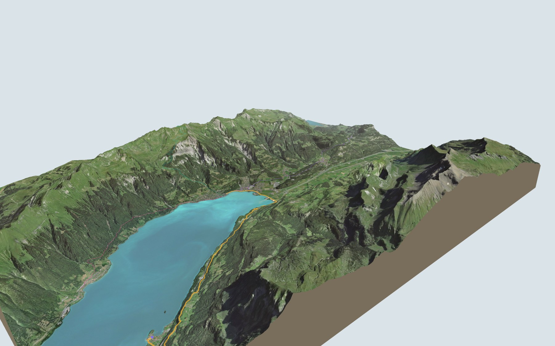

Along Lake Brienz to the Giessbach Falls
This is the second stage of the Brienzersee Drei Wasserfälleweg, SwitzerlandMobility route 360. You start in Iseltwald, on the shore of Lake Brienz, and finish in Brienz, at the upper end of the lake. SwitzerlandMobility rates the stage medium for fitness and easy for technique.
The climb comes first: you leave Iseltwald and head up to the high point, near Isch. After that the path rolls along above the lake, passes the Giessbach Falls, drops to Engi and comes back down to lake level, finishing through Kienholz and Brienz. The elevation profile shows you where it climbs.
Rather reach Brienz another way? Come down from the top station of the Sörenberg-Brienzer Rothorn cable car, or start from Brünig-Hasliberg or from Oberried, on the north shore: each start has its own colour in the 3D view and its estimated time in all starting points.
At the finish is Brienz station. Check the next departures from Brienz and plan your day before you set off. Fancy something else nearby? See all hikes in the Bernese Oberland.
The story of the trail
What happened where you are going to walk, chapter by chapter.
One climb, then a balcony above the lake
You start at 567 m in Iseltwald and finish at 567 m in Brienz. In between: 11.7 km, 440 m up and 440 m down according to SwitzerlandMobility. SwitzerlandMobility gives 3 h 25 of walking, in either direction.
Just after the village the trail crosses the Mülibach, then climbs to the day's high point, 795 m, near the hamlet of Isch. It then rolls along above the lake through Gloota and Hohflue to the Giessbach Falls, a little past halfway, where Elisa - Bistro & Terrasse is just a few steps off the path. Next it drops to Engi and comes back to lake level. On the way, follow the signposts and check the day's conditions.
Iseltwald, a lakeside village
Iseltwald is recorded in 1146 as Iseltwalt. That year, Emperor Conrad III gave the Augustinian priory of Interlaken a quarter of Iseltwald and half of its forests. On a peninsula there is also a castle, which may have been home to the lords of Matten, and which from 1907 housed the Seeburg rehabilitation centre.
Villagers lived from fishing, fruit growing, livestock and alpine farming. The boat landing opened in 1871, and from the 1870s hotels and inns were built. Until the motorway link came in 1988, the only way in was a dead-end road from Bönigen.
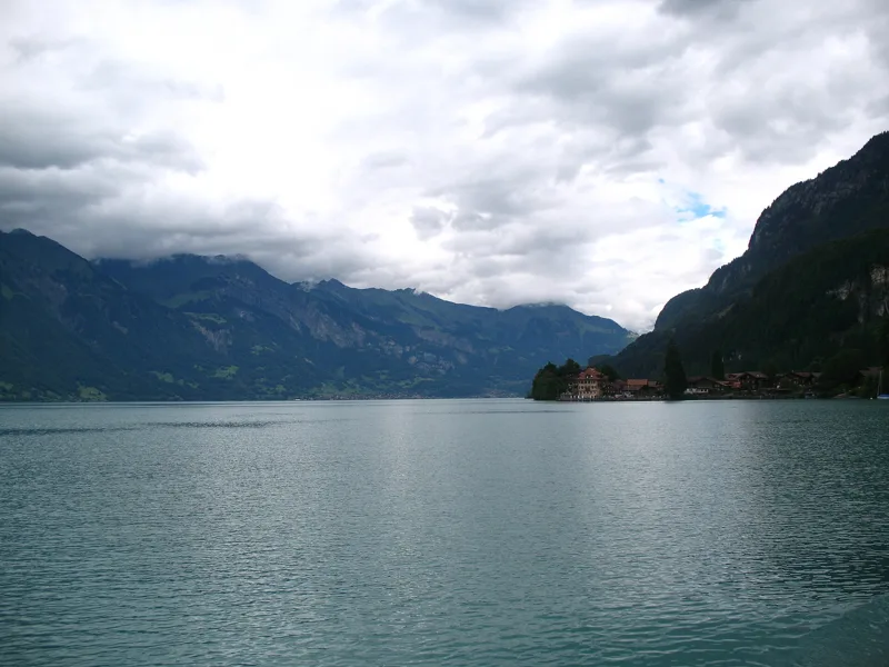
The fourteen Giessbach Falls
Interlaken Tourism describes a “path of the three waterfalls”: the Erschwandenbach, between Bönigen and Iseltwald, then the Mülibach, above Iseltwald, and the Giessbach Falls, which cascade down into the lake. In 1818, the schoolteacher Johannes Kehrli built an access path linking Brienz and the lake to the fourteen Giessbach Falls; he opened an inn in 1822. There has been a boat landing since 1839.
From 1870, the Hauser hotel family turned it into a large business: a grand hotel built in 1874-1875 and restored after a fire in 1883, and, in 1879, a funicular from the lake up to the hotel. Closed during the Second World War, the hotel was saved by a campaign led by Franz Weber from 1982 and renovated from 1984 to 1987. The trail passes close to the Grand-Hotel Giessbach.
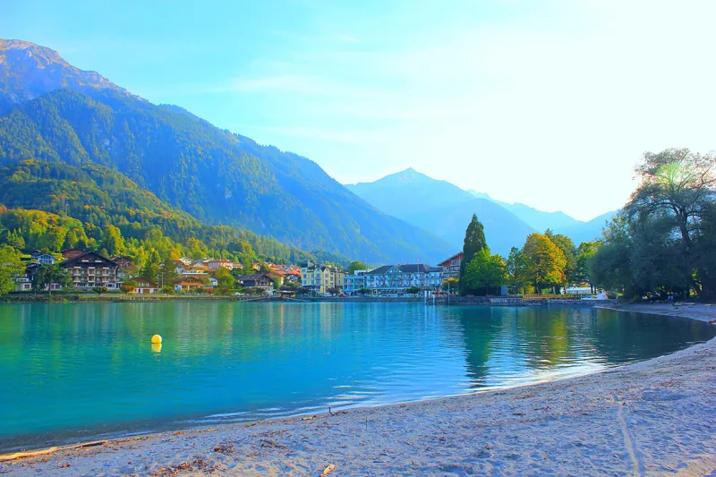
A narrow lake with steep shores
Lake Brienz is narrow and elongated, with two steep shores. The Aare and the Lütschine, its main tributaries, carry large amounts of gravel into it. Between 1866 and 1875, the lake level was lowered and the course of the Aare was corrected between Meiringen and Brienz.
The Historical Dictionary of Switzerland notes that the shores today have an exceptionally high number of stretches left untouched by human activity. Before Brienz, the trail reaches the lakeshore and crosses the Aare.
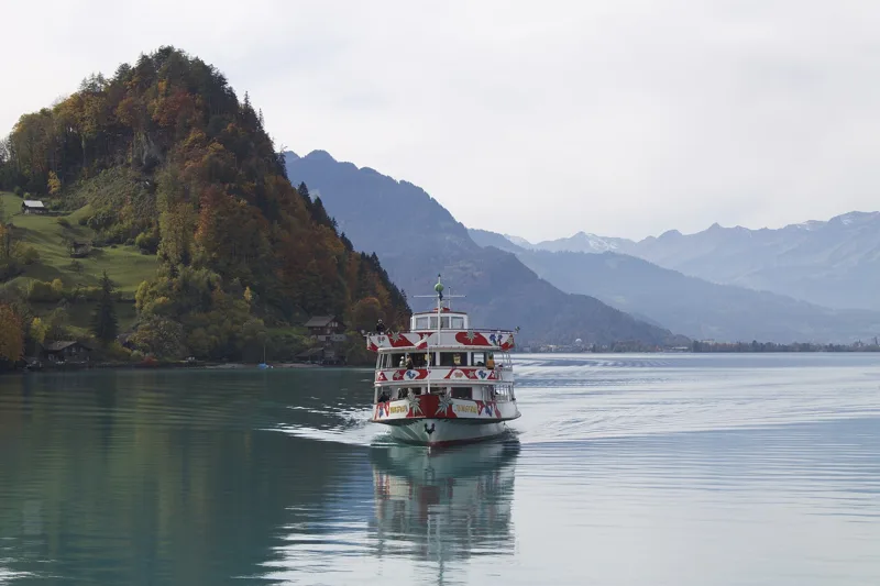
Kienholz, Tracht and Brienz
In 1353, representatives of Bern and the Waldstätten met at Kienholz, north of the mouth of the Aare. The Kienholz warehouse was at first where boats docked and goods were transferred; between 1610 and 1624 it moved to Tracht, closer to Brienz, probably because of the mud and rock flows caused by flooding torrents. In Brienz, the trail crosses the Lammbach and the Glyssibach before Tracht.
During the famine of 1816-1817, the woodturner Christian Fischer started a woodcarving business in Brienz which, by 1868, employed more than 1,000 people working from home. A drawing school opened in 1862 and became the cantonal woodcarving school in 1884. The Brünig railway reached Brienz in 1888, and the Rothorn railway dates from 1892. Further down the page you'll find the next departures from Brienz station.
Every way to Brienz
4 starting points to reach Brienz. Pick yours: the 3D view shows it and “My day” recalculates.
Walking times without breaks. “Estimated” times are calculated on the swisstopo profile with a model fitted to the official SwitzerlandMobility stages; the shortest path may differ from the one on the yellow signposts: on the ground, follow the signs. Gradient: the steepest over 200 m of trail. Profiles share the same scale (length and altitude). Stations and car parks within 500 m of the start, according to OpenStreetMap.
In pictures
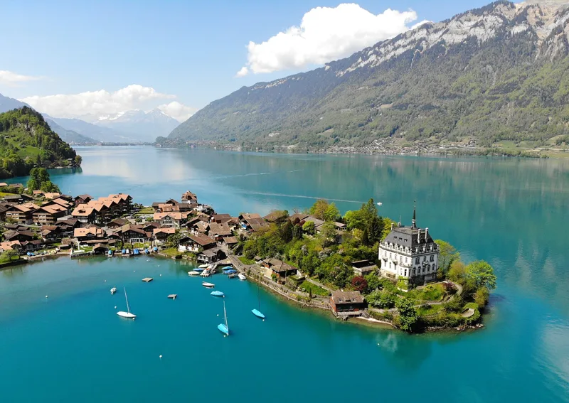
Iseltwald (BE), seen from a drone
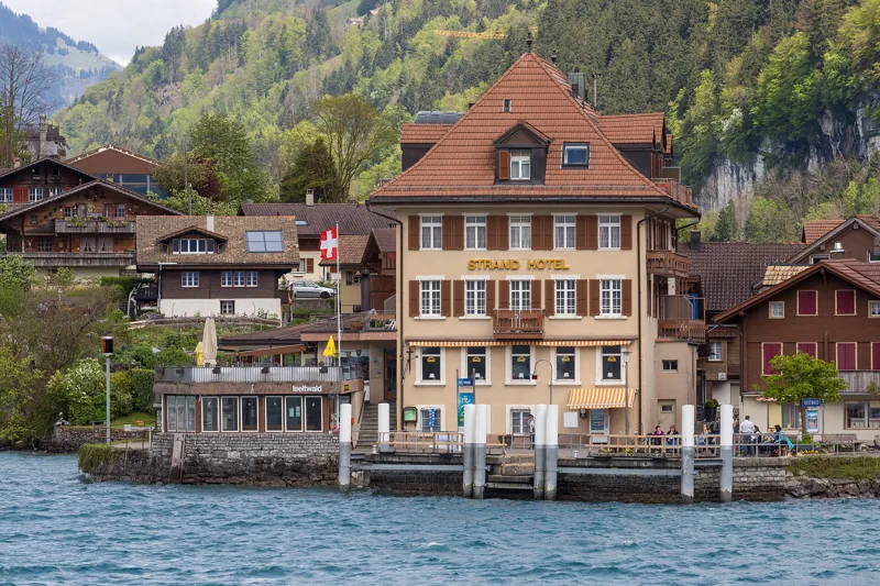
Iseltwald on Lake Brienz: the boat landing and the Strandhotel, built around 1920
Villa Seeburg in Iseltwald, on Lake Brienz
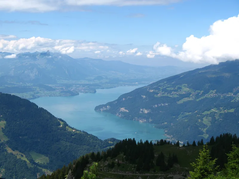
Looking toward the Giessbach Falls from Iseltwald, Lake Brienz
Iseltwald, Ringgenberg, Niederried and Oberried on Lake Brienz
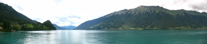
Lake Brienz at Iseltwald
A boat on Lake Brienz at Iseltwald, in autumn
A house with a small clock tower in Iseltwald, above Lake Brienz
Lake Brienz in October
Vegetable gardens in Iseltwald by the lake, in autumn
The next few days
MeteoSwiss local forecast, updated every hour
Reading the MeteoSwiss forecast…
My day
Pick your day and start time: everything updates.
- Arrival at Brienz
- 11:55 3 h 25 of walking without breaks, starting at 08:30
The trail, kilometre by kilometre
Places are listed under the kilometre where you pass them. Drag along the profile: the marker moves on the 3D view too.
- under 10 %
- 10 to 20 %
- 20 to 30 %
- over 30 %
- fountain or water point
- toilets
Around the trail (250 m, OpenStreetMap, extract of 25/10/2026): 11 restaurants, 1 café, 12 fountains and water points, 12 toilets. Estimated time: the official walking time spread by effort (1 km on the flat counts as 100 m of climbing), start time set in “My day”.
Getting there and back
Back by public transport from the Brienz stop
Next departures from BrienzReading the official timetable…
By car
Careful, this is one way: public transport back arrives in Brienz, not in Iseltwald. Plan to get back to your car by public transport, or park at the finish and take the train to the start.
- Car park open-air, Dorfplatzpaid60 m from the start
- Car park open-air, Feld4 spaces140 m from the start
- Car park open-air, Mühlepaid430 m from the start
- Car park open-air, Hübeli80 m from the start
Public car parks within 600 m of the start, according to OpenStreetMap: prices and number of spaces may have changed, check the signs on site.
Questions people ask
How long is the hike from Iseltwald to the finish (Brienz)?
3 h 25 of walking according to SwitzerlandMobility, in this direction, not counting breaks. The other way: 3 h 25.
Is it hard?
SwitzerlandMobility rates this stage: fitness medium, technique easy. It is 440 m of climbing over 11.7 km.
Can I get back by public transport?
Yes. The Brienz stop is at the finish. The next departures show live under “Getting there and back”.
Where can I eat on the way?
13 restaurants, cafés and huts within 250 m of the trail, including Dorfpintli, Seegarten, Bistro. Where they are and their opening hours: below the profile.
Is there water and are there toilets on the way?
12 fountains and water points and 12 toilets within 250 m of the trail (survey of 25/10/2026).
Can I download the track?
Yes, as a GPX file for your watch or map app: “Download the track” button at the top of the page.
More hikes within 10 km
Official SwitzerlandMobility stages that pass within 10 km of this trail. Each card says whether its page is already up.
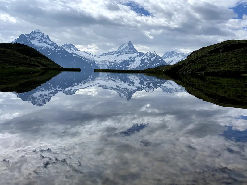 Schynige Platte → Grindelwald, First5 h 45ViaBerna, stage 1517.0kmDistance1,100mAscent900mDescentTechnical mediumFitness difficult. See the hike
 Schynige Platte, loop1 h 55Panoramaweg Schynige Platte6.0kmDistance340mAscent340mDescentTechnical mediumFitness easy. See the hike
- Bönigen → Iseltwald2 h 05Brienzersee Drei Wasserfälleweg, stage 17.0kmDistance320mAscent320mDescentTechnical easyFitness easy. Page coming
- Brünigpass → Interlaken8 h 15ViaJacobi, stage 930.0kmDistance860mAscent1,300mDescentTechnical easyFitness difficult. Page coming
- Axalp, Sportbahnen, loop2 h 05Axalp-Schnitzlerweg6.0kmDistance400mAscent400mDescentTechnical mediumFitness easy. Page coming
- Brienzer Rothorn → Brünigpass4 h 15Grenzpfad Napfbergland, stage 612.0kmDistance360mAscent1,600mDescentTechnical mediumFitness difficult. Page coming