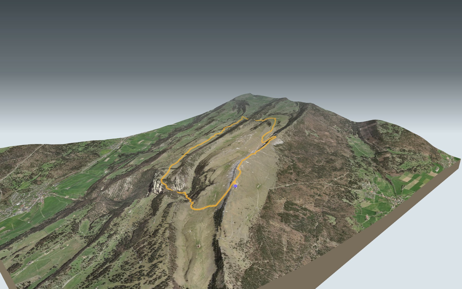

Hiking around the Chasseral
A loop that starts and ends at the Chasseral hotel, on the long Chasseral ridge. You first head down the north side, walk from pasture to mountain farm, then climb back up to the summit and its mast before returning to the hotel. It's rated medium for fitness and easy for technique.
The trail passes near the Métairie de St-Jean, drops to Pré aux Auges, then runs via Les Limes to the Métairie de Meuringue. Next comes the Creux de Glace, the Métairie de la Petite Douanne and the Métairie du Milieu de Bienne, before the climb back up via the Métairie La Neuve and the Pâturage de Chasseral. The elevation profile shows you where it climbs.
The whole loop lies inside the Chasseral Regional Park, recognised since 2012 by the Swiss Confederation and the cantons of Bern and Neuchâtel. At the start and at the end, the trail also crosses the Chasseral landscape of national importance, and the Combe-Grède federal hunting reserve as far as the Métairie de Meuringue. Elsewhere in the Jura, the Creux du Van is also on the site.
Along the way, three mountain farms serve food: Meuringue, the Petite Douanne and the Milieu de Bienne; their opening hours, where known, are further down. Check getting there and departures and plan your day before you set off. Looking for more in the area? See all hikes in the Jura.
The story of the trail
What happened where you are going to walk, chapter by chapter.
A loop over the summit
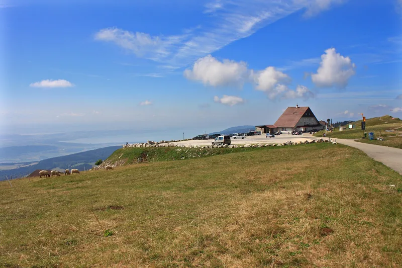
You start at the Chasseral hotel, at 1,548 m, and finish there too. In between: 13.3 km, with 540 m of climbing and 540 m of descent. The highest point, at 1,606 m, is the Chasseral summit, shortly before the end. Allow 3 h 50 of walking, whichever way round you go.
The trail first heads down the north side, passes near the Métairie de St-Jean and reaches its lowest point just after Pré aux Auges. It then climbs again via Les Limes Derrière and Les Limes du Haut to the Métairie de Meuringue, at 1,375 m. On the way, follow the signposts and check the conditions on the day.
The hotel, the road and the mast
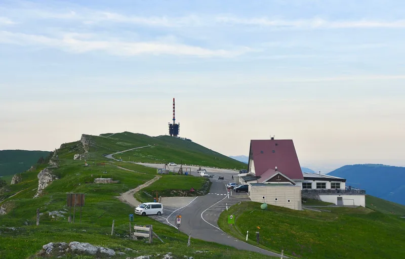
Work on the chalet-hotel began in 1879, funded by public subscription: La Neuveville and Saint-Imier raised the money, and the municipalities of Lignières and Nods gave the timber. The left wing was finished in 1881. After a fire destroyed it completely, the hotel was rebuilt in 1925.
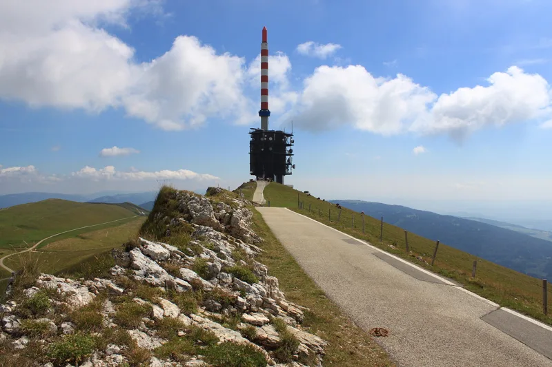
Only in the 1930s did a tarred road link the Chasseral to Saint-Imier and Nods, built to give work to the unemployed during the Depression. From 1963 to 1993, a chairlift also linked Nods to the Chasseral. The summit has carried a telecommunications station since the 1940s; its first mast was replaced in 1970 by a bigger one.
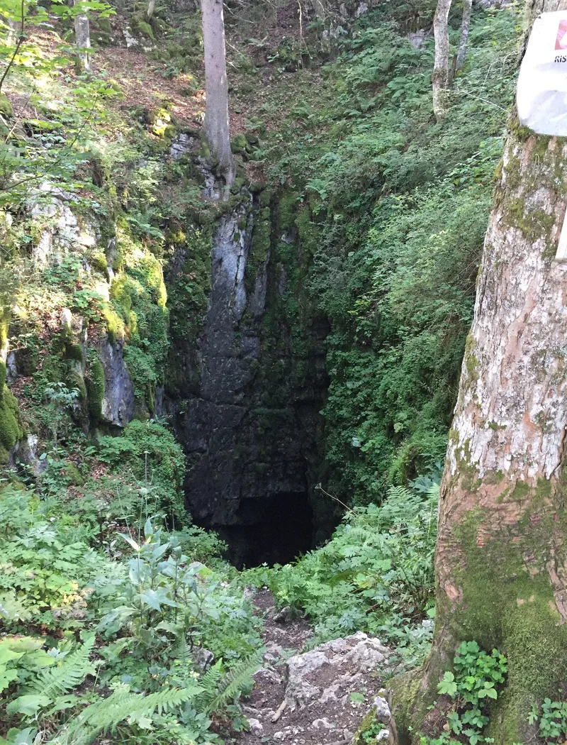
Sinkholes, limestone pavement and a hidden glacier
The Chasseral is an anticline, a fold that formed as the Jura rose, around 10 million years ago. In the heart of the massif, marl hollows are pitted with dozens of sinkholes in neat lines, a rare sight in the Jura. On the ridge, rainwater has carved grooves into the limestone, known as karren or limestone pavement. After the Métairie de Meuringue, the trail passes the Creux de Glace, a hole that hides a small glacier: the snow that piles up there in winter turns to ice.
As far as the Métairie de Meuringue, and again around the Métairie La Neuve, you are walking through the Combe-Grède federal hunting reserve. It protects a varied habitat, especially for the capercaillie and the peregrine falcon, as well as chamois and roe deer. The massif is also home to plants of alpine origin, such as the rare large-flowered sandwort, and to dry meadows and pastures of national importance, with several species of orchid.
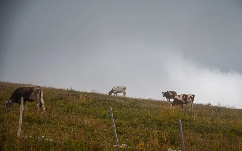
Mountain farms, from fief to cheese
In 2013 the Chasseral chain had 45 mountain farms, called métairies, and close to 5,000 head of cattle spent the summer there. In 1368, when he confirmed the charter of La Neuveville, Prince-Bishop Jean de Vienne granted grazing rights on the Chasseral. The forests were cleared mainly in the 16th century, by Anabaptists driven out of the Bernese plateau. The clumps of trees left standing became today's wooded pastures; on the north side, dry-stone walls separate them.
In the 19th century, the Burgergemeinde of Biel bought back several estates and became the largest landowner on the chain. In 2013 there were three cheesemakers left on the Chasseral, one of them at the Petite Douanne, together making more than 20 tonnes of AOC mountain Gruyère a year. The farms were still running summer grazing, cheesemaking and food service.
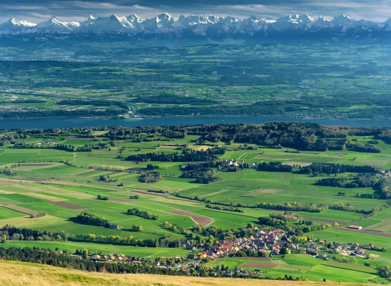
The summit, then the hotel
After the Métairie La Neuve, the trail climbs through the Pâturage de Chasseral to the summit, at 1,606 m, crowned by its mast. The view opens onto the Franches-Montagnes, the Swiss plateau and the Alps.
All that's left is to walk back down to the Chasseral hotel, where you started. Further down this page: how to get home and where to eat.
In pictures
The summit of the Chasseral.
The Hotel Chasseral on the Chasseral summit, with Lake Neuchâtel in the background.
Looking north from the Chasseral: a line of sinkholes, with St-Imier in the background.
The entrance to the Creux de Glace.
Sign for the Métairie de Meuringue.
Cows grazing on the Chasseral.
Dry meadow on the Chasseral; below, a sinkhole in the karst massif.
Sign for the Combe Grède nature reserve, on the Chasseral.
The transmitter mast on the Chasseral summit.
The Chasseral triangulation point.
The Bernese Alps seen from the Chasseral, with Lake Biel.
What you see from the top
360° view from Chasseral (1,606 m). 27 named peaks, including Mont Blanc, 145.3 km away. Swipe to look around.
Chemin de Chasseral: when to go
The bus runs up to the start on 56 days a year, between 24 April 2027 and 24 October 2027, mostly at weekends, according to the official timetable. The latest time to set off ranges from 16:39 in June to 11:52 in December.
- Bus to the start
- off season
- no arrival found in the official timetable, read on 11/11/2026
- Sun at the start, mid-January
- from 8:20
- rises at 8:14
- Leave by, for 3 h 50 of walking
- 12:19
- arrive 1 hour before sunset, at 17:09
| Month | Sun at the start | Leave by | In the sun, leaving at 9:00 | Bus |
|---|---|---|---|---|
| December | 8:21 → 16:42 | 11:52 | 51 % | off season |
| January | 8:20 → 17:09 | 12:19 | 51 % | off season |
| February | 7:39 → 17:55 | 13:05 | 75 % | off season |
“In the sun”: the share of the path in sunlight under a clear sky, with the terrain worked out point by point. The path climbs to 1,606 m: today's snow and frost are in the weather and My day.
- Bus to the start
- 14 of 92 days
- mostly at weekends
- 4 to 7 buses a day
- first bus 9:54
- last 15:54 or 16:42
- Sun at the start, mid-April
- from 6:48
- rises at 6:44
- Leave by, for 3 h 50 of walking
- 15:30
- arrive 1 hour before sunset, at 20:20
| Month | Sun at the start | Leave by | In the sun, leaving at 9:00 | Bus |
|---|---|---|---|---|
| March | 6:49 → 18:37 | 13:47 | 95 % | off season |
| April | 6:48 → 20:20 | 15:30 | 95 % | 2 of 30 days |
| May | 6:10 → 21:00 | 16:10 | 99 % | 12 of 31 days |
“In the sun”: the share of the path in sunlight under a clear sky, with the terrain worked out point by point. The path climbs to 1,606 m: today's snow and frost are in the weather and My day.
- Bus to the start
- 26 of 92 days
- mostly at weekends
- 7 buses a day
- first bus 9:54
- last 16:42
- Sun at the start, mid-July
- from 6:11
- rises at 5:51, hidden by the ridge
- Leave by, for 3 h 50 of walking
- 16:34
- arrive 1 hour before sunset, at 21:24
| Month | Sun at the start | Leave by | In the sun, leaving at 9:00 | Bus |
|---|---|---|---|---|
| June | 5:58 → 21:29 | 16:39 | 99 % | 8 of 30 days |
| July | 6:11 → 21:24 | 16:34 | 99 % | 9 of 31 days |
| August | 6:31 → 20:44 | 15:54 | 98 % | 9 of 31 days |
“In the sun”: the share of the path in sunlight under a clear sky, with the terrain worked out point by point. The path climbs to 1,606 m: today's snow and frost are in the weather and My day.
- Bus to the start
- 16 of 91 days
- mostly at weekends
- 7 buses a day
- first bus 9:54
- last 16:42
- Sun at the start, mid-October
- from 7:52
- rises at 7:50
- Leave by, for 3 h 50 of walking
- 13:55
- arrive 1 hour before sunset, at 18:45
| Month | Sun at the start | Leave by | In the sun, leaving at 9:00 | Bus |
|---|---|---|---|---|
| September | 7:11 → 19:45 | 14:55 | 92 % | 8 of 30 days |
| October | 7:52 → 18:45 | 13:55 | 76 % | 8 of 31 days |
| November | 7:37 → 16:57 | 12:07 | 68 % | off season |
“In the sun”: the share of the path in sunlight under a clear sky, with the terrain worked out point by point. The path climbs to 1,606 m: today's snow and frost are in the weather and My day.
The next few days
Local forecast, updated every hour
Reading the forecast…
My day
Pick your day and start time: everything updates.
- Arrival at Chasseral, Hôtel
- 12:20 3 h 50 of walking without breaks, starting at 08:30
The trail, kilometre by kilometre
Places are listed under the kilometre where you pass them. Drag along the profile: the marker moves on the 3D view too.
- under 10 %
- 10 to 20 %
- 20 to 30 %
- over 30 %
- fountain or water point
- toilets
Around the trail (250 m): 3 restaurants and 1 fountain or water point. Estimated time: the official walking time spread by effort (1 km on the flat counts as 100 m of climbing), start time set in “My day”.
Getting there and back
Back by public transport from the Chasseral, Hôtel stop
Next departures from Chasseral, HôtelReading the official timetable…
By car
Park in Chasseral, Hôtel. It's a loop: you walk back to where you started, and so to your car.
- Car park open-air70 m from the start
Public car parks within 600 m of the start: prices and number of spaces may have changed, check the signs on site.
Questions people ask
How long does the loop from Chasseral, Hôtel take?
3 h 50 of walking (official time), in this direction, not counting breaks. The other way: 3 h 50.
Is it hard?
Official rating for this stage: fitness medium, technique easy. It is 540 m of climbing over 13.3 km.
Can I get back by public transport?
Yes. The Chasseral, Hôtel stop is at the finish. The next departures show live under “Getting there and back”.
Where can I eat on the way?
3 places to eat within 250 m of the trail: Mét. de la Meuringue, La Petite Douane, Métairie du Milieu de Bienne. Where they are and their opening hours: below the profile.
Is there water and are there toilets on the way?
1 fountain or water point and 0 toilets within 250 m of the trail (survey of 25/10/2026).
Can I download the track?
Yes, as a GPX file for your watch or map app: “Download the track” button at the top of the page.
More hikes within 10 km
Official stages that pass within 10 km of this trail. Each card says whether its page is already up.
- Frinvillier → Chasseral5 h 50Jura-Höhenweg, stage 717.0kmDistance1,350mAscent300mDescentTechnical easyFitness difficult. Official waymarked stage
- St-Imier → Nods4 h 00ViaBerna, stage 311.0kmDistance880mAscent780mDescentTechnical mediumFitness medium. Official waymarked stage
- Chasseral → Vue des Alpes5 h 35Jura-Höhenweg, stage 820.0kmDistance660mAscent1,000mDescentTechnical easyFitness difficult. Official waymarked stage
- Saint-Imier → Sonvilier4 h 10Chemin de la Combe Grède13.0kmDistance720mAscent680mDescentTechnical mediumFitness medium. Official waymarked stage
- Nods → Magglingen5 h 00ViaBerna, stage 417.0kmDistance780mAscent780mDescentTechnical easyFitness medium. Official waymarked stage
- Sonvilier → Saint-Imier4 h 00Chemin de Mont-Soleil13.0kmDistance580mAscent620mDescentTechnical easyFitness medium. Official waymarked stage