
Hiking around the Moosalp
An easy-going loop on the Moosalp plateau, high above the Rhône valley. You start at Chalte Brunne, walk via the Bürchner Alp, the Breitmattusee and the Bonigersee bog, then climb to the Stand, the viewpoint at the highest point. It's rated easy for both fitness and technique.
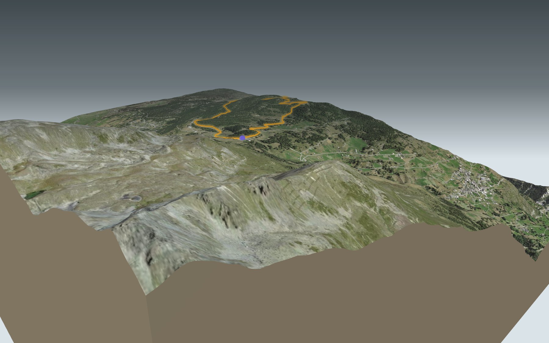
After the Restaurant Panorama, the path drops to the hamlet of Ledi, climbs back to the Breitmatte clearing and reaches the Breitmattusee. The elevation profile shows you where it climbs again, from Ledi up to the Stand.
The Bonigersee is listed in the Federal Inventory of Raised Bogs of national importance, and the Moosalp has eleven different bog habitats. Among the nearby hikes is the Walliser Sonnenweg from Gampel to Ausserberg.
Back at Moosalp, the Bergrestaurant Dorbia is at the start and the Restaurant Moosalp at the pass, a few steps from the path. The PostBus comes up from Visp via Bürchen, or from Stalden via Törbel. Check the next departures and plan your day before you set off. Looking for more in the area? See all hikes in Valais.
The story of the trail
What happened where you are going to walk, chapter by chapter.
A loop on the plateau
You start at Moosalp, at Chalte Brunne, at 2,048 m, and finish there too. In between: 6.3 km, 280 m of climbing and 280 m of descent. The highest point, at 2,121 m, is the Stand viewpoint. Allow 1 h 55 of walking, whichever way round you go.
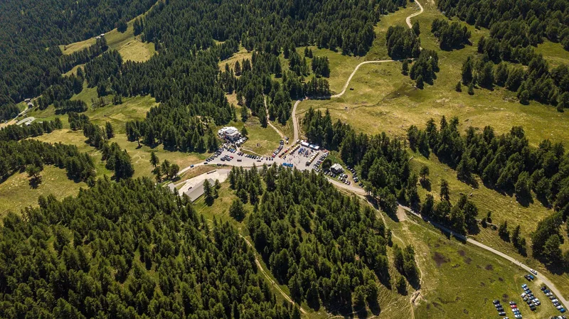
At the start there's the Bergrestaurant Dorbia; at km 1, the Restaurant Panorama, at 2,013 m, on the Bürchner Alp. The Restaurant Moosalp, at the pass, is right by the finish. On the way, follow the signposts and check the conditions on the day.
From the Bürchner Alp to the Stand
The path leaves Chalte Brunne across the pastures, passes alpine cowsheds and reaches the Bürchner Alp. Near the Restaurant Panorama it crosses several times between the municipalities of Törbel and Bürchen; the rest of the loop lies in the municipality of Törbel.
It then drops to the hamlet of Ledi, climbs back to the Breitmatte, a wide clearing, and reaches the Breitmattusee, a small landscaped lake. Next it runs along the Bonigersee before the last climb to the Stand. The way back to Chalte Brunne goes via Z'Plattjistei and Bieltini.
Törbel, Bürchen and shared water
In 1034, Törbel appears in the records as Dorbia, the name of the restaurant at the start. The village, above Stalden in the Vispa valley, regulated the use of water in 1392 and 1400; its municipal statutes date from 1463 and its rules for the alpine pastures and common land from 1507. Bürchen, on the other side of the boundary, appears in 1307 as "ze Birke". The road from Visp to Bürchen, built between 1930 and 1934, and the PostBus helped tourism grow there from the 1960s.
In 1970 and 1971, American anthropologist Robert McCorkle Netting came to study Törbel, and in 1981 he published the book "Balancing on an Alp". In the 1980s, political scientist Elinor Ostrom came to study Törbel in turn, a community that has managed its irrigation channels, the Suonen, since at least 1483. Combined with her research elsewhere in the world, her Törbel studies became the core of her theory of common-pool resources, which won her a share of the 2009 Nobel Prize in Economics. To mark when water use could begin, Törbel chose the moment the first rays of sunlight hit the Weisshorn.
The Bonigersee, a bog of national importance
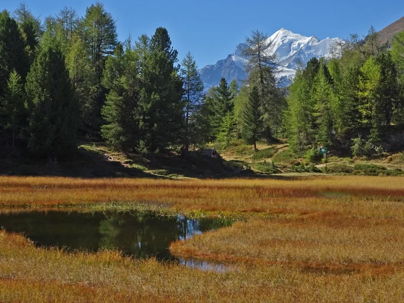
The Bonigersee, in the municipality of Törbel, is listed in the federal inventories of raised bogs and of fens of national importance. It is also an amphibian breeding site of national importance: when it was listed, in 2001, it had a large population of alpine newts, and the common frog was considered likely to be present.
The lake is covered with thick carpets of moss and is protected. Around it, the Moosalp has eleven different bog habitats over 1.5 km², both raised bogs and fens. Underfoot, it's mostly moraine left by the last ice age; in places the path crosses an augen gneiss named after the Bonigersee, a rock of plutonic origin dated to the Ordovician, in the Siviez-Mischabel nappe.
At the Stand, the four-thousanders opposite
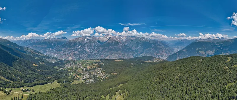
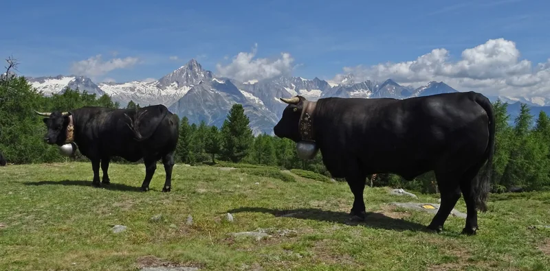
At the Stand, at 2,121 m, you're at the highest point of the loop, one of the most popular viewpoints on the Moosalp. From the plateau the view takes in the Upper Valais and twelve four-thousanders. All around: the Bietschhorn, the Weisshorn and the Mischabel group, with the Nadelhorn, the Dom and the Täschhorn.
From the Stand, the path heads back down to Chalte Brunne via Z'Plattjistei and Bieltini. At the pass, the Restaurant Moosalp is a good place for a slice of cream tart before you catch the PostBus to Visp or Stalden. Further down this page: the next departures.
In pictures
The Bonigersee and the Weisshorn, on the Moosalp
The Moosalp in summer 2024
View towards Bürchen and the Bernese Alps
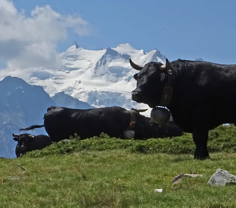
Hérens cows on the Stand, with the Bernese Alps behind
Hérens cows on the Stand, with the Mischabel group behind
Alpine aster at the Stand viewpoint near Moosalp, above Törbel
The Riedgletscher and a weather-beaten larch, from the Moosalp
Arnica (wolf's bane) at Moosalp
Rhellicani vanilla orchid close to Moosalp
The Restaurant Moosalp in August 2020
Hiking signpost at the Stand, Törbel
Moosalp Panoramaweg: when to go
The bus runs up to the start every day from 5 June to 17 October 2027, according to the official timetable: that's the season to do this loop without a car. The latest time to set off ranges from 18:27 in June to 13:48 in December.
- Bus to the start
- off season
- no arrival found in the official timetable, read on 11/11/2026
- Sun at the start, mid-January
- from 8:54
- rises at 8:08, hidden by the ridge
- Leave by, for 1 h 55 of walking
- 14:13
- arrive 1 hour before sunset, at 17:08
| Month | Sun at the start | Leave by | In the sun, leaving at 9:00 | Bus |
|---|---|---|---|---|
| December | 8:47 → 16:43 | 13:48 | 67 % | off season |
| January | 8:54 → 17:08 | 14:13 | 69 % | off season |
| February | 8:06 → 17:54 | 14:59 | 94 % | off season |
“In the sun”: the share of the path in sunlight under a clear sky, with the terrain worked out point by point. The path climbs to 2,121 m: today's snow and frost are in the weather and My day.
- Bus to the start
- off season
- no arrival found in the official timetable, read on 11/11/2026
- Sun at the start, mid-April
- from 7:12
- rises at 6:42, hidden by the ridge
- Leave by, for 1 h 55 of walking
- 17:20
- arrive 1 hour before sunset, at 20:15
| Month | Sun at the start | Leave by | In the sun, leaving at 9:00 | Bus |
|---|---|---|---|---|
| March | 7:06 → 18:34 | 15:39 | 100 % | off season |
| April | 7:12 → 20:15 | 17:20 | 100 % | off season |
| May | 6:44 → 20:54 | 17:59 | 100 % | off season |
“In the sun”: the share of the path in sunlight under a clear sky, with the terrain worked out point by point. The path climbs to 2,121 m: today's snow and frost are in the weather and My day.
- Bus to the start
- daily, 5 Jun to 31 Aug
- 9 to 12 buses a day
- first bus 8:57
- last 17:07
- Sun at the start, mid-July
- from 6:44
- rises at 5:52, hidden by the ridge
- Leave by, for 1 h 55 of walking
- 18:23
- arrive 1 hour before sunset, at 21:18
| Month | Sun at the start | Leave by | In the sun, leaving at 9:00 | Bus |
|---|---|---|---|---|
| June | 6:32 → 21:22 | 18:27 | 100 % | 26 of 30 days |
| July | 6:44 → 21:18 | 18:23 | 100 % | every day |
| August | 7:06 → 20:39 | 17:44 | 100 % | every day |
“In the sun”: the share of the path in sunlight under a clear sky, with the terrain worked out point by point. The path climbs to 2,121 m: today's snow and frost are in the weather and My day.
- Bus to the start
- daily, 1 Sept to 17 Oct
- 9 to 12 buses a day
- first bus 8:57
- last 17:07
- Sun at the start, mid-October
- from 8:14
- rises at 7:46, hidden by the ridge
- Leave by, for 1 h 55 of walking
- 15:48
- arrive 1 hour before sunset, at 18:43
| Month | Sun at the start | Leave by | In the sun, leaving at 9:00 | Bus |
|---|---|---|---|---|
| September | 7:27 → 19:41 | 16:46 | 98 % | every day |
| October | 8:14 → 18:43 | 15:48 | 92 % | 17 of 31 days |
| November | 8:18 → 16:57 | 14:02 | 86 % | off season |
“In the sun”: the share of the path in sunlight under a clear sky, with the terrain worked out point by point. The path climbs to 2,121 m: today's snow and frost are in the weather and My day.
The next few days
Local forecast, updated every hour
Reading the forecast…
My day
Pick your day and start time: everything updates.
- Arrival at Moosalp, Chalte Brunne
- 10:25 1 h 55 of walking without breaks, starting at 08:30
The trail, kilometre by kilometre
Places are listed under the kilometre where you pass them. Drag along the profile: the marker moves on the 3D view too.
- under 10 %
- 10 to 20 %
- 20 to 30 %
- over 30 %
- fountain or water point
- toilets
Around the trail (250 m): 3 restaurants, 1 fountain or water point and 1 toilet. Estimated time: the official walking time spread by effort (1 km on the flat counts as 100 m of climbing), start time set in “My day”.
Getting there and back
Back by public transport from the Moosalp stop
Next departures from MoosalpReading the official timetable…
By car
Park in Moosalp, Chalte Brunne. It's a loop: you walk back to where you started, and so to your car.
- Car park open-air, Moosalpstrassepaid30 m from the start
Public car parks within 600 m of the start: prices and number of spaces may have changed, check the signs on site.
Questions people ask
How long does the loop from Moosalp, Chalte Brunne take?
1 h 55 of walking (official time), in this direction, not counting breaks. The other way: 1 h 55.
Is it hard?
Official rating for this stage: fitness easy, technique easy. It is 280 m of climbing over 6.3 km.
Can I get back by public transport?
Yes. The Moosalp stop is at the finish. The next departures show live under “Getting there and back”.
Where can I eat on the way?
3 places to eat within 250 m of the trail: Dorbia, Panorama, Moosalp. Where they are and their opening hours: below the profile.
Is there water and are there toilets on the way?
1 fountain or water point and 1 toilet within 250 m of the trail (survey of 25/10/2026).
Can I download the track?
Yes, as a GPX file for your watch or map app: “Download the track” button at the top of the page.
More hikes within 10 km
Official stages that pass within 10 km of this trail. Each card says whether its page is already up.
- © swisstopoBrandalp → Eischoll3 h 00Suonenweg Brandalp–Eischoll10.0kmDistance320mAscent700mDescentTechnical mediumFitness medium. Official waymarked stage
- © swisstopoGrächen, loop3 h 50Zauberwasser-Weg Grächen14.0kmDistance440mAscent440mDescentTechnical easyFitness medium. Official waymarked stage
- © swisstopoAusserberg → Brig5 h 00Walliser Sonnenweg, stage 417.0kmDistance540mAscent880mDescentTechnical easyFitness medium. Official waymarked stage
- © swisstopoSimplon Hospiz → Gspon7 h 00Alpenpässe-Weg, stage 1823.0kmDistance1,000mAscent1,100mDescentTechnical mediumFitness difficult. Official waymarked stage
- © swisstopoGspon → Saas Fee5 h 50Alpenpässe-Weg, stage 1917.0kmDistance950mAscent1,000mDescentTechnical mediumFitness difficult. Official waymarked stage
- © swisstopoSaas Fee → Grächen9 h 00Alpenpässe-Weg, stage 2020.0kmDistance1,300mAscent1,450mDescentTechnical mediumFitness difficult. Official waymarked stage