
Walking round Gryden from Leiterli
A high-level loop above Lenk: you start at Leiterli station, at the top of the Betelberg gondola, and finish back there. Over 7.3 km you climb 320 m in total, between 1,946 m and 2,100 m. It's rated easy for fitness and medium for technique.
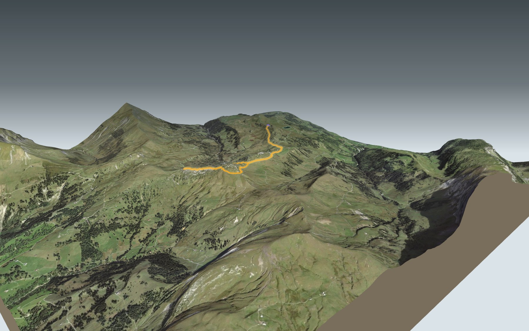
The path first heads for the Steistoos alp, then crosses the Stübleni, a limestone formation. On its north side lies Gryden, a crater-like rocky landscape. Next come the high point, the Gryden shelter and the way back along the south side. The elevation profile shows you where it climbs.
Fancy another hike from Lenk? The Iffigsee-Rundweg is another loop, starting from the Iffigenalp, and the walk from Adelboden to Lenk ends down in the valley.
At the end, the Betelberg gondola takes you back down to Lenk. Check getting there and transport and plan your day before you set off. Looking for more in the area? See all hikes in the Bernese Oberland.
The story of the trail
What happened where you are going to walk, chapter by chapter.
A loop around Gryden
You start at Leiterli station, at 1,946 m, at the top of the Betelberg gondola, and finish back there. In between: 7.3 km, 320 m of climbing and the same again downhill, with a high point at 2,100 m. Allow 2 h 15 of walking time, whichever way round you go.
The first stretch follows the AlpRundweg Leiterli and its information points. Next comes the Steistoos alp, where alpine cheese is made. Near the alp, the path narrows and the view opens up over the head of the valley.
Gryden, a landscape of craters
A short, steeper climb takes you over the Stübleni, a limestone formation. On its north side lies Gryden, a landscape of crater-shaped rocks. The rock here is limestone and gypsum: rainwater slowly dissolves the gypsum and seeps underground, hollowing out sinkholes. This crater landscape resembles a lunar landscape, and it fascinates geologists and biologists alike.
At the high point, 2,100 m, on a clear day the view reaches from the Simmental across the Saanenland to the Fribourg mountains. The path then drops to the turning point of the loop.
A moorland of national importance
The path crosses the Haslerberg/Betelberg moorland, listed in the federal inventory of mire landscapes of particular beauty and national importance. Surveyed in 1996 and revised in 2017, it covers 541 hectares in the municipalities of Lauenen, Lenk and Saanen.
The ground beneath is flysch and moraine, which don't let water through. At Gryden, the hard, permeable limestone and gypsum rocks stand out sharply: white limestone knolls, alpine grassland and bog sit side by side, and many fens are edged by deep sinkholes. Higher up, heath with juniper, alpenrose and heather gives way to pasture, green alder, alpine grassland and scattered stands of Swiss stone pine and larch.
Flowers, pastures and litter huts
Near the station, the Leiterli alpine flower trail brings together more than 300 species of flowers, grasses and lichens; around 90 of them are shown on signs. Nothing here is sown or planted. Most plants flower in July and August; in midsummer the alpenrose slopes turn into a sea of blossom.
Within the moorland, the alpine pastures, litter meadows and hay meadows are still in use. The landscape keeps its drystone walls, wooden trough fountains and small litter huts; the buildings are mostly old alpine chalets, barns and huts in the typical Oberland style. At Haslerheuberg and Grydmeder, the fens are used for gathering litter.
The Gryden shelter and the way back
From the turning point, a short detour leads to the Gryden shelter, and the route on this page takes it. The detour winds between hollows in the ground: you need to be sure-footed and have a head for heights. Follow the signposts and check the conditions on the day. If you carry on along the path, you reach the Trütlisbergpass, the gateway to the Saanenland.
The way back runs along the south side, towards Steistoos. For the last stretch to Leiterli, you can finish on the AlpRundweg or make a detour along the alpine flower trail. The Berghaus Leiterli, at the station, dates from the 1980s: its rebuilding was approved in 2025, with work announced from April to December 2026 and the restaurant announced as closed during summer 2026. Further down this page you'll find where to eat; bring something to drink.
In pictures
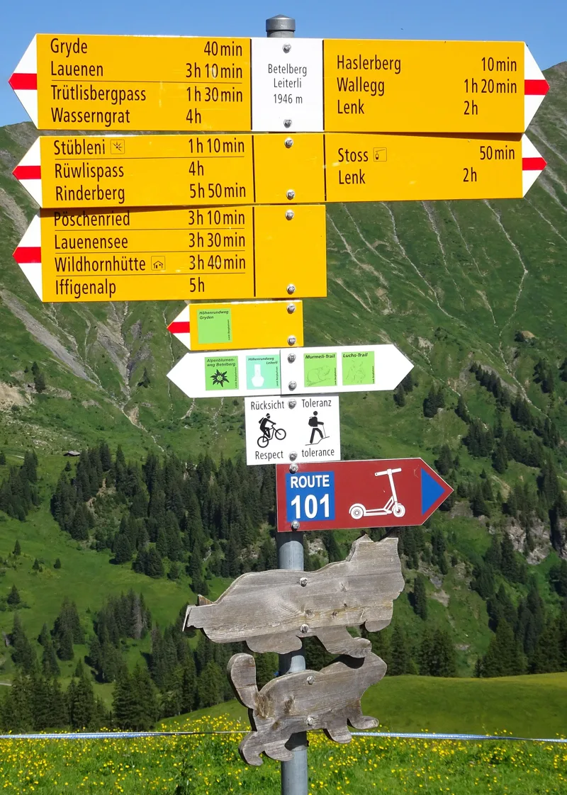
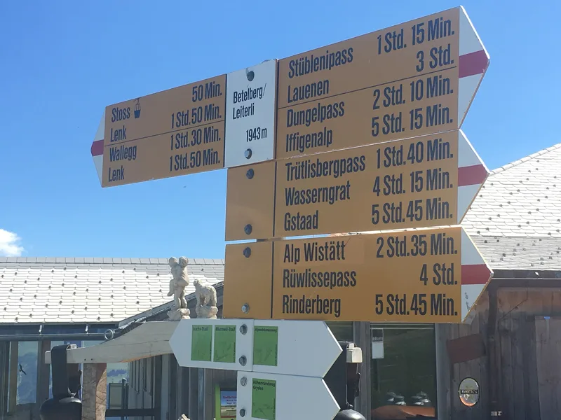
Hiking signpost at Betelberg Leiterli, Lenk
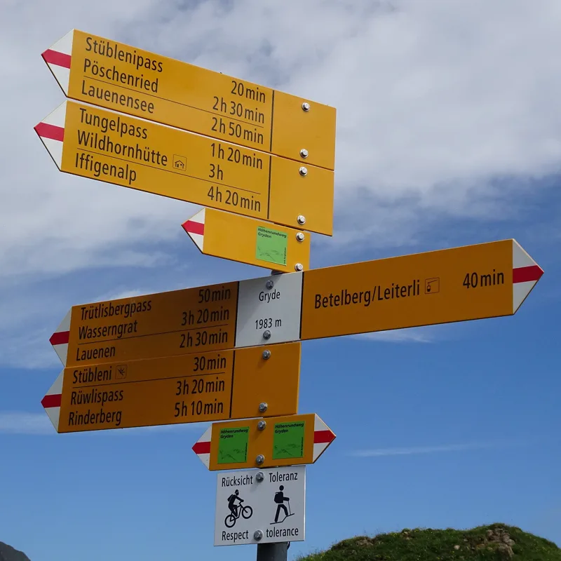
Hiking signpost at Gryde, Lenk
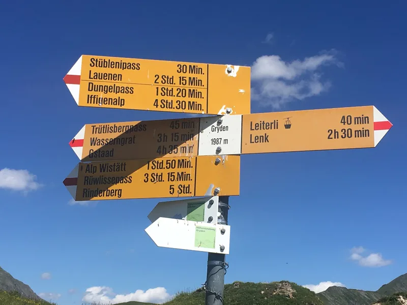
Hiking signpost at Gryden, Lenk
Hiking signpost at Betelberg Leiterli, Lenk
Höhenrundweg Gryden: when to go
Public transport serves the start every day from 19 December 2026 to 4 April 2027 and from 5 June to 24 October 2027 (and 10 other days), according to the official timetable: that's the season to do this loop without a car. The latest time to set off ranges from 18:10 in June to 13:29 in December.
- Public transport to the start
- daily, 19 Dec to 28 Feb
- 465 arrivals a day
- first arrival 8:48
- last 16:32
- Sun at the start, mid-January
- from 9:16
- rises at 8:10, hidden by the ridge
- Leave by, for 2 h 15 of walking
- 13:55
- arrive 1 hour before sunset, at 17:10
| Month | Sun at the start | Leave by | In the sun, leaving at 9:00 | Transport |
|---|---|---|---|---|
| December | 9:17 → 16:44 | 13:29 | 71 % | 13 of 31 days |
| January | 9:16 → 17:10 | 13:55 | 75 % | every day |
| February | 8:12 → 17:55 | 14:40 | 88 % | every day |
“In the sun”: the share of the path in sunlight under a clear sky, with the terrain worked out point by point. The path climbs to 2,100 m: today's snow and frost are in the weather and My day.
- Public transport to the start
- daily, 1 Mar to 4 Apr
- and also 4 other days
- 465 to 480 arrivals a day
- first arrival 8:48 or 8:52
- last 16:32 or 16:51
- Sun at the start, mid-April
- from 7:10
- rises at 6:44, hidden by the ridge
- Leave by, for 2 h 15 of walking
- 17:02
- arrive 1 hour before sunset, at 20:17
| Month | Sun at the start | Leave by | In the sun, leaving at 9:00 | Transport |
|---|---|---|---|---|
| March | 7:27 → 18:35 | 15:20 | 97 % | every day |
| April | 7:10 → 20:17 | 17:02 | 99 % | 4 of 30 days |
| May | 6:11 → 20:57 | 17:42 | 100 % | 4 of 31 days |
“In the sun”: the share of the path in sunlight under a clear sky, with the terrain worked out point by point. The path climbs to 2,100 m: today's snow and frost are in the weather and My day.
- Public transport to the start
- daily, 5 Jun to 31 Aug
- 480 arrivals a day
- first arrival 8:52
- last 16:51
- Sun at the start, mid-July
- from 6:11
- rises at 5:53, hidden by the ridge
- Leave by, for 2 h 15 of walking
- 18:05
- arrive 1 hour before sunset, at 21:20
| Month | Sun at the start | Leave by | In the sun, leaving at 9:00 | Transport |
|---|---|---|---|---|
| June | 5:55 → 21:25 | 18:10 | 100 % | 26 of 30 days |
| July | 6:11 → 21:20 | 18:05 | 100 % | every day |
| August | 6:47 → 20:41 | 17:26 | 100 % | every day |
“In the sun”: the share of the path in sunlight under a clear sky, with the terrain worked out point by point. The path climbs to 2,100 m: today's snow and frost are in the weather and My day.
- Public transport to the start
- daily, 1 Sept to 24 Oct
- and also 6 other days
- 480 arrivals a day
- first arrival 8:52
- last 16:51
- Sun at the start, mid-October
- from 8:34
- rises at 7:48, hidden by the ridge
- Leave by, for 2 h 15 of walking
- 15:30
- arrive 1 hour before sunset, at 18:45
| Month | Sun at the start | Leave by | In the sun, leaving at 9:00 | Transport |
|---|---|---|---|---|
| September | 7:36 → 19:43 | 16:28 | 94 % | every day |
| October | 8:34 → 18:45 | 15:30 | 86 % | 26 of 31 days |
| November | 8:34 → 16:58 | 13:43 | 85 % | 4 of 30 days |
“In the sun”: the share of the path in sunlight under a clear sky, with the terrain worked out point by point. The path climbs to 2,100 m: today's snow and frost are in the weather and My day.
The next few days
Local forecast, updated every hour
Reading the forecast…
My day
Pick your day and start time: everything updates.
- Arrival at Lenk, Betelberg
- 10:45 2 h 15 of walking without breaks, starting at 08:30
The trail, kilometre by kilometre
Places are listed under the kilometre where you pass them. Drag along the profile: the marker moves on the 3D view too.
- under 10 %
- 10 to 20 %
- 20 to 30 %
- over 30 %
- fountain or water point
- toilets
Around the trail (250 m): 1 restaurant. Estimated time: the official walking time spread by effort (1 km on the flat counts as 100 m of climbing), start time set in “My day”.
Getting there and back
Back by public transport from the Leiterli (Bergstation) stop
Next departures from Leiterli (Bergstation)Reading the official timetable…
By car
Park in Lenk, Betelberg. It's a loop: you walk back to where you started, and so to your car.
Public car parks within 600 m of the start: prices and number of spaces may have changed, check the signs on site.
Questions people ask
How long does the loop from Lenk, Betelberg take?
2 h 15 of walking (official time), in this direction, not counting breaks. The other way: 2 h 15.
Is it hard?
Official rating for this stage: fitness easy, technique medium. It is 320 m of climbing over 7.3 km.
Can I get back by public transport?
Yes. The Leiterli (Bergstation) stop is at the finish. The next departures show live under “Getting there and back”.
Where can I eat on the way?
One place to eat within 250 m of the trail: Berghaus Leiterli. Where it is and its opening hours: below the profile.
Is there water and are there toilets on the way?
0 fountains and water points and 0 toilets within 250 m of the trail (survey of 25/10/2026).
Can I download the track?
Yes, as a GPX file for your watch or map app: “Download the track” button at the top of the page.
More hikes within 10 km
Official stages that pass within 10 km of this trail. Each card says whether its page is already up.
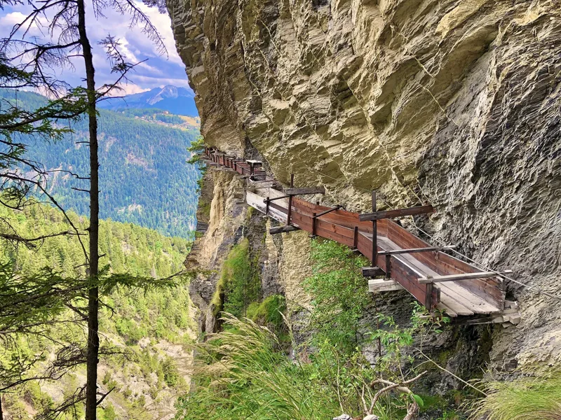 Tseuzier, Barrage → Arbaz, Etang-Long3 h 10Grand Bisse d'Ayent12.0kmDistance150mAscent620mDescentTechnical mediumFitness medium. See the hike
- © swisstopoLenk → Gstaad7 h 00Via Alpina, stage 1622.0kmDistance1,150mAscent1,200mDescentTechnical mediumFitness difficult. Official waymarked stage
- © swisstopoLenk im Simmental, loop1 h 25Lenker Rundweg6.0kmDistance50mAscent50mDescentTechnical mediumFitness difficult. Official waymarked stage
- © swisstopoLenk, Simmenfälle → Lenk, Iffigenalp3 h 20Siebenbrunnen-Weg8.0kmDistance820mAscent340mDescentTechnical mediumFitness medium. Official waymarked stage
- © swisstopoZweisimmen, Rinderberg → Schönried, Horneggli1 h 55Horneggli-Panoramaweg6.0kmDistance200mAscent440mDescentTechnical mediumFitness medium. Official waymarked stage
- © swisstopoGsteig → Hôtel du Sanetsch4 h 50Sanetsch-Muveran-Weg, stage 113.0kmDistance1,150mAscent300mDescentTechnical mediumFitness difficult. Official waymarked stage