
Walking the Europaweg from Grächen
Day one of the two-day Europaweg, the trail between Grächen and Zermatt: you set off from the village of Grächen and end the day at the Europahütte, above Randa, where you spend the night. A long day, rated difficult for fitness and medium for technique. It is also stage 2 of the Swiss Tour Monte Rosa.
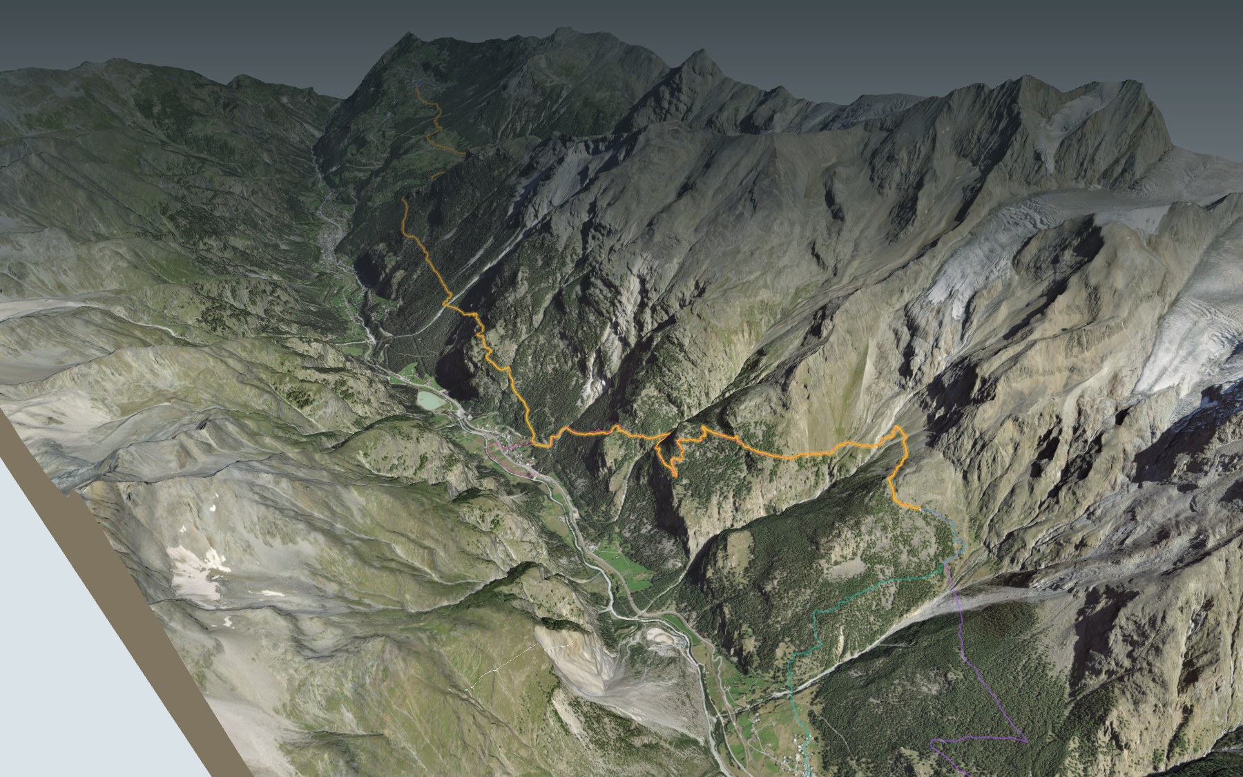
You start on the level, along an irrigation channel, the Bineri, as far as Gasenried. Then the trail drops through the forest, crosses the Grosse Grabe, passes close to the Taflüe and plunges down to Herbriggen, the lowest point of the day. From there it climbs in one go towards the hut. The elevation profile shows you that long final climb.
This stage was redesigned in 2021: the old route was closed because of the rockfall risk. Before you go, read the chapter on the long climb below: the official information announced the trail's winter closure from 28 October. Only want the climb? Start from Herbriggen, Randa or Täsch: each start climbs to the hut, has its own colour on the 3D map and its estimated time in the list of starting points. The Randa Hängebrückenweg passes very close by.
At the finish: the Europahütte and its terrace. The next day, the Europaweg to Zermatt leaves from the hut and crosses the Charles Kuonen suspension bridge. Check the transport and plan your day before you set off. Fancy something else nearby? All the hikes in Valais.
The story of the trail
What happened where you are going to walk, chapter by chapter.
A long stage in three parts
You start at 1,621 m in Grächen and finish at 2,264 m at the Europahütte. In between: 16.9 km, 1,700 m of climbing and 1,050 m of descent. The highest point, 2,335 m, comes around kilometre 16, just before the hut. Allow 7 h 10 of walking in this direction and 6 h 35 the other way. The stage is rated difficult for fitness and medium for technique.
Grächen has places to eat at the start, and there is a water point around kilometre 4. After Gasenried, the next village is Herbriggen, down in the valley, then comes the hut. Take enough to drink and to eat, and follow the signposts and the conditions on the day.
From the channel to the forest, down to Herbriggen
From the first kilometre, the trail follows the Bineri, an irrigation channel, through larches and meadows, and crosses the Ritigraben ravine. Around kilometre 2 it reaches Gasenried, above St. Niklaus, and it leaves the channel around kilometre 3. Around kilometre 4 it crosses the Riedbach stream.
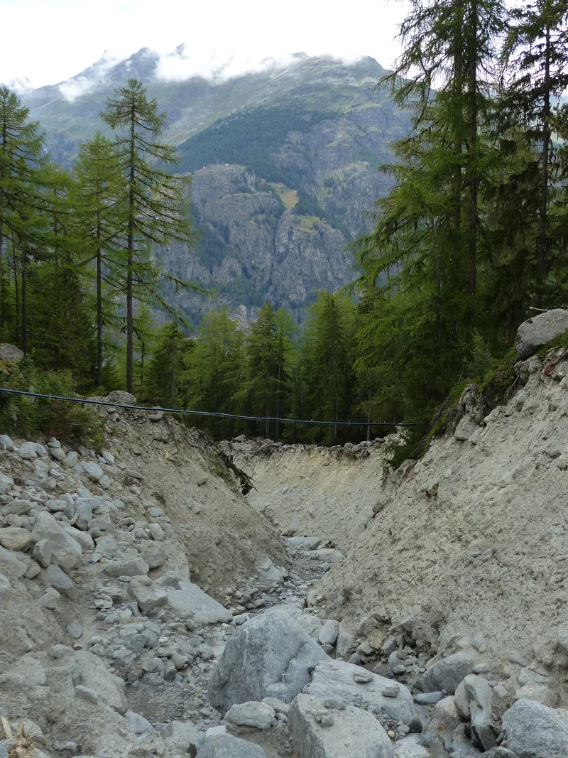
Then the trail goes downhill, and the stage passes through a forest of larch and Swiss stone pine. Around kilometre 8 it crosses the Grosse Grabe: after this ravine come more demanding sections, in places with fixed ropes. Around kilometre 9 it passes close to the Taflüe, with a view of the Breithorn and the Klein Matterhorn, then drops to Herbriggen, around kilometre 10.
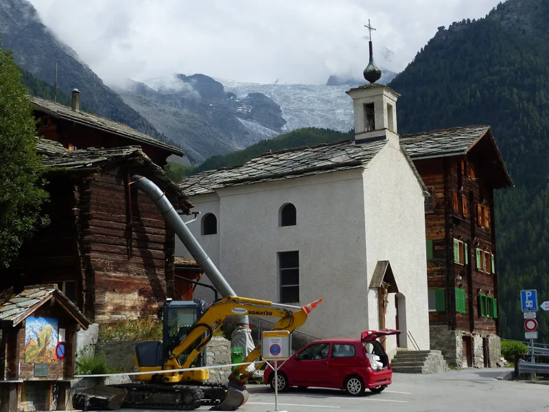
Grächen, Gasenried and Thomas Platter
Grächen sits on a terrace in line with the Ried Glacier, surrounded by forest. The area counts among the driest not only in Valais but in the whole Alps. A chapel dedicated to St James was built here in 1433, and in 1750 the village split from the parish of Stalden to become a parish of its own. The road linking it to the main valley dates from 1953. Its neighbour Gasenried, part of St. Niklaus since 1870, signed a contract with Grächen in 1603 on the use of the Riedbach's water.
The humanist Thomas Platter is regarded as Grächen's most famous son. He was born in 1499 or a little later and died in Basel in 1582. A goatherd as a child, he set off on the road at twelve, became a printer in Basel and printed a work by John Calvin there in 1536. In 1572 he wrote the story of his life for his son Felix, considered one of the most important autobiographies of the 16th century.
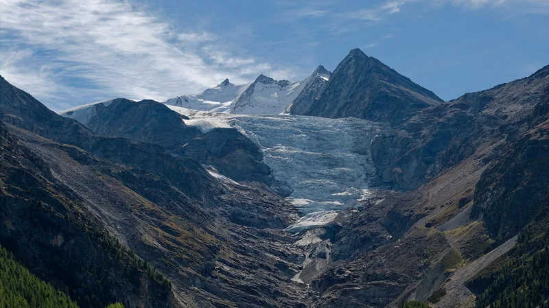
The glacier that fills the channels
In four irrigation channels of the Grächen area, the Eggeri, the Chilcheri, the Drieri and the Bineri, water flows from the Ried Glacier to the meadows. The Eggeri is the oldest and the highest. The Bineri, the one you follow, runs through quiet woods, meadows and a marshy area.
The front of the Ried Glacier has been measured since 1895. Its last measured advance dates from 1987 to 1988; since then, each of the thirty measurements published up to 2024 shows a retreat.
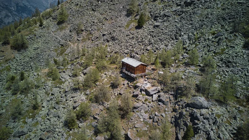
The long climb to the Europahütte
From Herbriggen the trail climbs: it reaches its highest point around kilometre 16, then drops a little to the Europahütte. The hut was built in 1999 by the Burgergemeinde (citizens' community) of Randa. It sleeps 42, has a large dining room and a terrace, and it is open from the end of June to mid or late September.
The Europaweg was created in 1997 by the municipalities of St. Niklaus, Grächen, Randa, Täsch and Zermatt. The original route of this stage was closed because of an acute rockfall risk, and the stage, redesigned via Herbriggen, reopened in July 2021. On 10 November 2026, the official information announced the trail's winter closure from 28 October, and it reported closed sections further on, between Randa and Täsch, on the next stage. Check the conditions on the day before you go and follow the signposts.
Every way to Europahütte
4 starting points to reach Europahütte. Pick yours: the 3D view shows it and “My day” recalculates.
Walking times without breaks. “Estimated” times are calculated on the terrain profile with a model fitted to the official stages; the shortest path may differ from the one on the yellow signposts: on the ground, follow the signs. Gradient: the steepest over 200 m of trail. Profiles share the same scale (length and altitude). Stations and car parks within 500 m of the start.
In pictures
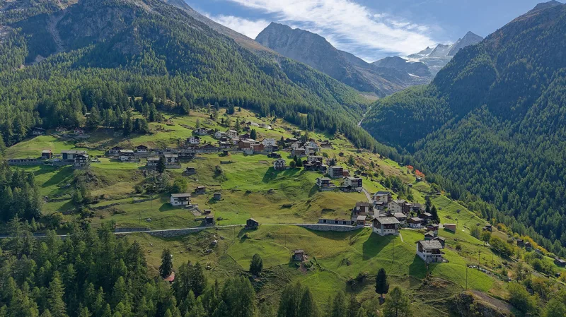
The village of Grächen; in the background on the left, the village of Törbel
The Ritigraben, between Grächen and Gasenried
Gasenried, with the Ried Glacier in the background
The chapel of St Theodul in Gasenried and the Ried Glacier
The Riedbach stream and the Ried Glacier
The Ried Glacier with the Nadelgrat, and the Ulrichshorn on the left
The glacier mouth near Gasenried
Herbriggen, municipality of St. Niklaus
The Europahütte in the Mattertal, in summer
An alpine morning, seen from the Europahütte
Europaweg: Grächen → Europahütte: when to go
The bus runs up to the start every day of the year, according to the official timetable. The latest time to set off ranges from 13:12 in June to 8:33 in December.
- Bus to the start
- every day
- 24 to 27 buses a day
- first bus 6:36, 6:42, 7:06 or 7:22
- last 22:06, 22:12, 23:27 or 23:34
- Sun at the start, mid-January
- from 12:03
- rises at 8:07, hidden by the ridge
- Leave by, for 7 h 10 of walking
- 8:59
- arrive 1 hour before sunset, at 17:09
| Month | Sun at the start | Leave by | In the sun, leaving at 9:00 | Bus |
|---|---|---|---|---|
| December | 12:00 → 16:43 | 8:33 | 31 % | every day |
| January | 12:03 → 17:09 | 8:59 | 37 % | every day |
| February | 10:44 → 17:54 | 9:44 | 43 % | every day |
“In the sun”: the share of the path in sunlight under a clear sky, with the terrain worked out point by point. The path climbs to 2,335 m: today's snow and frost are in the weather and My day.
- Bus to the start
- every day
- 24 to 26 buses a day
- first bus 6:36 or 7:06
- last 22:06 or 23:27
- Sun at the start, mid-April
- from 8:54
- rises at 6:42, hidden by the ridge
- Leave by, for 7 h 10 of walking
- 12:05
- arrive 1 hour before sunset, at 20:15
| Month | Sun at the start | Leave by | In the sun, leaving at 9:00 | Bus |
|---|---|---|---|---|
| March | 9:28 → 18:34 | 10:24 | 74 % | every day |
| April | 8:54 → 20:15 | 12:05 | 84 % | every day |
| May | 7:46 → 20:54 | 12:44 | 99 % | every day |
“In the sun”: the share of the path in sunlight under a clear sky, with the terrain worked out point by point. The path climbs to 2,335 m: today's snow and frost are in the weather and My day.
- Bus to the start
- every day
- 24 to 26 buses a day
- first bus 6:36 or 7:06
- last 22:06 or 23:27
- Sun at the start, mid-July
- from 7:34
- rises at 5:52, hidden by the ridge
- Leave by, for 7 h 10 of walking
- 13:07
- arrive 1 hour before sunset, at 21:17
| Month | Sun at the start | Leave by | In the sun, leaving at 9:00 | Bus |
|---|---|---|---|---|
| June | 7:14 → 21:22 | 13:12 | 99 % | every day |
| July | 7:34 → 21:17 | 13:07 | 99 % | every day |
| August | 8:24 → 20:39 | 12:29 | 96 % | every day |
“In the sun”: the share of the path in sunlight under a clear sky, with the terrain worked out point by point. The path climbs to 2,335 m: today's snow and frost are in the weather and My day.
- Bus to the start
- every day
- 24 to 26 buses a day
- first bus 6:36, 6:42, 7:06 or 7:22
- last 22:06, 22:12, 23:27 or 23:34
- Sun at the start, mid-October
- from 10:48
- rises at 7:46, hidden by the ridge
- Leave by, for 7 h 10 of walking
- 10:33
- arrive 1 hour before sunset, at 18:43
| Month | Sun at the start | Leave by | In the sun, leaving at 9:00 | Bus |
|---|---|---|---|---|
| September | 9:35 → 19:41 | 11:31 | 63 % | every day |
| October | 10:48 → 18:43 | 10:33 | 44 % | every day |
| November | 10:59 → 16:57 | 8:47 | 38 % | every day |
“In the sun”: the share of the path in sunlight under a clear sky, with the terrain worked out point by point. The path climbs to 2,335 m: today's snow and frost are in the weather and My day.
The next few days
Local forecast, updated every hour
Reading the forecast…
My day
Pick your day and start time: everything updates.
- Arrival at Europahütte
- 15:40 7 h 10 of walking without breaks, starting at 08:30
The trail, kilometre by kilometre
From Grächen
Places are listed under the kilometre where you pass them. Drag along the profile: the marker moves on the 3D view too.
- under 10 %
- 10 to 20 %
- 20 to 30 %
- over 30 %
- fountain or water point
- toilets
Around the trail (250 m): 8 restaurants, 4 cafés, 5 fountains and water points and 4 toilets. Estimated time: the official walking time spread by effort (1 km on the flat counts as 100 m of climbing), start time set in “My day”.
- under 10 %
- 10 to 20 %
- 20 to 30 %
- over 30 %
- fountain or water point
- toilets
Around the trail (250 m): 3 restaurants, 4 fountains and water points and 3 toilets. Estimated time: the official walking time spread by effort (1 km on the flat counts as 100 m of climbing), start time set in “My day”.
- under 10 %
- 10 to 20 %
- 20 to 30 %
- over 30 %
- fountain or water point
- toilets
Around the trail (250 m): 7 restaurants, 1 café, 6 fountains and water points and 6 toilets. Estimated time: the official walking time spread by effort (1 km on the flat counts as 100 m of climbing), start time set in “My day”.
- under 10 %
- 10 to 20 %
- 20 to 30 %
- over 30 %
- fountain or water point
- toilets
Estimated time: the official walking time spread by effort (1 km on the flat counts as 100 m of climbing), start time set in “My day”.
Getting there and back
Europahütte, 2,264 m
By car
From Grächen
Careful, this is one way: public transport back arrives in Europahütte, not in Grächen. Plan to get back to your car by public transport, or park at the finish and take public transport to the start.
- Citymulti-storey car park · paid170 m from the start
- Parkplatz Hannigopen-air · paid280 m from the start
- Car park open-air, Kantonsstrassepaid70 m from the start
Public car parks within 600 m of the start: prices and number of spaces may have changed, check the signs on site.
Careful, this is one way: public transport back arrives in Europahütte, not in Randa. Plan to get back to your car by public transport, or park at the finish and take public transport to the start.
- Car parkpaid40 m from the start
- Station Randaor by public transport0 m from the start
The nearest car park and stop for this start. Check the signs on site for the price.
Careful, this is one way: public transport back arrives in Europahütte, not in Täsch. Plan to get back to your car by public transport, or park at the finish and take public transport to the start.
- Täscherhofpaid90 m from the start
- Station Täschor by public transport0 m from the start
The nearest car park and stop for this start. Check the signs on site for the price.
Careful, this is one way: public transport back arrives in Europahütte, not in Herbriggen. Plan to get back to your car by public transport, or park at the finish and take public transport to the start.
- Car parkfree40 m from the start
- Station Herbriggenor by public transport0 m from the start
The nearest car park and stop for this start. Check the signs on site for the price.
Questions people ask
How long is the hike from Grächen to Europahütte?
7 h 10 of walking (official time), in this direction, not counting breaks. The other way: 6 h 35.
Is it hard?
Official rating for this stage: fitness difficult, technique medium. It is 1,700 m of climbing over 16.9 km.
Where can I eat on the way?
13 places to eat within 250 m of the trail, including Café 13 Etoiles, Walliser-Kanne, Paletti. Where they are and their opening hours: below the profile.
Is there water and are there toilets on the way?
5 fountains and water points and 4 toilets within 250 m of the trail (survey of 25/10/2026).
Can I download the track?
Yes, as a GPX file for your watch or map app: “Download the track” button at the top of the page.
More hikes within 10 km
Official stages that pass within 10 km of this trail. Each card says whether its page is already up.
- © swisstopoSaas Fee → Grächen9 h 00Alpenpässe-Weg, stage 2020.0kmDistance1,300mAscent1,450mDescentTechnical mediumFitness difficult. Official waymarked stage
- © swisstopoGrächen → Gruben9 h 10Alpenpässe-Weg, stage 2122.0kmDistance1,950mAscent1,750mDescentTechnical mediumFitness difficult. Official waymarked stage
- © swisstopoSaas Fee → Grächen9 h 00Swiss Tour Monte Rosa, stage 120.0kmDistance1,300mAscent1,450mDescentTechnical mediumFitness difficult. Official waymarked stage
- © swisstopoGrächen, loop3 h 50Zauberwasser-Weg Grächen14.0kmDistance440mAscent440mDescentTechnical easyFitness medium. Official waymarked stage
- © swisstopoGspon → Saas Fee5 h 50Alpenpässe-Weg, stage 1917.0kmDistance950mAscent1,000mDescentTechnical mediumFitness difficult. Official waymarked stage
- © swisstopoSimplon Hospiz → Gspon7 h 00Alpenpässe-Weg, stage 1823.0kmDistance1,000mAscent1,100mDescentTechnical mediumFitness difficult. Official waymarked stage