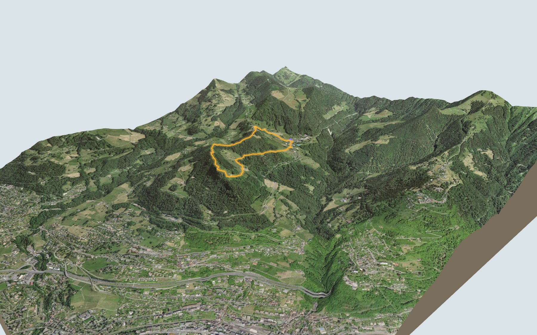

The Chemin des Narcisses, a loop from Les Avants
A short loop in the hills above Montreux: you start in Les Avants and finish there too. It is SwitzerlandMobility route 133, rated easy for both fitness and technique. It is a documented trail, with six signs about the narcissi, a medieval tower, an erratic boulder and the Sonloup funicular.
The path goes through Azot, up to Le Cubly, then past Fiaudire. The highest point, at 1,191 m, comes next, before the descent via Sonloup. The elevation profile shows you where it climbs.
According to the Park, the narcissus season is the best time for the loop, but it considers the walk pleasant all year round. Les Avants is also one of the possible starting points for the Rochers-de-Naye, if you want a longer day.
For the way home, check the next departures from Les Avants and plan your day before you set off. Looking for more in the area? All hikes in the Vaud Alps.
The story of the trail
What happened where you are going to walk, chapter by chapter.
A loop around Le Cubly
You start in Les Avants, at 972 m, and come back to the same place. The loop is 5.6 km long, with 360 m of climbing and the same amount of descent according to SwitzerlandMobility, which gives 2 h 00 of walking in either direction.
The path goes through Azot, climbs to Le Cubly, then passes Fiaudire. The highest point, at 1,191 m, comes in the fourth kilometre. You then pass Sonloup before heading back down to Les Avants. For food, Tramontana Café and Comme Avants are both in Les Avants, at the start. On the trail, follow the signposts and check the day's conditions.
May snow
From Mont-Pèlerin to the hills above Montreux, narcissi bloom so thickly in May that the fields turn white: locals call it “May snow”. From the late 19th century, Montreux turned this into a tourist attraction: a narcissus train ran from Basel to Les Avants, and bouquets sold far away were an important source of income for farmers.
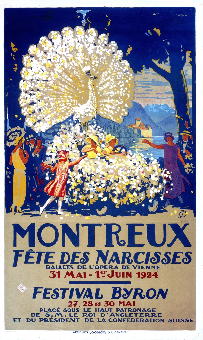
In Montreux, the Narcissus Festival, launched by the town's promotion society, took place from 1897 to 1957, with parades of flower-decked floats and shows. In his History of Montreux (1877), Eugène Rambert was already advising visitors to go up to Les Avants for the bloom, “at the end of May or in the first half of June, depending on the year”.

Two narcissi and a glacier
Two species grow in Les Avants, in hay meadows, pastures, banks and along forest edges: the poet's narcissus and the narcissus radiiflorus. The narcissus stores the energy the bulb needs to reproduce through its leaves, which is why they must not be damaged. The Park asks you not to pick them, not to walk or lie down in the meadows, and to keep dogs on a lead. The narcissi are steadily declining, because of more intensive farming, reforestation and building zones. At Fiaudire, a plot that was turning back into forest is cleared and mown in September, with help from the municipality of Montreux.
About 20,000 years ago, the Rhône glacier covered Le Cubly. As it melted, it left erratic boulders behind: the one on the trail weighs about 4 tonnes and comes from the Dorénaz area, in Valais. The largest in the region, near Sonzier at the foot of Le Cubly, weighs nearly 400 tonnes.
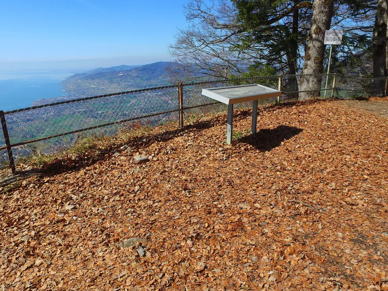
The Salausex tower
On the rocky spur of Le Cubly stood a square tower, probably from the 10th or 11th century, of which almost nothing remains. A ditch, still clearly visible, protected it on the east side. It was probably a refuge and a lookout post: thanks to its commanding position, the castles of Chillon, Le Châtelard and Blonay could communicate quickly to warn each other of danger.
The trail passes these ruins. The name Salausex refers to a rock or a rock face, from the Latin saxum. This is the setting for the legend of Eléonore, daughter of Archibald d'Aigremont, whose father forced her into a convent rather than let her marry Berthold de Blonay, whom she had met at the tower. Her soul is said to wander near the ruins ever since.
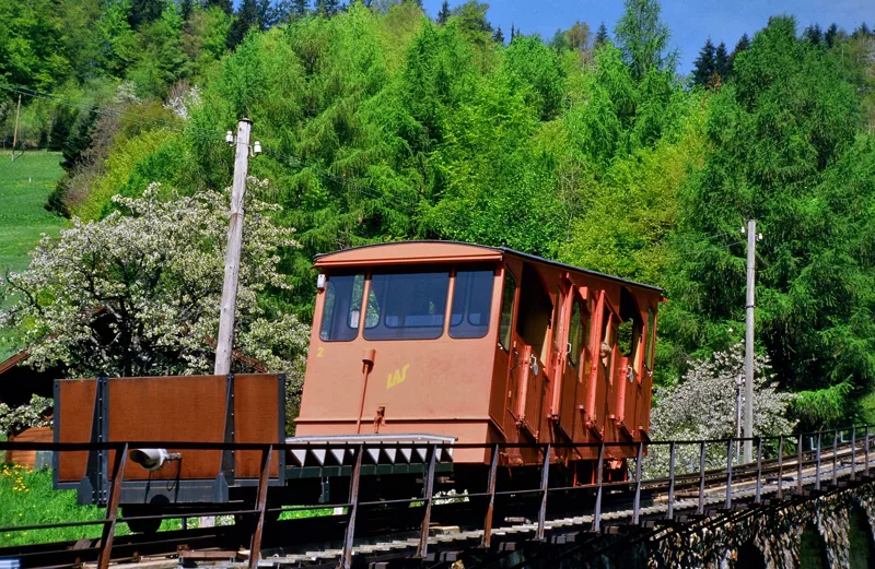
Sonloup, then the station
The path then passes Sonloup. Since 14 December 1910, a funicular has climbed here from Les Avants; at the time it served a bobsleigh run and two toboggan runs. The line has three engineering structures, including an eleven-arch masonry viaduct, and it is largely preserved in its original state; its historic red cars have been adapted to today's requirements. Next to the station, the Hôtel de Sonloup opened in 1913, designed by the architect Louis Villard.
The loop ends in Les Avants. The Montreux to Les Avants line of the Montreux Oberland Bernois railway (MOB) was inaugurated here on 16 December 1901, and the station is the work of the Montreux architect Louis Villard. The rest of the page shows the next departures.
In pictures
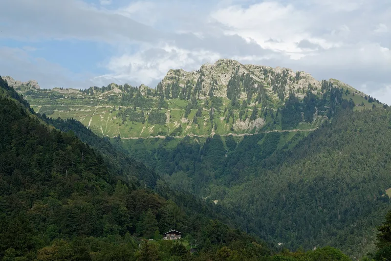
Les Verraux seen from the Route des Narcisses in Les Avants
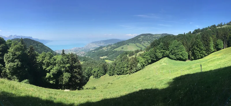
Lake Geneva seen from La Pacoresse, above Sonloup
Saleuscex
Poster for the Narcissus Festival, Montreux, 31 May and 1 June 1924
Les Avants, with the Dent de Jaman and Lake Geneva (Photochrom print)
The Les Avants - Sonloup funicular
Les Avants (Montreux Oberland Bernois railway, MOB): the station seen from the square
Aerial view of Les Avants
The Dents du Midi seen from Les Avants
A cow in a meadow at Les Avants
The next few days
MeteoSwiss local forecast, updated every hour
Reading the MeteoSwiss forecast…
My day
Pick your day and start time: everything updates.
- Arrival at Montreux, Les Avants
- 10:30 2 h 00 of walking without breaks, starting at 08:30
The trail, kilometre by kilometre
Places are listed under the kilometre where you pass them. Drag along the profile: the marker moves on the 3D view too.
- under 10 %
- 10 to 20 %
- 20 to 30 %
- over 30 %
- fountain or water point
- toilets
Around the trail (250 m, OpenStreetMap, extract of 25/10/2026): 2 restaurants, 0 cafés, 3 fountains and water points, 1 toilet. Estimated time: the official walking time spread by effort (1 km on the flat counts as 100 m of climbing), start time set in “My day”.
Getting there and back
Back by public transport from the Les Avants stop
Next departures from Les AvantsReading the official timetable…
By car
Careful, this is one way: public transport back arrives in Les Avants, not in Montreux, Les Avants. Plan to get back to your car by public transport, or park at the finish and take the train to the start.
- Car park roadside, Route des Narcisses60 m from the start
- Car park open-air, Route des Narcisses70 m from the start
Public car parks within 600 m of the start, according to OpenStreetMap: prices and number of spaces may have changed, check the signs on site.
Questions people ask
How long is the hike from Montreux, Les Avants to the finish (Montreux, Les Avants)?
2 h 00 of walking according to SwitzerlandMobility, in this direction, not counting breaks. The other way: 2 h 00.
Is it hard?
SwitzerlandMobility rates this stage: fitness easy, technique easy. It is 360 m of climbing over 5.6 km.
Can I get back by public transport?
Yes. The Les Avants stop is at the finish. The next departures show live under “Getting there and back”.
Where can I eat on the way?
2 restaurants, cafés and huts within 250 m of the trail, including Tramontana Café, Comme Avants. Where they are and their opening hours: below the profile.
Is there water and are there toilets on the way?
3 fountains and water points and 1 toilet within 250 m of the trail (survey of 25/10/2026).
Can I download the track?
Yes, as a GPX file for your watch or map app: “Download the track” button at the top of the page.
More hikes within 10 km
Official SwitzerlandMobility stages that pass within 10 km of this trail. Each card says whether its page is already up.
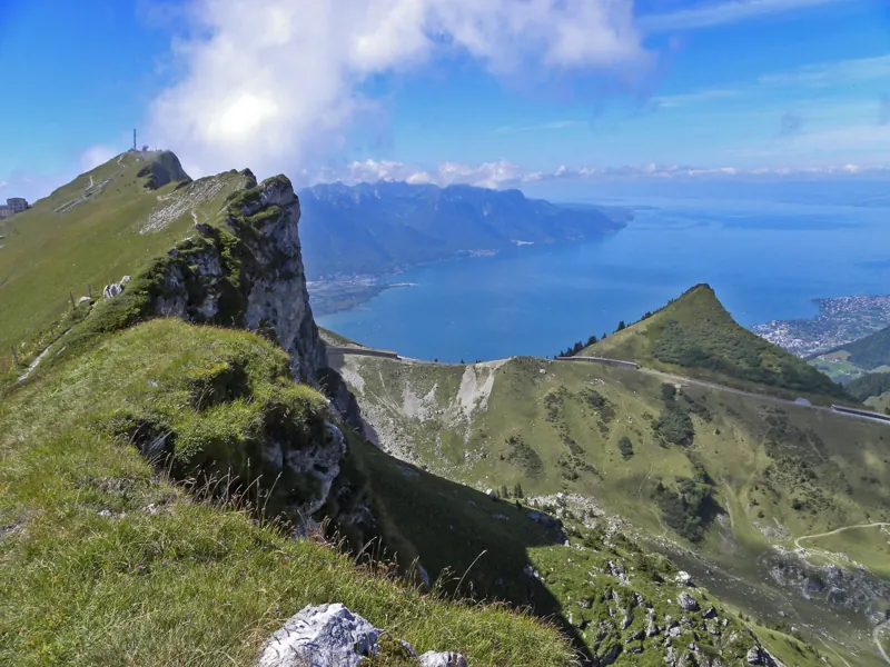 Rochers de Naye → Montreux4 h 00Via Alpina, stage 2014.0kmDistance90mAscent1,700mDescentTechnical mediumFitness difficult. See the hike
- Montreux → Villeneuve1 h 25Promenade de Montreux Riviera6.0kmDistance30mAscent50mDescentTechnical mediumFitness medium. Page coming
- Vevey → Aigle6 h 00ViaFrancigena, stage 525.0kmDistance220mAscent180mDescentTechnical easyFitness difficult. Page coming
- Les Paccots → Vevey (Corseaux)6 h 00Alpenpanorama-Weg, stage 2319.0kmDistance640mAscent1,300mDescentTechnical easyFitness difficult. Page coming
- Rossinière → Rochers de Naye7 h 20Via Alpina, stage 1918.0kmDistance1,850mAscent780mDescentTechnical mediumFitness difficult. Page coming
- Rossinière → Allières4 h 30Le Grand Tour des Vanils13.0kmDistance820mAscent700mDescentTechnical mediumFitness medium. Page coming