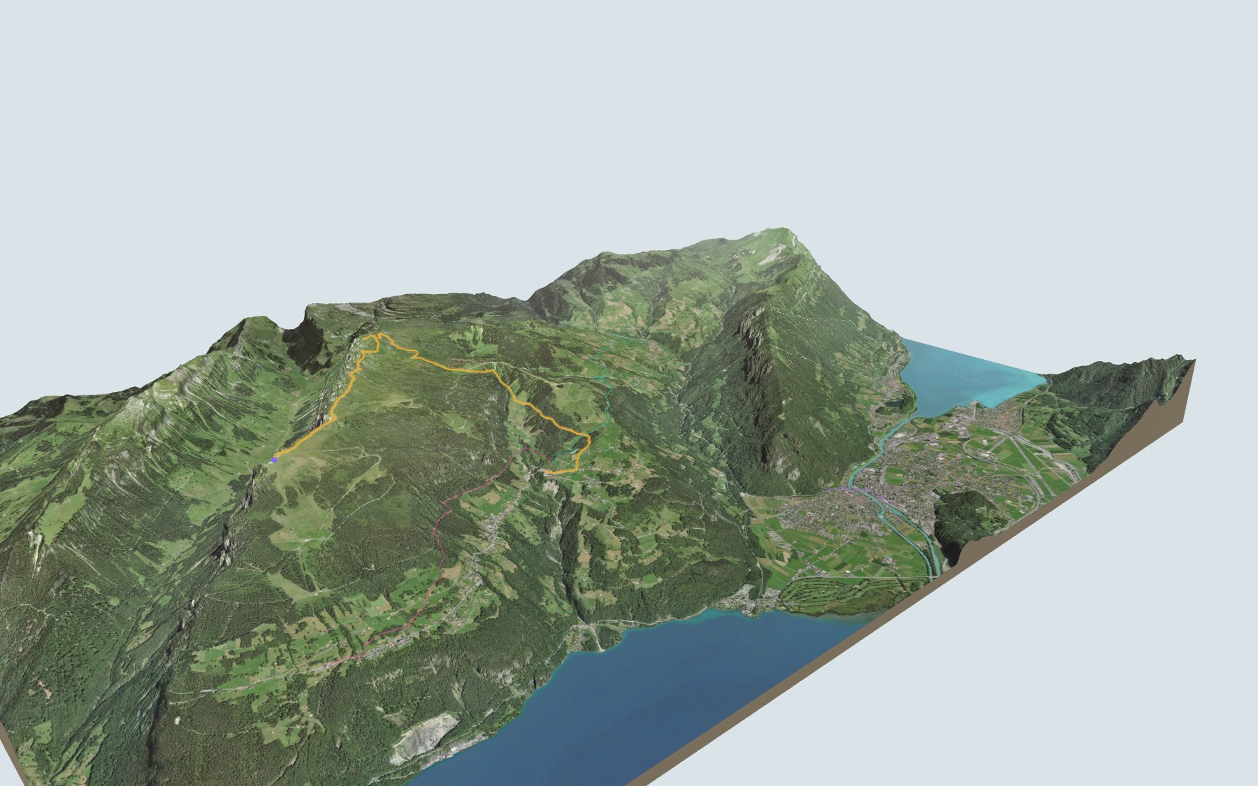

The Güggisgrat, from the Niederhorn to the Gemmenalphorn
This is SwitzerlandMobility route 342. You start on the summit of the Niederhorn and follow the Güggisgrat ridge to the Gemmenalphorn, then head down to Waldegg, part of the municipality of Beatenberg. Downhill wins: 1,100 m of descent for 400 m of climbing according to SwitzerlandMobility, which rates the route difficult for fitness and medium for technique.
To get to the start, the Niederhornbahn cable car takes you up from Beatenberg to the summit. The path then crosses the Burgfeldstand, the high point, and the Gemmenalphorn. It drops via the Loubenegg, crosses the Sundbach and reaches Waldegg. The elevation profile shows you where the descent gets steeper.
Rather skip the summit? Walk to Waldegg from Beatenberg, Habkern, Interlaken West or Ringgenberg: each start has its own colour in the 3D view and its estimated time in all starting points. On the other side of Interlaken, the walk from Iseltwald to Brienz follows Lake Brienz.
At the finish is the Beatenberg, Waldegg stop. Check the next departures and plan your day before you set off. Fancy something else nearby? See all hikes in the Bernese Oberland.
The story of the trail
What happened where you are going to walk, chapter by chapter.
A ridge above Lake Thun
You start at 1,933 m on the Niederhorn, next to the Bergrestaurant Niederhorn, and finish at 1,202 m in Waldegg. In between: 10.8 km, 400 m up and 1,100 m down according to SwitzerlandMobility. SwitzerlandMobility gives 3 h 35 of walking in this direction and 4 h 20 the other way.
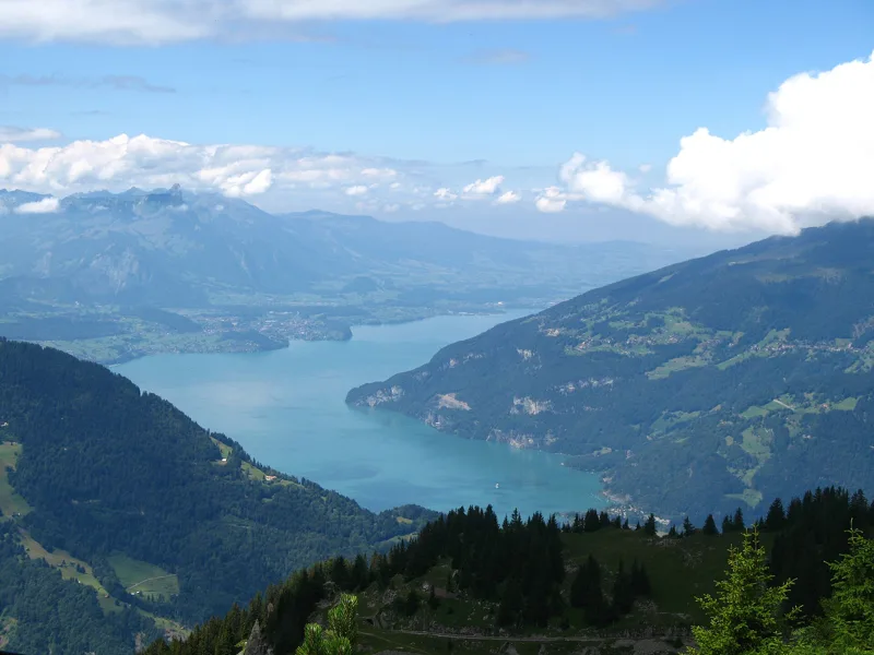
The path runs above the tree line, along the Güggisgrat, high above Lake Thun. The highest point, at 2,063 m, is the Burgfeldstand; the Gemmenalphorn comes a little further on. According to Thunersee Tourismus, the Niederhorn-Gemmenalphorn section was awarded a gold medal as the most beautiful hiking trail in Switzerland. The path then drops via the Loubenegg, crosses the Sundbach after about eight kilometres and enters Waldegg shortly before the finish. On the way, follow the signposts and check the conditions on the day.
Coal first, then cable cars
Before the hikers came the miners. Coal was mined on the Gemmenalp from 1771 and on the Niederhorn from 1795; mining stopped in 1856. In Beatenberg, the building of hotels and guesthouses began in 1866.
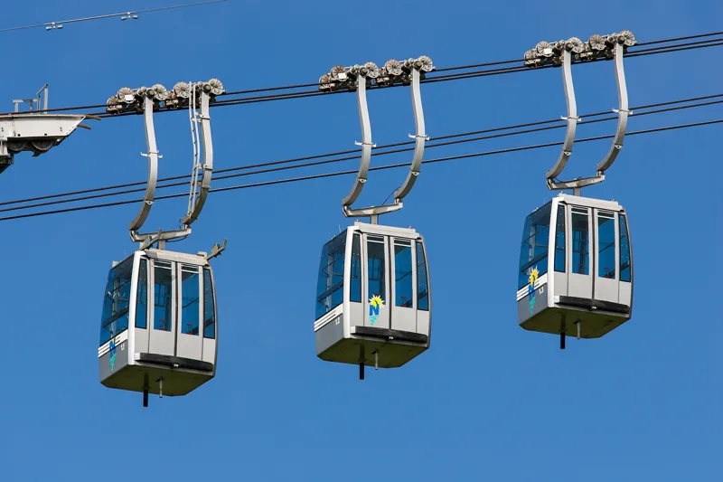
Since 1889, a funicular has linked Beatenbucht, on the shore of Lake Thun, with the village of Beatenberg. In 1946, a chairlift ran from the village to the summit of the Niederhorn. It was the forerunner of the three-cable cable car that opened in 1997, which, according to the operator, is the first and so far the only one of its kind in Switzerland. In 2014, the general meeting decided to merge the funicular and the cable car into Niederhornbahn AG.
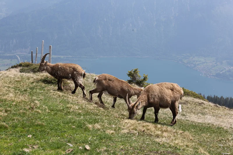
Ibex, ptarmigan and sandstone
An ibex colony lives at the Burgfeldstand, and the territory of ibex and ptarmigan stretches from the Burgfeldstand to the Gemmenalphorn; with luck, you may also see an eagle, a bearded vulture or chamois. In the Justistal, below the ridge, there are between 150 and 200 red deer, whose rutting calls can be heard from mid-August.
Under your feet, it is mostly the Niederhorn Formation: Hohgant sandstone, also known as Niederhorn sandstone, a grey-brown quartz sandstone that is partly limy, and Gemmenalp limestone, made of discocyclinids and red algae. These rocks date from the Eocene. Their type section is at Wagenmoos, north-east of the Gemmenalphorn.
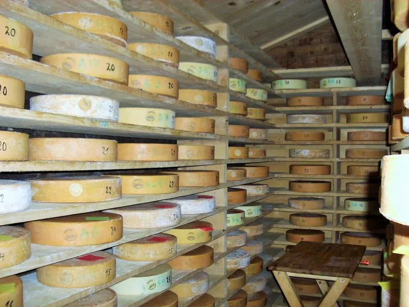
The Justistal and its cheese sharing
From the Gemmenalphorn, the view stretches east to the Sieben Hengste, the Hohgant and the whole Seefeld area. On the other side of the ridge from the lake lies the Justistal, a valley of alpine pastures.
The Chästeilet, the sharing of the cheese, has been held on the Spycherberg in the Justistal for almost 300 years. Every year in September, on the day the cattle come down from the alp, the valley's farmers gather to share the cheese made from the milk of more than 250 cows. Afterwards, the herders in traditional dress lead the decorated cattle down into the valley.
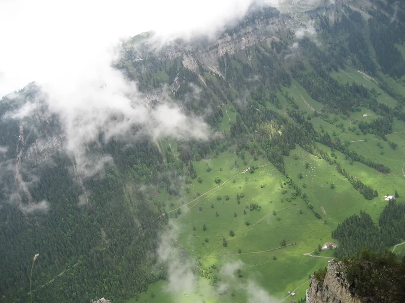
Waldegg, in the municipality of Beatenberg
The last kilometres descend to Waldegg. Shortly before the finish, the Hubelhuus Beatenberg is a few minutes' walk from the path; the Regina restaurant, almost at the finish, is right by the path.
Beatenberg is a large mountain municipality made up of communities, the Bäuerten: Schmocken, Spirenwald, Waldegg and Sundlauenen. Those of Spirenwald, Schmocken and Waldegg-Rufenen had common land and alpine pastures; their boundaries were only drawn in 1535. In 1357, the place is named 'Sant Beaten berge'. Further down the page you will find the next departures from Waldegg.
Every way to Waldegg
5 starting points to reach Waldegg. Pick yours: the 3D view shows it and “My day” recalculates.
Walking times without breaks. “Estimated” times are calculated on the swisstopo profile with a model fitted to the official SwitzerlandMobility stages; the shortest path may differ from the one on the yellow signposts: on the ground, follow the signs. Gradient: the steepest over 200 m of trail. Profiles share the same scale (length and altitude). Stations and car parks within 500 m of the start, according to OpenStreetMap.
In pictures
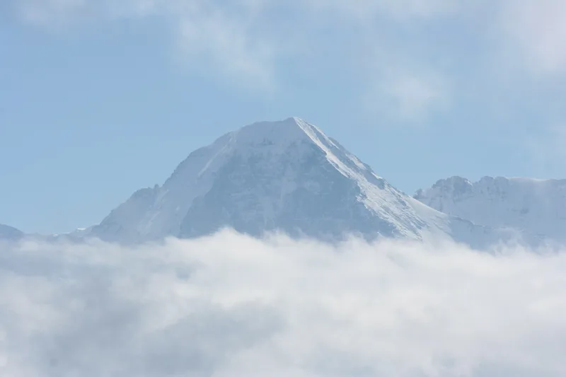
The Eiger seen from the Niederhorn
Hiking signpost on the Niederhorn
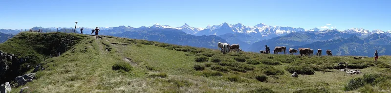
The summit of the Gemmenalphorn and the Alpine panorama: Schreckhorn, Finsteraarhorn, Eiger, Mönch, Jungfrau, Blümlisalphorn and Doldenhorn
The three-cable gondola Beatenberg-Niederhorn of Niederhornbahn AG
Ibex on the Niederhorn
Young ibex in the evening on the Güggisgrat
Rock ptarmigan on the Niederhorn
Justistal: the Grönhütte, the Grönbach stream and the Niederhorn
Chästeilet, the cheese sharing in the Justistal
View over the Justistal and the Niesen
The Mönch and the Jungfrau seen from the Niederhorn
View from Beatenberg
What you see from the top
360° view from Burgfeldstand (2,063 m). 34 named peaks, including Mont Blanc, 122.2 km away. Swipe to look around.
The next few days
MeteoSwiss local forecast, updated every hour
Reading the MeteoSwiss forecast…
My day
Pick your day and start time: everything updates.
- Arrival at Waldegg
- 12:05 3 h 35 of walking without breaks, starting at 08:30
The trail, kilometre by kilometre
Places are listed under the kilometre where you pass them. Drag along the profile: the marker moves on the 3D view too.
- under 10 %
- 10 to 20 %
- 20 to 30 %
- over 30 %
- fountain or water point
- toilets
Around the trail (250 m, OpenStreetMap, extract of 25/10/2026): 2 restaurants, 0 cafés, 3 fountains and water points, 1 toilet. Estimated time: the official walking time spread by effort (1 km on the flat counts as 100 m of climbing), start time set in “My day”.
Getting there and back
Back by public transport from the Beatenberg, Waldegg stop
Next departures from Beatenberg, WaldeggReading the official timetable…
By car
Careful, this is one way: public transport back arrives in Beatenberg, Waldegg, not in Niederhorn. Plan to get back to your car by public transport, or park at the finish and take the train to the start.
Public car parks within 600 m of the start, according to OpenStreetMap: prices and number of spaces may have changed, check the signs on site.
Questions people ask
How long is the hike from Niederhorn to the finish (Waldegg)?
3 h 35 of walking according to SwitzerlandMobility, in this direction, not counting breaks. The other way: 4 h 20.
Is it hard?
SwitzerlandMobility rates this stage: fitness difficult, technique medium. It is 1,100 m of descent over 10.8 km.
Can I get back by public transport?
Yes. The Beatenberg, Waldegg stop is at the finish. The next departures show live under “Getting there and back”.
Where can I eat on the way?
3 restaurants, cafés and huts within 250 m of the trail, including Bergrestaurant Niederhorn, Hubelhuus Beatenberg, Regina. Where they are and their opening hours: below the profile.
Is there water and are there toilets on the way?
3 fountains and water points and 1 toilet within 250 m of the trail (survey of 25/10/2026).
Can I download the track?
Yes, as a GPX file for your watch or map app: “Download the track” button at the top of the page.
More hikes within 10 km
Official SwitzerlandMobility stages that pass within 10 km of this trail. Each card says whether its page is already up.
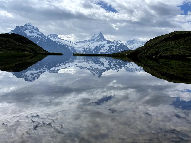 Schynige Platte → Grindelwald, First5 h 45ViaBerna, stage 1517.0kmDistance1,100mAscent900mDescentTechnical mediumFitness difficult. See the hike
 Schynige Platte, loop1 h 55Panoramaweg Schynige Platte6.0kmDistance340mAscent340mDescentTechnical mediumFitness easy. See the hike
- Schwanden, Säge, loop5 h 00Sigriswiler Rothorn Panoramaweg12.0kmDistance1,150mAscent1,150mDescentTechnical mediumFitness difficult. Page coming
- Interlaken → Spiez3 h 45ViaJacobi, stage 1013.0kmDistance420mAscent440mDescentTechnical easyFitness medium. Page coming
- Sigriswil → Interlaken4 h 45Panorama Rundweg Thunersee, stage 217.0kmDistance460mAscent700mDescentTechnical easyFitness medium. Page coming
- Interlaken West → Unterseen, Neuhaus1 h 10Unterseener-Uferweg5.0kmDistance30mAscent30mDescentTechnical mediumFitness difficult. Page coming