
Up the Gasterntal to Selden
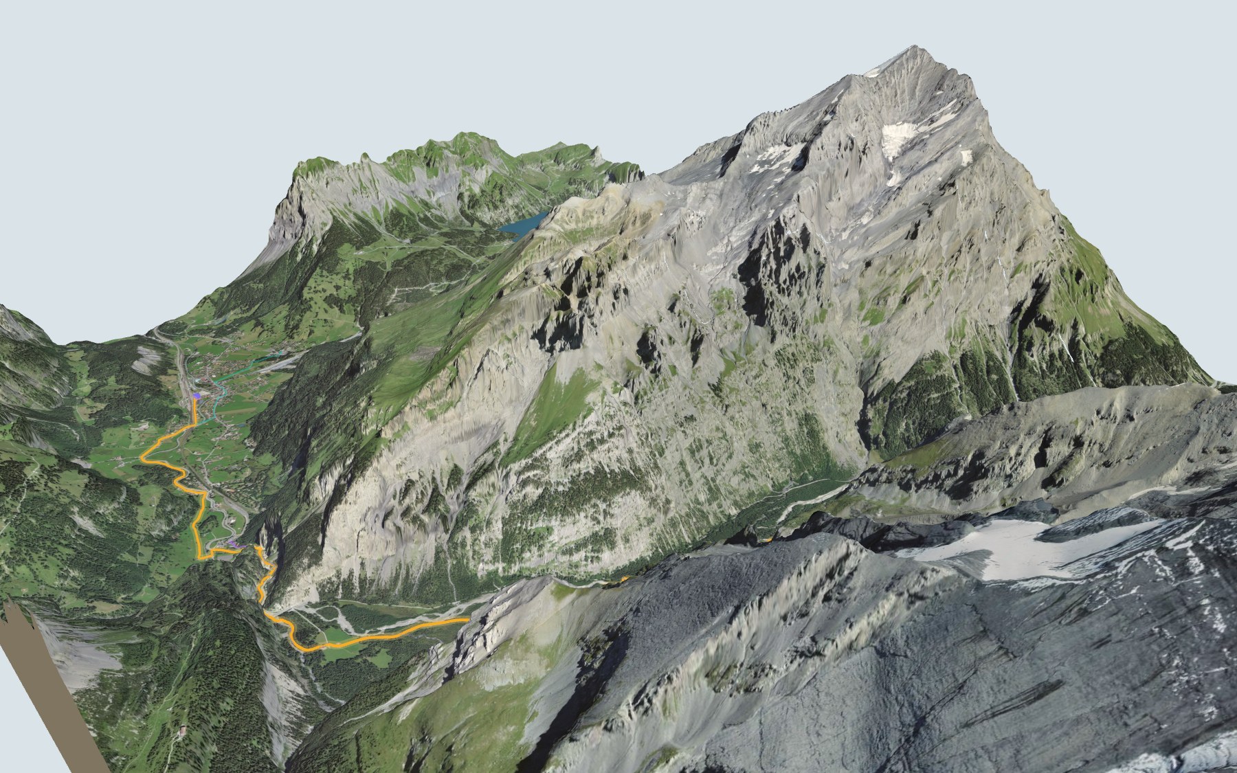
You start at Kandersteg station, go through the Chluse gorge and walk up the Gasterntal to the hotels of Selden. This is stage 2 of the Lötschberg-Panoramaweg, in its official direction. SwitzerlandMobility rates it medium for both fitness and technique.
The first three kilometres follow the floor of the Kandersteg valley, almost flat, as far as Eggeschwand. Then the path climbs through the Chluse and enters the Gasterntal: the Berghotel Waldhaus, numerous mountain streams and waterfalls, the Kander and its gravel banks, then Selden. The elevation profile shows you where it gets steeper.
Want to skip the start? Begin at the valley station of the Oeschinen gondola or of the Sunnbüel cable car: each starting point has its own colour in the 3D view and an estimated time under all starting points. Stage 14 of the Via Alpina also leaves Kandersteg for Adelboden, followed by the Adelboden → Lenk stage.
In Selden you'll find the Gasthaus Steinbock and the stop for the bus back down to Kandersteg. In 2025 this bus only ran from late May to early October and seats had to be booked: check the next departures from Selden and plan your day before you set off. Looking for more in the area? See all hikes in the Bernese Oberland.
The story of the trail
What happened where you are going to walk, chapter by chapter.
From the station to the Gasterntal
You start at 1,171 m at Kandersteg station and finish at 1,546 m in Selden. In between: 10.7 km, plus 460 m of climbing and 90 m of descent according to SwitzerlandMobility. It gives 3 h 00 of walking time in this direction, and 2 h 45 the other way.
The first three kilometres are almost flat: the path passes the Kandersteg International Scout Centre, then reaches Eggeschwand. The first real climb comes right after, in the Chluse gorge. All the places to eat are in Kandersteg, the last one being the Gemmi, before Eggeschwand, so bring food and drink for the rest of the way. On the way, follow the signposts and check the conditions on the day.
A palisade against the Valais
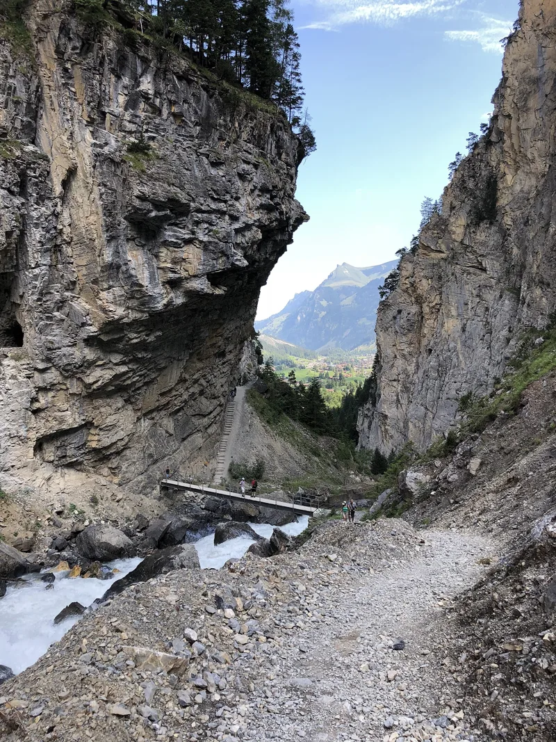
In the Middle Ages, people from the Valais crossed the Lötschenpass and settled the Gasterntal. At the Chluse, a palisade known as the "Tülle", first mentioned in 1367, was meant to stop their raids into the Frutigen valley. Military expeditions in 1384 and 1419 came before the border between Bern and the Valais was finally settled on the Lötschenpass.
From the 14th century until around 1820, the valley was lived in all year round: 8 to 10 families between 1374 and 1464, and 12 families in 1812. The Lötschenpass route is one of Switzerland's historic routes of national importance, and in the Chluse a short section is even listed as a "historic route with a great deal of substance". From 1550 to 1650 the pass was used mainly to export cattle to Italy, and it lost its importance when the Lötschberg tunnel opened in 1913.
A river that shapes the valley
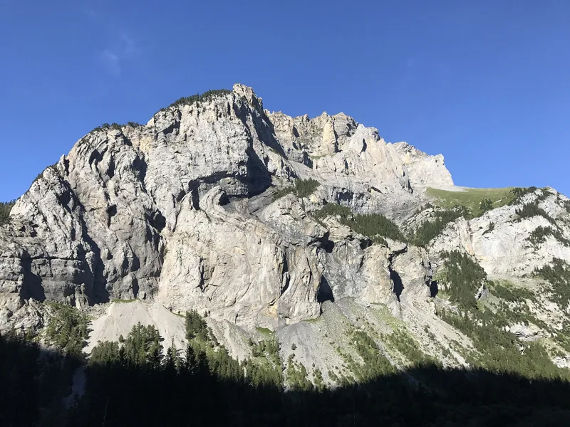
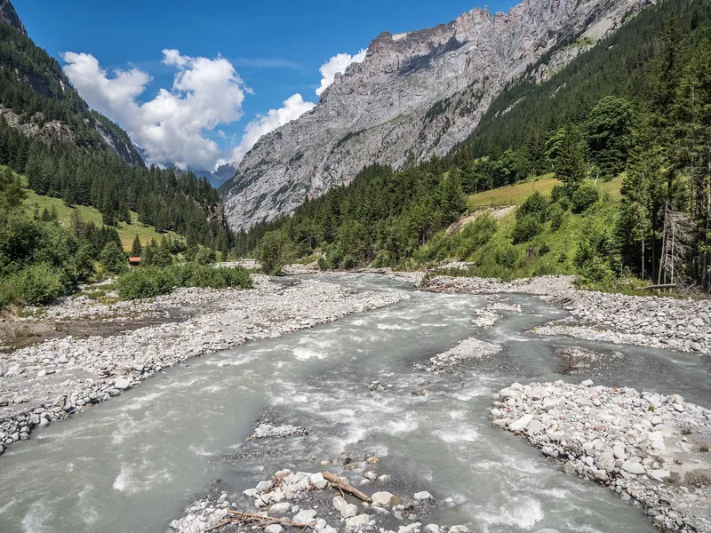
The Gasterntal is a U-shaped glacial valley, shaped by the mighty northern rock flank of the Doldenhorn. The Kander here is still largely natural: its floods keep reshaping the gravel and sand banks and the floodplain forests, mostly dominated by grey alder. After the Chluse, for almost five kilometres, the trail crosses the Gastereholz floodplain of national importance, then the Gastere bei Selden floodplain just before the finish. In the Chluse it twice dips briefly into the Swiss Alps Jungfrau-Aletsch UNESCO World Heritage site, then stays outside it all the way to Selden.
The rock changes along the way. In the Chluse the path crosses Cretaceous Helvetic rocks, including the Helvetic siliceous limestone, blue-black, weathering reddish-brown and forming brown cliffs. Shortly before Selden, for about a kilometre, it crosses the Gastern granite, dated to about 303 million years ago, which takes its name from this valley.
Hotels, a tunnel and a firing range
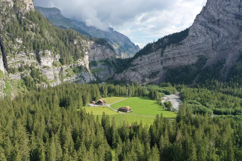
After 1890 the Gasterntal was drawn into Kandersteg's tourism, and the hotels still standing today were built. To soften the crisis in the hotel trade, the army set up a firing range here during the Second World War. The trail passes right by the Berghotel Waldhaus.
The Lötschberg railway also runs beneath you: the tunnel passes beneath the trail shortly before Selden. On 24 July 1908, during drilling, large amounts of water and sedimentary rock burst into the tunnel directly beneath the Gasterntal. 25 Italian miners lost their lives. Work stopped for about six months, then the tunnel was rerouted around the spot with three curves. The Lötschberg was broken through on 31 March 1911 and the line opened on 19 June 1913.
Selden, at the foot of the Lötschenpass
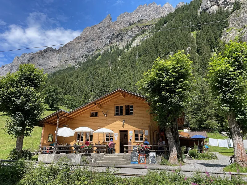
The last kilometres climb along the Kander to Selden, finishing near the Gasthaus Steinbock. Shortly before the finish, at a spot called Bi de Hüsere, the historic route up to the Lötschenpass begins. The next stage of the Lötschberg-Panoramaweg runs from Selden to the Lauchernalp. On the first Sunday in August, an open-air sermon, the "Gasternpredigt", is held in Selden.
To get back, the valley bus leaves from the Selden, Gasthaus Steinbock stop for Kandersteg station. In 2025 it ran from 31 May to 5 October, and seat booking was required: check this year's timetable. Further down this page: the next departures.
Every way up to the top
3 starting points to reach Selden. Pick yours: the 3D view shows it and “My day” recalculates.
Walking times without breaks. “Estimated” times are calculated on the swisstopo profile with a model fitted to the official SwitzerlandMobility stages; the shortest path may differ from the one on the yellow signposts: on the ground, follow the signs. Gradient: the steepest over 200 m of trail. Profiles share the same scale (length and altitude). Stations and car parks within 500 m of the start, according to OpenStreetMap.
In pictures
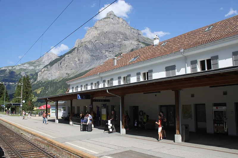
Kandersteg railway station, with the Bire in the background
The Spycher (granary) at Eggenschwand, Kandersteg
The Klus, the way into the Gasterntal
Farmhouse and Hotel Waldhaus in the Gasterntal
Gasterntal: the Geltibach waterfall at Gasternholz
The young Kander River in the Gasterntal, flowing here through an alluvial zone of national importance
Gasterntal at Gasternholz: looking north-west towards the mouth of the valley
In the Gasterntal, looking towards the Doldenhorn
Gasterntal: the Gasthaus Steinbock in Selden
The Selden pedestrian suspension bridge over the Kander, Gasterntal
The next few days
MeteoSwiss local forecast, updated every hour
Reading the MeteoSwiss forecast…
My day
Pick your day and start time: everything updates.
- Arrival at Selden
- 11:30 3 h 00 of walking without breaks, starting at 08:30
The trail, kilometre by kilometre
Places are listed under the kilometre where you pass them. Drag along the profile: the marker moves on the 3D view too.
- under 10 %
- 10 to 20 %
- 20 to 30 %
- over 30 %
- fountain or water point
- toilets
Around the trail (250 m, OpenStreetMap, extract of 25/10/2026): 11 restaurants, 1 café, 4 fountains and water points, 5 toilets. Estimated time: the official walking time spread by effort (1 km on the flat counts as 100 m of climbing), start time set in “My day”.
Getting there and back
Back by public transport from the Selden, Gasthaus Steinbock stop
Next departures from Selden, Gasthaus SteinbockReading the official timetable…
By car
Careful, this is one way: public transport back arrives in Selden, Gasthaus Steinbock, not in Kandersteg. Plan to get back to your car by public transport, or park at the finish and take the train to the start.
- Car park open-air, Umfahrungsstrassepaid110 m from the start
- Car park open-air, Aeussere Dorfstrassepaid200 m from the start
- Car park, Oeschistrassefree250 m from the start
Public car parks within 600 m of the start, according to OpenStreetMap: prices and number of spaces may have changed, check the signs on site.
Questions people ask
How long is the hike from Kandersteg to the finish (Selden)?
3 h 00 of walking according to SwitzerlandMobility, in this direction, not counting breaks. The other way: 2 h 45.
Is it hard?
SwitzerlandMobility rates this stage: fitness medium, technique medium. It is 460 m of climbing over 10.7 km.
Can I get back by public transport?
Yes. The Selden, Gasthaus Steinbock stop is at the finish. The next departures show live under “Getting there and back”.
Where can I eat on the way?
12 restaurants, cafés and huts within 250 m of the trail, including Schweizerhof, Adler, CAFE RESTAURANT AU VIEUX CHALET & Hotel. Where they are and their opening hours: below the profile.
Is there water and are there toilets on the way?
4 fountains and water points and 5 toilets within 250 m of the trail (survey of 25/10/2026).
Can I download the track?
Yes, as a GPX file for your watch or map app: “Download the track” button at the top of the page.
More hikes within 10 km
Official SwitzerlandMobility stages that pass within 10 km of this trail. Each card says whether its page is already up.
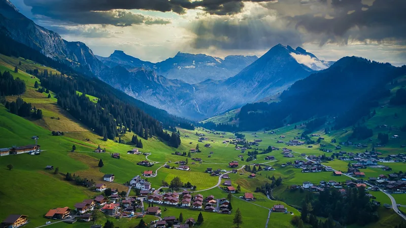 Adelboden → Lenk4 h 30Via Alpina, stage 1514.0kmDistance700mAscent1,000mDescentTechnical easyFitness difficult. See the hike
- Kandersteg → Adelboden6 h 45Via Alpina, stage 1416.0kmDistance1,400mAscent1,250mDescentTechnical mediumFitness difficult. Page coming
- Kandersteg, Bahnhof, loop0 h 55Wageti-Rundweg4.0kmDistance30mAscent30mDescentTechnical easyFitness medium. Page coming
- Griesalp → Kandersteg7 h 15Via Alpina, stage 1317.0kmDistance1,450mAscent1,700mDescentTechnical mediumFitness difficult. Page coming
- Kiental → Kandersteg6 h 30Lötschberg-Panoramaweg, stage 120.0kmDistance1,150mAscent950mDescentTechnical mediumFitness difficult. Page coming
- Selden → Lauchernalp5 h 00Lötschberg-Panoramaweg, stage 311.0kmDistance1,300mAscent720mDescentTechnical mediumFitness difficult. Page coming