
Up the Moléson by its ridge
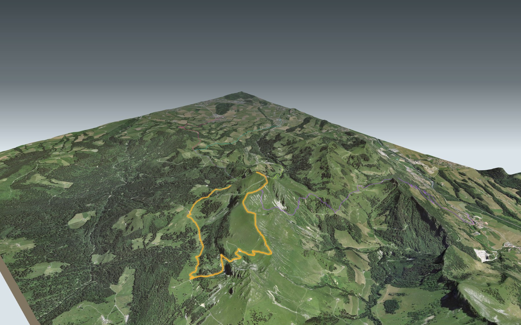
The Moléson is the mountain that stands for the whole Gruyère region. The cable car goes up from Plan-Francey; you take the path through the alpine pastures instead. You start at Plan-Francey, where the funicular stops and the cable car begins, first make a long loop through the pastures, then climb the ridge to the summit. The route is rated medium, for fitness as well as technique.
The first kilometres drop a little: Petit-Plané, then the Gros Plané alpine café, where a cheesemaker, the armailli, still makes cheese the traditional way. Next come the Villard pasture, the Creux de l'Ours, the Trême stream and Tremetta, before the climb onto the Moléson ridge. The elevation profile shows you where it gets steepest.
Want to climb from lower down? Set off from Gruyères, Neirivue, Le Pâquier or Moléson-Village: each start has its own colour on the 3D map, and its estimated time is in the list of starting points. Elsewhere in the canton, there is also the Gastlosen Tour.
At the top: the Le Sommet restaurant, the highest astronomical observatory in the canton and, on a clear day, a 360° view from Mont Blanc to Lake Geneva. The cable car takes you back to Plan-Francey. Check getting there by public transport and plan your day before you set off. Fancy something else nearby? All the hikes in Fribourg and Gruyère.
The story of the trail
What happened where you are going to walk, chapter by chapter.
Round the pastures, then the ridge
You start at 1,518 m, at Plan-Francey, and finish at 2,002 m, on the summit of the Moléson. In between: 8.1 km, 720 m of climbing and 240 m of descent. Allow 3 h 00 of walking this way, and 2 h 25 the other way, downhill.
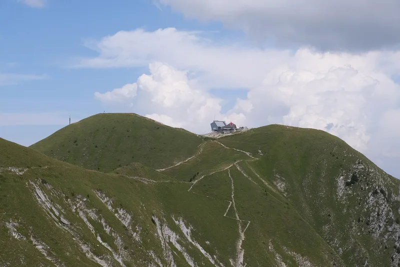
The path starts by heading away from the summit. It passes Petit-Plané, then the Gros Plané chalet at km 1.8, before Villard Bony, Au Mormotey and the Villard pasture. After the Creux de l'Ours it crosses the Trême and climbs to Tremetta, near the Teysachaux. Then it reaches the Moléson ridge and follows it to the summit: most of the climbing comes in the second half of the route.
A mountain that became a symbol
Interest in the Moléson began in the late 18th century, when Europe's elites fell for the Alps. Visited, sung about and described by Fribourg writers, it grew popular in the 19th century and became the image of the Gruyère and of Fribourg. From 1870 people wanted to make it the canton's tourist site par excellence, but plans for a hotel and a railway between 1905 and 1908 ran into the defenders of Alpine heritage, backed by the Heimatschutz.
After the Second World War came the cable car and ski lifts, from 1960. The ski area had its first winter season in 1963. The holiday village of Moléson-sur-Gruyères was built at the foot of the mountain in 1980, and a funicular has linked it to Plan-Francey since 1998. A new cable car went into service in 2011.
A limestone named after the Moléson
The first part of the path crosses scree, moraine and landslide ground. After the Trême, on the climb towards the ridge, the rock changes: massive limestone in thick beds, which geologists call the Moléson Formation. The reference site for this rock is on the mountain itself, between the Petit-Plané path and Bonnefontaine.
This limestone was laid down in a marine basin, from the Late Jurassic to the very start of the Cretaceous. It holds remains of echinoderms, algae, bivalves, brachiopods and cephalopods. It belongs to the Préalpes Médianes nappe.
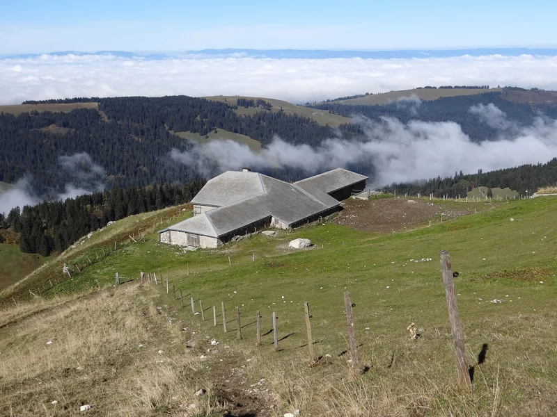
The armaillis' cheese
At the Gros Plané alpine café, a master cheesemaker, the armailli, keeps traditional cheesemaking alive. It's a good stop to taste the local specialities.
At the bottom of the funicular, in Moléson-sur-Gruyères, the alpine cheese dairy is housed in a traditional 17th-century chalet with a wooden-shingle roof. From May to September, the armailli explains the work when the cheeses are taken out, in the morning.
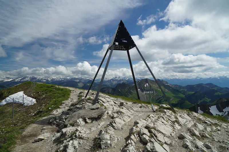
At the top: the sky and the cable car
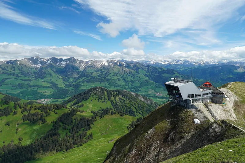
Just before the summit, at km 7.9, you pass the Le Sommet restaurant and the astronomical observatory, the highest in the canton. On a clear day the view goes all the way round, from Lake Geneva to the Jura and from Mont Blanc to the peaks of the Bernese Oberland.
Between Plan-Francey and the summit, the only place to eat found near the path is the Gros Plané café: bring something to drink. On the ridge, follow the signposts and the conditions on the day. To get back down, the cable car takes you to Plan-Francey, then the funicular to Moléson-sur-Gruyères.
Every way up to the top
5 starting points to reach Le Moléson, station supérieure du téléphérique. Pick yours: the 3D view shows it and “My day” recalculates.
Walking times without breaks. “Estimated” times are calculated on the terrain profile with a model fitted to the official stages; the shortest path may differ from the one on the yellow signposts: on the ground, follow the signs. Gradient: the steepest over 200 m of trail. Profiles share the same scale (length and altitude). Stations and car parks within 500 m of the start.
In pictures
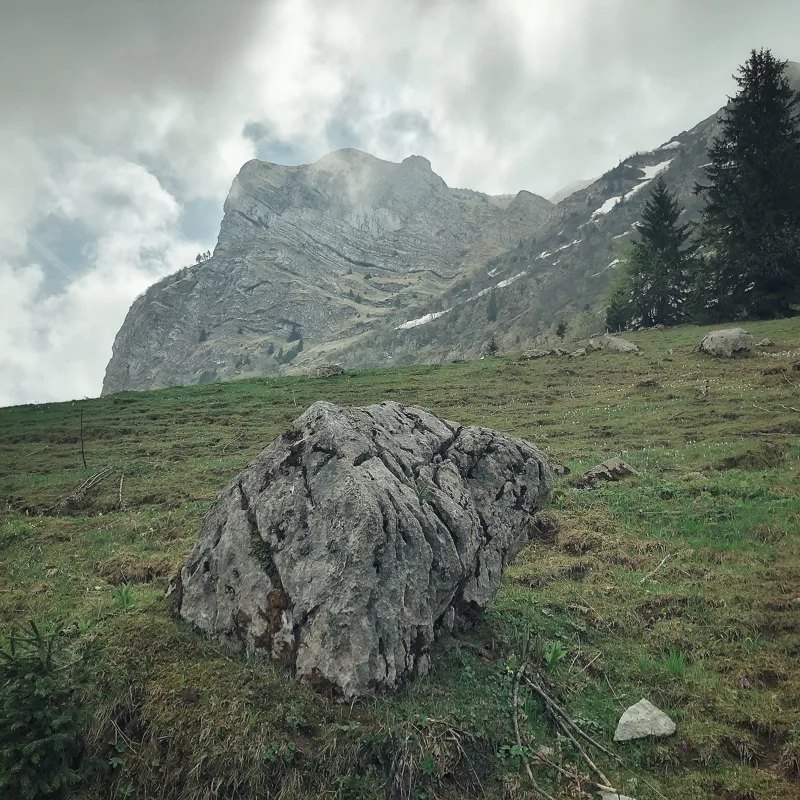
The rocky Moléson massif seen from Petit-Plané, on its north side
The hiking signpost at Gros-Plané
The Trême stream at the Teysachaux
Tremetta seen from the Teysachaux
The Teysachaux
Le Moléson seen from the south-west
An orchid on the path from Moléson
A butterfly spotted near Moléson
Le Moléson
Le Moléson
A barn on the hillside of Le Moléson, in the Fribourg Prealps
What you see from the top
360° view from Le Moléson (2,002 m). 29 named peaks, including Mont Blanc, 80.5 km away. Swipe to look around.
Sentier de la crête du Moléson: when to go
Public transport serves the start every day from 19 December 2026 to 21 February 2027 and from 24 April to 1 November 2027, according to the official timetable: that's the season to do this hike without a car. The latest time to set off ranges from 17:27 in June to 12:45 in December.
- Public transport to the start
- daily, 19 Dec to 21 Feb
- 23 arrivals a day
- first arrival 9:05
- last 16:35
- Sun at the start, mid-January
- from 8:52
- rises at 8:12, hidden by the ridge
- Leave by, for 3 h 00 of walking
- 13:11
- arrive 1 hour before sunset, at 17:11
| Month | Sun at the start | Leave by | In the sun, leaving at 9:00 | Transport |
|---|---|---|---|---|
| December | 8:45 → 16:45 | 12:45 | 43 % | 13 of 31 days |
| January | 8:52 → 17:11 | 13:11 | 43 % | every day |
| February | 8:08 → 17:56 | 13:56 | 44 % | 21 of 28 days |
“In the sun”: the share of the path in sunlight under a clear sky, with the terrain worked out point by point. The path climbs to 2,002 m: today's snow and frost are in the weather and My day.
- Public transport to the start
- daily, 24 Apr to 31 May
- 26 arrivals a day
- first arrival 9:05
- last 17:25
- Sun at the start, mid-April
- from 6:59
- rises at 6:45, hidden by the ridge
- Leave by, for 3 h 00 of walking
- 16:19
- arrive 1 hour before sunset, at 20:19
| Month | Sun at the start | Leave by | In the sun, leaving at 9:00 | Transport |
|---|---|---|---|---|
| March | 7:09 → 18:37 | 14:37 | 63 % | off season |
| April | 6:59 → 20:19 | 16:19 | 83 % | 7 of 30 days |
| May | 6:08 → 20:58 | 16:58 | 94 % | every day |
“In the sun”: the share of the path in sunlight under a clear sky, with the terrain worked out point by point. The path climbs to 2,002 m: today's snow and frost are in the weather and My day.
- Public transport to the start
- every day
- 26 arrivals a day
- first arrival 9:05
- last 17:25
- Sun at the start, mid-July
- from 6:00
- rises at 5:54
- Leave by, for 3 h 00 of walking
- 17:22
- arrive 1 hour before sunset, at 21:22
| Month | Sun at the start | Leave by | In the sun, leaving at 9:00 | Transport |
|---|---|---|---|---|
| June | 5:56 → 21:27 | 17:27 | 100 % | every day |
| July | 6:00 → 21:22 | 17:22 | 95 % | every day |
| August | 6:44 → 20:43 | 16:43 | 85 % | every day |
“In the sun”: the share of the path in sunlight under a clear sky, with the terrain worked out point by point. The path climbs to 2,002 m: today's snow and frost are in the weather and My day.
- Public transport to the start
- daily, 1 Sept to 1 Nov
- 26 arrivals a day
- first arrival 9:05
- last 17:25
- Sun at the start, mid-October
- from 8:21
- rises at 7:49, hidden by the ridge
- Leave by, for 3 h 00 of walking
- 14:46
- arrive 1 hour before sunset, at 18:46
| Month | Sun at the start | Leave by | In the sun, leaving at 9:00 | Transport |
|---|---|---|---|---|
| September | 7:24 → 19:45 | 15:45 | 65 % | every day |
| October | 8:21 → 18:46 | 14:46 | 43 % | every day |
| November | 8:14 → 16:59 | 12:59 | 46 % | 1 of 30 days |
“In the sun”: the share of the path in sunlight under a clear sky, with the terrain worked out point by point. The path climbs to 2,002 m: today's snow and frost are in the weather and My day.
The next few days
Local forecast, updated every hour
Reading the forecast…
My day
Pick your day and start time: everything updates.
- Arrival at Le Moléson, station supérieure du téléphérique
- 11:30 3 h 00 of walking without breaks, starting at 08:30
The trail, kilometre by kilometre
From Moléson-sur-Gruyères, Plan Francey
Places are listed under the kilometre where you pass them. Drag along the profile: the marker moves on the 3D view too.
- under 10 %
- 10 to 20 %
- 20 to 30 %
- over 30 %
- fountain or water point
- toilets
Around the trail (250 m): 3 restaurants. Estimated time: the official walking time spread by effort (1 km on the flat counts as 100 m of climbing), start time set in “My day”.
- under 10 %
- 10 to 20 %
- 20 to 30 %
- over 30 %
- fountain or water point
- toilets
Around the trail (250 m): 6 restaurants and 3 fountains and water points. Estimated time: the official walking time spread by effort (1 km on the flat counts as 100 m of climbing), start time set in “My day”.
- under 10 %
- 10 to 20 %
- 20 to 30 %
- over 30 %
- fountain or water point
- toilets
Around the trail (250 m): 3 restaurants and 3 fountains and water points. Estimated time: the official walking time spread by effort (1 km on the flat counts as 100 m of climbing), start time set in “My day”.
- under 10 %
- 10 to 20 %
- 20 to 30 %
- over 30 %
- fountain or water point
- toilets
Around the trail (250 m): 3 restaurants, 2 cafés and 4 fountains and water points. Estimated time: the official walking time spread by effort (1 km on the flat counts as 100 m of climbing), start time set in “My day”.
- under 10 %
- 10 to 20 %
- 20 to 30 %
- over 30 %
- fountain or water point
- toilets
Around the trail (250 m): 4 restaurants and 1 toilet. Estimated time: the official walking time spread by effort (1 km on the flat counts as 100 m of climbing), start time set in “My day”.
Getting there and back
Back by public transport from the Le Moléson stop
Next departures from Le MolésonReading the official timetable…
By car
From Moléson-sur-Gruyères, Plan Francey
Careful, this is one way: public transport back arrives in Le Moléson, not in Moléson-sur-Gruyères, Plan Francey. Plan to get back to your car by public transport, or park at the finish and take public transport to the start.
Public car parks within 600 m of the start: prices and number of spaces may have changed, check the signs on site.
Careful, this is one way: public transport back arrives in Le Moléson, not in Gruyères. Plan to get back to your car by public transport, or park at the finish and take public transport to the start.
- Car parkpaid60 m from the start
- Station Gruyèresor by public transport0 m from the start
The nearest car park and stop for this start. Check the signs on site for the price.
Careful, this is one way: public transport back arrives in Le Moléson, not in Neirivue. Plan to get back to your car by public transport, or park at the finish and take public transport to the start.
- Car park20 m from the start
- Station Neirivueor by public transport0 m from the start
The nearest car park and stop for this start. Check the signs on site for the price.
Careful, this is one way: public transport back arrives in Le Moléson, not in Le Pâquier. Plan to get back to your car by public transport, or park at the finish and take public transport to the start.
- Car parkfree30 m from the start
- Station Le Pâquieror by public transport0 m from the start
The nearest car park and stop for this start. Check the signs on site for the price.
Careful, this is one way: public transport back arrives in Le Moléson, not in Moléson-Village. Plan to get back to your car by public transport, or park at the finish and take public transport to the start.
- Car parkfree140 m from the start
- Station Moléson-Villageor by public transport0 m from the start
The nearest car park and stop for this start. Check the signs on site for the price.
Questions people ask
How long is the hike from Moléson-sur-Gruyères, Plan Francey to Le Moléson, station supérieure du téléphérique?
3 h 00 of walking (official time), in this direction, not counting breaks. The other way: 2 h 25.
Is it hard?
Official rating for this stage: fitness medium, technique medium. It is 720 m of climbing over 8.1 km.
Can I get back by public transport?
Yes. The Le Moléson stop is at the finish. The next departures show live under “Getting there and back”.
Where can I eat on the way?
4 places to eat within 250 m of the trail, including Plan-Francey, Le Gros Plané, Le Sommet. Where they are and their opening hours: below the profile.
Is there water and are there toilets on the way?
0 fountains and water points and 0 toilets within 250 m of the trail (survey of 25/10/2026).
Can I download the track?
Yes, as a GPX file for your watch or map app: “Download the track” button at the top of the page.
More hikes within 10 km
Official stages that pass within 10 km of this trail. Each card says whether its page is already up.
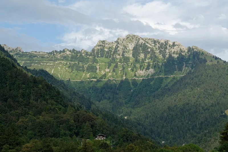 Montreux, Les Avants, loop2 h 00Chemin des Narcisses6.0kmDistance360mAscent360mDescentTechnical easyFitness easy. See the hike
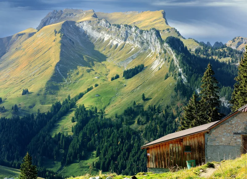 Rossinière → Rochers de Naye7 h 20Via Alpina, stage 1918.0kmDistance1,850mAscent780mDescentTechnical mediumFitness difficult. See the hike
- © swisstopoGruyères → Les Paccots5 h 00Alpenpanorama-Weg, stage 2216.0kmDistance950mAscent620mDescentTechnical easyFitness difficult. Official waymarked stage
- © swisstopoLes Paccots, Les Rosalys, loop4 h 10Sentier panoramique des Paccots13.0kmDistance720mAscent720mDescentTechnical easyFitness medium. Official waymarked stage
- © swisstopoLes Paccots → Vevey (Corseaux)6 h 00Alpenpanorama-Weg, stage 2319.0kmDistance640mAscent1,300mDescentTechnical easyFitness difficult. Official waymarked stage
- Gruyères → Bulle2 h 40Fribourg en diagonale, stage 110.0kmDistance240mAscent220mDescentTechnical easyFitness easy. Official waymarked stage