
Following the Areuse through its gorge
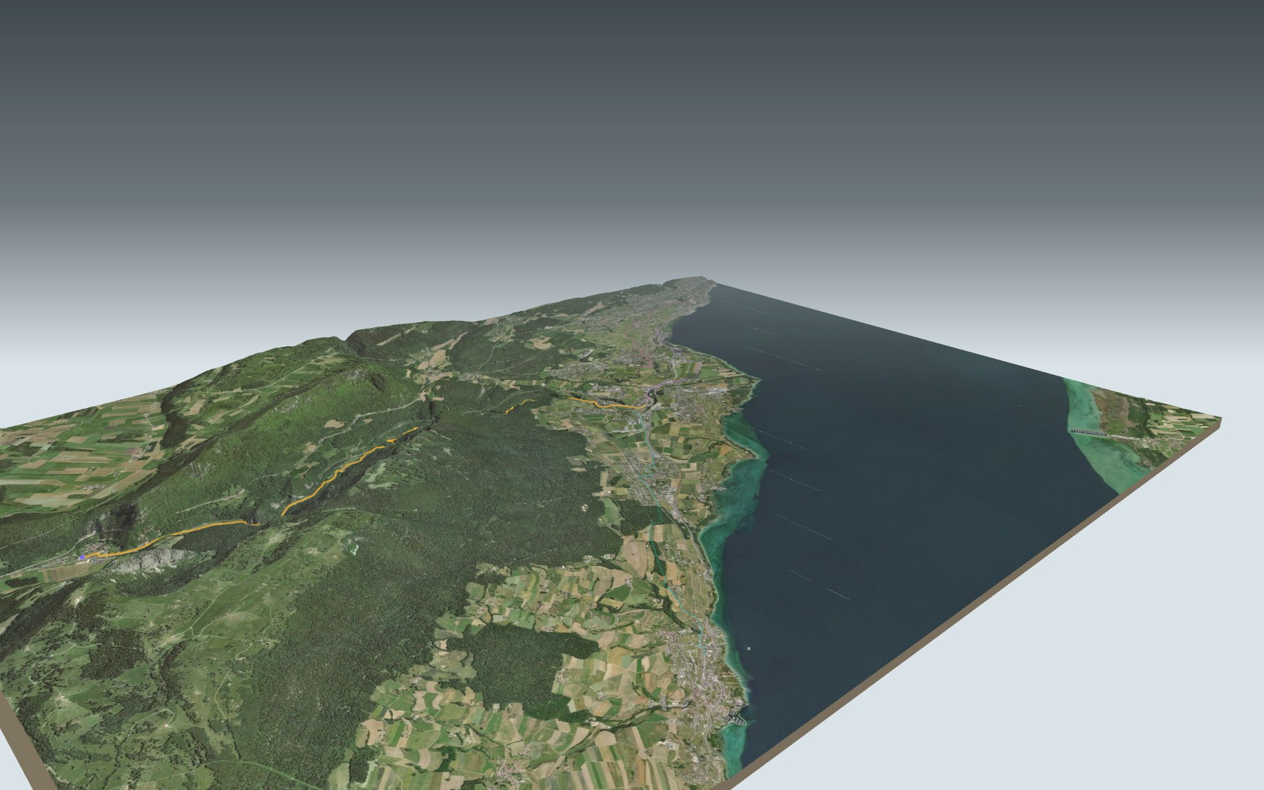
Here, the river sets the route. Swollen by the Noiraigue, the Areuse churns, foams and roars between rock walls that close in on it. The trail follows it all the way to Boudry, over stone bridges and footbridges, up and down steps and through narrow passages between the cliffs. There is far more down than up, and the route is rated medium, for fitness as well as technique.
You start at Noiraigue station, pass Le Furcil, then the bridge at the Saut de Brot. At km 4.2, Champ-du-Moulin and the La Truite restaurant make a good break. Then come the Verrière falls, the Combe Garot and the Pré aux Clées shelter, before Boudry. The route profile shows you where it drops.
Fancy a shorter version? The train also stops at Champ-du-Moulin. The starts from Gorgier-Saint-Aubin, Auvernier, Champ-Bougin and Corcelles-Peseux reach Boudry by other paths, without going through the gorge: each has its own colour on the 3D map and its estimated time in the list of starting points. The Sentier du Creux du Van also starts from Noiraigue.
At the finish, Boudry's cafés and the tram back to Neuchâtel; in Boudry castle, a museum of vines and wine. Check the next departures and plan your day before you set off. Looking for something else nearby? All the hikes in the Jura.
The story of the trail
What happened where you are going to walk, chapter by chapter.
Downhill with the Areuse
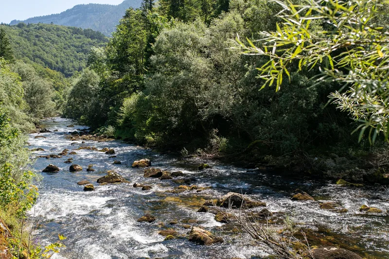
You start at 729 m in Noiraigue and finish at 446 m in Boudry. In between: 11.9 km, 170 m of climbing and 460 m of descent. Allow 3 h 00 of walking in this direction and 3 h 25 the other way.
The path passes Le Furcil, then the Saut de Brot, before Champ-du-Moulin at km 4.2: the Café rive gauche is right there, La Truite a little further on. Next come the Verrière falls, the Combe Garot and the Pré aux Clées shelter, then the first cafés of Boudry.
A trail cut with pickaxes
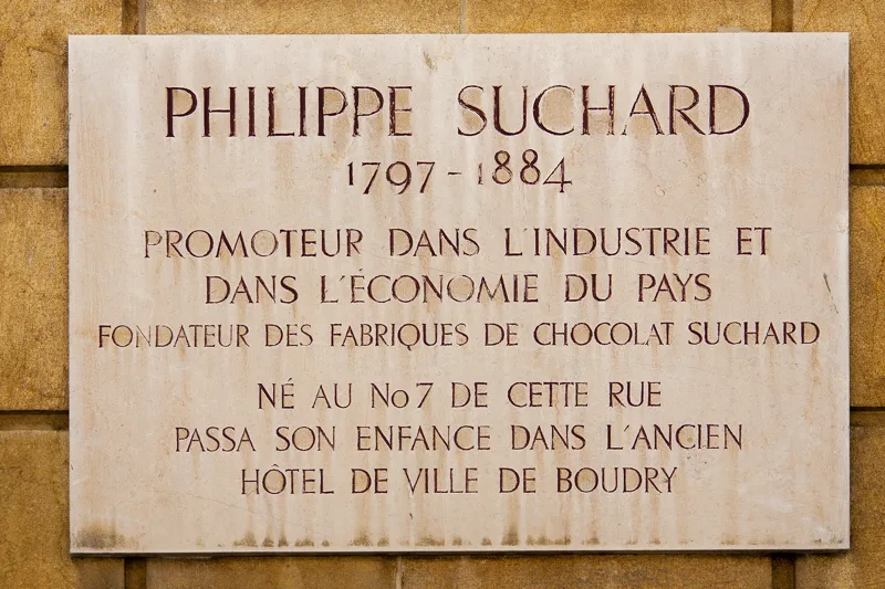
The trail was the idea of Fritz Berthoud, a Neuchâtel banker with a passion for painting and literature, who wanted an easier way between the Val-de-Travers and Colombier. A first committee, in Colombier, raised the money for the works of 1874 and 1875. The Gor de Brayes passage, impassable until then, was hacked out with pickaxes and shovels and opened in 1875. Among the crowd was the chocolate maker Philippe Suchard.
In 1878, a company took over to link Champ-du-Moulin with Noiraigue; that path opened in 1880. Also in 1878, Suchard opened the Hôtel des Gorges in Champ-du-Moulin and put up an offer there: a free cup of chocolate and a loaf of bread for anyone who gave to the trails. After his death in 1884, money ran short. On 4 November 1886, the three groups that looked after the paths merged into the Société des Sentiers des Gorges de l'Areuse, which still maintains them.
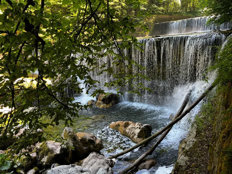
A river that comes from underground
The Areuse rises upstream of Saint-Sulpice. It is fed by water from the Lac des Taillères, higher up, which travels a long way underground by a route nobody knows in detail. In the gorge, several important aquifers are tapped by the towns of Neuchâtel, La Chaux-de-Fonds and Boudry for their water supply.
Ice and rockfalls have reshaped this landscape. During the Würm glaciation, the moraine of a local glacier from the Creux du Van pushed the Areuse north and dammed the valley, creating a short-lived lake in the Val-de-Travers. Further downstream, a landslide formed a small lake at Champ-du-Moulin, which soon vanished too. The gorge and the Creux du Van are part of the Creux du Van nature reserve, created in 1956 and made a federal hunting reserve in 1976.
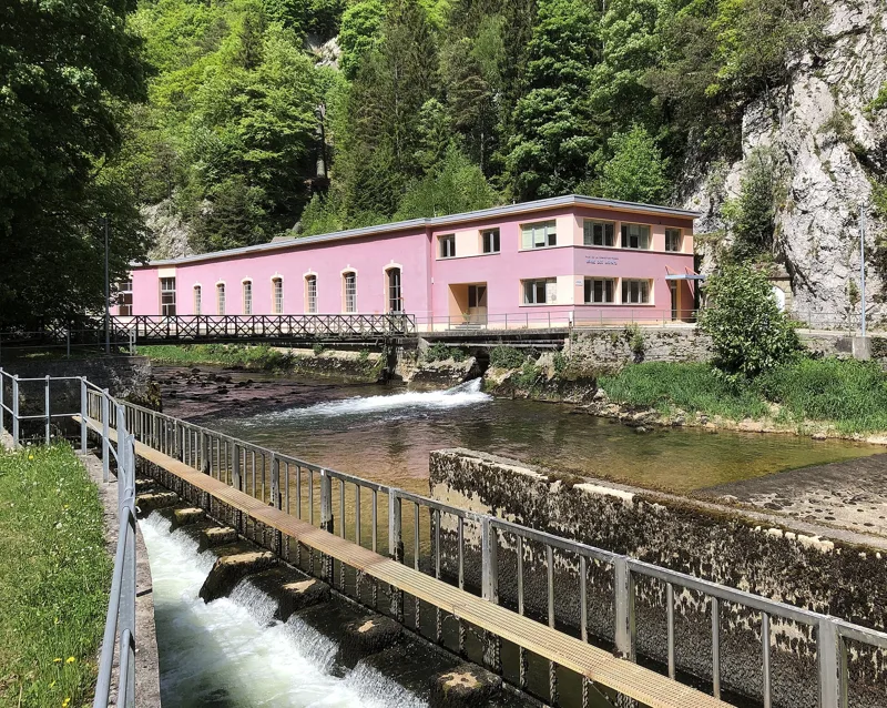
Power plants, an inn and caves
At the end of the 19th century, the gorge filled with building sites. The Moyats plant, in 1887, was mainly built to supply drinking water to La Chaux-de-Fonds, and also produced electricity. The Plan de l'Eau plant followed in 1892 and the Combe-Garot plant in 1893. From 1895, the city of Neuchâtel produced its own electricity at the Pré des Clées plant, for its motors, its trams and its street lighting; the Chanet plant replaced it in 1913.
In Champ-du-Moulin, the La Truite building is already mentioned in 1811; it officially became a hotel, under that name, in 1897-1898. Rousseau passed through this gorge, and painters and draughtsmen later followed his route to show the places described in his Confessions. Much earlier, the gorge sheltered prehistoric people: some twenty caves and rock shelters; some of them, such as the Baume du Four and the Cottencher cave, are of worldwide importance in archaeology.
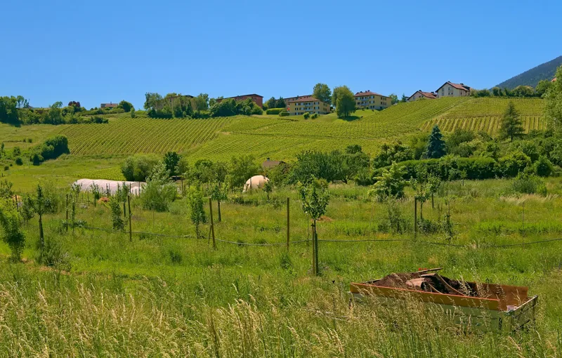
Boudry, then the tram
The path reaches Boudry. At the end, at km 11.9, the Café du tram and BÖLAMA burger & coffee are a few steps from the path, and the tram takes you back to Neuchâtel. In Boudry castle, a museum tells the story of vines and wine. Further down this page you'll find the next departures.
The trail runs along steep ravines in several places. In the rain it can be slippery: wear shoes with a good tread. In winter some sections can be dangerous, with ice on the path and icicles on the cliffs. Read on 10 November 2026: a detour along the right bank bypasses the Moyats plant, between Champ-du-Moulin and Noiraigue, for several years. Go by the signposts and the conditions on the day.
Every way to Boudry
5 starting points to reach Boudry. Pick yours: the 3D view shows it and “My day” recalculates.
Walking times without breaks. “Estimated” times are calculated on the terrain profile with a model fitted to the official stages; the shortest path may differ from the one on the yellow signposts: on the ground, follow the signs. Gradient: the steepest over 200 m of trail. Profiles share the same scale (length and altitude). Stations and car parks within 500 m of the start.
In pictures
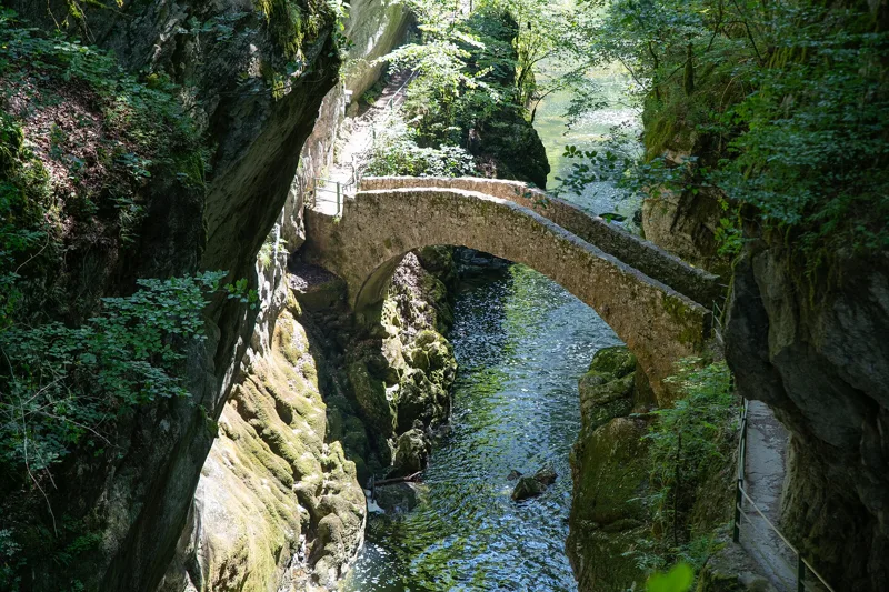
The Pont du Saut de Brot in the Areuse gorge
Hiking through the Areuse gorge, between Noiraigue and Brot-Dessous
Pedestrian tunnel on the Areuse gorge trail, between Noiraigue and Boudry
Waterfall in the Areuse gorge
The Hôtel de la Truite in Champ-du-Moulin
Plaque honouring Philippe Suchard, the chocolate maker from Boudry
The Moyats hydroelectric plant on the Areuse
The Pré du Chanet hydroelectric plant, canton of Neuchâtel
The Maison Rousseau in Champ-du-Moulin-Dessous, a cultural property of regional significance
The covered wooden Expo.02 footbridge over the Areuse, between Champ-du-Moulin and Boudry
Vineyards in the north of Boudry, at the end of the Areuse gorge trail
Sentier des Gorges de l'Areuse: when to go
Public transport serves the start every day of the year, according to the official timetable. Here the sun clears the ridge late, and the latest time to set off ranges from 17:30 in June to 12:44 in December.
- Public transport to the start
- every day
- 43 to 59 arrivals a day
- first arrival 0:03 or 6:53
- last 23:53
- Sun at the start, mid-January
- from 10:28
- rises at 8:14, hidden by the ridge
- Leave by, for 3 h 00 of walking
- 13:10
- arrive 1 hour before sunset, at 17:10
| Month | Sun at the start | Leave by | In the sun, leaving at 9:00 | Transport |
|---|---|---|---|---|
| December | 13:38 → 16:44 | 12:44 | 20 % | every day |
| January | 10:28 → 17:10 | 13:10 | 24 % | every day |
| February | 8:56 → 17:57 | 13:57 | 34 % | every day |
“In the sun”: the share of the path in sunlight under a clear sky, with the terrain worked out point by point. The path climbs to 730 m: today's snow and frost are in the weather and My day.
- Public transport to the start
- every day
- 44 to 59 arrivals a day
- first arrival 0:03
- last 23:53
- Sun at the start, mid-April
- from 7:56
- rises at 6:46, hidden by the ridge
- Leave by, for 3 h 00 of walking
- 16:21
- arrive 1 hour before sunset, at 20:21
| Month | Sun at the start | Leave by | In the sun, leaving at 9:00 | Transport |
|---|---|---|---|---|
| March | 7:38 → 18:38 | 14:38 | 81 % | every day |
| April | 7:56 → 20:21 | 16:21 | 97 % | every day |
| May | 7:52 → 21:01 | 17:01 | 99 % | every day |
“In the sun”: the share of the path in sunlight under a clear sky, with the terrain worked out point by point. The path climbs to 730 m: today's snow and frost are in the weather and My day.
- Public transport to the start
- every day
- 44 to 59 arrivals a day
- first arrival 0:03
- last 23:53
- Sun at the start, mid-July
- from 8:03
- rises at 5:53, hidden by the ridge
- Leave by, for 3 h 00 of walking
- 17:25
- arrive 1 hour before sunset, at 21:25
| Month | Sun at the start | Leave by | In the sun, leaving at 9:00 | Transport |
|---|---|---|---|---|
| June | 7:56 → 21:30 | 17:30 | 99 % | every day |
| July | 8:03 → 21:25 | 17:25 | 99 % | every day |
| August | 8:00 → 20:45 | 16:45 | 99 % | every day |
“In the sun”: the share of the path in sunlight under a clear sky, with the terrain worked out point by point. The path climbs to 730 m: today's snow and frost are in the weather and My day.
- Public transport to the start
- every day
- 44 to 59 arrivals a day
- first arrival 0:03 or 0:05
- last 23:53
- Sun at the start, mid-October
- from 9:03
- rises at 7:51, hidden by the ridge
- Leave by, for 3 h 00 of walking
- 14:47
- arrive 1 hour before sunset, at 18:47
| Month | Sun at the start | Leave by | In the sun, leaving at 9:00 | Transport |
|---|---|---|---|---|
| September | 7:57 → 19:46 | 15:46 | 89 % | every day |
| October | 9:03 → 18:47 | 14:47 | 36 % | every day |
| November | 9:26 → 16:59 | 12:59 | 25 % | every day |
“In the sun”: the share of the path in sunlight under a clear sky, with the terrain worked out point by point. The path climbs to 730 m: today's snow and frost are in the weather and My day.
The next few days
Local forecast, updated every hour
Reading the forecast…
My day
Pick your day and start time: everything updates.
- Arrival at Boudry
- 11:30 3 h 00 of walking without breaks, starting at 08:30
The trail, kilometre by kilometre
From Noiraigue
Places are listed under the kilometre where you pass them. Drag along the profile: the marker moves on the 3D view too.
- under 10 %
- 10 to 20 %
- 20 to 30 %
- over 30 %
- fountain or water point
- toilets
Around the trail (250 m): 7 restaurants, 3 cafés, 13 fountains and water points and 3 toilets. Estimated time: the official walking time spread by effort (1 km on the flat counts as 100 m of climbing), start time set in “My day”.
- under 10 %
- 10 to 20 %
- 20 to 30 %
- over 30 %
- fountain or water point
- toilets
Around the trail (250 m): 10 restaurants, 1 café, 16 fountains and water points and 4 toilets. Estimated time: the official walking time spread by effort (1 km on the flat counts as 100 m of climbing), start time set in “My day”.
- under 10 %
- 10 to 20 %
- 20 to 30 %
- over 30 %
- fountain or water point
- toilets
Around the trail (250 m): 13 restaurants, 1 café, 12 fountains and water points and 6 toilets. Estimated time: the official walking time spread by effort (1 km on the flat counts as 100 m of climbing), start time set in “My day”.
- under 10 %
- 10 to 20 %
- 20 to 30 %
- over 30 %
- fountain or water point
- toilets
Around the trail (250 m): 9 restaurants, 3 cafés, 15 fountains and water points and 4 toilets. Estimated time: the official walking time spread by effort (1 km on the flat counts as 100 m of climbing), start time set in “My day”.
- under 10 %
- 10 to 20 %
- 20 to 30 %
- over 30 %
- fountain or water point
- toilets
Around the trail (250 m): 7 restaurants, 2 cafés, 10 fountains and water points and 3 toilets. Estimated time: the official walking time spread by effort (1 km on the flat counts as 100 m of climbing), start time set in “My day”.
Getting there and back
Back by public transport from the Boudry Littorail, gare stop
Next departures from Boudry Littorail, gareReading the official timetable…
By car
From Noiraigue
Careful, this is one way: public transport back arrives in Boudry Littorail, gare, not in Noiraigue. Plan to get back to your car by public transport, or park at the finish and take public transport to the start.
- Parking des Courtonsopen-air · paid120 m from the start
- Parking du Devinsopen-air · paid430 m from the start
- Car park open-air, Rue du Templefree20 m from the start
- Car park open-air, Rue des Tilleulspaid20 m from the start
Public car parks within 600 m of the start: prices and number of spaces may have changed, check the signs on site.
Careful, this is one way: public transport back arrives in Boudry Littorail, gare, not in Gorgier-Saint-Aubin. Plan to get back to your car by public transport, or park at the finish and take public transport to the start.
- Car park140 m from the start
- Station Gorgier-Saint-Aubinor by public transport0 m from the start
The nearest car park and stop for this start. Check the signs on site for the price.
Careful, this is one way: public transport back arrives in Boudry Littorail, gare, not in Auvernier Littorail. Plan to get back to your car by public transport, or park at the finish and take public transport to the start.
- Car park100 m from the start
- Station Auvernier Littorailor by public transport0 m from the start
The nearest car park and stop for this start. Check the signs on site for the price.
Careful, this is one way: public transport back arrives in Boudry Littorail, gare, not in Champ-Bougin. Plan to get back to your car by public transport, or park at the finish and take public transport to the start.
- Car park40 m from the start
- Station Champ-Bouginor by public transport0 m from the start
The nearest car park and stop for this start. Check the signs on site for the price.
Careful, this is one way: public transport back arrives in Boudry Littorail, gare, not in Corcelles-Peseux. Plan to get back to your car by public transport, or park at the finish and take public transport to the start.
- Car parkfree20 m from the start
- Station Corcelles-Peseuxor by public transport0 m from the start
The nearest car park and stop for this start. Check the signs on site for the price.
Questions people ask
How long is the hike from Noiraigue to Boudry?
3 h 00 of walking (official time), in this direction, not counting breaks. The other way: 3 h 25.
Is it hard?
Official rating for this stage: fitness medium, technique medium. It is 460 m of descent over 11.9 km.
Can I get back by public transport?
Yes. The Boudry Littorail, gare stop is at the finish. The next departures show live under “Getting there and back”.
Where can I eat on the way?
10 places to eat within 250 m of the trail, including L'Auberge de Noiraigue, Café rive gauche, La Truite. Where they are and their opening hours: below the profile.
Is there water and are there toilets on the way?
13 fountains and water points and 3 toilets within 250 m of the trail (survey of 25/10/2026).
Can I download the track?
Yes, as a GPX file for your watch or map app: “Download the track” button at the top of the page.
More hikes within 10 km
Official stages that pass within 10 km of this trail. Each card says whether its page is already up.
- Noiraigue → La Combaz5 h 10Jura-Höhenweg, stage 1017.0kmDistance950mAscent440mDescentTechnical easyFitness difficult. Official waymarked stage
- Vue des Alpes → Noiraigue6 h 45Jura-Höhenweg, stage 922.0kmDistance860mAscent1,400mDescentTechnical easyFitness difficult. Official waymarked stage
- Travers, loop2 h 10Chemin de l'Areuse9.0kmDistance50mAscent50mDescentTechnical easyFitness difficult. Official waymarked stage
- Les Hauts Geneveys → La Sagne3 h 50Sentier des Statues12.0kmDistance680mAscent600mDescentTechnical easyFitness medium. Official waymarked stage
- Neuchâtel, loop0 h 50Sentier du Lac de Neuchâtel3.0kmDistance20mAscent20mDescentTechnical mediumFitness easy. Official waymarked stage
- Estavayer-le-Lac → Portalban3 h 00Chemin des Trois-Lacs, stage 212.0kmDistance80mAscent80mDescentTechnical easyFitness medium. Official waymarked stage