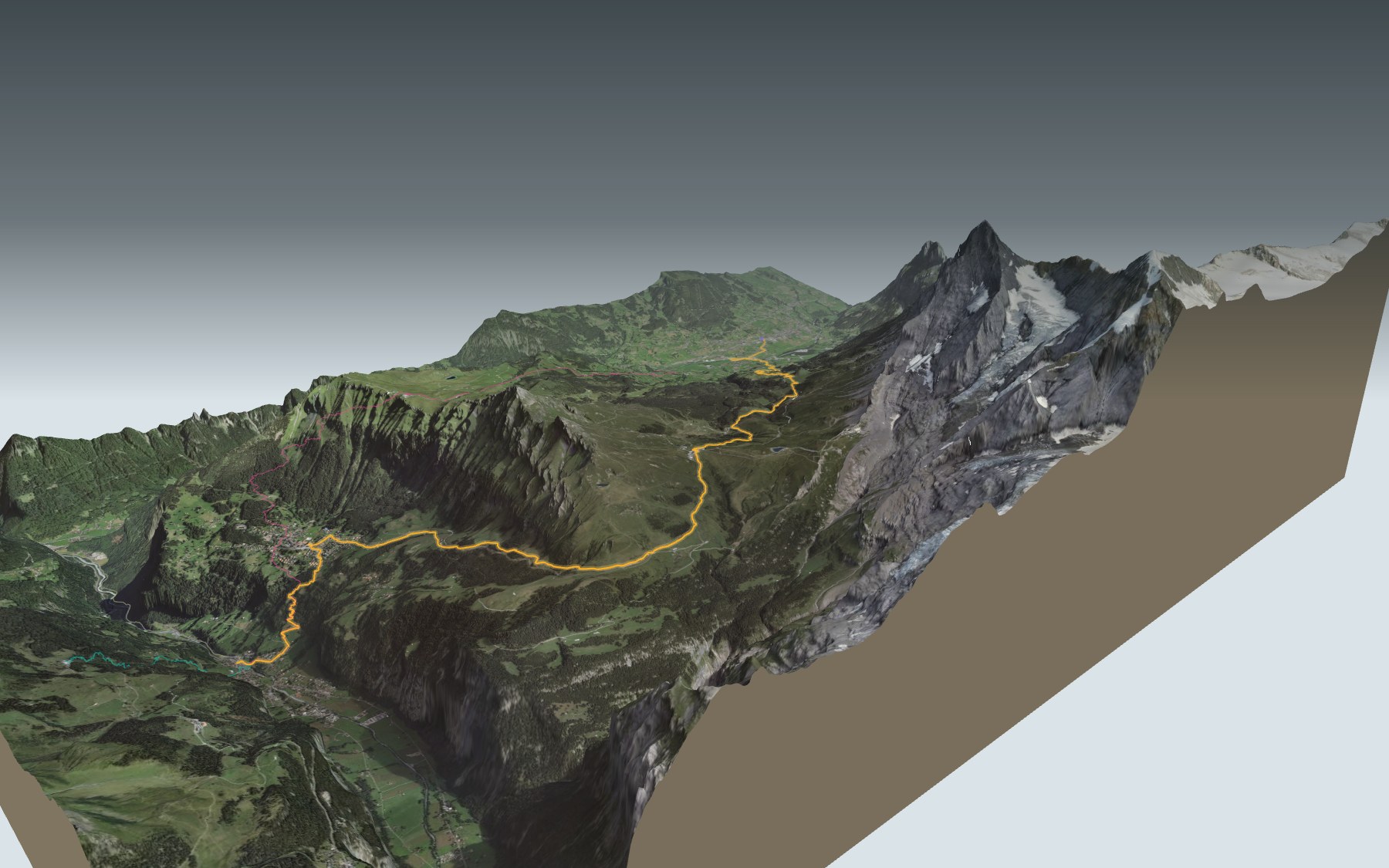

From Grindelwald to Lauterbrunnen via Kleine Scheidegg
The great crossing of the Jungfrau region: you start in Grindelwald, climb up to Kleine Scheidegg, then head down via Wengernalp and Wengen to Lauterbrunnen. It's stage 11 of the Via Alpina, walked in its official direction. Nothing technical, but a proper day out: it's rated difficult for fitness and easy for technique.
It starts with a short descent to Grindelwald Grund. Then comes the climb: Brandegg, Alpiglen, Mettla, and finally Kleine Scheidegg, the highest point. On the other side, Wengernalp, Wengen and the last descent into Lauterbrunnen. The elevation profile shows you where the climb gets steepest.
Other starting points also lead to Lauterbrunnen, on other paths that only join this one at the end: from Schwendi, a long climb and then the descent; from Zweilütschinen, you walk up the valley; from Breitlauenen or Grütschalp, where the Mountain View Trail also starts, it's mostly downhill. Each starting point has its own colour in the 3D view and an estimated time under all starting points. At Alpiglen you meet the end of the Eiger Trail; between Wengen and Kleine Scheidegg, the Lauberhorn Trail.
The Berghaus Alpiglen is the last listed stop on the way before the restaurants at Kleine Scheidegg, so bring something to drink. At the finish, Lauterbrunnen station. Check the next departures and plan your day before you set off. Looking for more in the area? See all hikes in the Bernese Oberland.
The story of the trail
What happened where you are going to walk, chapter by chapter.
One day, two valleys
You start at 1,034 m in Grindelwald and finish at 796 m in Lauterbrunnen. In between: 19.7 km, 1,150 m of climbing and 1,400 m of descent, with a high point of 2,062 m at the Kleine Scheidegg pass. Allow 6 h 40 of walking time in this direction and 7 h 00 the other way.
Grindelwald lies in the valley of the Black Lütschine, Lauterbrunnen in that of the White Lütschine. You cross the first one at the start, near Grindelwald Grund, and the second one at the finish, in Lauterbrunnen. This is stage 11 of the Via Alpina, walked in its official direction.
From Grund up to Kleine Scheidegg
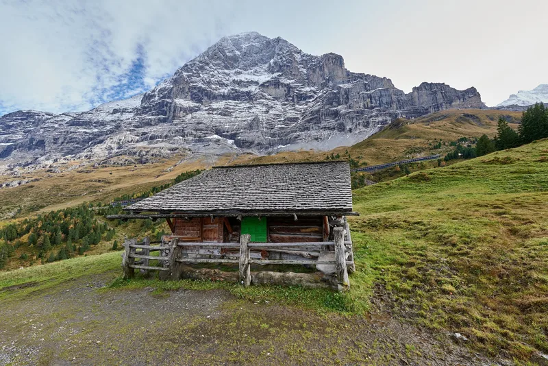
The path first drops to Grindelwald Grund, at km 1.1, then climbs again through the Wärgistal. Wärgistal and Scheidegg are two of Grindelwald's seven alpine pasture communities, which still exist; each one was an independent corporation with its own council. At km 4.0 you pass Brandegg, home to the Restaurant Brandegg.
At km 5.7 comes the Berghaus Alpiglen, at 1,618 m. This is where the Eiger Trail ends, the path that runs along the foot of the Eiger North Face. The route carries on via Mettla up to Kleine Scheidegg, the highest point of the day.
The crossing that made the valley famous
From the late 18th century, foreign travellers, mostly English, came to Grindelwald for its glaciers and its panorama. Lauterbrunnen gained an international reputation thanks to its waterfalls and to the crossing from Wengernalp to Grindelwald via Kleine Scheidegg: the very path you're on. Local guides took English climbers up the peaks, including on the first ascent of the Eiger in 1858.
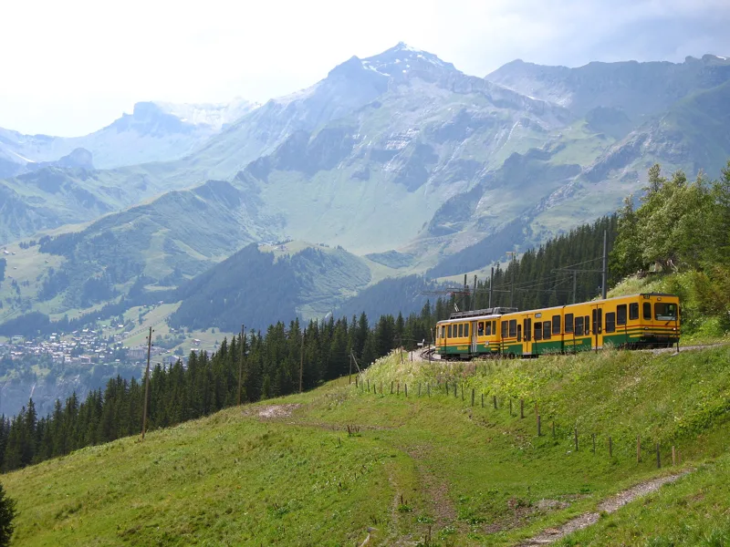
The Wengernalp Railway got its concession in 1890; the rack railway up to Kleine Scheidegg opened three years later, in 1893. It is the longest continuous rack railway in the world. In 1910 a longer, gentler line replaced the first section between Lauterbrunnen and Wengen; the old line was dismantled in 2008 and 2009. In 1912 the Jungfrau Railway became the valley's main attraction.
Moraine, shale and rockfall
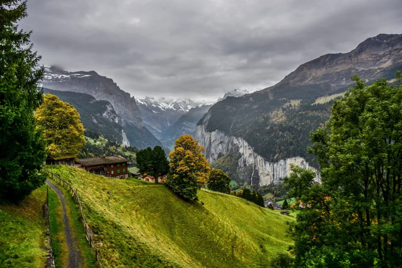
On the Grindelwald side, from Grund to above Alpiglen, the geological map shows mostly moraine from the valley's main glacier, dating from the Late Pleistocene. Around Kleine Scheidegg and down to below Wengernalp, the ground changes: clay shales and iron-rich sandstones from the Aalenian, a stage of the Jurassic. Between Kleine Scheidegg and Wengernalp, the route passes through the "Wengernalp Weiher" site, listed in the federal inventory of amphibian breeding sites of national importance; shortly after Brandegg, it touches the Bidem fen, listed in the federal inventory of fens.
Heading down towards Wengen and Lauterbrunnen, the path crosses scree and rockfall deposits made of big boulders. At the bottom, the municipality of Lauterbrunnen fills the U-shaped valley of the White Lütschine, from its source at the foot of the mountains.
Wengen, then the valley of waterfalls
Wengen sits on a terrace above the valley. The railway reached it in 1893, bringing tourists and making way for new hotels. In the municipality of Lauterbrunnen, which includes Wengen, winter tourism took off from 1909 thanks to skiing, spread by the English pioneers Walter and Arnold Lunn. Since 1930, Wengen has hosted the International Lauberhorn Races.
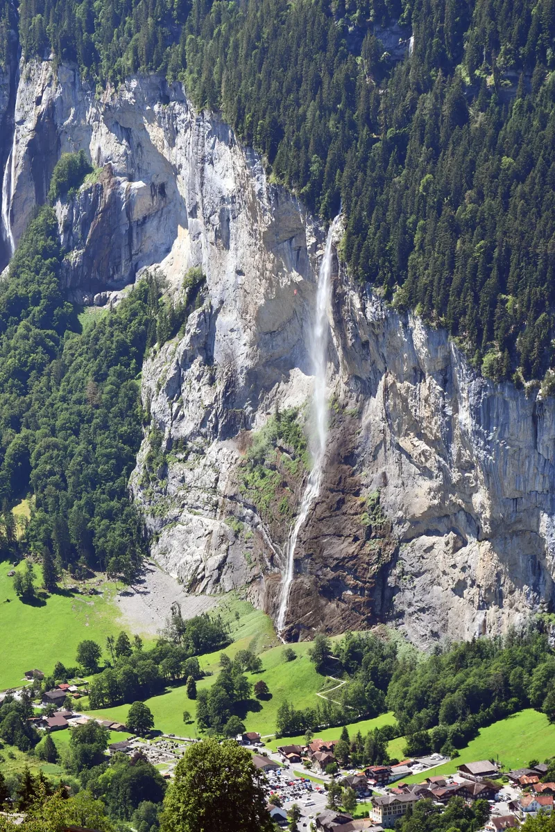
The path then drops down into Lauterbrunnen. Near the finish, though not on the route, the Staubbach Falls are the highest free-falling waterfall in Switzerland; the painter Caspar Wolf painted them in 1774-1777. At Lauterbrunnen station you catch the train: further down the page you'll find the next departures.
Every way to Lauterbrunnen
5 starting points to reach Lauterbrunnen. Pick yours: the 3D view shows it and “My day” recalculates.
Walking times without breaks. “Estimated” times are calculated on the terrain profile with a model fitted to the official stages; the shortest path may differ from the one on the yellow signposts: on the ground, follow the signs. Gradient: the steepest over 200 m of trail. Profiles share the same scale (length and altitude). Stations and car parks within 500 m of the start.
In pictures
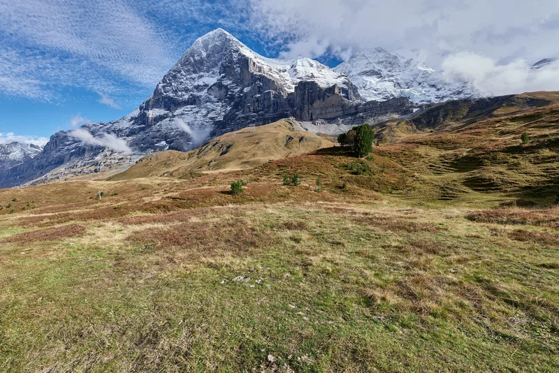
The Eiger North Face seen from the Wärgistal
Shops in Grindelwald village centre, with the Mettenberg in the background
The Mettla mountain pasture in Grindelwald
The Wengernalp Railway bridge over the Black Lütschine, Grindelwald
The Wengernalp Railway at Wengernalp
The Eiger and the Mönch from Kleine Scheidegg
View over the Lauterbrunnen valley
A cow on the hiking trail to Wengernalp
Wengen seen from Allmend station
The Staubbach Falls in Lauterbrunnen, seen from the path down from Wengen
Grindelwald → Kleine Scheidegg → Wengen → Lauterbrunnen: when to go
Public transport serves the start every day of the year, according to the official timetable. Here the sun clears the ridge late, and the latest time to set off ranges from 13:43 in June to 9:00 in December.
- Public transport to the start
- every day
- 132 to 276 arrivals a day
- first arrival 0:22, 0:46, 6:19 or 6:27
- last 23:35 or 23:42
- Sun at the start, mid-January
- from 10:16
- rises at 8:08, hidden by the ridge
- Leave by, for 6 h 40 of walking
- 9:26
- arrive 1 hour before sunset, at 17:06
| Month | Sun at the start | Leave by | In the sun, leaving at 9:00 | Transport |
|---|---|---|---|---|
| December | → 16:40 | 9:00 | 41 % | every day |
| January | 10:16 → 17:06 | 9:26 | 48 % | every day |
| February | 9:44 → 17:52 | 10:12 | 59 % | every day |
“In the sun”: the share of the path in sunlight under a clear sky, with the terrain worked out point by point. The path climbs to 2,062 m: today's snow and frost are in the weather and My day.
- Public transport to the start
- every day
- 217 to 276 arrivals a day
- first arrival 0:22
- last 23:42
- Sun at the start, mid-April
- from 9:03
- rises at 6:41, hidden by the ridge
- Leave by, for 6 h 40 of walking
- 12:35
- arrive 1 hour before sunset, at 20:15
| Month | Sun at the start | Leave by | In the sun, leaving at 9:00 | Transport |
|---|---|---|---|---|
| March | 9:27 → 18:33 | 10:53 | 81 % | every day |
| April | 9:03 → 20:15 | 12:35 | 95 % | every day |
| May | 8:00 → 20:55 | 13:15 | 100 % | every day |
“In the sun”: the share of the path in sunlight under a clear sky, with the terrain worked out point by point. The path climbs to 2,062 m: today's snow and frost are in the weather and My day.
- Public transport to the start
- every day
- 234 to 243 arrivals a day
- first arrival 0:22
- last 23:42
- Sun at the start, mid-July
- from 8:05
- rises at 5:49, hidden by the ridge
- Leave by, for 6 h 40 of walking
- 13:38
- arrive 1 hour before sunset, at 21:18
| Month | Sun at the start | Leave by | In the sun, leaving at 9:00 | Transport |
|---|---|---|---|---|
| June | 7:54 → 21:23 | 13:43 | 100 % | every day |
| July | 8:05 → 21:18 | 13:38 | 100 % | every day |
| August | 8:16 → 20:39 | 12:59 | 100 % | every day |
“In the sun”: the share of the path in sunlight under a clear sky, with the terrain worked out point by point. The path climbs to 2,062 m: today's snow and frost are in the weather and My day.
- Public transport to the start
- every day
- 132 to 243 arrivals a day
- first arrival 0:22, 0:46 or 6:19
- last 23:35 or 23:42
- Sun at the start, mid-October
- from 10:11
- rises at 7:45, hidden by the ridge
- Leave by, for 6 h 40 of walking
- 11:02
- arrive 1 hour before sunset, at 18:42
| Month | Sun at the start | Leave by | In the sun, leaving at 9:00 | Transport |
|---|---|---|---|---|
| September | 10:00 → 19:41 | 12:01 | 86 % | every day |
| October | 10:11 → 18:42 | 11:02 | 60 % | every day |
| November | 9:22 → 16:55 | 9:15 | 49 % | every day |
“In the sun”: the share of the path in sunlight under a clear sky, with the terrain worked out point by point. The path climbs to 2,062 m: today's snow and frost are in the weather and My day.
The next few days
Local forecast, updated every hour
Reading the forecast…
My day
Pick your day and start time: everything updates.
- Arrival at Lauterbrunnen
- 15:10 6 h 40 of walking without breaks, starting at 08:30
The trail, kilometre by kilometre
From Grindelwald
Places are listed under the kilometre where you pass them. Drag along the profile: the marker moves on the 3D view too.
- under 10 %
- 10 to 20 %
- 20 to 30 %
- over 30 %
- fountain or water point
- toilets
Around the trail (250 m): 20 restaurants, 5 cafés, 14 fountains and water points and 13 toilets. Estimated time: the official walking time spread by effort (1 km on the flat counts as 100 m of climbing), start time set in “My day”.
- under 10 %
- 10 to 20 %
- 20 to 30 %
- over 30 %
- fountain or water point
- toilets
Around the trail (250 m): 3 restaurants, 4 cafés, 3 fountains and water points and 4 toilets. Estimated time: the official walking time spread by effort (1 km on the flat counts as 100 m of climbing), start time set in “My day”.
- under 10 %
- 10 to 20 %
- 20 to 30 %
- over 30 %
- fountain or water point
- toilets
Around the trail (250 m): 3 restaurants, 1 café, 3 fountains and water points and 4 toilets. Estimated time: the official walking time spread by effort (1 km on the flat counts as 100 m of climbing), start time set in “My day”.
- under 10 %
- 10 to 20 %
- 20 to 30 %
- over 30 %
- fountain or water point
- toilets
Around the trail (250 m): 9 restaurants, 2 cafés, 9 fountains and water points and 8 toilets. Estimated time: the official walking time spread by effort (1 km on the flat counts as 100 m of climbing), start time set in “My day”.
- under 10 %
- 10 to 20 %
- 20 to 30 %
- over 30 %
- fountain or water point
- toilets
Around the trail (250 m): 3 restaurants, 1 café, 7 fountains and water points and 6 toilets. Estimated time: the official walking time spread by effort (1 km on the flat counts as 100 m of climbing), start time set in “My day”.
Getting there and back
Back by public transport from the Lauterbrunnen stop
Next departures from LauterbrunnenReading the official timetable…
By car
From Grindelwald
Careful, this is one way: public transport back arrives in Lauterbrunnen, not in Grindelwald. Plan to get back to your car by public transport, or park at the finish and take public transport to the start.
- Parking Eiger+underground car park · paid · 160 spaces110 m from the start
- Parkhaus Sportzentrummulti-storey car park · paid210 m from the start
- Auto-Parkplatzopen-air · paid680 m from the start
- Auto- & Carparkplatz Talgüetliroadside · paid710 m from the start
Public car parks within 600 m of the start: prices and number of spaces may have changed, check the signs on site.
Careful, this is one way: public transport back arrives in Lauterbrunnen, not in Grütschalp. Plan to get back to your car by public transport, or park at the finish and take public transport to the start.
- Station Grütschalpor by public transport0 m from the start
The nearest car park and stop for this start. Check the signs on site for the price.
Careful, this is one way: public transport back arrives in Lauterbrunnen, not in Zweilütschinen. Plan to get back to your car by public transport, or park at the finish and take public transport to the start.
- Car park30 m from the start
- Station Zweilütschinenor by public transport0 m from the start
The nearest car park and stop for this start. Check the signs on site for the price.
Careful, this is one way: public transport back arrives in Lauterbrunnen, not in Schwendi. Plan to get back to your car by public transport, or park at the finish and take public transport to the start.
- Car park110 m from the start
- Station Schwendior by public transport0 m from the start
The nearest car park and stop for this start. Check the signs on site for the price.
Careful, this is one way: public transport back arrives in Lauterbrunnen, not in Breitlauenen. Plan to get back to your car by public transport, or park at the finish and take public transport to the start.
- Station Breitlauenenor by public transport0 m from the start
The nearest car park and stop for this start. Check the signs on site for the price.
Questions people ask
How long is the hike from Grindelwald to Lauterbrunnen?
6 h 40 of walking (official time), in this direction, not counting breaks. The other way: 7 h 00.
Is it hard?
Official rating for this stage: fitness difficult, technique easy. It is 1,400 m of descent over 19.7 km.
Can I get back by public transport?
Yes. The Lauterbrunnen stop is at the finish. The next departures show live under “Getting there and back”.
Where can I eat on the way?
25 places to eat within 250 m of the trail, including Restaurant Kreuz & Post, Central Hotel Wolter Restaurant, Restaurant Derby. Where they are and their opening hours: below the profile.
Is there water and are there toilets on the way?
14 fountains and water points and 13 toilets within 250 m of the trail (survey of 25/10/2026).
Can I download the track?
Yes, as a GPX file for your watch or map app: “Download the track” button at the top of the page.
More hikes within 10 km
Official stages that pass within 10 km of this trail. Each card says whether its page is already up.
- © swisstopoMeiringen → Grindelwald8 h 00Via Alpina, stage 1023.0kmDistance1,550mAscent1,100mDescentTechnical mediumFitness difficult. Official waymarked stage
- © swisstopoSaxeten → Isenfluh5 h 20ViaBerna, stage 1313.0kmDistance1,100mAscent1,100mDescentTechnical mediumFitness difficult. Official waymarked stage
- © swisstopoAeschi bei Spiez → Saxeten6 h 10ViaBerna, stage 1217.0kmDistance1,200mAscent950mDescentTechnical mediumFitness difficult. Official waymarked stage
- © swisstopoBönigen → Iseltwald2 h 05Brienzersee Drei Wasserfälleweg, stage 17.0kmDistance320mAscent320mDescentTechnical easyFitness easy. Official waymarked stage
- © swisstopoInterlaken → Spiez5 h 50Panorama Rundweg Thunersee, stage 320.0kmDistance740mAscent740mDescentTechnical easyFitness difficult. Official waymarked stage
- © swisstopoSigriswil → Interlaken4 h 45Panorama Rundweg Thunersee, stage 217.0kmDistance460mAscent700mDescentTechnical easyFitness medium. Official waymarked stage