
From Evolène to Arolla via Lac Bleu
A proper mountain day: you set off from Evolène, climb into the upper Val d'Arolla, pass right by Lac Bleu and finish in Arolla. It is stage 26 of the Alpine Passes Trail (Alpenpässe-Weg), rated difficult for fitness and medium for technique.
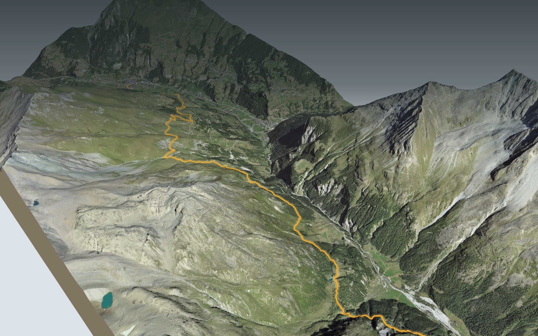
The path crosses the Borgne river, climbs via L'Ata Gieute and Les Chottes de l'Etoile to the high point, then drops down before heading back up towards the lake. The elevation profile shows you where it climbs and where it comes down again.
On the Alpine Passes Trail, the stage before arrives in Evolène from the Becs de Bosson hut, and the next one carries on from Arolla to the Dix hut. Fancy another lake? The Tour du Lac de Moiry is on the site too.
At the finish: Arolla, an old summer pasture turned mountaineering centre, and the bus at the Arolla, poste stop. Check the next departures and plan your day before you set off. Looking for more in the area? See all hikes in Valais.
The story of the trail
What happened where you are going to walk, chapter by chapter.
A long climb, a lake, a village
You start at 1,373 m in Evolène and finish at 2,008 m in Arolla. In between: 15.0 km, 1,500 m of climbing and 880 m of descent. Allow 6 h 20 of walking in this direction and 5 h 40 the other way. The high point, at 2,297 m, comes at around km 7.5.
Soon after the start, the path crosses the Borgne, then climbs via L'Ata Gieute, at around km 3, and enters the Val d'Arolla at around km 4.5. It passes Les Chottes de l'Etoile, at around km 6, reaches the high point, drops down, then runs along Lac Bleu at around km 11.5 before reaching Arolla. After the restaurants of Evolène, the next restaurant on this page is the Hôtel du Glacier, at the finish: bring food and water. On the trail, follow the signposts and check the day's conditions.
Evolène, the big commune of the Val d'Hérens
Evolène is a very large commune: it covers the whole upper part of the Val d'Hérens, right up to the Italian border, and takes in several villages, among them Evolène, La Sage, Les Haudères and Arolla. The name first appears in 1250, as Ewelina. Today's commune dates from 1882, when the commune of Hérens was split between Evolène and Saint-Martin.
In the 14th and 15th centuries, many families moved here from Zermatt: by 1498, two thirds of the people had German as their mother tongue. In 1445, 101 heads of household asked to build a church at their own expense; the chapel was consecrated in 1448. Until 1950, people lived mainly from mountain farming, with the Hérens cow. Tourism began around 1860 with the opening of the Hôtel de la Dent Blanche, and Evolène is one of the last French-speaking communes in Switzerland where the local patois is still used.
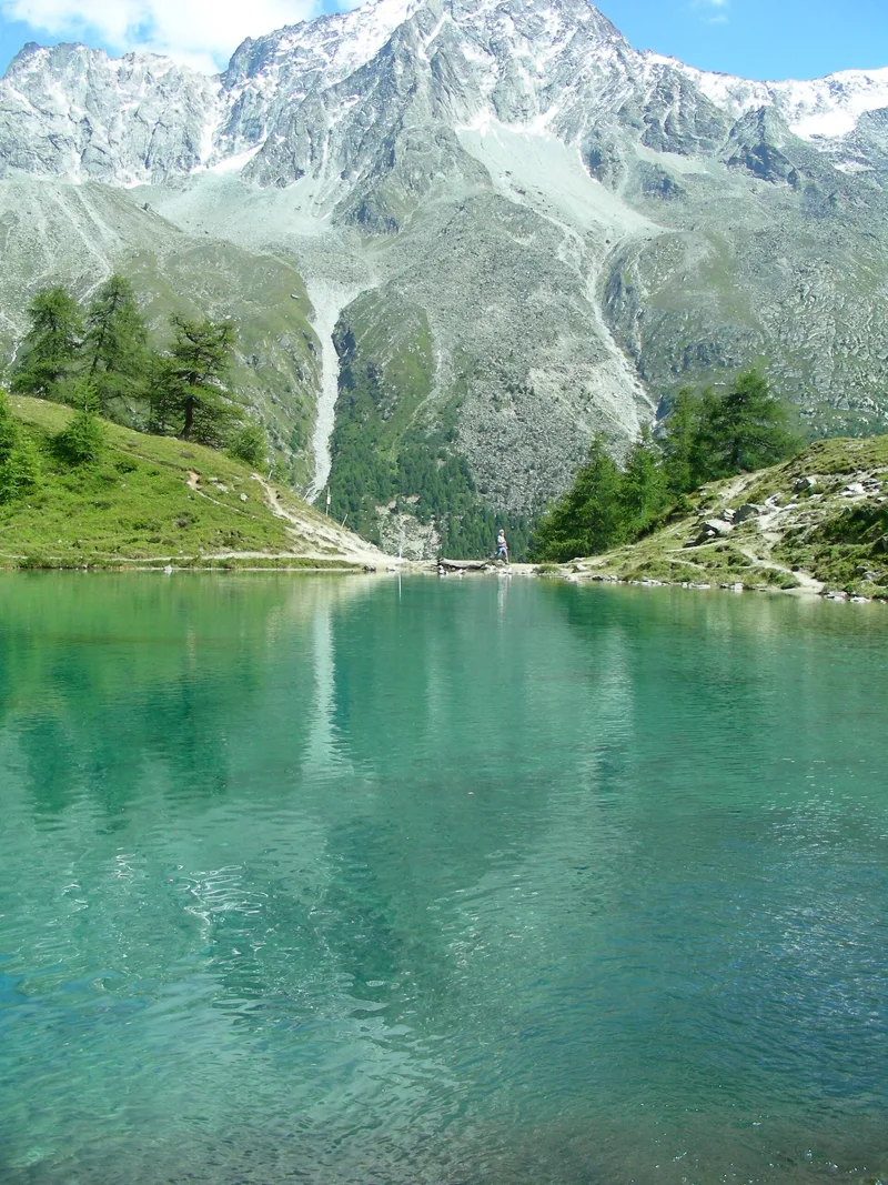
Lac Bleu and its rocks
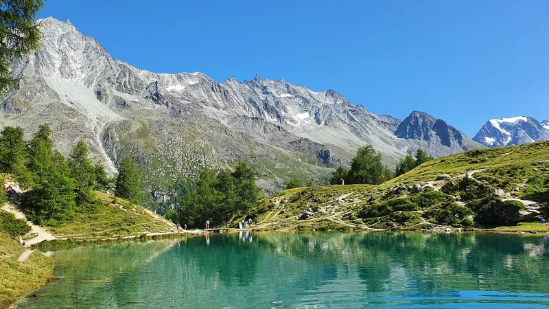
At around km 11.5, the path runs along the shore of Lac Bleu. Its bright blue comes from algae and glacial clay working together, and a strong spring bursts out above the lake. Around it: larches, Swiss stone pines, marmots, chamois and butterflies, plus some lovely picnic spots.
Around the lake, the geological map shows metabasalts of the Tsaté nappe and deposits left by the glaciers as they retreated after the Last Glacial Maximum. At around km 13.5, shortly before Arolla, the trail crosses Arolla orthogneiss, a greenish rock, from lime green to olive green, that makes up most of the Dent Blanche nappe.
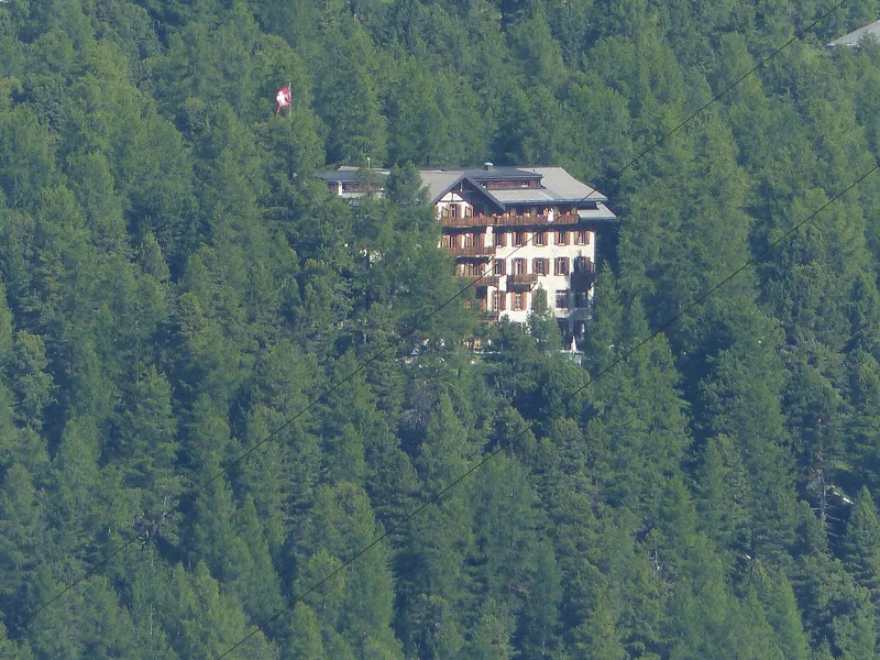
Arolla, from pasture to mountaineering
Arolla started out as a summer pasture, mentioned as early as the 13th century. It belonged to the lords of Rarogne, then to Bishop Walter Supersaxo, who left it in 1482 to the bishop's estate, which kept most of it until 1875. The area is crossed by the old Col de Collon route between Valais and Aosta, gradually abandoned as the glaciers advanced in the 17th and 19th centuries. As early as 1517, the Valais Diet had decided to close the pass, judged too hard to defend; the people of Hérens protested and promised to defend it themselves.
In the 18th century, botanists and geologists met here. Then came the first climbers and guides in 1838, the first guesthouse in 1865, summits conquered in 1873, the Kurhaus in 1897 and the Swiss Alpine Club centre in 1964. In the same commune, Mont Collon has given its name to a rock: the Mont Collon gabbro.
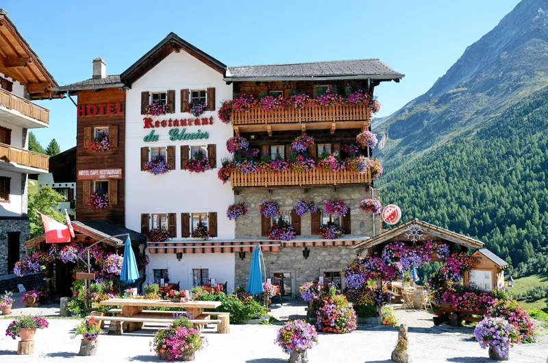
Arriving in Arolla
The final stretch passes Zau des Têtes, at around km 14.4, and heads down into Arolla. The Hôtel du Glacier, at 2,017 m, sits right by the path, and the walk ends at the Arolla, poste bus stop. Further down the page you will find the next departures.
On 10 November 2026, a closure was reported off the route, level with km 11, on the path from La Gouille to Satarma, because of a destroyed bridge. That section is not part of the route on this page, but check the day's conditions before you set off.
In pictures
Lac Bleu, Arolla (Valais)
Lac Bleu in the Val d'Hérens
Val d'Hérens: the Dent de Perroc seen from Lac Bleu
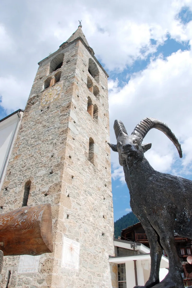
Evolène church with the ibex monument, Val d'Hérens
Traditional flower decoration on old wooden houses and modern stone houses in Evolène
The Evolène museum
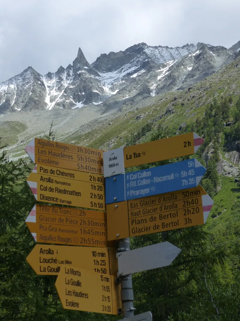
Signpost in Arolla, with the Aiguille de la Tsa
The Hotel-Restaurant Glacier in Arolla, known locally as "flower power" for its summer flowers
The Grand Hôtel & Kurhaus, Arolla
Mont Collon near Arolla, with flowers
Edelweiss (Leontopodium alpinum), Arolla
Evolène → Arolla: when to go
The bus runs up to the start every day of the year, according to the official timetable. Here the sun clears the ridge late, and the latest time to set off ranges from 14:03 in June to 9:25 in December.
- Bus to the start
- every day
- 26 to 30 buses a day
- first bus 1:11, 5:34 or 6:40
- last 20:22 or 21:22
- Sun at the start, mid-January
- from 9:38
- rises at 8:08, hidden by the ridge
- Leave by, for 6 h 20 of walking
- 9:50
- arrive 1 hour before sunset, at 17:10
| Month | Sun at the start | Leave by | In the sun, leaving at 9:00 | Bus |
|---|---|---|---|---|
| December | 9:29 → 16:45 | 9:25 | 57 % | every day |
| January | 9:38 → 17:10 | 9:50 | 66 % | every day |
| February | 9:21 → 17:55 | 10:35 | 82 % | every day |
“In the sun”: the share of the path in sunlight under a clear sky, with the terrain worked out point by point. The path climbs to 2,297 m: today's snow and frost are in the weather and My day.
- Bus to the start
- every day
- 28 to 30 buses a day
- first bus 5:34 or 6:40
- last 20:22 or 21:22
- Sun at the start, mid-April
- from 9:18
- rises at 6:44, hidden by the ridge
- Leave by, for 6 h 20 of walking
- 12:56
- arrive 1 hour before sunset, at 20:16
| Month | Sun at the start | Leave by | In the sun, leaving at 9:00 | Bus |
|---|---|---|---|---|
| March | 8:57 → 18:35 | 11:15 | 92 % | every day |
| April | 9:18 → 20:16 | 12:56 | 98 % | every day |
| May | 8:58 → 20:55 | 13:35 | 100 % | every day |
“In the sun”: the share of the path in sunlight under a clear sky, with the terrain worked out point by point. The path climbs to 2,297 m: today's snow and frost are in the weather and My day.
- Bus to the start
- every day
- 28 to 30 buses a day
- first bus 5:34 or 6:40
- last 20:22 or 21:22
- Sun at the start, mid-July
- from 9:06
- rises at 5:54, hidden by the ridge
- Leave by, for 6 h 20 of walking
- 13:58
- arrive 1 hour before sunset, at 21:18
| Month | Sun at the start | Leave by | In the sun, leaving at 9:00 | Bus |
|---|---|---|---|---|
| June | 8:58 → 21:23 | 14:03 | 100 % | every day |
| July | 9:06 → 21:18 | 13:58 | 99 % | every day |
| August | 9:13 → 20:40 | 13:20 | 99 % | every day |
“In the sun”: the share of the path in sunlight under a clear sky, with the terrain worked out point by point. The path climbs to 2,297 m: today's snow and frost are in the weather and My day.
- Bus to the start
- every day
- 26 to 30 buses a day
- first bus 1:11, 5:34 or 6:40
- last 20:22 or 21:22
- Sun at the start, mid-October
- from 9:49
- rises at 7:47, hidden by the ridge
- Leave by, for 6 h 20 of walking
- 11:25
- arrive 1 hour before sunset, at 18:45
| Month | Sun at the start | Leave by | In the sun, leaving at 9:00 | Bus |
|---|---|---|---|---|
| September | 9:30 → 19:43 | 12:23 | 95 % | every day |
| October | 9:49 → 18:45 | 11:25 | 88 % | every day |
| November | 9:07 → 16:59 | 9:39 | 69 % | every day |
“In the sun”: the share of the path in sunlight under a clear sky, with the terrain worked out point by point. The path climbs to 2,297 m: today's snow and frost are in the weather and My day.
The next few days
Local forecast, updated every hour
Reading the forecast…
My day
Pick your day and start time: everything updates.
- Arrival at Arolla
- 14:50 6 h 20 of walking without breaks, starting at 08:30
The trail, kilometre by kilometre
Places are listed under the kilometre where you pass them. Drag along the profile: the marker moves on the 3D view too.
- under 10 %
- 10 to 20 %
- 20 to 30 %
- over 30 %
- fountain or water point
- toilets
Around the trail (250 m): 8 restaurants, 4 fountains and water points and 1 toilet. Estimated time: the official walking time spread by effort (1 km on the flat counts as 100 m of climbing), start time set in “My day”.
Getting there and back
Back by public transport from the Arolla, poste stop
Next departures from Arolla, posteReading the official timetable…
By car
Careful, this is one way: public transport back arrives in Arolla, poste, not in Evolène. Plan to get back to your car by public transport, or park at the finish and take public transport to the start.
- Car park, Rue Centrale240 m from the start
- Car park, Route des Condémines350 m from the start
- Car park, Route de Lanna400 m from the start
Public car parks within 600 m of the start: prices and number of spaces may have changed, check the signs on site.
Questions people ask
How long is the hike from Evolène to Arolla?
6 h 20 of walking (official time), in this direction, not counting breaks. The other way: 5 h 40.
Is it hard?
Official rating for this stage: fitness difficult, technique medium. It is 1,500 m of climbing over 15.0 km.
Can I get back by public transport?
Yes. The Arolla, poste stop is at the finish. The next departures show live under “Getting there and back”.
Where can I eat on the way?
8 places to eat within 250 m of the trail, including Le Central, Au Vieux-Mazot, Le Mosset. Where they are and their opening hours: below the profile.
Is there water and are there toilets on the way?
4 fountains and water points and 1 toilet within 250 m of the trail (survey of 25/10/2026).
Can I download the track?
Yes, as a GPX file for your watch or map app: “Download the track” button at the top of the page.
More hikes within 10 km
Official stages that pass within 10 km of this trail. Each card says whether its page is already up.
- © swisstopoEvolène, loop3 h 25Chemin des villages d’Evolène11.0kmDistance520mAscent520mDescentTechnical mediumFitness medium. Official waymarked stage
- Arolla → Cab. des Dix5 h 00Alpenpässe-Weg, stage 2711.0kmDistance1,350mAscent440mDescentTechnical mediumFitness difficult. Official waymarked stage
- © swisstopoCab. des Becs de Bosson → Evolène3 h 30Alpenpässe-Weg, stage 2511.0kmDistance90mAscent1,700mDescentTechnical mediumFitness difficult. Official waymarked stage
- Cab. des Dix → Cab. de Prafleuri4 h 10Alpenpässe-Weg, stage 2812.0kmDistance600mAscent860mDescentTechnical mediumFitness medium. Official waymarked stage
- © swisstopoGrimentz → Cab. des Becs de Bosson4 h 40Alpenpässe-Weg, stage 2410.0kmDistance1,500mAscent90mDescentTechnical mediumFitness difficult. Official waymarked stage
- © swisstopoVernamiège, Les Prixes → Euseigne, La Luette2 h 35Chemin d’Ossona8.0kmDistance360mAscent540mDescentTechnical mediumFitness medium. Official waymarked stage