
From Crans-Montana to Leukerbad, from one language to another
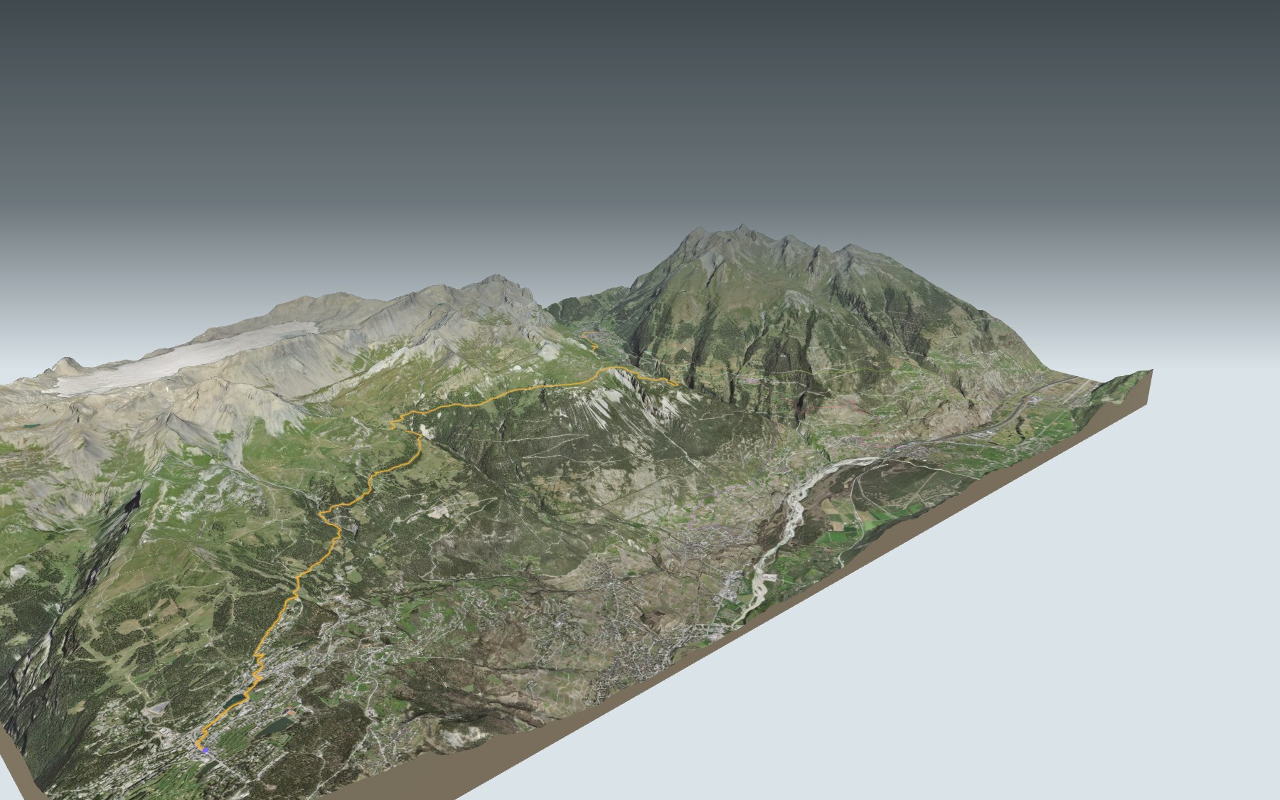
The first stage of the Walliser Sonnenweg is also the toughest of its four: a real day on your feet, rated difficult for fitness and medium for technique, on a mountain trail. You start in Crans-Montana, on the French-speaking side, and finish in Leukerbad, in German-speaking Upper Valais, with the thermal baths as your reward.
The trail leaves Crans-Montana past the Etang Grenon pond and Vermala, then heads up into the pastures: Les Marolies, the Relais de Colombire, the Cave du Sex and the Cabane de la Tièche. Next it skirts the Varneralp pasture, reaches its highest point in the municipality of Varen and then drops a long way down to Leukerbad. The stage profile shows you where it climbs and where it descends.
Too long for one day? Other trails climb towards Leukerbad from the stations of Salgesch, Leuk or Turtmann: each start has its own colour on the 3D map, and its estimated time is in the list of starts. The Sentier Panorama 4000 crosses your path above Crans-Montana, and stage 3 of the same route, Gampel → Ausserberg, is waiting further along the valley.
At the finish: Leukerbad and its hot springs, already famous throughout the Swiss Confederation by the end of the 15th century. Check the next departures from Leukerbad and plan your day before you set off. Fancy something else nearby? All the hikes in Valais.
The story of the trail
What happened where you are going to walk, chapter by chapter.
A long balcony stage
You start at 1,462 m, in Crans-Montana, and finish at 1,389 m, in Leukerbad. In between: 24.4 km, 1,150 m of climbing and 1,250 m of descent, with a high point at 2,183 m. Allow 7 h 40 of walking in this direction and 7 h 50 the other way.
This is the first of the four stages of the Walliser Sonnenweg (the Valais sun trail), which follows the southern slopes of the Bernese Alps, and it is the toughest. After the Cave du Sex and the Cabane de la Tièche, the next place to eat is Leukerbad: bring enough to drink and eat. On the trail, follow the signposts and the conditions of the day.
Crans-Montana, golf and the first downhill race
The trail leaves Crans-Montana along the Etang Grenon, then the Etang d'Ycoor, and runs past the edge of the Super Crans golf course at Vermala. In 1893 the Hôtel du Parc, Montana's first hotel, opened its doors; it was thought up by two friends who were local hunters, Louis Antille and Michel Zufferey. In 1906 the Englishman Henry Lunn brought golf to the resort, which opened an 18-hole course in 1908, described at the time as the highest in the world.
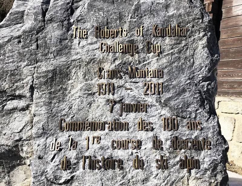
On 7 January 1911, Crans-Montana hosted the Roberts of Kandahar Challenge Cup, a race conceived by Arnold Lunn, Henry's son, from the Plaine-Morte glacier down to Montana. The sports press called it the first major downhill challenge in the history of skiing. In Crans-Montana, a monument marks the 100th anniversary of the race.
Colombire, the Tièche and the language border
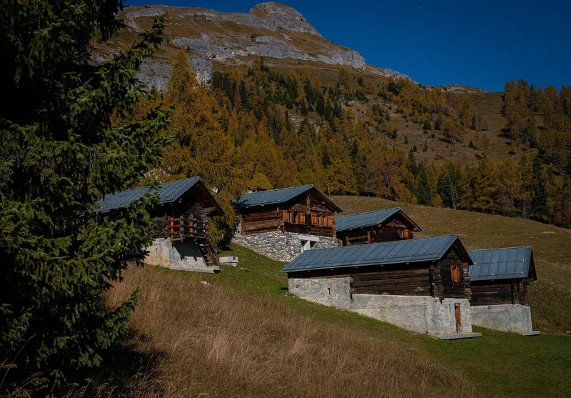
After Les Marolies, the trail climbs to the Relais de Colombire. The hamlet is home to an ecomuseum of transhumance: three traditional mayens (summer chalets) explain the seasonal movement of herds and people between the villages and the high pastures. Just after it, you pass beside the Bisse de Tsittoret irrigation channel, then come the Cave du Sex and the Cabane de la Tièche.
Shortly after the hut, you cross the Tièche stream, and the Raspille is not far away. This stream, which rises at the Plaine-Morte glacier and flows into the Rhone between Salgesch and Sierre, officially separates the two language regions of Valais. This is also where you enter the Pfyn-Finges nature park, a regional nature park since 2013, sitting right on this language border.
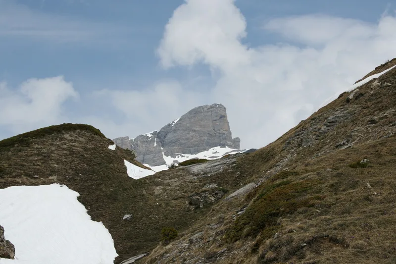
The high point, on the German-speaking side
The trail then climbs to Nüschelet, at the edge of the Varneralp pasture, and enters the municipality of Varen. It reaches its highest point, 2,183 m, shortly before Planitschat. From here, the names on the map switch to German: the Tschajetu-Wasserleitu irrigation channel, Chäller, then, in the municipality of Inden, the Larschi.
Before Leukerbad, the trail crosses parts of the Leukerbad federal hunting reserve. These reserves have existed since 1875: they were set up to protect chamois, ibex, red deer and roe deer, which had become rare because of hunting and competition from livestock.
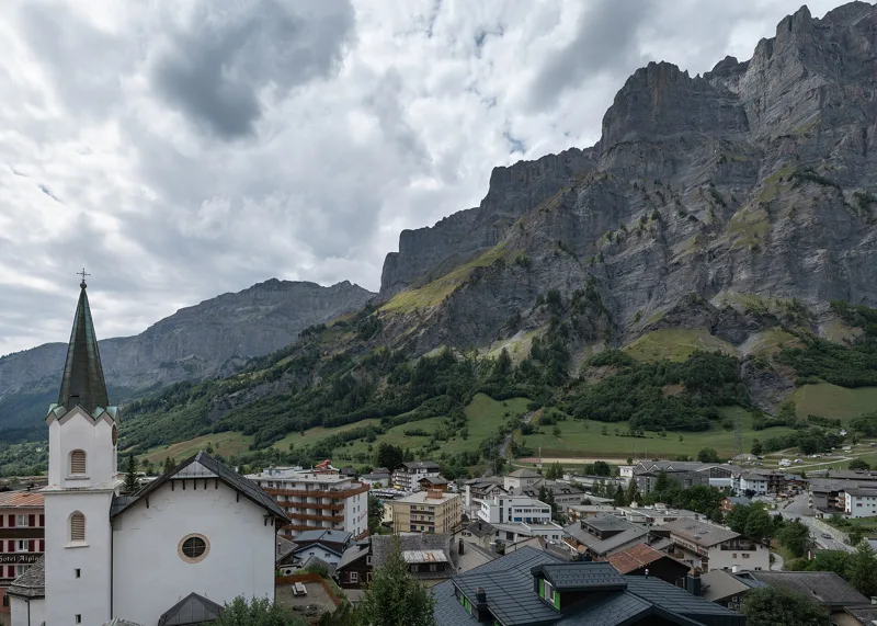
Leukerbad, warm water at the end
The trail descends via Larschi and Pfiess, passing near Birchen, to Leukerbad (Loèche-les-Bains), at the foot of high rock walls and the Gemmi pass. The village has around twenty springs; the most important, the Saint-Laurent spring, gives water at 51 °C. By the end of the 15th century, the baths were already famous throughout the Swiss Confederation.
The Gemmi mule track, built between 1739 and 1741, links the village with the Bernese Oberland. A railway ran between Leukerbad and Leuk from 1915 to 1967, before a bus took over. Near the finish, a warm-water fountain flows in the village. Further down the page you will find the next departures.
Every way to Leukerbad
5 starting points to reach Leukerbad. Pick yours: the 3D view shows it and “My day” recalculates.
Walking times without breaks. “Estimated” times are calculated on the terrain profile with a model fitted to the official stages; the shortest path may differ from the one on the yellow signposts: on the ground, follow the signs. Gradient: the steepest over 200 m of trail. Profiles share the same scale (length and altitude). Stations and car parks within 500 m of the start.
In pictures
Crans-Montana and the Etang de la Moubra
Lac Grenon
Monument marking 100 years since the first downhill race in the history of alpine skiing, Crans-Montana
Colombire, a group of mayens (summer chalets) at Crans-Montana
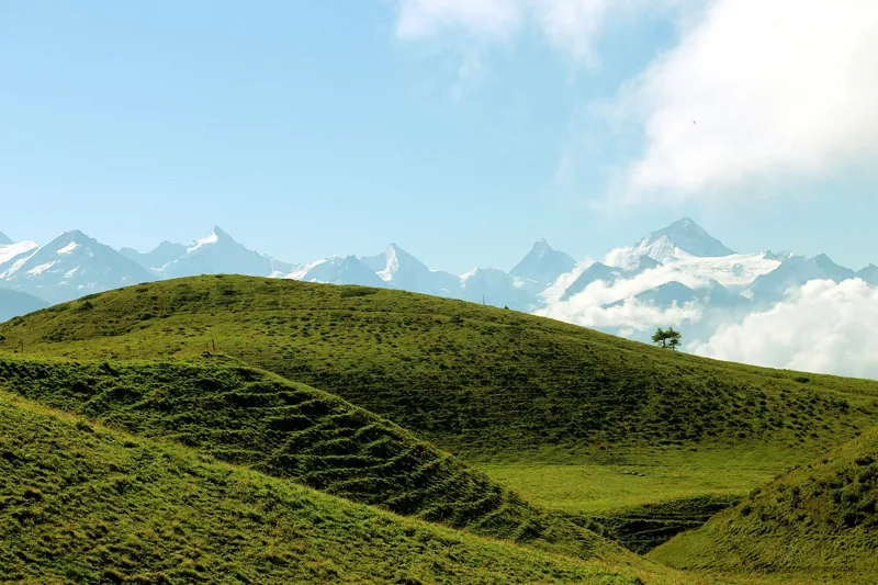
The Weisshorn seen from around the Cave du Sex
View above La Tièche
The Trubelstock from the Varneralp, above Salgesch
The Leeshörner from Birchen, Leukerbad
Leukerbad
Thermal baths in Leukerbad
The Dala river in Leukerbad
Crans-Montana → Leukerbad: when to go
The bus runs up to the start every day of the year, according to the official timetable. The latest time to set off ranges from 12:44 in June to 8:04 in December.
- Bus to the start
- every day
- 52 to 76 buses a day
- first bus 1:11, 6:09 or 7:10
- last 22:24 or 22:56
- Sun at the start, mid-January
- from 8:47
- rises at 8:09, hidden by the ridge
- Leave by, for 7 h 40 of walking
- 8:30
- arrive 1 hour before sunset, at 17:10
| Month | Sun at the start | Leave by | In the sun, leaving at 9:00 | Bus |
|---|---|---|---|---|
| December | 8:44 → 16:44 | 8:04 | 69 % | every day |
| January | 8:47 → 17:10 | 8:30 | 70 % | every day |
| February | 8:12 → 17:55 | 9:15 | 72 % | every day |
“In the sun”: the share of the path in sunlight under a clear sky, with the terrain worked out point by point. The path climbs to 2,183 m: today's snow and frost are in the weather and My day.
- Bus to the start
- every day
- 72 to 75 buses a day
- first bus 1:11 or 6:09
- last 22:24 or 22:56
- Sun at the start, mid-April
- from 7:06
- rises at 6:44, hidden by the ridge
- Leave by, for 7 h 40 of walking
- 11:37
- arrive 1 hour before sunset, at 20:17
| Month | Sun at the start | Leave by | In the sun, leaving at 9:00 | Bus |
|---|---|---|---|---|
| March | 6:57 → 18:35 | 9:55 | 73 % | every day |
| April | 7:06 → 20:17 | 11:37 | 96 % | every day |
| May | 6:29 → 20:56 | 12:16 | 97 % | every day |
“In the sun”: the share of the path in sunlight under a clear sky, with the terrain worked out point by point. The path climbs to 2,183 m: today's snow and frost are in the weather and My day.
- Bus to the start
- every day
- 74 to 76 buses a day
- first bus 1:11 or 6:09
- last 22:24 or 22:56
- Sun at the start, mid-July
- from 6:29
- rises at 5:53, hidden by the ridge
- Leave by, for 7 h 40 of walking
- 12:39
- arrive 1 hour before sunset, at 21:19
| Month | Sun at the start | Leave by | In the sun, leaving at 9:00 | Bus |
|---|---|---|---|---|
| June | 6:17 → 21:24 | 12:44 | 98 % | every day |
| July | 6:29 → 21:19 | 12:39 | 98 % | every day |
| August | 6:57 → 20:40 | 12:00 | 97 % | every day |
“In the sun”: the share of the path in sunlight under a clear sky, with the terrain worked out point by point. The path climbs to 2,183 m: today's snow and frost are in the weather and My day.
- Bus to the start
- every day
- 52 to 75 buses a day
- first bus 1:11, 6:09 or 7:10
- last 22:24 or 22:56
- Sun at the start, mid-October
- from 8:15
- rises at 7:47, hidden by the ridge
- Leave by, for 7 h 40 of walking
- 10:05
- arrive 1 hour before sunset, at 18:45
| Month | Sun at the start | Leave by | In the sun, leaving at 9:00 | Bus |
|---|---|---|---|---|
| September | 7:20 → 19:43 | 11:03 | 95 % | every day |
| October | 8:15 → 18:45 | 10:05 | 86 % | every day |
| November | 8:07 → 16:58 | 8:18 | 70 % | every day |
“In the sun”: the share of the path in sunlight under a clear sky, with the terrain worked out point by point. The path climbs to 2,183 m: today's snow and frost are in the weather and My day.
The next few days
Local forecast, updated every hour
Reading the forecast…
My day
Pick your day and start time: everything updates.
- Arrival at Leukerbad
- 16:10 7 h 40 of walking without breaks, starting at 08:30
The trail, kilometre by kilometre
From Crans-Montana
Places are listed under the kilometre where you pass them. Drag along the profile: the marker moves on the 3D view too.
- under 10 %
- 10 to 20 %
- 20 to 30 %
- over 30 %
- fountain or water point
- toilets
Around the trail (250 m): 56 restaurants, 8 cafés, 15 fountains and water points and 5 toilets. Estimated time: the official walking time spread by effort (1 km on the flat counts as 100 m of climbing), start time set in “My day”.
- under 10 %
- 10 to 20 %
- 20 to 30 %
- over 30 %
- fountain or water point
- toilets
Around the trail (250 m): 21 restaurants, 2 cafés, 9 fountains and water points and 2 toilets. Estimated time: the official walking time spread by effort (1 km on the flat counts as 100 m of climbing), start time set in “My day”.
- under 10 %
- 10 to 20 %
- 20 to 30 %
- over 30 %
- fountain or water point
- toilets
Around the trail (250 m): 23 restaurants, 3 cafés, 14 fountains and water points and 4 toilets. Estimated time: the official walking time spread by effort (1 km on the flat counts as 100 m of climbing), start time set in “My day”.
- under 10 %
- 10 to 20 %
- 20 to 30 %
- over 30 %
- fountain or water point
- toilets
Around the trail (250 m): 30 restaurants, 3 cafés, 24 fountains and water points and 7 toilets. Estimated time: the official walking time spread by effort (1 km on the flat counts as 100 m of climbing), start time set in “My day”.
- under 10 %
- 10 to 20 %
- 20 to 30 %
- over 30 %
- fountain or water point
- toilets
Around the trail (250 m): 23 restaurants, 2 cafés, 20 fountains and water points and 6 toilets. Estimated time: the official walking time spread by effort (1 km on the flat counts as 100 m of climbing), start time set in “My day”.
Getting there and back
Back by public transport from the Leukerbad, City stop
Next departures from Leukerbad, CityReading the official timetable…
By car
From Crans-Montana
Careful, this is one way: public transport back arrives in Leukerbad, City, not in Crans-Montana. Plan to get back to your car by public transport, or park at the finish and take public transport to the start.
- Parking du Rhodaniaunderground car park210 m from the start
- Underground car park, Rue Centralepaid80 m from the start
- Car park open-air, Rue Centralepaid120 m from the start
- Car park open-air, Rue du Pradopaid140 m from the start
Public car parks within 600 m of the start: prices and number of spaces may have changed, check the signs on site.
Careful, this is one way: public transport back arrives in Leukerbad, City, not in Albinenleitern (Torrentbahn). Plan to get back to your car by public transport, or park at the finish and take public transport to the start.
- Car parkpaid80 m from the start
- Stop Albinenleitern, Flaschenor by public transport30 m from the start
The nearest car park and stop for this start. Check the signs on site for the price.
Careful, this is one way: public transport back arrives in Leukerbad, City, not in Salgesch. Plan to get back to your car by public transport, or park at the finish and take public transport to the start.
- Car park310 m from the start
- Station Salgeschor by public transport0 m from the start
The nearest car park and stop for this start. Check the signs on site for the price.
Careful, this is one way: public transport back arrives in Leukerbad, City, not in Leuk. Plan to get back to your car by public transport, or park at the finish and take public transport to the start.
- Car parkfree70 m from the start
- Station Leukor by public transport0 m from the start
The nearest car park and stop for this start. Check the signs on site for the price.
Careful, this is one way: public transport back arrives in Leukerbad, City, not in Turtmann. Plan to get back to your car by public transport, or park at the finish and take public transport to the start.
- Car park320 m from the start
- Station Turtmannor by public transport0 m from the start
The nearest car park and stop for this start. Check the signs on site for the price.
Questions people ask
How long is the hike from Crans-Montana to Leukerbad?
7 h 40 of walking (official time), in this direction, not counting breaks. The other way: 7 h 50.
Is it hard?
Official rating for this stage: fitness difficult, technique medium. It is 1,250 m of descent over 24.4 km.
Can I get back by public transport?
Yes. The Leukerbad, City stop is at the finish. The next departures show live under “Getting there and back”.
Where can I eat on the way?
64 places to eat within 250 m of the trail, including Il était une fois..., Burger Lounge, La Rôtisserie. Where they are and their opening hours: below the profile.
Is there water and are there toilets on the way?
15 fountains and water points and 5 toilets within 250 m of the trail (survey of 25/10/2026).
Can I download the track?
Yes, as a GPX file for your watch or map app: “Download the track” button at the top of the page.
More hikes within 10 km
Official stages that pass within 10 km of this trail. Each card says whether its page is already up.
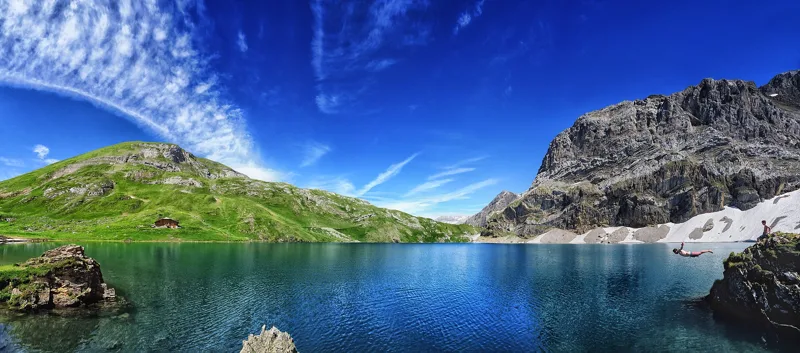 Lenk (Iffigenalp), loop4 h 25Iffigsee-Rundweg11.0kmDistance880mAscent880mDescentTechnical mediumFitness medium. See the hike
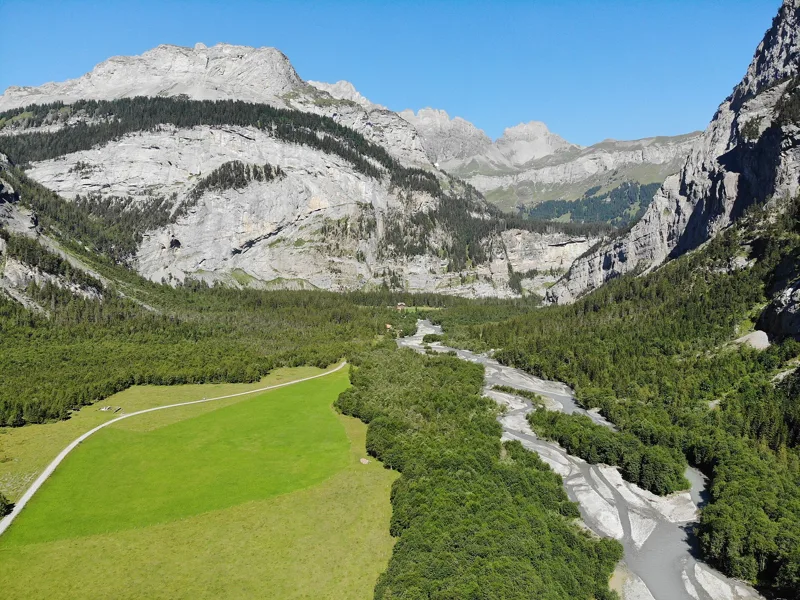 Kandersteg → Selden3 h 00Lötschberg-Panoramaweg, stage 211.0kmDistance460mAscent90mDescentTechnical mediumFitness medium. See the hike
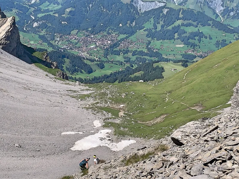 Kandersteg → Adelboden6 h 45Via Alpina, stage 1416.0kmDistance1,400mAscent1,250mDescentTechnical mediumFitness difficult. See the hike
- © swisstopoLeukerbad → Gampel7 h 25Walliser Sonnenweg, stage 224.0kmDistance1,000mAscent1,700mDescentTechnical easyFitness difficult. Official waymarked stage
- © swisstopoInden → Miège3 h 10Über die Raspille11.0kmDistance300mAscent740mDescentTechnical mediumFitness medium. Official waymarked stage
- © swisstopoVenthône → Leuk4 h 00Chemin du vignoble, stage 412.0kmDistance400mAscent580mDescentTechnical easyFitness medium. Official waymarked stage