
Hiking through the Breccaschlund
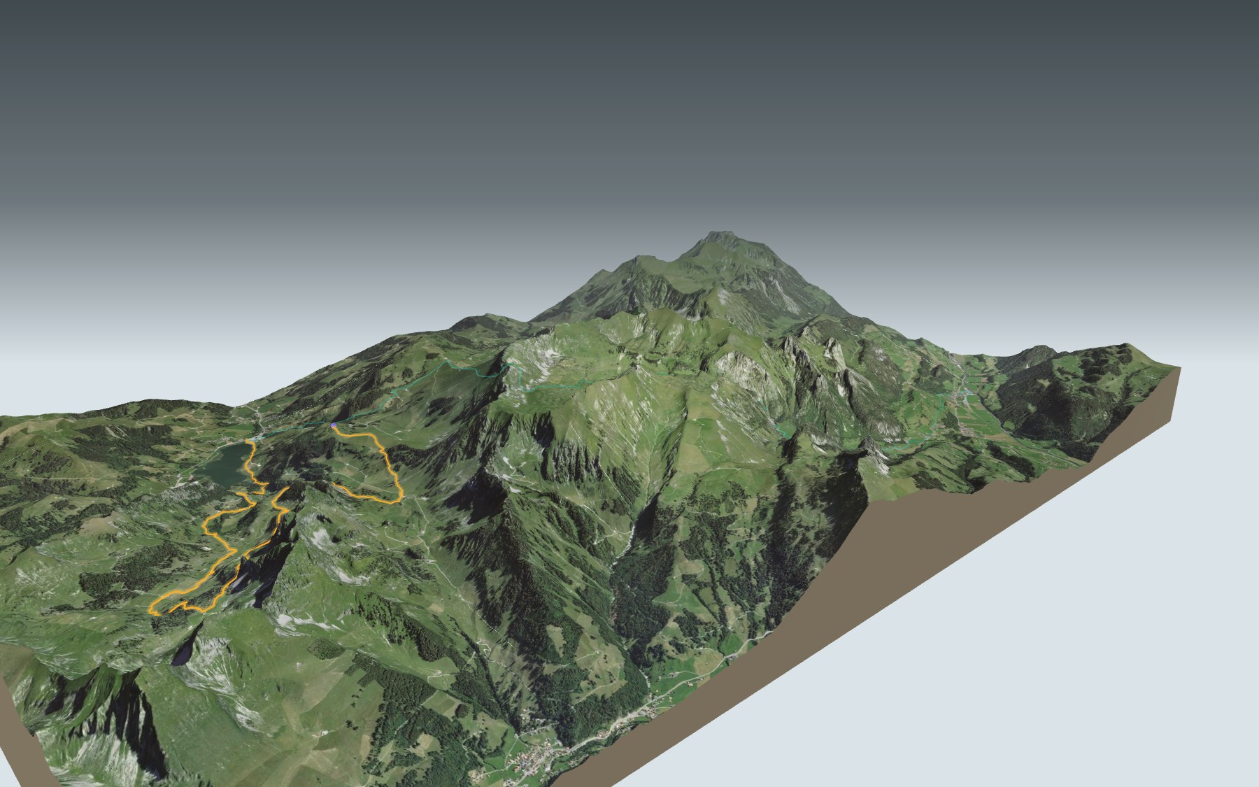
This hike takes you into the valley above Schwarzsee (Lac Noir in French): you ride the chairlift up to Riggisalp, cross the Breccaschlund, a glacial limestone trough listed in the Federal Inventory of Landscapes of National Importance, then walk back down to the lakeshore at Gypsera. It's rated difficult for fitness and easy for technique: 13.8 km, 480 m of climbing and 900 m of descent.
The path first passes the Untere Euschels alpine pasture, then enters the Breccaschlund and passes Rippetli, where the view over the lake is especially good. It then climbs to its highest point, 1,657 m, at the foot of the Türmli. The elevation profile shows you where it goes up and where it goes down.
On the way down you pass one alpine hut after another: Cerniets, Marbach Brecca, Steinige Rippa and Hubel Rippa. Rather do it all on foot? Start from Boltigen: that starting point has its own colour in the 3D view and its estimated time is under all starting points. By the lake, the Auf dem Rücken des Schwyberg loop also goes through Gypsera.
At the finish, Gypsera: the lake, restaurants and your way back down the valley. Check the next departures and plan your day before you set off. Looking for more in the area? See all hikes in Fribourg and Gruyère.
The story of the trail
What happened where you are going to walk, chapter by chapter.
A chairlift, then the valley
You start at 1,485 m at the Riggisalp top station and finish at 1,047 m at Gypsera, on the shore of Schwarzsee. In between: 13.8 km, 480 m of climbing and 900 m of descent. Allow 4 h 10 of walking time in this direction and 4 h 35 the other way.
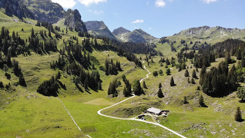
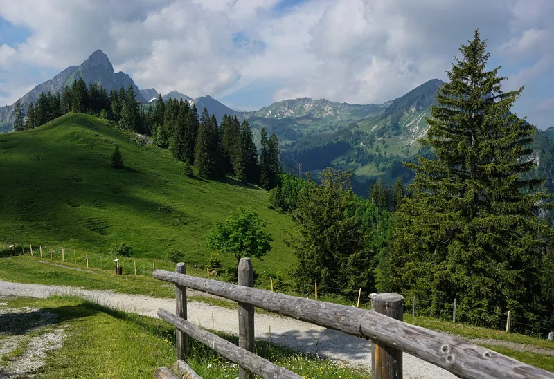
To get up, a detachable two-seater chairlift runs from Schwarzsee; the Bärghuus Riggisalp is right next to the top station. The path then passes the Untere Euschels alpine pasture, enters the Breccaschlund around the 4th kilometre and passes Rippetli. The recommended season is June to October, and the route may be closed or interrupted depending on the season and the weather: follow the signposts and check the conditions on the day.
A trough carved by two glaciers
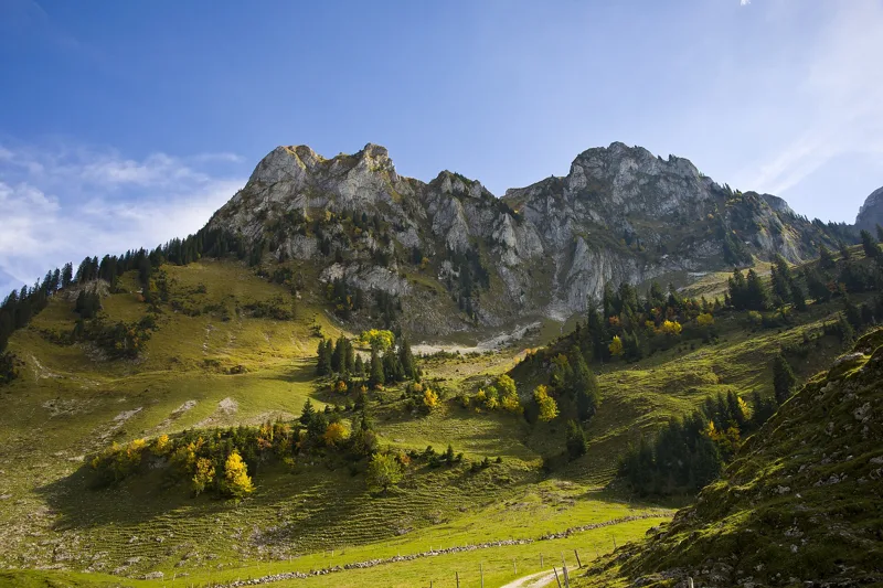
The Breccaschlund is an old glacial cirque, facing north-east and opening onto Schwarzsee. During the last ice age it held two glaciers, the Breccaschlund glacier and the Combi glacier, which joined near Cerniets, where the path goes. The whole valley is carved into limestone. Around the 6th kilometre you reach the highest point of the hike, 1,657 m, at the foot of the Türmli: together with the Spitzflue, it forms the steep northern flank of the Combi fold.
As the ice age ended, meltwater dissolved the rock. Limestone pavements and sinkholes, mostly covered with vegetation, shape the landscape; the limestone pavements above all between Cerniets and Combi. The valley has hardly any streams: the rock soaks up the rain through its cracks, and the water comes out at springs to the east before flowing into Schwarzsee.
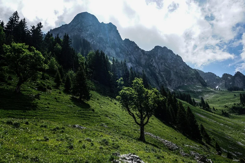
Land of the great maples
What strikes you here are the lone trees standing in the pastures, above all big sycamore maples. These wooded pastures with maples are one of the reasons the Breccaschlund has been listed since 1996 in the Federal Inventory of Landscapes and Natural Monuments of National Importance. A monumental maple stands in the pastures of Rippetli.
The meadows and stony slopes are home to large populations of the Apollo butterfly. Black grouse and rock partridge live along the forest edges and on the high grasslands. The trail is one of the hikes of the Gantrisch Regional Nature Park, a habitat for marmots, eagles and orchids.
From the monks' sheep to the cheese huts
At the end of the 12th century, the Breccaschlund and the neighbouring valleys became the summer pastures of the Cistercian abbey of Hauterive, founded in 1138. In the Middle Ages the monks seem to have grazed their own sheep here. From the 15th century, the pastures were leased to farmers from the lowlands, who gradually came to own them.
Cattle farming and hard cheese making later led to large alpine huts being built, mostly in the 18th century, in wood or stone depending on the altitude. The path passes several of them: Cerniets (7.5 km), Marbach Brecca (8.7 km), Steinige Rippa (9.7 km) and Hubel Rippa (11.5 km). By constantly clearing stones from the pastures, farmers kept the scree in check and preserved the quality of the grazing.
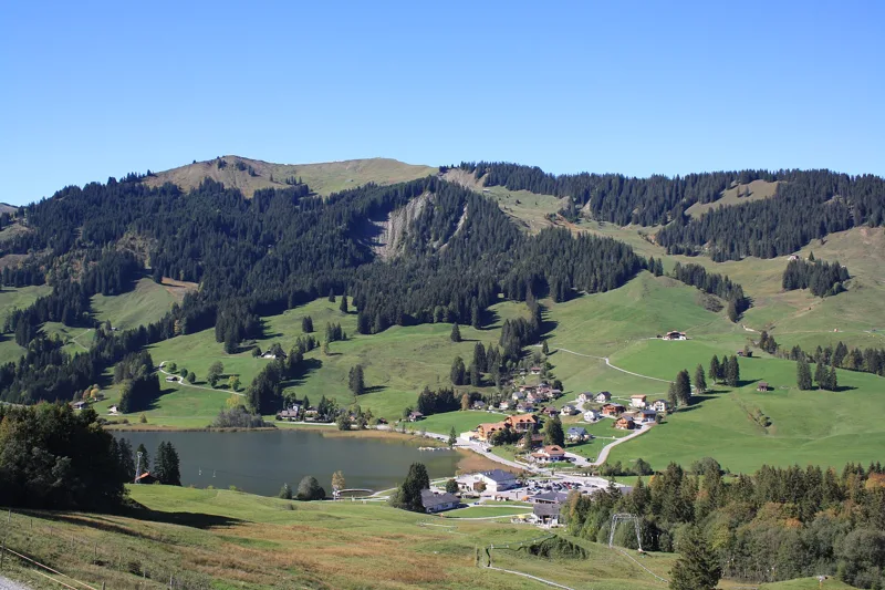
Schwarzsee and its legend
The last part of the path runs by the Euschelsbach, the stream that marks the eastern edge of the Breccaschlund, then drops to Schwarzsee, called Lac Noir in French, and to Gypsera, at 1,047 m. The Hotel Gypsera, built some 90 years after the 1810 baths, owes its name to the gypsum deposits of the area. Back in 1946, a ski lift already ran from Gypsera up to Riggisalp.
Legend has it that there was once only a pasture here, crossed by a river. To punish the pride of Ubald, son of the wealthy Bernhard Riggi, a storm brought down part of the mountain along with his hunting lodge, and the earth dammed the water: the lake was born. Later, a dragon from the Kaiseregg, driven off by the hermit Remigi, threw itself into the lake from a rock still called the Drachenfluh. Further down this page: where to eat and the next departures.
Every way to Schwarzsee, Gypsera
2 starting points to reach Schwarzsee, Gypsera. Pick yours: the 3D view shows it and “My day” recalculates.
Walking times without breaks. “Estimated” times are calculated on the terrain profile with a model fitted to the official stages; the shortest path may differ from the one on the yellow signposts: on the ground, follow the signs. Gradient: the steepest over 200 m of trail. Profiles share the same scale (length and altitude). Stations and car parks within 500 m of the start.
In pictures
View from Riggisalp top station towards the Breccaschlund
The Brecca above Schwarzsee
Breccaschlund: sycamore maple, Spitzflue and Fochsenflue
The Breccaschlund plain, Gantrisch Nature Park
The Kaiseregg seen from the Breccaschlund
The hamlet of Schwarzsee, the lake and the Schwyberg
Schwarzsee (Lac Noir)
The terrace of the Gypsera restaurant, Schwarzsee
The chairlift to Riggisalp, Schwarzsee
Riggisalp, canton of Fribourg
Breccaschlund-Panoramaweg: when to go
Public transport serves the start every day from 13 December 2026 to 29 March 2027 and from 6 May to 1 November 2027, according to the official timetable: that's the season to do this hike without a car. The latest time to set off ranges from 16:16 in June to 11:33 in December.
- Public transport to the start
- daily, 13 Dec to 28 Feb
- 480 arrivals a day
- first arrival 8:37
- last 16:36
- Sun at the start, mid-January
- from 10:23
- rises at 8:11, hidden by the ridge
- Leave by, for 4 h 10 of walking
- 11:59
- arrive 1 hour before sunset, at 17:09
| Month | Sun at the start | Leave by | In the sun, leaving at 9:00 | Transport |
|---|---|---|---|---|
| December | 10:40 → 16:43 | 11:33 | 17 % | 19 of 31 days |
| January | 10:23 → 17:09 | 11:59 | 23 % | every day |
| February | 9:33 → 17:55 | 12:45 | 50 % | every day |
“In the sun”: the share of the path in sunlight under a clear sky, with the terrain worked out point by point. The path climbs to 1,657 m: today's snow and frost are in the weather and My day.
- Public transport to the start
- daily, 1 Mar to 29 Mar
- and also 26 other days
- 480 to 540 arrivals a day
- first arrival 8:07 or 8:37
- last 16:36 or 17:06
- Sun at the start, mid-April
- from 7:32
- rises at 6:44, hidden by the ridge
- Leave by, for 4 h 10 of walking
- 15:08
- arrive 1 hour before sunset, at 20:18
| Month | Sun at the start | Leave by | In the sun, leaving at 9:00 | Transport |
|---|---|---|---|---|
| March | 8:44 → 18:36 | 13:26 | 82 % | 29 of 31 days |
| April | 7:32 → 20:18 | 15:08 | 85 % | off season |
| May | 6:33 → 20:58 | 15:48 | 96 % | 26 of 31 days |
“In the sun”: the share of the path in sunlight under a clear sky, with the terrain worked out point by point. The path climbs to 1,657 m: today's snow and frost are in the weather and My day.
- Public transport to the start
- every day
- 510 to 540 arrivals a day
- first arrival 8:07 or 8:37
- last 17:06
- Sun at the start, mid-July
- from 6:36
- rises at 5:52, hidden by the ridge
- Leave by, for 4 h 10 of walking
- 16:11
- arrive 1 hour before sunset, at 21:21
| Month | Sun at the start | Leave by | In the sun, leaving at 9:00 | Transport |
|---|---|---|---|---|
| June | 6:27 → 21:26 | 16:16 | 98 % | every day |
| July | 6:36 → 21:21 | 16:11 | 96 % | every day |
| August | 7:07 → 20:42 | 15:32 | 89 % | every day |
“In the sun”: the share of the path in sunlight under a clear sky, with the terrain worked out point by point. The path climbs to 1,657 m: today's snow and frost are in the weather and My day.
- Public transport to the start
- daily, 1 Sept to 1 Nov
- 510 to 540 arrivals a day
- first arrival 8:07 or 8:37
- last 17:06
- Sun at the start, mid-October
- from 9:42
- rises at 7:48, hidden by the ridge
- Leave by, for 4 h 10 of walking
- 13:35
- arrive 1 hour before sunset, at 18:45
| Month | Sun at the start | Leave by | In the sun, leaving at 9:00 | Transport |
|---|---|---|---|---|
| September | 8:35 → 19:44 | 14:34 | 80 % | every day |
| October | 9:42 → 18:45 | 13:35 | 51 % | every day |
| November | 9:27 → 16:58 | 11:48 | 41 % | 1 of 30 days |
“In the sun”: the share of the path in sunlight under a clear sky, with the terrain worked out point by point. The path climbs to 1,657 m: today's snow and frost are in the weather and My day.
The next few days
Local forecast, updated every hour
Reading the forecast…
My day
Pick your day and start time: everything updates.
- Arrival at Schwarzsee, Gypsera
- 12:40 4 h 10 of walking without breaks, starting at 08:30
The trail, kilometre by kilometre
From Riggisalp, Bergstation
Places are listed under the kilometre where you pass them. Drag along the profile: the marker moves on the 3D view too.
- under 10 %
- 10 to 20 %
- 20 to 30 %
- over 30 %
- fountain or water point
- toilets
Around the trail (250 m): 5 restaurants, 1 café, 3 fountains and water points and 4 toilets. Estimated time: the official walking time spread by effort (1 km on the flat counts as 100 m of climbing), start time set in “My day”.
- under 10 %
- 10 to 20 %
- 20 to 30 %
- over 30 %
- fountain or water point
- toilets
Around the trail (250 m): 4 restaurants, 2 cafés, 3 fountains and water points and 3 toilets. Estimated time: the official walking time spread by effort (1 km on the flat counts as 100 m of climbing), start time set in “My day”.
Getting there and back
Back by public transport from the Schwarzsee, Gypsera stop
Next departures from Schwarzsee, GypseraReading the official timetable…
By car
From Riggisalp, Bergstation
Careful, this is one way: public transport back arrives in Schwarzsee, Gypsera, not in Riggisalp, Bergstation. Plan to get back to your car by public transport, or park at the finish and take public transport to the start.
Public car parks within 600 m of the start: prices and number of spaces may have changed, check the signs on site.
Careful, this is one way: public transport back arrives in Schwarzsee, Gypsera, not in Boltigen. Plan to get back to your car by public transport, or park at the finish and take public transport to the start.
- Car park30 m from the start
- Station Boltigenor by public transport0 m from the start
The nearest car park and stop for this start. Check the signs on site for the price.
Questions people ask
How long is the hike from Riggisalp, Bergstation to Schwarzsee, Gypsera?
4 h 10 of walking (official time), in this direction, not counting breaks. The other way: 4 h 35.
Is it hard?
Official rating for this stage: fitness difficult, technique easy. It is 900 m of descent over 13.8 km.
Can I get back by public transport?
Yes. The Schwarzsee, Gypsera stop is at the finish. The next departures show live under “Getting there and back”.
Where can I eat on the way?
14 places to eat within 250 m of the trail, including Bärghuus, Rainlihuus, Combi. Where they are and their opening hours: below the profile.
Is there water and are there toilets on the way?
3 fountains and water points and 4 toilets within 250 m of the trail (survey of 25/10/2026).
Can I download the track?
Yes, as a GPX file for your watch or map app: “Download the track” button at the top of the page.
More hikes within 10 km
Official stages that pass within 10 km of this trail. Each card says whether its page is already up.
- Guggisberg → Schwarzsee4 h 50Alpenpanorama-Weg, stage 1916.0kmDistance660mAscent740mDescentTechnical easyFitness medium. Official waymarked stage
- Schwarzsee → Jaun4 h 10Alpenpanorama-Weg, stage 2012.0kmDistance700mAscent740mDescentTechnical easyFitness medium. Official waymarked stage
- Plaffeien → Schwarzsee2 h 45Freiburger Voralpenweg, stage 210.0kmDistance340mAscent140mDescentTechnical easyFitness easy. Official waymarked stage
- Schwarzsee → Jaun4 h 10Freiburger Voralpenweg, stage 312.0kmDistance700mAscent740mDescentTechnical easyFitness medium. Official waymarked stage
- Schwarzsee, loop1 h 00Schwarzsee Rundweg4.0kmDistance50mAscent50mDescentTechnical mediumFitness difficult. Official waymarked stage
- Jaun → Gruyères6 h 00Alpenpanorama-Weg, stage 2122.0kmDistance500mAscent780mDescentTechnical easyFitness difficult. Official waymarked stage