
Crossing the Jura over Mont Tendre
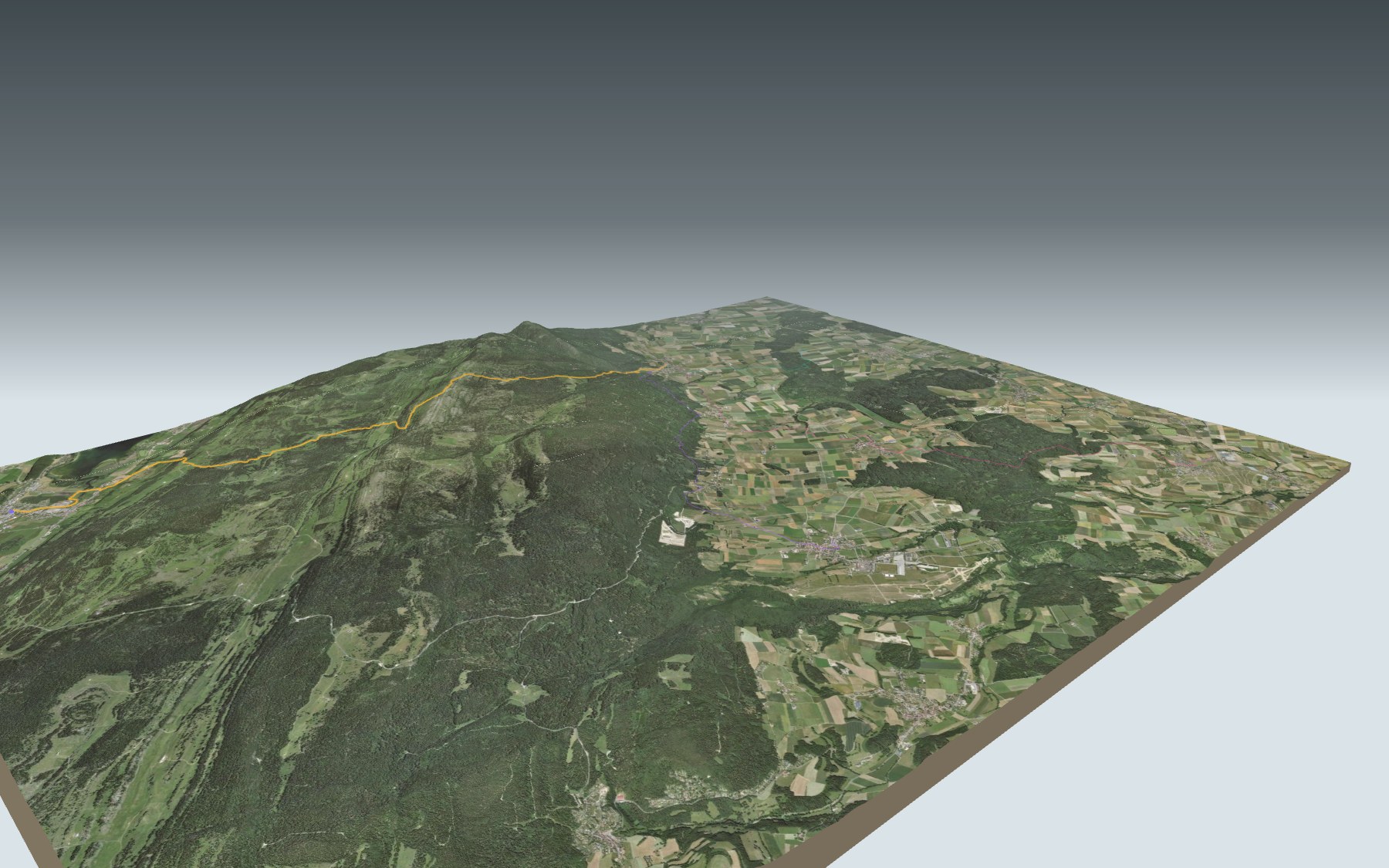
You start at Le Sentier-L'Orient station, on the floor of the Vallée de Joux, climb to Mont Tendre, the highest summit of the Swiss Jura, and walk down the other side to Montricher. A real crossing of the range: hard on the legs, easy on technique.
Shortly after the start, the path crosses the Orbe right next to Lac de Joux, goes through L'Orient, then climbs through wooded pastures. It passes the Cabane du Servan and the Chalet de Yens before the summit. The elevation profile shows you where the climb bites and where the descent gets steeper.
Between the valley and Montricher, the only place to eat we have found near the path is the Buvette du Mont Tendre, shortly after the summit. The way down goes through the Creux du Nid and the Combe des Criblets to Montricher. To reach Montricher without going over the ridge, there are also starting points at Bière, Yens and La Tuilerie, each with its estimated time in Every starting point.
At the finish: the Auberge aux 2 sapins and the village bus stop. Check the next departures from Montricher and plan your day before you set off. Looking for more in the area? See all hikes in the Jura.
The story of the trail
What happened where you are going to walk, chapter by chapter.
Right across the range
You start at 1,013 m at Le Sentier-L'Orient station, pass the highest point of the route, 1,679 m, on Mont Tendre, and finish at 754 m in Montricher. In between: 15.9 km, 760 m of climbing and 1,000 m of descent. Allow 5 h 00 of walking time in this direction and 5 h 20 the other way. The route is rated difficult for fitness and easy for technique.
After the Cabane du Servan and the Chalet de Yens, you reach the summit. The Buvette du Mont Tendre, at 1,614 m, is a little further on; its opening hours are not known, so bring food and water. On the way, follow the signposts and the conditions on the day.
Le Sentier, a watchmaking village
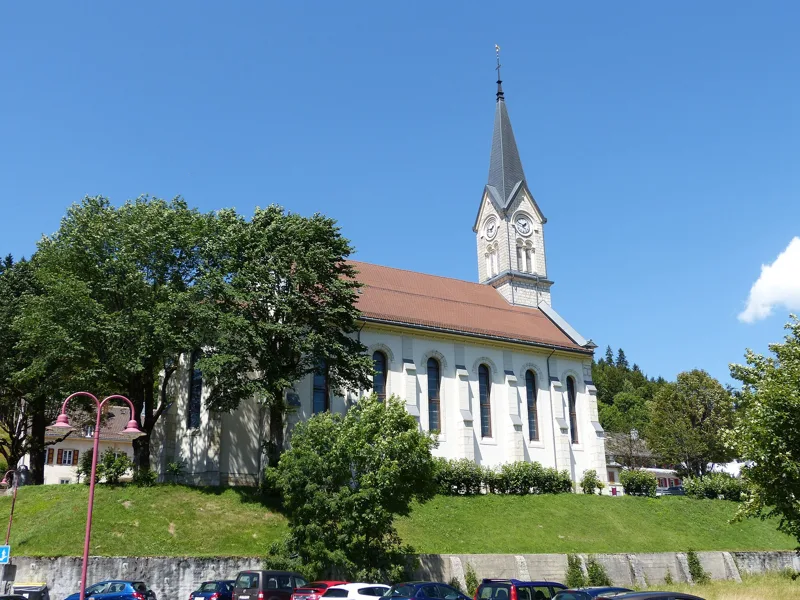
Le Sentier is the main village of the municipality of Le Chenit, on the left bank of the Orbe. The first land was cleared in the second half of the 16th century; the first settlers, most of them from Le Lieu, arrived in the early 17th. The church was built in 1612, then rebuilt in 1725 and in 1898.
Watchmaking arrived in the 18th century. The Le Coultre & Cie factory was founded in 1833 and became Jaeger-LeCoultre in 1937. The industrial school of 1894 later became the technical school of the Vallée de Joux.
The roof of the Swiss Jura
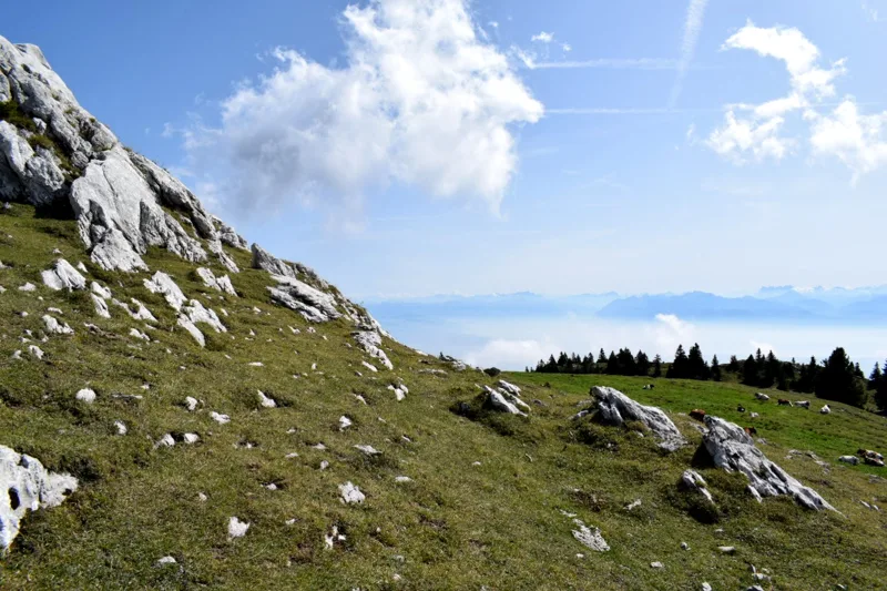
Mont Tendre rises to 1,679 m: it is the highest summit of the Swiss Jura. It belongs to the first range of the Jura, a long limestone arch that separates the Vallée de Joux from the Swiss Plateau. It rains a lot up here, yet no flowing water is visible on the massif: the water slips underground into a vast hidden network.
Around the summit, the path crosses dry meadows listed in the federal inventory. The summit grasslands are home to rare alpine plants such as the Alpine scabious (Cephalaria alpina). Down at the start, the path crosses a mire landscape of national importance, where the Orbe meanders through the marshes before flowing into Lac de Joux.
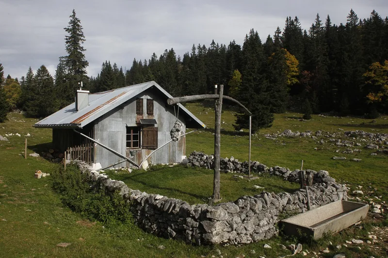
Dry-stone walls and summer farms
Cattle sheds are recorded on these mountains from the 13th century. When cheesemaking arrived, towards the end of the 17th century, new farm buildings were needed, built of rubble stone. Because the ground is karst with no streams, most of them have a stone cistern that collects water from the large roofs for the cattle.
The pastures are enclosed by dry-stone walls, stones fitted together without mortar and topped with flat slabs set on edge. They mark out the summer pastures, keep the cattle in and give shelter to small animals. They are a great part of the region's heritage.
Down to Montricher
The way down goes through the Creux du Nid, then past the Crêt aux Fruitiers and through the Combe des Criblets, near the Combe de la Verrière. On a spur above that valley stood a Middle Bronze Age hillfort, at a place called Châtel-Arruffens; only an earth bank remains. Mont Tendre itself lies within the municipality of Montricher.
Montricher is first mentioned in 1049. Of its medieval castle, only one tower of the outer wall can still be seen: it serves as the bell tower of the medieval church. The village lives mainly from forestry and livestock, and the Bière-Apples-Morges railway has linked it to Lake Geneva since 1896. Further down this page: the next departures.
Every way to Montricher
4 starting points to reach Montricher. Pick yours: the 3D view shows it and “My day” recalculates.
Walking times without breaks. “Estimated” times are calculated on the terrain profile with a model fitted to the official stages; the shortest path may differ from the one on the yellow signposts: on the ground, follow the signs. Gradient: the steepest over 200 m of trail. Profiles share the same scale (length and altitude). Stations and car parks within 500 m of the start.
In pictures
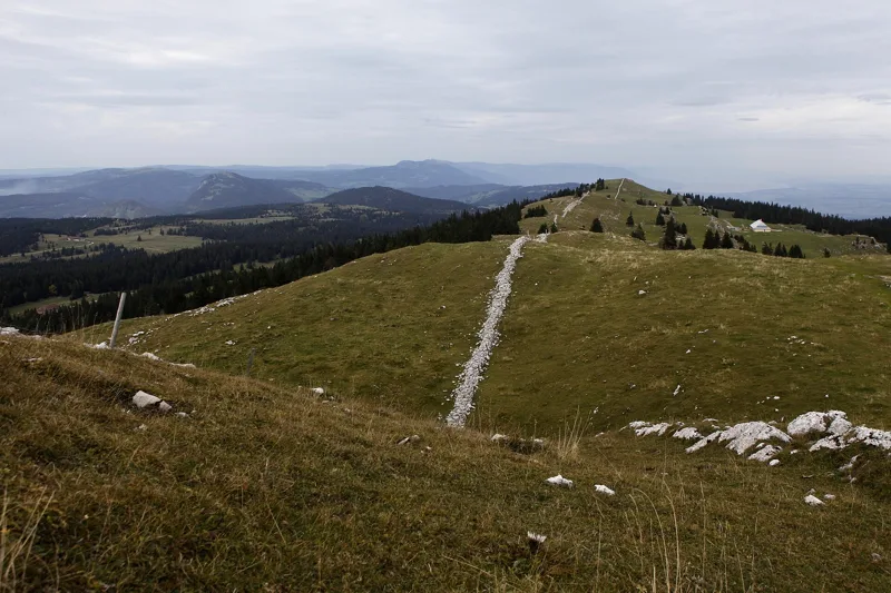
The Mont Tendre ridge, looking north
Sentier-Orient railway station, seen from the north
Chez le Poisson fen on the Orbe, Le Chenit
The church in Le Sentier
The Cabane du Servan on Mont Tendre
View of the Alps from Mont Tendre
Pearl-bordered fritillary (Boloria euphrosyne) on Mont Tendre
Wooded path near Mont Tendre
Rue du Lac road bridge over the Orbe, between Le Sentier and L'Orient
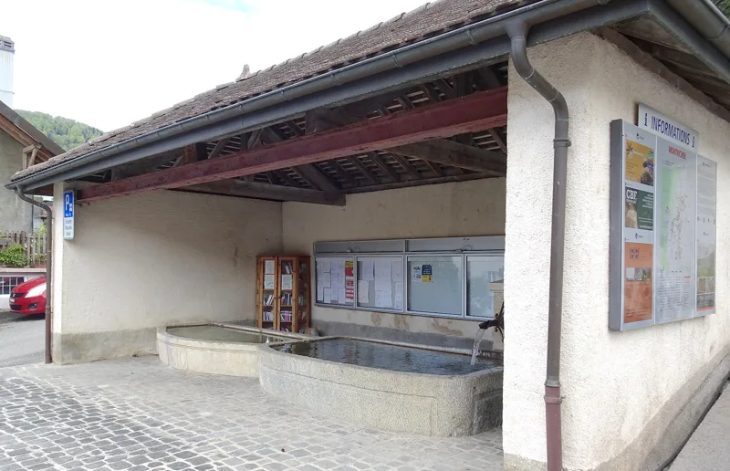
Fountain in Montricher
What you see from the top
360° view from Mont Tendre (1,678 m). 28 named peaks, including Mont Blanc, 94.9 km away. Swipe to look around.
Mont Tendre: Au sommet du Jura: when to go
Public transport serves the start every day of the year, according to the official timetable. The latest time to set off ranges from 15:30 in June to 10:48 in December.
- Public transport to the start
- every day
- 47 to 71 arrivals a day
- first arrival 0:45 or 5:45
- last 23:45
- Sun at the start, mid-January
- from 9:21
- rises at 8:15, hidden by the ridge
- Leave by, for 5 h 00 of walking
- 11:14
- arrive 1 hour before sunset, at 17:14
| Month | Sun at the start | Leave by | In the sun, leaving at 9:00 | Transport |
|---|---|---|---|---|
| December | 9:22 → 16:48 | 10:48 | 80 % | every day |
| January | 9:21 → 17:14 | 11:14 | 80 % | every day |
| February | 8:31 → 17:59 | 11:59 | 100 % | every day |
“In the sun”: the share of the path in sunlight under a clear sky, with the terrain worked out point by point. The path climbs to 1,679 m: today's snow and frost are in the weather and My day.
- Public transport to the start
- every day
- 56 to 72 arrivals a day
- first arrival 0:45 or 5:45
- last 23:45
- Sun at the start, mid-April
- from 7:20
- rises at 6:48, hidden by the ridge
- Leave by, for 5 h 00 of walking
- 14:22
- arrive 1 hour before sunset, at 20:22
| Month | Sun at the start | Leave by | In the sun, leaving at 9:00 | Transport |
|---|---|---|---|---|
| March | 7:28 → 18:40 | 12:40 | 100 % | every day |
| April | 7:20 → 20:22 | 14:22 | 100 % | every day |
| May | 6:25 → 21:02 | 15:02 | 100 % | every day |
“In the sun”: the share of the path in sunlight under a clear sky, with the terrain worked out point by point. The path climbs to 1,679 m: today's snow and frost are in the weather and My day.
- Public transport to the start
- every day
- 56 to 71 arrivals a day
- first arrival 0:45 or 5:45
- last 23:45
- Sun at the start, mid-July
- from 6:11
- rises at 5:57, hidden by the ridge
- Leave by, for 5 h 00 of walking
- 15:25
- arrive 1 hour before sunset, at 21:25
| Month | Sun at the start | Leave by | In the sun, leaving at 9:00 | Transport |
|---|---|---|---|---|
| June | 5:51 → 21:30 | 15:30 | 100 % | every day |
| July | 6:11 → 21:25 | 15:25 | 100 % | every day |
| August | 6:59 → 20:46 | 14:46 | 100 % | every day |
“In the sun”: the share of the path in sunlight under a clear sky, with the terrain worked out point by point. The path climbs to 1,679 m: today's snow and frost are in the weather and My day.
- Public transport to the start
- every day
- 47 to 71 arrivals a day
- first arrival 0:45 or 5:45
- last 23:45
- Sun at the start, mid-October
- from 8:38
- rises at 7:52, hidden by the ridge
- Leave by, for 5 h 00 of walking
- 12:49
- arrive 1 hour before sunset, at 18:49
| Month | Sun at the start | Leave by | In the sun, leaving at 9:00 | Transport |
|---|---|---|---|---|
| September | 7:49 → 19:48 | 13:48 | 100 % | every day |
| October | 8:38 → 18:49 | 12:49 | 98 % | every day |
| November | 8:37 → 17:02 | 11:02 | 97 % | every day |
“In the sun”: the share of the path in sunlight under a clear sky, with the terrain worked out point by point. The path climbs to 1,679 m: today's snow and frost are in the weather and My day.
The next few days
Local forecast, updated every hour
Reading the forecast…
My day
Pick your day and start time: everything updates.
- Arrival at Montricher
- 13:30 5 h 00 of walking without breaks, starting at 08:30
The trail, kilometre by kilometre
From Le Sentier
Places are listed under the kilometre where you pass them. Drag along the profile: the marker moves on the 3D view too.
- under 10 %
- 10 to 20 %
- 20 to 30 %
- over 30 %
- fountain or water point
- toilets
Around the trail (250 m): 9 restaurants, 1 café, 6 fountains and water points and 1 toilet. Estimated time: the official walking time spread by effort (1 km on the flat counts as 100 m of climbing), start time set in “My day”.
- under 10 %
- 10 to 20 %
- 20 to 30 %
- over 30 %
- fountain or water point
- toilets
Around the trail (250 m): 1 restaurant. Estimated time: the official walking time spread by effort (1 km on the flat counts as 100 m of climbing), start time set in “My day”.
- under 10 %
- 10 to 20 %
- 20 to 30 %
- over 30 %
- fountain or water point
- toilets
Around the trail (250 m): 3 restaurants, 6 fountains and water points and 3 toilets. Estimated time: the official walking time spread by effort (1 km on the flat counts as 100 m of climbing), start time set in “My day”.
- under 10 %
- 10 to 20 %
- 20 to 30 %
- over 30 %
- fountain or water point
- toilets
Around the trail (250 m): 1 restaurant and 3 fountains and water points. Estimated time: the official walking time spread by effort (1 km on the flat counts as 100 m of climbing), start time set in “My day”.
Getting there and back
Back by public transport from the Montricher, village stop
Next departures from Montricher, villageReading the official timetable…
By car
From Le Sentier
Careful, this is one way: public transport back arrives in Montricher, village, not in Le Sentier. Plan to get back to your car by public transport, or park at the finish and take public transport to the start.
- Parking des Bruyèresopen-air · paid200 m from the start
- Coopunderground car park130 m from the start
- Car park open-air, Grand-Ruefree190 m from the start
- Car park roadside, Grand-Ruefree210 m from the start
Public car parks within 600 m of the start: prices and number of spaces may have changed, check the signs on site.
Careful, this is one way: public transport back arrives in Montricher, village, not in Tuilerie. Plan to get back to your car by public transport, or park at the finish and take public transport to the start.
- Station Tuilerieor by public transport0 m from the start
The nearest car park and stop for this start. Check the signs on site for the price.
Careful, this is one way: public transport back arrives in Montricher, village, not in Bière. Plan to get back to your car by public transport, or park at the finish and take public transport to the start.
- Car park60 m from the start
- Station Bièreor by public transport0 m from the start
The nearest car park and stop for this start. Check the signs on site for the price.
Careful, this is one way: public transport back arrives in Montricher, village, not in Yens. Plan to get back to your car by public transport, or park at the finish and take public transport to the start.
- Station Yensor by public transport0 m from the start
The nearest car park and stop for this start. Check the signs on site for the price.
Questions people ask
How long is the hike from Le Sentier to Montricher?
5 h 00 of walking (official time), in this direction, not counting breaks. The other way: 5 h 20.
Is it hard?
Official rating for this stage: fitness difficult, technique easy. It is 1,000 m of descent over 15.9 km.
Can I get back by public transport?
Yes. The Montricher, village stop is at the finish. The next departures show live under “Getting there and back”.
Where can I eat on the way?
10 places to eat within 250 m of the trail, including Buffet de la gare, Notos Bar, Convivium. Where they are and their opening hours: below the profile.
Is there water and are there toilets on the way?
6 fountains and water points and 1 toilet within 250 m of the trail (survey of 25/10/2026).
Can I download the track?
Yes, as a GPX file for your watch or map app: “Download the track” button at the top of the page.
More hikes within 10 km
Official stages that pass within 10 km of this trail. Each card says whether its page is already up.
- Ballaigues → Le Pont5 h 35Jura-Höhenweg, stage 1318.0kmDistance900mAscent760mDescentTechnical easyFitness difficult. Official waymarked stage
- Le Pont → Col du Marchairuz6 h 20Jura-Höhenweg, stage 1421.0kmDistance1,050mAscent620mDescentTechnical easyFitness difficult. Official waymarked stage
- Le Sentier, loop5 h 30Tour du Lac de Joux22.0kmDistance260mAscent260mDescentTechnical easyFitness difficult. Official waymarked stage
- Col du Marchairuz → St-Cergue4 h 40Jura-Höhenweg, stage 1517.0kmDistance460mAscent860mDescentTechnical easyFitness medium. Official waymarked stage
- Bière → Yens Gare2 h 50Chemin du Vallon de l'Aubonne11.0kmDistance260mAscent420mDescentTechnical easyFitness medium. Official waymarked stage
- Le Pont, loop2 h 55Chemin de la Dent de Vaulion10.0kmDistance440mAscent440mDescentTechnical easyFitness medium. Official waymarked stage