
Hiking around Lac de Moiry, high above the water
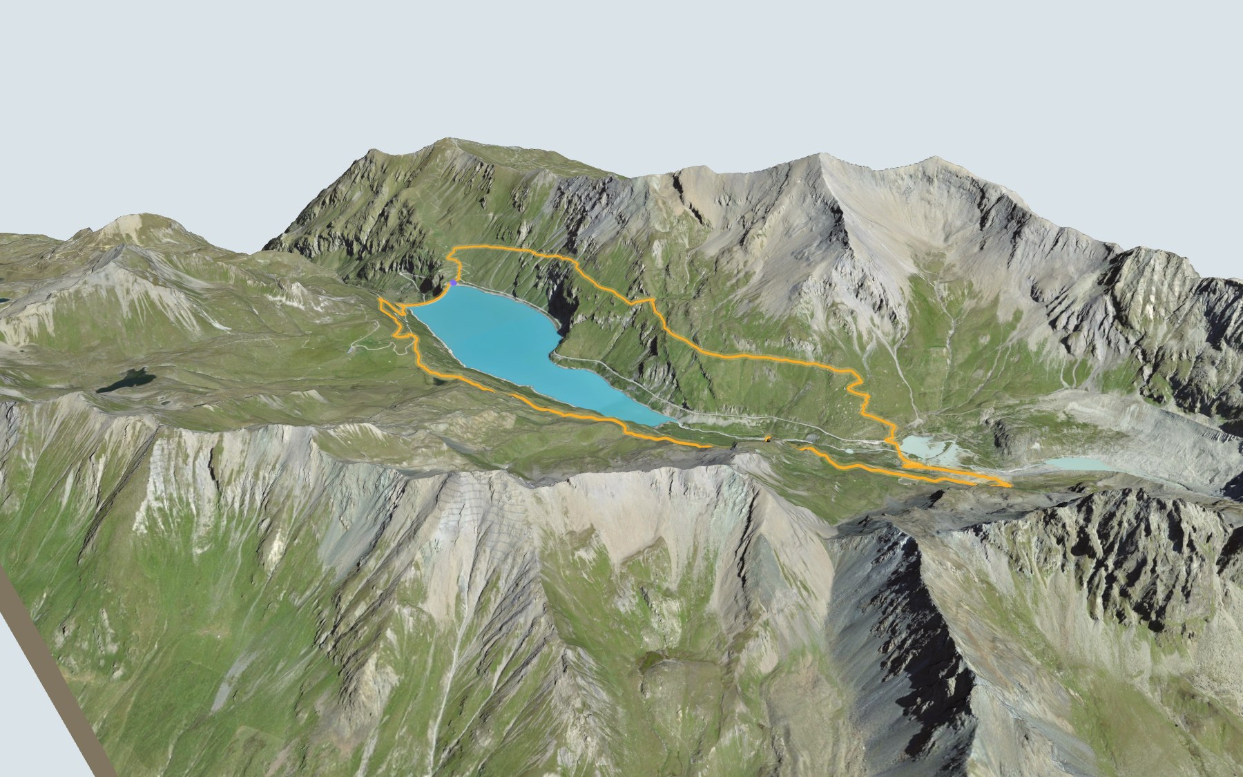
You don't walk along the shore here: you circle Lac de Moiry on the slopes above the water. It's a high-level trail: follow the signs for the Chemin 2500. You start and finish at the dam, in the Val de Moiry. SwitzerlandMobility rates the loop medium for both fitness and technique.
First you climb the east side, through Fache and the Rochers de Paris, then drop to the far end of the lake, beside Lac de Châteaupré. You cross the Gougra, climb towards Lac de la Bayenna and the highest point, then head back to the dam, passing near the Torrent pasture. The elevation profile shows you both climbs.
Halfway round, at the Moiry Glacier car park, you can stop and take the bus back to the dam, from late June to early September. Further down the valley, the last stage of the Chemin des Bisses ends in Grimentz.
At the finish you walk across the top of the dam, and there's a restaurant right next to it. Check the next departures from Moiry VS, barrage and plan your day before you set off. Looking for more in the area? See all hikes in Valais.
The story of the trail
What happened where you are going to walk, chapter by chapter.
A loop high on the slopes
You start at 2,250 m at the Moiry VS, barrage bus stop, and you come back to it. In between: 13.6 km, plus 840 m of climbing and the same amount of descent according to SwitzerlandMobility, which gives 4 h 45 of walking time in either direction. The highest point, 2,594 m, comes shortly after Lac de la Bayenna.
The path first climbs the east side, through Fache and the Rochers de Paris, then crosses the Fêta d'Août de Châteaupré and drops to Lac de Châteaupré, where it crosses the Gougra. It then climbs through La Bayenna and its small lake, passes the Fêta d'Août de Moiry and the spot called Le Lauché, and comes back down near the Torrent pasture to the dam. On the way, follow the signposts and check the conditions on the day.
A wall built from 1954 to 1958
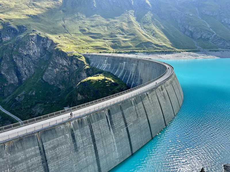
The Moiry Dam is an arch dam built from 1954 to 1958, one hundred and forty-eight metres high. It stands on the Gougra and its reservoir holds 77 million m³. It belongs to Forces Motrices de la Gougra SA. With its construction, Grimentz turned to industry, and then to tourism, for its living.
The wall may still grow. Raising it by nine metres has been under discussion since 2020 and has the agreement in principle of the municipalities holding the concession; the work is expected to take four years. In 2039, the dam will be handed over to the six concession municipalities.
A shrinking glacier
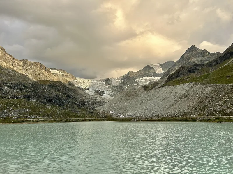
At the far end of the lake, the path runs along Lac de Châteaupré. Further south lies the Moiry Glacier. The Gougra is the small mountain stream that feeds the reservoir with water from the Moiry Glacier; once across it, the path climbs back up along the glacial moraine.
GLAMOS, the Swiss glacier monitoring network, has been tracking the snout of the Moiry Glacier since 1891. Since the 2004 to 2005 measurement, every measurement it has published shows the glacier retreating, up to the latest one, from 2023 to 2024. For 2021 to 2022 alone, the snout retreated by five hundred and fifty metres.
Alpine pastures and turbines
Grimentz lived until the early 20th century from mountain farming and from Hérens cattle, on the Avoin, Moiry and Torrent pastures. The loop passes near the place called Moiry and near the Torrent pasture.
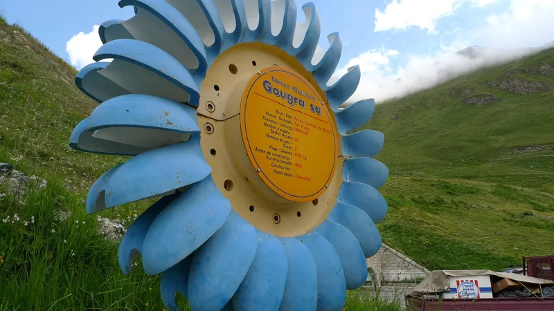
Before it reaches the Rhône plain, the lake water runs through three hydropower stations, at Mottec, Vissoie and Chippis. The Mottec, Vissoie and Navizence power stations run on Pelton turbines, and the Gougra scheme went into service in 1958.
Back across the wall
The last steps take you across the top of the dam. At the finish, right next to the path, there's the Clems & Fabs restaurant. Swimming is prohibited in the reservoir.
A road leads up to the top of the dam from late June until the first heavy snowfalls. Further down this page you'll find the next departures from the Moiry VS, barrage stop.
In pictures
The Moiry Dam
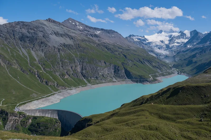
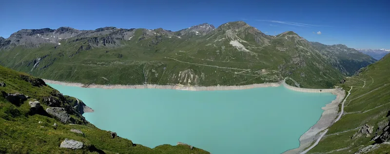
Lac de Moiry and the Moiry Dam
The Moiry hut, the Moiry Glacier and the Pigne de la Lé, seen from the path to Lac de la Bayenna
Lac de Châteaupré and the Moiry Glacier
Lac de la Bayenna
A marmot in the Val de Moiry, above Lac de Moiry
Lac de Moiry, with the Moiry Glacier in the background
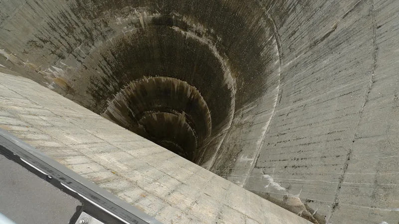
The semicircular spillway of the Moiry Dam (July 2009)
A Pelton wheel on display at Lac de Moiry (July 2009)
The Moiry Dam, with its lake and glacier in the background
The next few days
MeteoSwiss local forecast, updated every hour
Reading the MeteoSwiss forecast…
My day
Pick your day and start time: everything updates.
- Arrival at Moiry, Barrage
- 13:15 4 h 45 of walking without breaks, starting at 08:30
The trail, kilometre by kilometre
Places are listed under the kilometre where you pass them. Drag along the profile: the marker moves on the 3D view too.
- under 10 %
- 10 to 20 %
- 20 to 30 %
- over 30 %
- fountain or water point
- toilets
Around the trail (250 m, OpenStreetMap, extract of 25/10/2026): 1 restaurant, 0 cafés, 1 fountain or water point, 3 toilets. Estimated time: the official walking time spread by effort (1 km on the flat counts as 100 m of climbing), start time set in “My day”.
Getting there and back
Back by public transport from the Moiry VS, barrage stop
Next departures from Moiry VS, barrageReading the official timetable…
By car
Careful, this is one way: public transport back arrives in Moiry VS, barrage, not in Moiry, Barrage. Plan to get back to your car by public transport, or park at the finish and take the train to the start.
- Car park open-air, Route du Barragefree20 m from the start
- Car park, Route du Barrage380 m from the start
Public car parks within 600 m of the start, according to OpenStreetMap: prices and number of spaces may have changed, check the signs on site.
Questions people ask
How long is the hike from Moiry, Barrage to the finish (Moiry, Barrage)?
4 h 45 of walking according to SwitzerlandMobility, in this direction, not counting breaks. The other way: 4 h 45.
Is it hard?
SwitzerlandMobility rates this stage: fitness medium, technique medium. It is 840 m of climbing over 13.6 km.
Can I get back by public transport?
Yes. The Moiry VS, barrage stop is at the finish. The next departures show live under “Getting there and back”.
Where can I eat on the way?
1 restaurant, cafés and huts within 250 m of the trail, including Clems & Fabs. Where they are and their opening hours: below the profile.
Is there water and are there toilets on the way?
1 fountain or water point and 3 toilets within 250 m of the trail (survey of 25/10/2026).
Can I download the track?
Yes, as a GPX file for your watch or map app: “Download the track” button at the top of the page.
More hikes within 10 km
Official SwitzerlandMobility stages that pass within 10 km of this trail. Each card says whether its page is already up.
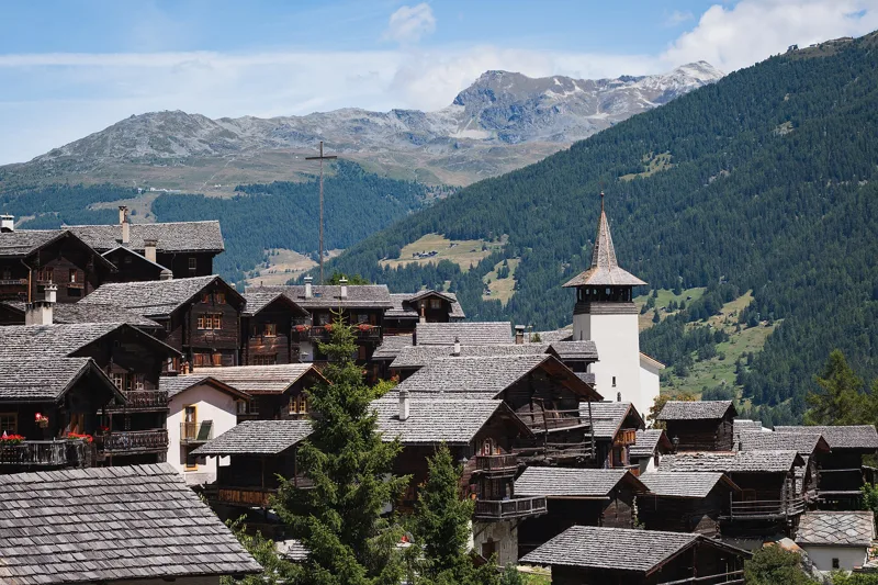 Vercorin → Grimentz5 h 25Chemin des Bisses, stage 717.0kmDistance900mAscent660mDescentTechnical easyFitness difficult. See the hike
- Grimentz → Cab. des Becs de Bosson4 h 40Alpenpässe-Weg, stage 2410.0kmDistance1,500mAscent90mDescentTechnical mediumFitness difficult. Page coming
- Hotel Weisshorn → Grimentz4 h 00Alpenpässe-Weg, stage 2312.0kmDistance460mAscent1,200mDescentTechnical mediumFitness difficult. Page coming
- Cab. des Becs de Bosson → Evolène3 h 30Alpenpässe-Weg, stage 2511.0kmDistance90mAscent1,700mDescentTechnical mediumFitness difficult. Page coming
- Evolène, loop3 h 25Chemin des villages d’Evolène11.0kmDistance520mAscent520mDescentTechnical mediumFitness medium. Page coming
- Evolène → Arolla6 h 20Alpenpässe-Weg, stage 2615.0kmDistance1,500mAscent880mDescentTechnical mediumFitness difficult. Page coming