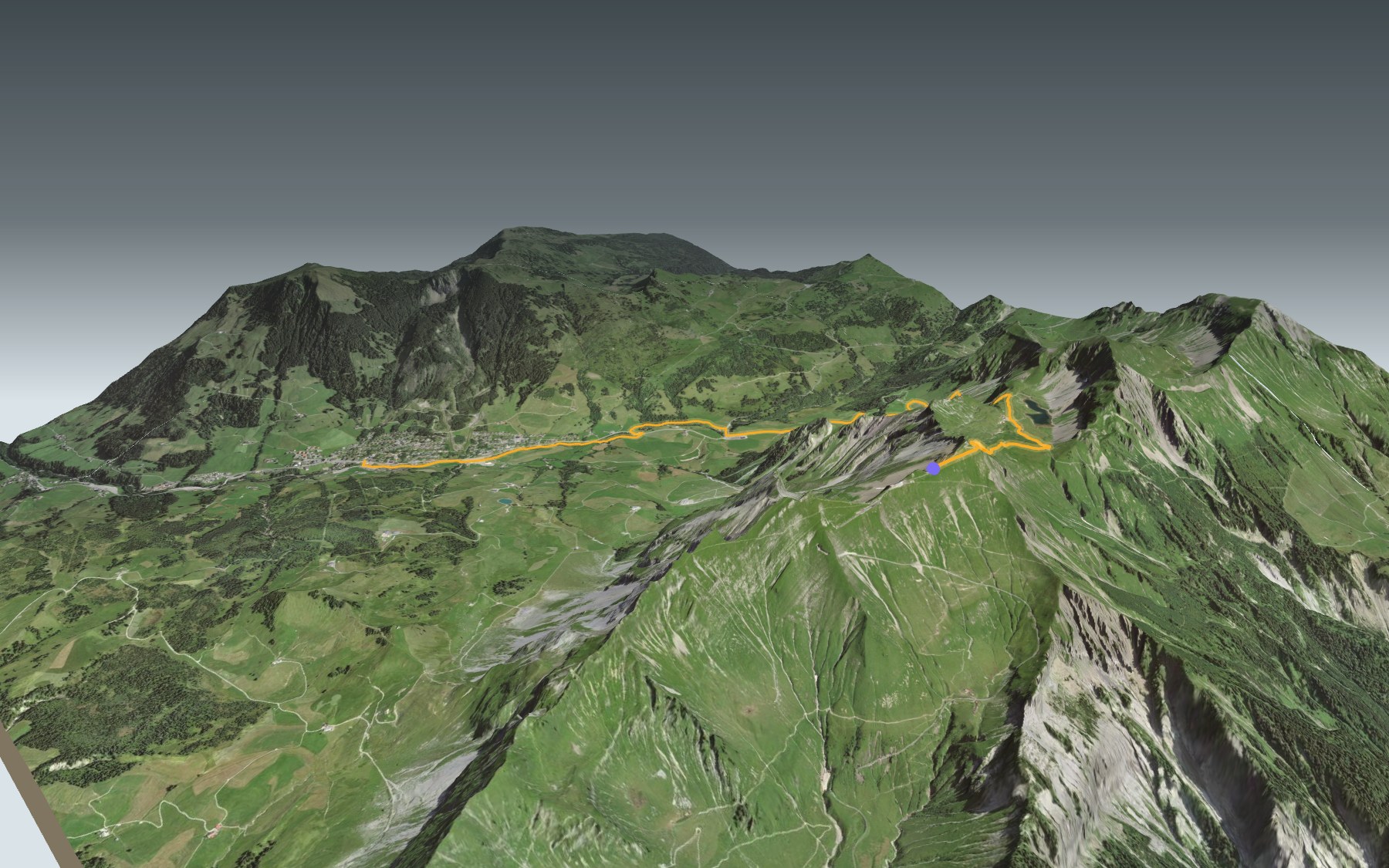

Walking down from the Brienzer Rothorn to Sörenberg
Here the train or the cable car does the climbing, and you do the descent. You start on the Brienzer Rothorn, the highest summit in the canton of Lucerne, and walk down to the village of Sörenberg: 1,250 m of descent for 100 m of climbing. It's stage 1 of the Emmenuferweg, signposted '83 Emmenuferweg'. It's rated difficult for fitness and medium for technique.
From the top, the path drops to the Eiseesattel and then runs along the Eisee, a small mountain lake. The zigzags carry on down to the Emmensprung, where spring water comes out of the ground. Further down, from the cable car's valley station, the path follows the Waldemme, without any big climbs or descents, all the way to the village. The elevation profile shows you where the descent is steepest.
To get up there, take your pick: the cable car from Sörenberg, whose valley station is right on the path, or the steam rack railway from Brienz. So you can leave your car in the paid car park at the valley station, or get off the PostBus there (stop 'Rothornbahn'), ride up to the top and walk back down.
At the finish you have Sörenberg and its restaurants, plus the PostBus to Schüpfheim, on the Bern–Lucerne railway line. Check the next departures and plan your day before you set off. Looking for more in the area? See all hikes in Central Switzerland.
The story of the trail
What happened where you are going to walk, chapter by chapter.
From the summit to the Eisee
You start at 2,287 m, just below the summit of the Brienzer Rothorn, and finish at 1,154 m, in the village of Sörenberg. In between: 9.9 km, 100 m of climbing and 1,250 m of descent. Allow 3 h 00 of walking in this direction and 4 h 10 the other way, uphill.
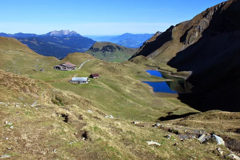
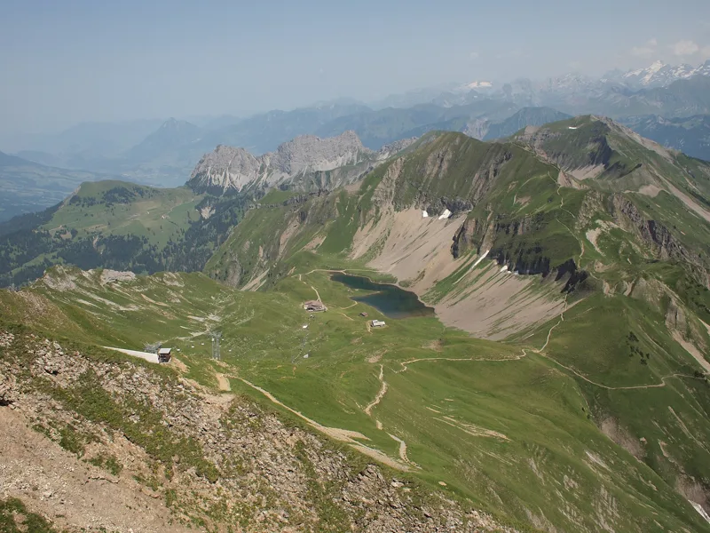
The first steps still climb a little, to the highest point of the walk, 2,328 m, next to the summit. Then the descent begins: in the 2nd kilometre you cross the Eiseesattel, then pass the Berghaus Eisee and the small Eisee lake, at the foot of the Arnihaaggen, between scree slopes and meadows. The lakeshore is a good spot for a first break. The Gipfel Restaurant Rothorn is at the start; after that, a fountain is marked around the 6th kilometre, and the next places to eat are in Sörenberg.
A steam railway saved twice
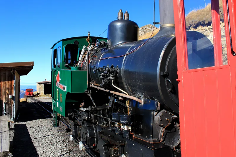
On 15 October 1889, a group of Brienz residents, probably at the initiative of the engineer Alexander Lindner, applied for a concession to build a rack railway up the Brienzer Rothorn. The Swiss Parliament granted it 65 days later. Some 700 workers, mostly from Italy, built the line in 16 months, and the railway opened on 16 June 1892.
In 1914, with the outbreak of the First World War, passenger numbers collapsed, all the staff were laid off and the trains stopped. Service to Rothorn Kulm only resumed in June 1931: this long sleep is why the line is still not electrified. In 1958 the shareholders' meeting voted to replace it with a cable car; a committee in Brienz fought back, and the decision was withdrawn. The company still owns five steam locomotives from 1891 and 1892, and two of them run regularly.
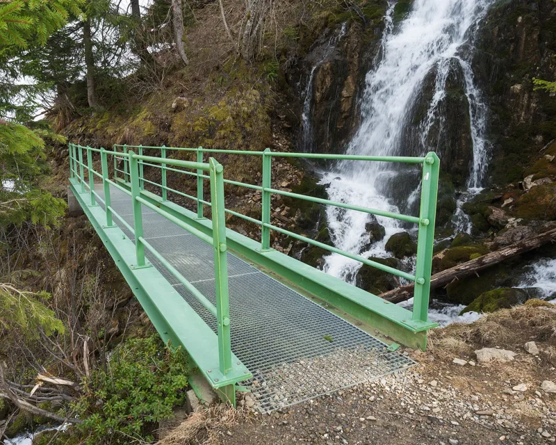
The source of the Emme
Below the Eisee, the path zigzags down to the Emmensprung, around the 5th kilometre. Here spring water bubbles out of the ground and heads down the valley, where it joins the Waldemme. A few metres further on, two waterfalls tumble over moss-covered rocks in a small wood.
Keep your eyes open up high: the Brienzer Rothorn is home to a colony of more than 150 ibex, and they sometimes come right up to the summit. Wear good shoes, bring a rain jacket and enough water, and go by the signposts and the day's conditions.
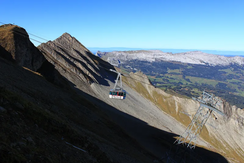
Into the Entlebuch Biosphere
On the way down you enter the UNESCO Entlebuch Biosphere. It all began in 1987, when Swiss voters accepted the Rothenthurm initiative to protect the country's moors; UNESCO recognised the region as a biosphere reserve in 2001. It holds the largest moorland landscapes in Switzerland and some striking karst country. Flühli, the municipality Sörenberg belongs to, is part of it.
The cable car between Sörenberg and the summit grew out of an idea by three Entlebuch locals in the 1960s, whose motto was 'Fortune favours the bold'. Its new generation, with cabins for up to 80 people, made its first trip with invited guests on 13 December 2023, before officially opening the winter season on 16 December.
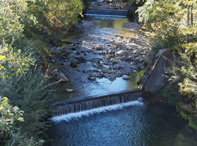
Along the Waldemme to Sörenberg
Around the 7th kilometre you pass the cable car's valley station and meet the Waldemme again. From there the path follows the river, without any big climbs or descents, through the Flüehütten neighbourhood to the village of Sörenberg.
In Sörenberg, the PostBus runs down to Schüpfheim, on the Bern–Lucerne railway line. Further down this page you'll find where to eat and when the next bus leaves.
In pictures
The Eisee seen from the Brienzer Rothorn
A Brienz Rothorn Bahn steam locomotive at Rothorn Kulm station
The Emmensprung footbridge over the Waldemme, Giswil (Obwalden)
From the top of the Brienzer Rothorn, the cable car to Sörenberg; behind it, the Schrattenfluh and its karst landscape
The Waldemme in Sörenberg
The Eisee and the Berggasthaus Eisee, seen from just below the Eiseesattel; Pilatus and the Stanserhorn in the distance
On the shore of the Eisee, a mountain lake on the north-east slope of the Brienzer Rothorn, canton of Obwalden
View south from the Brienzer Rothorn
Bistort flowers (Bistorta officinalis) on the Rothorn above Brienz
Flühli-Sörenberg seen from the Rothorn
The Brienz Rothorn Bahn train at Rothorn Kulm station
What you see from the top
360° view from Brienzer Rothorn (2,328 m). 34 named peaks, including Rocher de la Tournette, 140 km away. Swipe to look around.
Brienzer Rothorn → Sörenberg: when to go
Public transport serves the start every day from 19 December 2026 to 29 March 2027 and from 5 June to 31 October 2027 (and 13 December), according to the official timetable: that's the season to do this hike without a car. The latest time to set off ranges from 17:23 in June to 12:40 in December.
- Public transport to the start
- daily, 19 Dec to 28 Feb
- and also 13 December
- 24 arrivals a day
- first arrival 8:40
- last 16:20
- Sun at the start, mid-January
- from 8:27
- rises at 8:09, hidden by the ridge
- Leave by, for 3 h 00 of walking
- 13:06
- arrive 1 hour before sunset, at 17:06
| Month | Sun at the start | Leave by | In the sun, leaving at 9:00 | Transport |
|---|---|---|---|---|
| December | 8:18 → 16:40 | 12:40 | 34 % | 14 of 31 days |
| January | 8:27 → 17:06 | 13:06 | 43 % | every day |
| February | 8:10 → 17:52 | 13:52 | 54 % | every day |
“In the sun”: the share of the path in sunlight under a clear sky, with the terrain worked out point by point. The path climbs to 2,328 m: today's snow and frost are in the weather and My day.
- Public transport to the start
- daily, 1 Mar to 29 Mar
- 24 arrivals a day
- first arrival 8:40
- last 16:20
- Sun at the start, mid-April
- from 8:15
- rises at 6:41, hidden by the ridge
- Leave by, for 3 h 00 of walking
- 16:15
- arrive 1 hour before sunset, at 20:15
| Month | Sun at the start | Leave by | In the sun, leaving at 9:00 | Transport |
|---|---|---|---|---|
| March | 7:49 → 18:33 | 14:33 | 79 % | 29 of 31 days |
| April | 8:15 → 20:15 | 16:15 | 86 % | off season |
| May | 5:57 → 20:55 | 16:55 | 99 % | off season |
“In the sun”: the share of the path in sunlight under a clear sky, with the terrain worked out point by point. The path climbs to 2,328 m: today's snow and frost are in the weather and My day.
- Public transport to the start
- daily, 5 Jun to 31 Aug
- 28 arrivals a day
- first arrival 8:40
- last 17:40
- Sun at the start, mid-July
- from 5:51
- rises at 5:49
- Leave by, for 3 h 00 of walking
- 17:19
- arrive 1 hour before sunset, at 21:19
| Month | Sun at the start | Leave by | In the sun, leaving at 9:00 | Transport |
|---|---|---|---|---|
| June | 5:35 → 21:23 | 17:23 | 100 % | 26 of 30 days |
| July | 5:51 → 21:19 | 17:19 | 100 % | every day |
| August | 6:27 → 20:39 | 16:39 | 94 % | every day |
“In the sun”: the share of the path in sunlight under a clear sky, with the terrain worked out point by point. The path climbs to 2,328 m: today's snow and frost are in the weather and My day.
- Public transport to the start
- daily, 1 Sept to 31 Oct
- 28 arrivals a day
- first arrival 8:40
- last 17:40
- Sun at the start, mid-October
- from 8:35
- rises at 7:45, hidden by the ridge
- Leave by, for 3 h 00 of walking
- 14:42
- arrive 1 hour before sunset, at 18:42
| Month | Sun at the start | Leave by | In the sun, leaving at 9:00 | Transport |
|---|---|---|---|---|
| September | 8:31 → 19:41 | 15:41 | 80 % | every day |
| October | 8:35 → 18:42 | 14:42 | 54 % | every day |
| November | 7:50 → 16:54 | 12:54 | 51 % | off season |
“In the sun”: the share of the path in sunlight under a clear sky, with the terrain worked out point by point. The path climbs to 2,328 m: today's snow and frost are in the weather and My day.
The next few days
Local forecast, updated every hour
Reading the forecast…
My day
Pick your day and start time: everything updates.
- Arrival at Sörenberg
- 11:30 3 h 00 of walking without breaks, starting at 08:30
The trail, kilometre by kilometre
Places are listed under the kilometre where you pass them. Drag along the profile: the marker moves on the 3D view too.
- under 10 %
- 10 to 20 %
- 20 to 30 %
- over 30 %
- fountain or water point
- toilets
Around the trail (250 m): 6 restaurants, 1 café, 2 fountains and water points and 3 toilets. Estimated time: the official walking time spread by effort (1 km on the flat counts as 100 m of climbing), start time set in “My day”.
Getting there and back
Back by public transport from the Sörenberg, Post stop
Next departures from Sörenberg, PostReading the official timetable…
By car
Careful, this is one way: public transport back arrives in Sörenberg, Post, not in Brienzer Rothorn. Plan to get back to your car by public transport, or park at the finish and take public transport to the start.
Public car parks within 600 m of the start: prices and number of spaces may have changed, check the signs on site.
Questions people ask
How long is the hike from Brienzer Rothorn to Sörenberg?
3 h 00 of walking (official time), in this direction, not counting breaks. The other way: 4 h 10.
Is it hard?
Official rating for this stage: fitness difficult, technique medium. It is 1,250 m of descent over 9.9 km.
Can I get back by public transport?
Yes. The Sörenberg, Post stop is at the finish. The next departures show live under “Getting there and back”.
Where can I eat on the way?
7 places to eat within 250 m of the trail, including Gipfel Restaurant Rothorn, Rothorn, Chalet Sörenberg. Where they are and their opening hours: below the profile.
Is there water and are there toilets on the way?
2 fountains and water points and 3 toilets within 250 m of the trail (survey of 25/10/2026).
Can I download the track?
Yes, as a GPX file for your watch or map app: “Download the track” button at the top of the page.
More hikes within 10 km
Official stages that pass within 10 km of this trail. Each card says whether its page is already up.
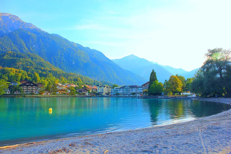 Iseltwald → Brienz3 h 25Brienzersee Drei Wasserfälleweg, stage 212.0kmDistance440mAscent440mDescentTechnical easyFitness medium. See the hike
- © swisstopoBrienzer Rothorn → Brünigpass4 h 15Grenzpfad Napfbergland, stage 612.0kmDistance360mAscent1,600mDescentTechnical mediumFitness difficult. Official waymarked stage
- © swisstopoSchangnau → Sörenberg5 h 40Trans Swiss Trail, stage 1519.0kmDistance860mAscent620mDescentTechnical easyFitness difficult. Official waymarked stage
- © swisstopoSörenberg → Giswil5 h 45Trans Swiss Trail, stage 1618.0kmDistance700mAscent1,350mDescentTechnical mediumFitness difficult. Official waymarked stage
- © swisstopoSörenberg → Schüpfheim5 h 00Emmenuferweg, stage 218.0kmDistance680mAscent1,100mDescentTechnical easyFitness difficult. Official waymarked stage
- © swisstopoMarbach → Brienzer Rothorn9 h 25Grenzpfad Napfbergland, stage 525.0kmDistance2,300mAscent860mDescentTechnical mediumFitness difficult. Official waymarked stage