
Walking the old Rigi railway line
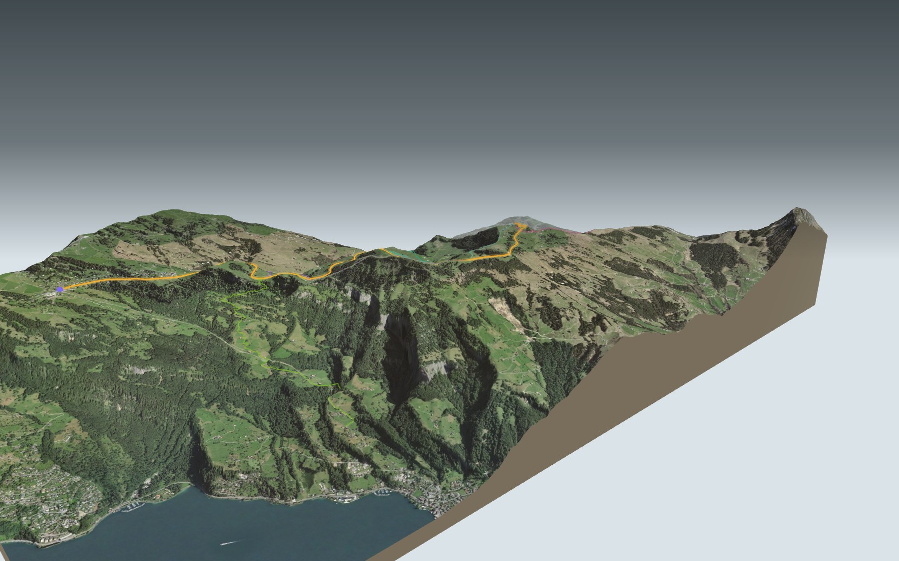
Here you walk where a train once ran. From Rigi Kaltbad to Rigi Scheidegg, the path follows the old track bed of the railway that linked the two resorts from 1874 to 1931. It stays almost flat as far as Unterstetten, then climbs steadily to the finish.
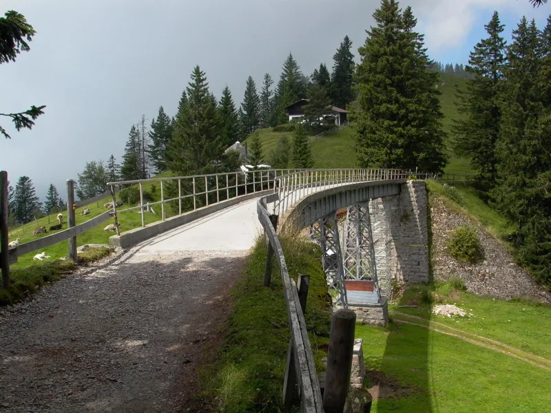
You pass through First, by the Chalet Schild and the Alpwirtschaft Schild, then cross the Unterstetten bridge, just before the Berggasthaus of the same name. Further on comes the Hinder Dosse pass before Rigi Scheidegg. The elevation profile shows you where the climb starts.
Fancy a real climb? Start from below, at Goldau or Mittlerschwanden, or walk up from Fruttli or Rigi Klösterli stations: each start has its own colour on the 3D map, and its estimated time is in the list of starting points.
At the finish, the cable car drops from Rigi Scheidegg to Kräbel, where the Rigi railway runs to Goldau. Check the next departures and plan your day before you set off. Want something else nearby? All hikes in Central Switzerland.
The story of the trail
What happened where you are going to walk, chapter by chapter.
Almost flat, then the climb
You start at 1,438 m in Rigi Kaltbad and finish at 1,642 m in Rigi Scheidegg. In between: 7.05 km, 220 m of climbing and 20 m of descent. The official walking time is 1 h 50 in this direction and 1 h 35 the other way.
As far as Unterstetten the path stays almost flat. After that it climbs smoothly all the way to Rigi Scheidegg. On the way, follow the signposts and the conditions of the day.
From First to the Hinder Dosse pass
Leaving Rigi Kaltbad, you soon reach First. The Chalet Schild is at km 1.2 of the route, the Alpwirtschaft Schild at km 2.4. Then you cross the Unterstetten bridge and pass the Berggasthaus Unterstetten, at km 3.1 and 1,451 m.
After Unterstetten, the path passes near the Wisstannegg ridge and over the Hinder Dosse pass. Along the way it uses old bridges and tunnels of the line. What is left is the end of the climb to Rigi Scheidegg.
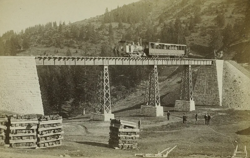
The train of the grand hotels
The Rigi led the way: in 1871 the line from Vitznau became the first rack railway in Europe. In 1874 the line from Rigi Kaltbad to Rigi Scheidegg opened, with no rack at all: the highest adhesion railway in Europe. It linked the high-class hotels of Kaltbad, First and Scheidegg, and ran until 1931.
The grand hotels vanished in turn. The Rigi First hotel, opened in 1875, burned down in 1948; the Rigi Scheidegg hotel was destroyed in 1943-1944. Of the line, the tunnel, the Unterstetten bridge, kilometre markers and the site of a water tank remain.
A bridge riveted like the Eiffel Tower
The Unterstetten bridge was built in 1874-1875. It is made of riveted steel plates, the same technique as the Eiffel Tower in Paris, and is one of the most important railway bridges in Switzerland. It was restored in 2017 for 1.1 million francs.
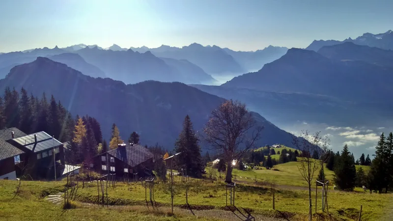
Under your feet, Rigi Kaltbad and Rigi Scheidegg are made of molasse. To the south-east of the massif, the Rigi Hochflue is limestone: it is the last foothill of the Alps. Along the way, the view takes in the Alps and the Schwyz basin.
Rigi Scheidegg, the old spa
The first inn at Rigi Scheidegg opened in 1830. In 1840 a spa hotel followed, offering cures with spring water, to drink and to bathe in. Near Rigi Kaltbad, where you started, a chapel was consecrated in 1585, and in the 17th and 18th centuries the baths drew spa guests and pilgrims.
To get down, take the cable car from Rigi Scheidegg to Kräbel, then the Rigi railway to Goldau. In 2019 the operator announced a maintenance break every spring and every autumn: check the timetable before you go. Further down the page you will find the next departures.
Every way up to the top
5 starting points to reach Rigi Scheidegg. Pick yours: the 3D view shows it and “My day” recalculates.
Walking times without breaks. “Estimated” times are calculated on the terrain profile with a model fitted to the official stages; the shortest path may differ from the one on the yellow signposts: on the ground, follow the signs. Gradient: the steepest over 200 m of trail. Profiles share the same scale (length and altitude). Stations and car parks within 500 m of the start.
In pictures
The bridge of the former Rigi-Scheidegg railway near Unterstetten
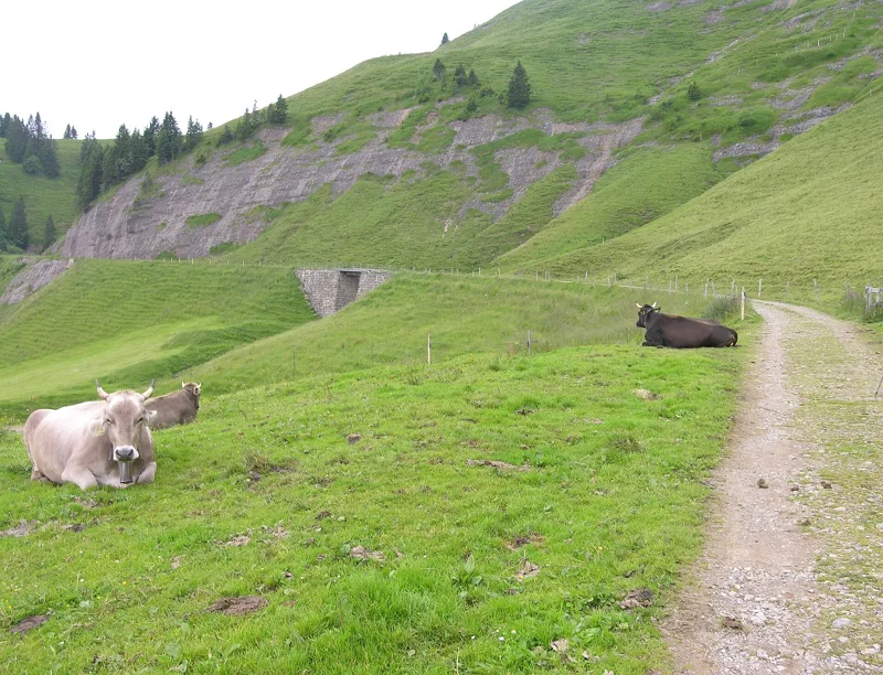
The track bed of the former Rigi-Scheidegg railway, a metre-gauge line closed in 1931
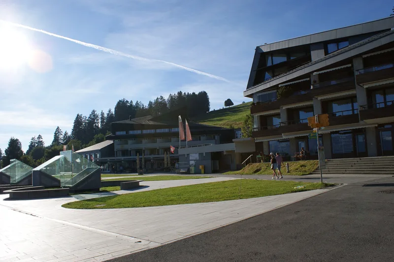
Rigi Kaltbad, in the municipality of Weggis (Lucerne)
Signpost at Rigi First
Rigi First
The Rigi-Kaltbad-Scheidegg railway bridge near Unterstetten, probably during its load test
The hotel at Rigi Scheidegg, photochrom print
Lake Lauerz seen from Rigi Scheidegg
View from Rigi Scheidegg to the south-east, with the Rigi Hochflue and Niederbauen Kulm
Peacock goats on the Scheidegg, on the Rigi
Top station of the Kräbel–Rigi Scheidegg cable car
What you see from the top
360° view from Rigi Scheidegg (1,642 m). 30 named peaks, including Finsteraarhorn, 62.3 km away. Swipe to look around.
Rigi-Panoramaweg: when to go
Public transport serves the start every day of the year, according to the official timetable. The latest time to set off ranges from 18:33 in June to 13:47 in December.
- Public transport to the start
- every day
- 22 to 28 arrivals a day
- first arrival 0:23 or 6:53
- last 22:23 or 22:53
- Sun at the start, mid-January
- from 8:44
- rises at 8:08, hidden by the ridge
- Leave by, for 1 h 50 of walking
- 14:13
- arrive 1 hour before sunset, at 17:03
| Month | Sun at the start | Leave by | In the sun, leaving at 9:00 | Transport |
|---|---|---|---|---|
| December | 8:35 → 16:37 | 13:47 | 65 % | every day |
| January | 8:44 → 17:03 | 14:13 | 64 % | every day |
| February | 8:01 → 17:50 | 15:00 | 81 % | every day |
“In the sun”: the share of the path in sunlight under a clear sky, with the terrain worked out point by point. The path climbs to 1,642 m: today's snow and frost are in the weather and My day.
- Public transport to the start
- every day
- 24 to 31 arrivals a day
- first arrival 0:23 or 6:53
- last 22:23, 22:53 or 23:48
- Sun at the start, mid-April
- from 7:44
- rises at 6:38, hidden by the ridge
- Leave by, for 1 h 50 of walking
- 17:24
- arrive 1 hour before sunset, at 20:14
| Month | Sun at the start | Leave by | In the sun, leaving at 9:00 | Transport |
|---|---|---|---|---|
| March | 7:19 → 18:31 | 15:41 | 99 % | every day |
| April | 7:44 → 20:14 | 17:24 | 99 % | every day |
| May | 7:21 → 20:54 | 18:04 | 100 % | every day |
“In the sun”: the share of the path in sunlight under a clear sky, with the terrain worked out point by point. The path climbs to 1,642 m: today's snow and frost are in the weather and My day.
- Public transport to the start
- every day
- 29 to 31 arrivals a day
- first arrival 0:23 or 6:53
- last 22:53
- Sun at the start, mid-July
- from 7:24
- rises at 5:46, hidden by the ridge
- Leave by, for 1 h 50 of walking
- 18:28
- arrive 1 hour before sunset, at 21:18
| Month | Sun at the start | Leave by | In the sun, leaving at 9:00 | Transport |
|---|---|---|---|---|
| June | 7:16 → 21:23 | 18:33 | 100 % | every day |
| July | 7:24 → 21:18 | 18:28 | 100 % | every day |
| August | 7:37 → 20:38 | 17:48 | 99 % | every day |
“In the sun”: the share of the path in sunlight under a clear sky, with the terrain worked out point by point. The path climbs to 1,642 m: today's snow and frost are in the weather and My day.
- Public transport to the start
- every day
- 22 to 31 arrivals a day
- first arrival 0:23 or 6:53
- last 22:23, 22:53 or 23:48
- Sun at the start, mid-October
- from 8:10
- rises at 7:44, hidden by the ridge
- Leave by, for 1 h 50 of walking
- 15:50
- arrive 1 hour before sunset, at 18:40
| Month | Sun at the start | Leave by | In the sun, leaving at 9:00 | Transport |
|---|---|---|---|---|
| September | 7:52 → 19:39 | 16:49 | 96 % | every day |
| October | 8:10 → 18:40 | 15:50 | 78 % | every day |
| November | 7:55 → 16:52 | 14:02 | 76 % | every day |
“In the sun”: the share of the path in sunlight under a clear sky, with the terrain worked out point by point. The path climbs to 1,642 m: today's snow and frost are in the weather and My day.
The next few days
Local forecast, updated every hour
Reading the forecast…
My day
Pick your day and start time: everything updates.
- Arrival at Rigi Scheidegg
- 10:20 1 h 50 of walking without breaks, starting at 08:30
The trail, kilometre by kilometre
From Rigi Kaltbad
Places are listed under the kilometre where you pass them. Drag along the profile: the marker moves on the 3D view too.
- under 10 %
- 10 to 20 %
- 20 to 30 %
- over 30 %
- fountain or water point
- toilets
Around the trail (250 m): 12 restaurants, 4 fountains and water points and 9 toilets. Estimated time: the official walking time spread by effort (1 km on the flat counts as 100 m of climbing), start time set in “My day”.
- under 10 %
- 10 to 20 %
- 20 to 30 %
- over 30 %
- fountain or water point
- toilets
Around the trail (250 m): 1 restaurant, 2 fountains and water points and 3 toilets. Estimated time: the official walking time spread by effort (1 km on the flat counts as 100 m of climbing), start time set in “My day”.
- under 10 %
- 10 to 20 %
- 20 to 30 %
- over 30 %
- fountain or water point
- toilets
Around the trail (250 m): 5 restaurants, 3 fountains and water points and 4 toilets. Estimated time: the official walking time spread by effort (1 km on the flat counts as 100 m of climbing), start time set in “My day”.
- under 10 %
- 10 to 20 %
- 20 to 30 %
- over 30 %
- fountain or water point
- toilets
Around the trail (250 m): 2 restaurants, 1 fountain or water point and 2 toilets. Estimated time: the official walking time spread by effort (1 km on the flat counts as 100 m of climbing), start time set in “My day”.
- under 10 %
- 10 to 20 %
- 20 to 30 %
- over 30 %
- fountain or water point
- toilets
Around the trail (250 m): 3 restaurants, 3 fountains and water points and 4 toilets. Estimated time: the official walking time spread by effort (1 km on the flat counts as 100 m of climbing), start time set in “My day”.
Getting there and back
Back by public transport from the Rigi Scheidegg stop
Next departures from Rigi ScheideggReading the official timetable…
By car
From Rigi Kaltbad
Careful, this is one way: public transport back arrives in Rigi Scheidegg, not in Rigi Kaltbad. Plan to get back to your car by public transport, or park at the finish and take public transport to the start.
Public car parks within 600 m of the start: prices and number of spaces may have changed, check the signs on site.
Careful, this is one way: public transport back arrives in Rigi Scheidegg, not in Fruttli. Plan to get back to your car by public transport, or park at the finish and take public transport to the start.
- Station Fruttlior by public transport0 m from the start
The nearest car park and stop for this start. Check the signs on site for the price.
Careful, this is one way: public transport back arrives in Rigi Scheidegg, not in Rigi Klösterli. Plan to get back to your car by public transport, or park at the finish and take public transport to the start.
- Station Rigi Klösterlior by public transport0 m from the start
The nearest car park and stop for this start. Check the signs on site for the price.
Careful, this is one way: public transport back arrives in Rigi Scheidegg, not in Goldau A4. Plan to get back to your car by public transport, or park at the finish and take public transport to the start.
- Car park50 m from the start
- Station Goldau A4or by public transport0 m from the start
The nearest car park and stop for this start. Check the signs on site for the price.
Careful, this is one way: public transport back arrives in Rigi Scheidegg, not in Mittlerschwanden. Plan to get back to your car by public transport, or park at the finish and take public transport to the start.
- Car park500 m from the start
- Station Mittlerschwandenor by public transport0 m from the start
The nearest car park and stop for this start. Check the signs on site for the price.
Questions people ask
How long is the hike from Rigi Kaltbad to Rigi Scheidegg?
1 h 50 of walking (official time), in this direction, not counting breaks. The other way: 1 h 35.
Is it hard?
Official rating for this stage: fitness difficult, technique difficult. It is 220 m of climbing over 7.1 km.
Can I get back by public transport?
Yes. The Rigi Scheidegg stop is at the finish. The next departures show live under “Getting there and back”.
Where can I eat on the way?
12 places to eat within 250 m of the trail, including Hotel Alpina, Rigi Stübli, Gratalpstübli. Where they are and their opening hours: below the profile.
Is there water and are there toilets on the way?
4 fountains and water points and 9 toilets within 250 m of the trail (survey of 25/10/2026).
Can I download the track?
Yes, as a GPX file for your watch or map app: “Download the track” button at the top of the page.
More hikes within 10 km
Official stages that pass within 10 km of this trail. Each card says whether its page is already up.
- Bürgenstock, loop1 h 25Felsenweg Bürgenstock5.0kmDistance190mAscent190mDescentTechnical easyFitness easy. Official waymarked stage
- Rigi Kaltbad, loop0 h 30Rigi-Chänzeli-Weg2.0kmDistance40mAscent40mDescentTechnical mediumFitness difficult. Official waymarked stage
- Gersau → Rigi Scheidegg3 h 50Rigi Scheidegg-Weg8.0kmDistance1,250mAscent50mDescentTechnical mediumFitness difficult. Official waymarked stage
- Rigi → Goldau2 h 30Schwyzer Höhenweg, stage 29.0kmDistance20mAscent1,100mDescentTechnical easyFitness difficult. Official waymarked stage
- Küssnacht a.R. → Rigi3 h 50Schwyzer Höhenweg, stage 19.0kmDistance1,200mAscent50mDescentTechnical easyFitness difficult. Official waymarked stage
- Vitznau → Küssnacht5 h 40Waldstätterweg, stage 219.0kmDistance800mAscent780mDescentTechnical mediumFitness difficult. Official waymarked stage