
The chamois trail, from Hannig to Saas-Fee
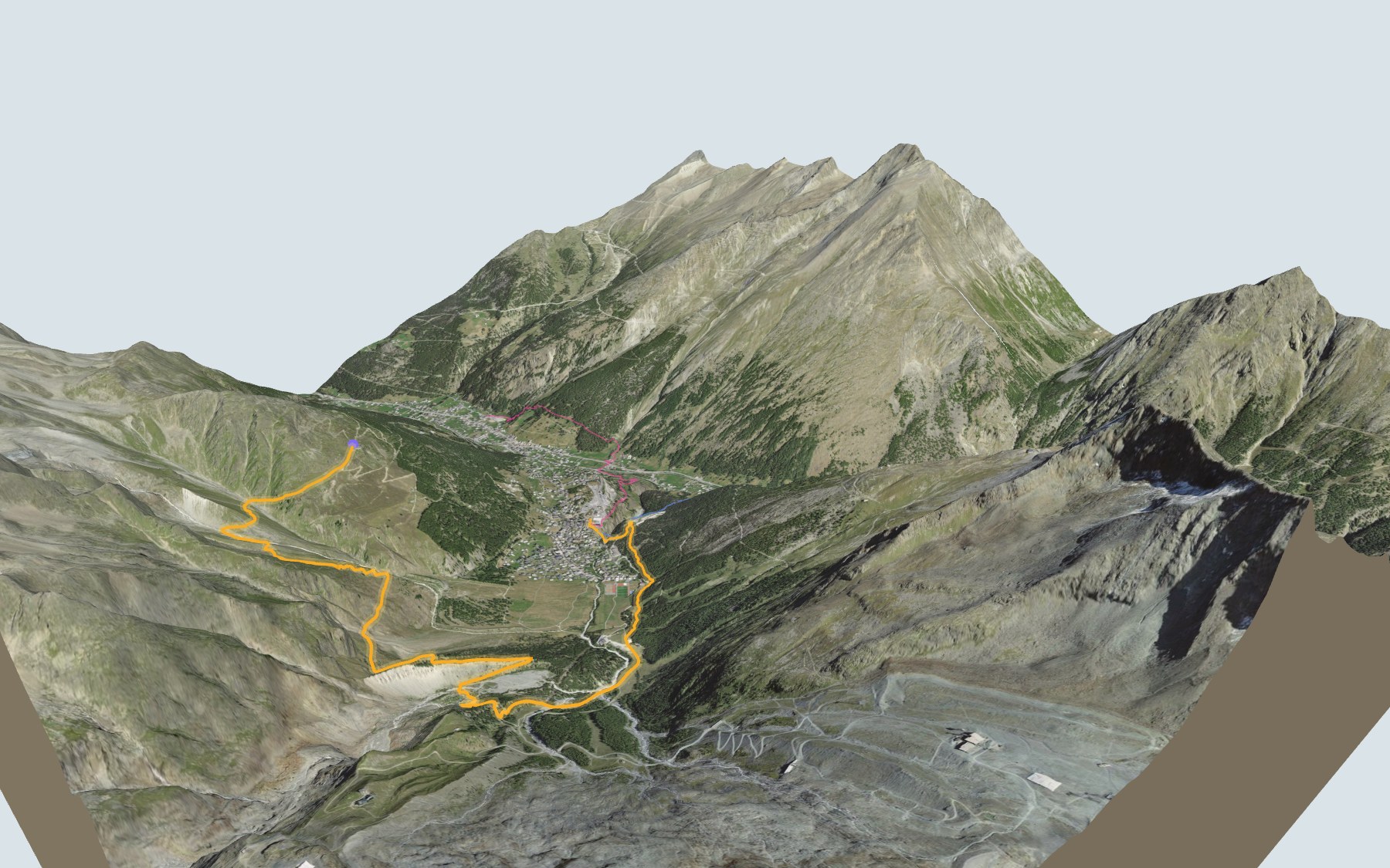
You ride the gondola up to Hannig, and from there it is mostly downhill to the village of Saas-Fee. On the way, the trail follows the mountain slopes, then an old moraine of the Fee Glacier. SwitzerlandMobility rates it medium for both fitness and technique.
After the station you cross the Torrenbach and the Triftbach, then pass Schönegge. The trail then runs down the moraine, above the Gletschersee, and climbs a little to the Gletschergrotte restaurant. The elevation profile shows you that short climb.
Would you rather reach Saas-Fee another way? Walk up from Saas-Grund or Furggstalden, or start from Heidbodme: each starting point has its own colour in the 3D view and an estimated time under all starting points. In the next valley, the Randa Hängebrückenweg is in 3D too.
At the finish you'll find the Saas-Fee bus terminal, where the PostBus leaves from. Check the next departures from Saas-Fee and plan your day before you set off. Looking for more in the area? See all hikes in Valais.
The story of the trail
What happened where you are going to walk, chapter by chapter.
Downhill from Hannig to the village
You start at 2,339 m at Hannig station and finish at 1,803 m in Saas-Fee. In between: 7.9 km, plus 190 m of climbing and 720 m of descent according to SwitzerlandMobility. It gives 2 h 20 of walking time in this direction, and 2 h 55 the other way.
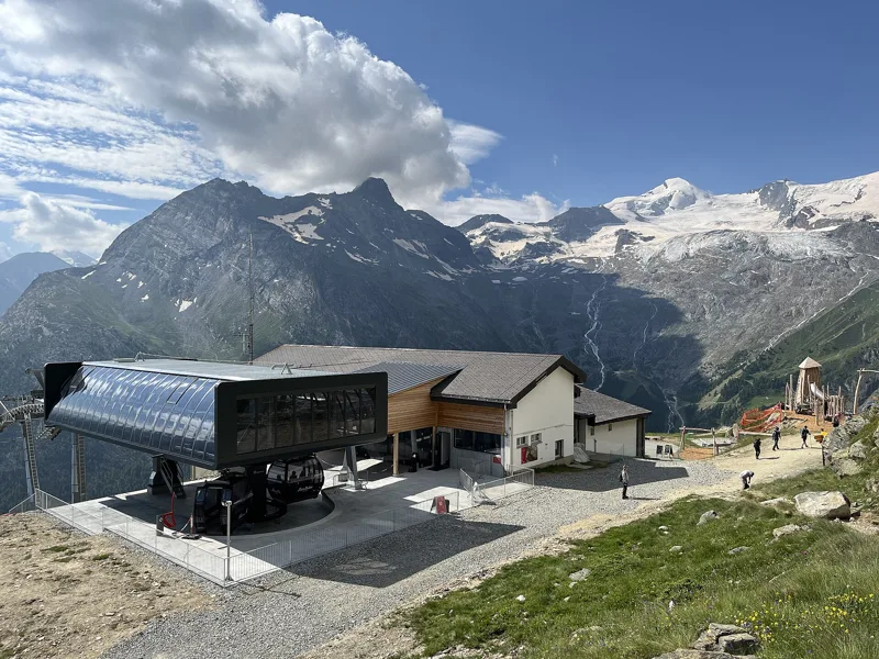
This is SwitzerlandMobility regional route 183. At the start there's the Bergrestaurant Hannig. The next place to eat is the Gletschergrotte restaurant, a little past halfway, so bring something to drink. On the way, follow the signposts and check the conditions on the day.
Along the Fee Glacier moraine
From Hannig the trail follows the slopes and crosses two mountain streams, the Torrenbach and then the Triftbach, before passing Schönegge. The first half of the route takes you to the old moraine of the Fee Glacier.
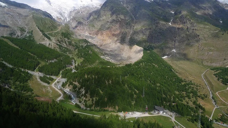
As the glacier retreated, it left a landscape of rock debris crossed by small streams that feed the Gletschersee. The trail runs down the crest of the moraine, then turns right above the lake and climbs back up to the Gletschergrotte restaurant, at 1,997 m.
Glacier Clara's café
In spring 1885, Cäsar Imseng began building the "Café Glacier Clara", after the burghers of Saas-Fee allowed the family of Peter Josef Imseng to build and run it for thirteen years. It stood about forty metres below today's restaurant, looking out over the village, with the two tongues of the Fee Glacier to the right and left. The building materials were carried up by the village's only mule.
Every summer, Cäsar's sister Clara went up to the café. Every year Cäsar had to carve a new grotto into the nearby ice. The lease was not renewed, and the building was torn down in 1898. In 1931 the municipality built the Café Gletschergrotte, about forty metres higher up. The current team has run it since the winter of 1999-2000.
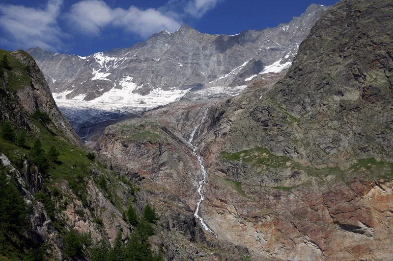
A shrinking glacier, chamois in the forest
GLAMOS, the Swiss glacier monitoring network, has been tracking the length of the Fee Glacier since 1883. Between 2020 and 2023, its snout retreated by almost half a kilometre. Underfoot, there's gneiss of the Siviez-Mischabel nappe at first, then mostly moraine, recent or older. As you approach the village, the trail is back on gneiss, this time of the Portjengrat nappe.
The trail is named after the chamois, "Gämsen" in German: many of them live in the protective forest of the Plattjen area, and you may occasionally see them there.
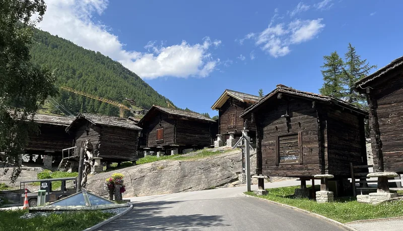
Along the water channel to the village
After the restaurant you pass under the Spielboden gondola and cross the Feevispa (Feeru Vispa on the map). The trail crosses the ski slope to Bifig, where the Bodmen water channel begins, then follows it past the village to Grundbiel, before heading to the bus terminal.
Saas-Fee is a municipality at the foot of the Dom in the Mischabel range, overlooked by thirteen peaks above four thousand metres. Its first hotel dates from 1880; the road from Saas-Grund arrived in 1951, but the village streets stayed closed to cars. The PostBus leaves from the bus terminal; further down this page you'll find the next departures.
Every way to Saas-Fee
4 starting points to reach Saas-Fee. Pick yours: the 3D view shows it and “My day” recalculates.
Walking times without breaks. “Estimated” times are calculated on the swisstopo profile with a model fitted to the official SwitzerlandMobility stages; the shortest path may differ from the one on the yellow signposts: on the ground, follow the signs. Gradient: the steepest over 200 m of trail. Profiles share the same scale (length and altitude). Stations and car parks within 500 m of the start, according to OpenStreetMap.
In pictures
Hannig station in Saas-Fee, with the Mittaghorn and the Egginer in the background.
Trail on Hannig, Saas-Fee.
View from the Hannigalp to the south-east, into the upper Saas valley; the Höhenweg Almagelleralp runs along the opposite side.
Zygaena purpuralis on Hannig, Saas-Fee (Valais).
Spielboden and the glacier, in 2024.
A mountain river flows down from the Fee Glacier.
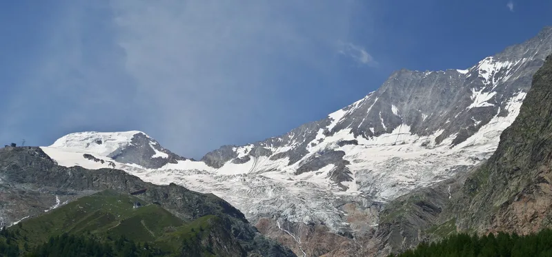
The Fee Glacier in Saas-Fee.
The moraine left downstream of the Fee Glacier, in Valais.
The Feevispa in Saas-Fee.
Wooden buildings in Saas-Fee.
Saas-Fee bus station.
The next few days
MeteoSwiss local forecast, updated every hour
Reading the MeteoSwiss forecast…
My day
Pick your day and start time: everything updates.
- Arrival at Saas-Fee
- 10:50 2 h 20 of walking without breaks, starting at 08:30
The trail, kilometre by kilometre
Places are listed under the kilometre where you pass them. Drag along the profile: the marker moves on the 3D view too.
- under 10 %
- 10 to 20 %
- 20 to 30 %
- over 30 %
- fountain or water point
- toilets
Around the trail (250 m, OpenStreetMap, extract of 25/10/2026): 20 restaurants, 2 cafés, 1 fountain or water point, 6 toilets. Estimated time: the official walking time spread by effort (1 km on the flat counts as 100 m of climbing), start time set in “My day”.
Getting there and back
Back by public transport from the Saas-Fee, Busterminal stop
Next departures from Saas-Fee, BusterminalReading the official timetable…
By car
Careful, this is one way: public transport back arrives in Saas-Fee, Busterminal, not in Saas-Fee, Hannig. Plan to get back to your car by public transport, or park at the finish and take the train to the start.
Public car parks within 600 m of the start, according to OpenStreetMap: prices and number of spaces may have changed, check the signs on site.
Questions people ask
How long is the hike from Saas-Fee, Hannig to the finish (Saas-Fee)?
2 h 20 of walking according to SwitzerlandMobility, in this direction, not counting breaks. The other way: 2 h 55.
Is it hard?
SwitzerlandMobility rates this stage: fitness medium, technique medium. It is 720 m of descent over 7.9 km.
Can I get back by public transport?
Yes. The Saas-Fee, Busterminal stop is at the finish. The next departures show live under “Getting there and back”.
Where can I eat on the way?
22 restaurants, cafés and huts within 250 m of the trail, including Bergrestaurant Hannig, Gletschergrotte, Belmont. Where they are and their opening hours: below the profile.
Is there water and are there toilets on the way?
1 fountain or water point and 6 toilets within 250 m of the trail (survey of 25/10/2026).
Can I download the track?
Yes, as a GPX file for your watch or map app: “Download the track” button at the top of the page.
More hikes within 10 km
Official SwitzerlandMobility stages that pass within 10 km of this trail. Each card says whether its page is already up.
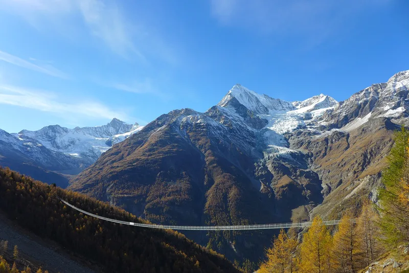 Randa, loop3 h 10Randa Hängebrückenweg7.0kmDistance700mAscent700mDescentTechnical mediumFitness medium. See the hike
- Gspon → Saas Fee5 h 50Alpenpässe-Weg, stage 1917.0kmDistance950mAscent1,000mDescentTechnical mediumFitness difficult. Page coming
- Saas Fee → Grächen9 h 00Alpenpässe-Weg, stage 2020.0kmDistance1,300mAscent1,450mDescentTechnical mediumFitness difficult. Page coming
- Saas Fee → Grächen9 h 00Swiss Tour Monte Rosa, stage 120.0kmDistance1,300mAscent1,450mDescentTechnical mediumFitness difficult. Page coming
- Saas Grund (Kreuzboden) → Saas Almagell3 h 30Höhenweg Almagelleralp11.0kmDistance320mAscent1,050mDescentTechnical mediumFitness difficult. Page coming
- Grächen → Europahütte7 h 10Swiss Tour Monte Rosa, stage 217.0kmDistance1,700mAscent1,050mDescentTechnical mediumFitness difficult. Page coming