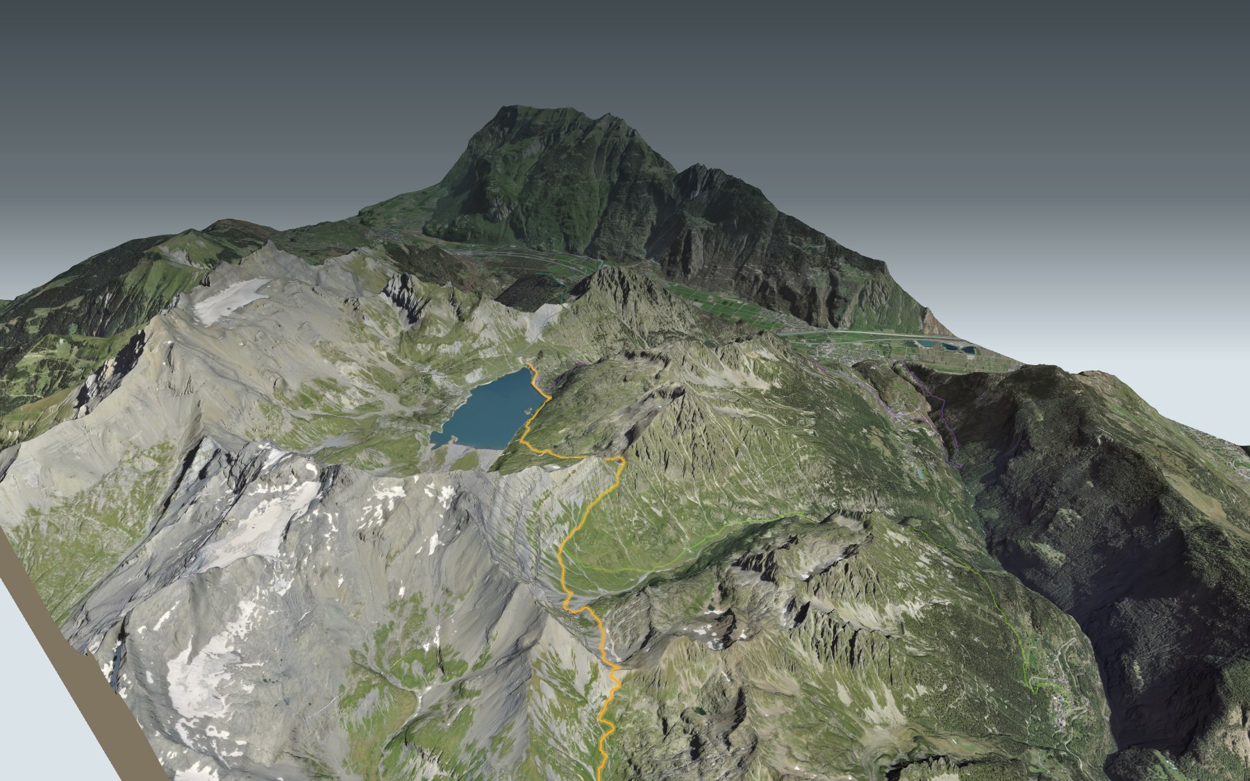

From Emosson to Salanfe over the passes
A high mountain stage between two reservoirs: you start at the Emosson dam, in the municipality of Finhaut, and finish at the Auberge de Salanfe, on the shore of the Lac de Salanfe. In between lie the Col de Barberine and the Col d'Emaney. It's stage 38 of the Alpenpässe-Weg, rated difficult for fitness and medium for technique.
The path first runs along the Lac d'Emosson, then climbs the Vallon de Barberine to the Col de Barberine, the highest point. It then drops into the Vallon d'Emaney and climbs again to the Col d'Emaney before reaching the Lac de Salanfe. The elevation profile shows both climbs.
Prefer to walk all the way up to Salanfe? Four other starting points, lower down, climb towards the finish: from Evionnaz, Vernayaz and Saint-Maurice you go up to Salanfe, and the start in Finhaut joins the route between the two passes, before the climb to the Col d'Emaney. Each start has its own colour on the 3D map, and its estimated time is in the list of starting points. From Finhaut, the Sentier du Balcon du Mont-Blanc climbs to the Emosson dam.
At the start, the Restaurant du Barrage d'Émosson; at the finish, the Auberge de Salanfe. Check the transport and plan your day before you set off. Looking for more in the area? All hikes in Valais.
The story of the trail
What happened where you are going to walk, chapter by chapter.
From one reservoir to the next
You start at 1,965 m, at the Emosson dam, and finish at 1,931 m, at Salanfe. In between: 13.7 km, 1,150 m of climbing and the same amount of descent. The highest point, at 2,482 m, is the Col de Barberine. Allow 5 h 50 of walking in this direction, and the same the other way round.
It's stage 38 of the Alpenpässe-Weg, rated difficult for fitness and medium for technique. The route is marked white-red-white: follow the markings closely. Late snow varies a lot from one summer to the next; follow the signposts and check the conditions on the day.
A lake that drowned another
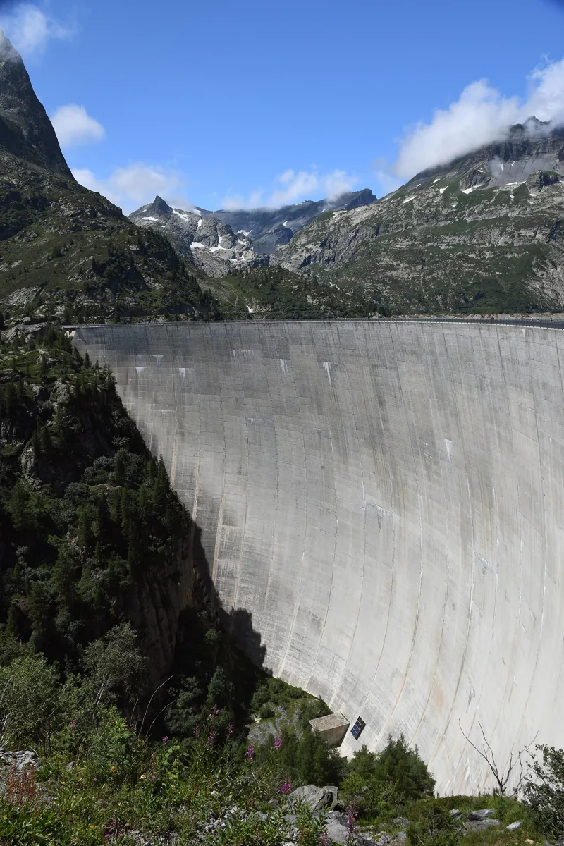
The Emosson dam is an arch dam built from 1967 to 1974 on the Barberine, in the municipality of Finhaut. It stands on the gneiss of the Aiguilles Rouges crystalline massif and holds back 227 million cubic metres of water, used to generate power in two stages, at Vallorcine and then at La Bâtiaz. Beneath its waters lies an older dam, the Barberine dam, built from 1921 to 1925 for the Swiss Federal Railways: this is where poured concrete was used for the first time in Switzerland.
To get up to the dam without walking, a three-part journey starts in Le Châtelard: a funicular to Les Montuires, a small panoramic train through ravines and tunnels to the foot of the dam, with views of the Mont Blanc massif, then a minifunicular to the top of the dam. It runs from June to October.
Over the Col de Barberine and the Col d'Emaney
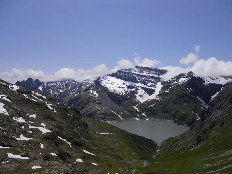
After the first few kilometres along the Lac d'Emosson, the path climbs the Vallon de Barberine to the Col de Barberine, around the 6th kilometre. On the other side, it drops into the Vallon d'Emaney, then climbs again to the Col d'Emaney, around the 10th kilometre.
At the Col d'Emaney, greenish sandstone sits directly on gneiss, which is violet here. Some 250 million years are missing between the two, wiped out by the erosion of an old mountain range at the end of the Palaeozoic era. This sandstone is old beach sand, and some of its surfaces still show current ripples.
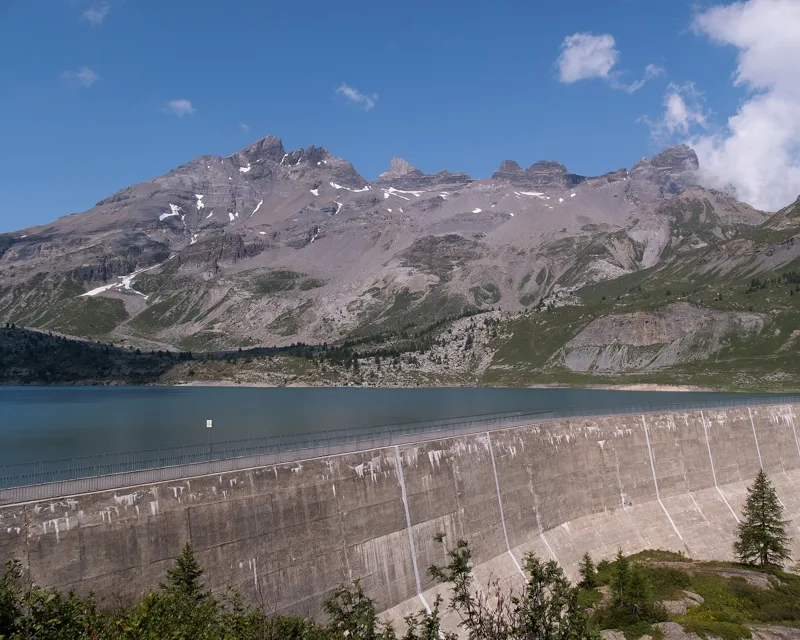
Salanfe, a flooded plateau
The first Dents-du-Midi hotel opened its doors in Salanfe in 1898. After the war, the company Salanfe SA was founded in 1947, and the dam was built from 1947 to 1953. The land and buildings were expropriated so the plateau could be flooded.
This gravity dam, made of 42 blocks, holds back up to 40 million cubic metres, a tenth of the capacity of the Grande Dixence. From the lake, the water runs down a penstock to the Miéville power station, in Vernayaz.
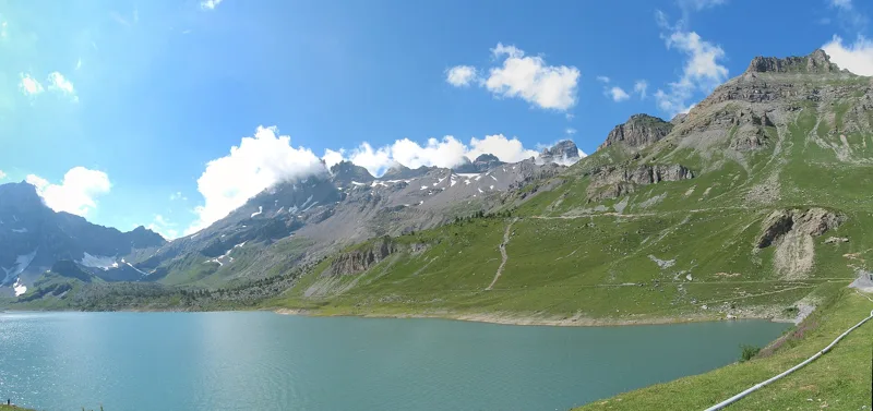
Finishing below the Dents du Midi
After the Col d'Emaney, the trail passes below the Lac des Ottans and heads down to the Lac de Salanfe, which it follows towards the end of the walk. To finish, you cross the dam wall to the Auberge de Salanfe.
The Salanfe basin is bordered by the Dents du Midi, the Tour Sallière and the Luisin. The Dents du Midi and the Tour Sallière are mostly made of limestone and clay laid down in the Tethys Sea. The dam itself is built on gneiss, which the glaciers rounded and polished near the inn some 10,000 years ago. Further down the page: where to eat and how to get back.
Every way to Cab. de Salanfe
5 starting points to reach Cab. de Salanfe. Pick yours: the 3D view shows it and “My day” recalculates.
Walking times without breaks. “Estimated” times are calculated on the terrain profile with a model fitted to the official stages; the shortest path may differ from the one on the yellow signposts: on the ground, follow the signs. Gradient: the steepest over 200 m of trail. Profiles share the same scale (length and altitude). Stations and car parks within 500 m of the start.
In pictures
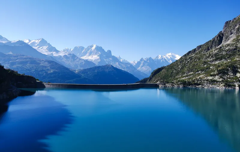
Lac d'Emosson and the Emosson dam, with the Mont Blanc massif
The Emosson dam and lake seen from the dam restaurant
The Émosson dam, built for hydroelectric power, in Valais
View from the Col de Barberine towards La Finive
The Vallon d'Emaney
Panoramic view of the Dents du Midi and the Lac de Salanfe
The Salanfe dam, its lake and the south face of the Dents du Midi
Mountain everlasting (Antennaria dioica) near the Lac de Salanfe
Wild marmot at the Lac de Salanfe
The chapel at the Auberge de Salanfe
Lac d’Emosson → Cab. de Salanfe: when to go
Public transport serves the start every day from 29 May to 24 October 2027, according to the official timetable: that's the season to do this hike without a car. The latest time to set off ranges from 14:35 in June to 9:57 in December.
- Public transport to the start
- off season
- no arrival found in the official timetable, read on 11/11/2026
- Sun at the start, mid-January
- from 9:16
- rises at 8:10, hidden by the ridge
- Leave by, for 5 h 50 of walking
- 10:23
- arrive 1 hour before sunset, at 17:13
| Month | Sun at the start | Leave by | In the sun, leaving at 9:00 | Transport |
|---|---|---|---|---|
| December | 9:03 → 16:47 | 9:57 | 41 % | off season |
| January | 9:16 → 17:13 | 10:23 | 49 % | off season |
| February | 9:09 → 17:58 | 11:08 | 77 % | off season |
“In the sun”: the share of the path in sunlight under a clear sky, with the terrain worked out point by point. The path climbs to 2,482 m: today's snow and frost are in the weather and My day.
- Public transport to the start
- 3 of 92 days
- 16 arrivals a day
- first arrival 9:15
- last 16:45
- Sun at the start, mid-April
- from 8:04
- rises at 6:46, hidden by the ridge
- Leave by, for 5 h 50 of walking
- 13:29
- arrive 1 hour before sunset, at 20:19
| Month | Sun at the start | Leave by | In the sun, leaving at 9:00 | Transport |
|---|---|---|---|---|
| March | 8:45 → 18:37 | 11:47 | 96 % | off season |
| April | 8:04 → 20:19 | 13:29 | 94 % | off season |
| May | 6:56 → 20:57 | 14:07 | 97 % | 3 of 31 days |
“In the sun”: the share of the path in sunlight under a clear sky, with the terrain worked out point by point. The path climbs to 2,482 m: today's snow and frost are in the weather and My day.
- Public transport to the start
- every day
- 16 arrivals a day
- first arrival 9:15
- last 16:45
- Sun at the start, mid-July
- from 6:50
- rises at 5:56, hidden by the ridge
- Leave by, for 5 h 50 of walking
- 14:31
- arrive 1 hour before sunset, at 21:21
| Month | Sun at the start | Leave by | In the sun, leaving at 9:00 | Transport |
|---|---|---|---|---|
| June | 6:31 → 21:25 | 14:35 | 97 % | every day |
| July | 6:50 → 21:21 | 14:31 | 97 % | every day |
| August | 7:30 → 20:42 | 13:52 | 93 % | every day |
“In the sun”: the share of the path in sunlight under a clear sky, with the terrain worked out point by point. The path climbs to 2,482 m: today's snow and frost are in the weather and My day.
- Public transport to the start
- daily, 1 Sept to 24 Oct
- 16 arrivals a day
- first arrival 9:15
- last 16:45
- Sun at the start, mid-October
- from 9:35
- rises at 7:49, hidden by the ridge
- Leave by, for 5 h 50 of walking
- 11:57
- arrive 1 hour before sunset, at 18:47
| Month | Sun at the start | Leave by | In the sun, leaving at 9:00 | Transport |
|---|---|---|---|---|
| September | 9:12 → 19:45 | 12:55 | 92 % | every day |
| October | 9:35 → 18:47 | 11:57 | 80 % | 24 of 31 days |
| November | 8:45 → 17:01 | 10:11 | 63 % | off season |
“In the sun”: the share of the path in sunlight under a clear sky, with the terrain worked out point by point. The path climbs to 2,482 m: today's snow and frost are in the weather and My day.
The next few days
Local forecast, updated every hour
Reading the forecast…
My day
Pick your day and start time: everything updates.
- Arrival at Cab. de Salanfe
- 14:20 5 h 50 of walking without breaks, starting at 08:30
The trail, kilometre by kilometre
From Lac d’Emosson
Places are listed under the kilometre where you pass them. Drag along the profile: the marker moves on the 3D view too.
- under 10 %
- 10 to 20 %
- 20 to 30 %
- over 30 %
- fountain or water point
- toilets
Around the trail (250 m): 1 restaurant, 2 fountains and water points and 1 toilet. Estimated time: the official walking time spread by effort (1 km on the flat counts as 100 m of climbing), start time set in “My day”.
- under 10 %
- 10 to 20 %
- 20 to 30 %
- over 30 %
- fountain or water point
- toilets
Around the trail (250 m): 1 fountain or water point. Estimated time: the official walking time spread by effort (1 km on the flat counts as 100 m of climbing), start time set in “My day”.
- under 10 %
- 10 to 20 %
- 20 to 30 %
- over 30 %
- fountain or water point
- toilets
Around the trail (250 m): 5 restaurants, 2 cafés, 17 fountains and water points and 6 toilets. Estimated time: the official walking time spread by effort (1 km on the flat counts as 100 m of climbing), start time set in “My day”.
- under 10 %
- 10 to 20 %
- 20 to 30 %
- over 30 %
- fountain or water point
- toilets
Around the trail (250 m): 3 fountains and water points and 2 toilets. Estimated time: the official walking time spread by effort (1 km on the flat counts as 100 m of climbing), start time set in “My day”.
- under 10 %
- 10 to 20 %
- 20 to 30 %
- over 30 %
- fountain or water point
- toilets
Around the trail (250 m): 1 restaurant, 4 cafés, 10 fountains and water points and 1 toilet. Estimated time: the official walking time spread by effort (1 km on the flat counts as 100 m of climbing), start time set in “My day”.
Getting there and back
Cab. de Salanfe, 1,931 m
By car
From Lac d’Emosson
Careful, this is one way: public transport back arrives in Cab. de Salanfe, not in Lac d’Emosson. Plan to get back to your car by public transport, or park at the finish and take public transport to the start.
- Car park open-air, Route d'Émossonfree40 m from the start
- Car park, Route d'Émosson190 m from the start
Public car parks within 600 m of the start: prices and number of spaces may have changed, check the signs on site.
Careful, this is one way: public transport back arrives in Cab. de Salanfe, not in Evionnaz. Plan to get back to your car by public transport, or park at the finish and take public transport to the start.
- Car park90 m from the start
- Station Evionnazor by public transport0 m from the start
The nearest car park and stop for this start. Check the signs on site for the price.
Careful, this is one way: public transport back arrives in Cab. de Salanfe, not in Vernayaz MC. Plan to get back to your car by public transport, or park at the finish and take public transport to the start.
- Car parkfree50 m from the start
- Station Vernayaz MCor by public transport0 m from the start
The nearest car park and stop for this start. Check the signs on site for the price.
Careful, this is one way: public transport back arrives in Cab. de Salanfe, not in St-Maurice (Arsenal). Plan to get back to your car by public transport, or park at the finish and take public transport to the start.
- Car park40 m from the start
- Station Saint-Mauriceor by public transport420 m from the start
The nearest car park and stop for this start. Check the signs on site for the price.
Careful, this is one way: public transport back arrives in Cab. de Salanfe, not in Finhaut. Plan to get back to your car by public transport, or park at the finish and take public transport to the start.
- Car park30 m from the start
- Station Finhautor by public transport0 m from the start
The nearest car park and stop for this start. Check the signs on site for the price.
Questions people ask
How long is the hike from Lac d’Emosson to Cab. de Salanfe?
5 h 50 of walking (official time), in this direction, not counting breaks. The other way: 5 h 50.
Is it hard?
Official rating for this stage: fitness difficult, technique medium. It is 1,150 m of descent over 13.7 km.
Where can I eat on the way?
One place to eat within 250 m of the trail: Restaurant du Barrage d'Émosson. Where it is and its opening hours: below the profile.
Is there water and are there toilets on the way?
2 fountains and water points and 1 toilet within 250 m of the trail (survey of 25/10/2026).
Can I download the track?
Yes, as a GPX file for your watch or map app: “Download the track” button at the top of the page.
More hikes within 10 km
Official stages that pass within 10 km of this trail. Each card says whether its page is already up.
- © swisstopoVan d’en Haut, loop4 h 25Sentier de Salanfe13.0kmDistance720mAscent720mDescentTechnical mediumFitness medium. Official waymarked stage
- © swisstopoTrient → Lac d’Emosson7 h 00Alpenpässe-Weg, stage 3716.0kmDistance1,700mAscent1,000mDescentTechnical mediumFitness difficult. Official waymarked stage
- © swisstopoCab. de Salanfe → Barme5 h 45Alpenpässe-Weg, stage 3915.0kmDistance950mAscent1,400mDescentTechnical mediumFitness difficult. Official waymarked stage
- © swisstopoSt-Maurice → Martigny4 h 00ViaFrancigena, stage 716.0kmDistance280mAscent240mDescentTechnical easyFitness medium. Official waymarked stage
- © swisstopoAigle → St-Maurice5 h 00ViaFrancigena, stage 619.0kmDistance500mAscent480mDescentTechnical easyFitness difficult. Official waymarked stage
- © swisstopoMartigny → Orsières6 h 00ViaFrancigena, stage 820.0kmDistance950mAscent520mDescentTechnical easyFitness difficult. Official waymarked stage