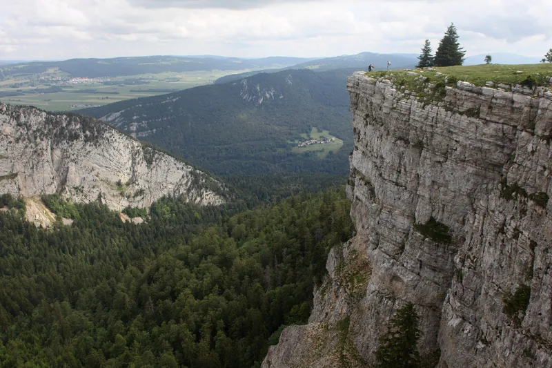
1Creux du Van
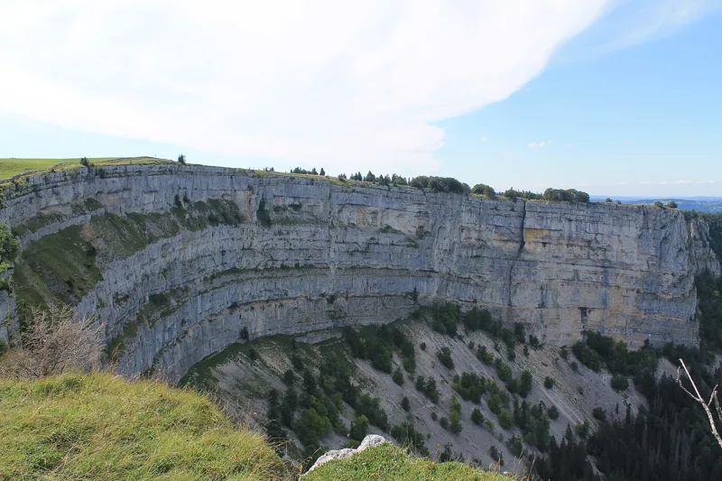
A semicircle of limestone cliffs, 1 km across. At its foot, under the scree, the ground stays frozen all year round, below 1,200 m.
Getting there on foot
Sentier du Creux du Van4 h 35Loop from Noiraigue

Bivio / Jura
What to see, what flowers up high, what to eat, and 4 hikes to get there on foot, from 3 h 00 to 5 h 00 of walking.
The spots not to miss, and the hike that takes you there.
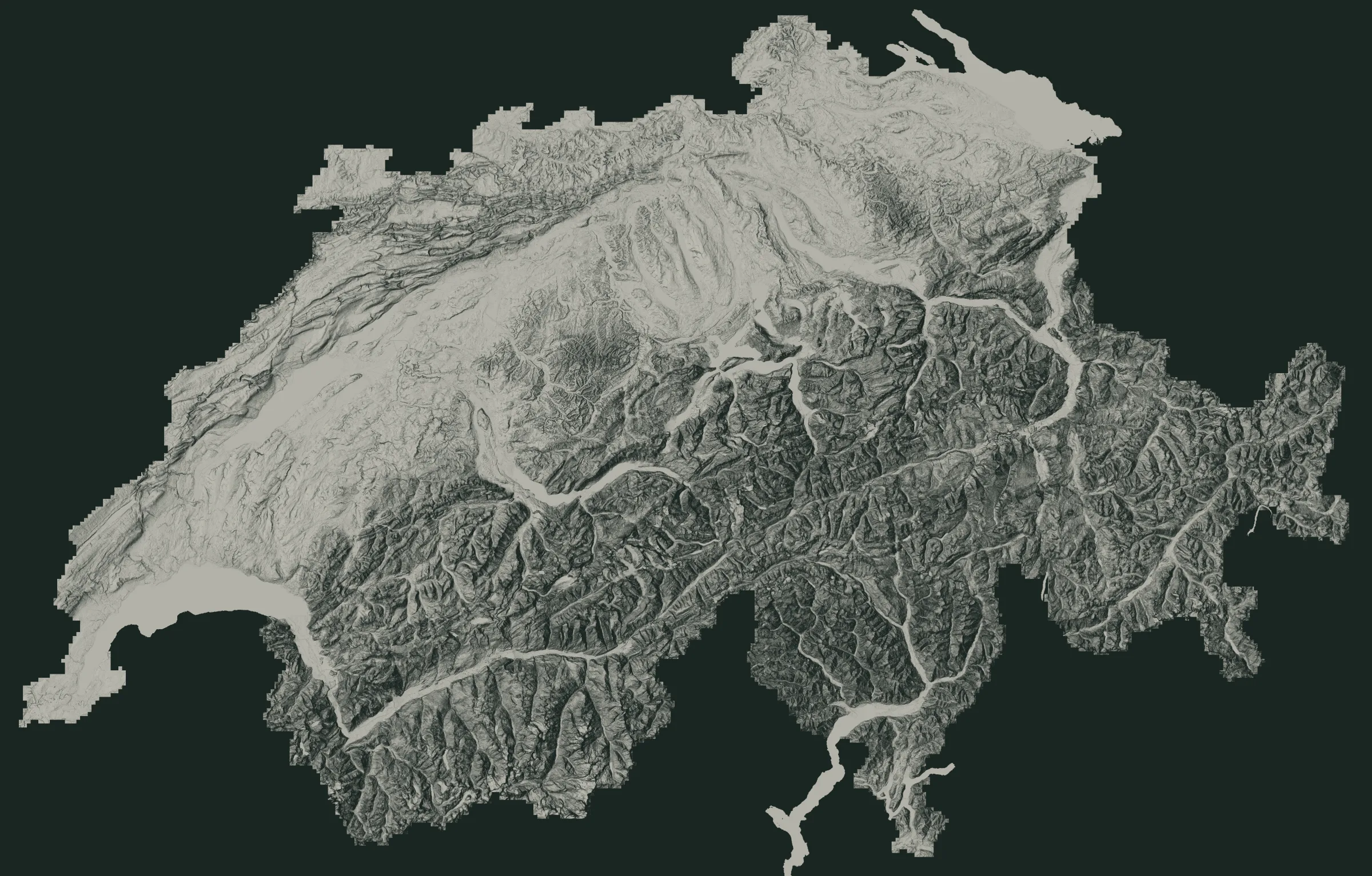 Col-des-Roches Underground MillsVallorbe CavesLa Brévine1Creux du Van2Saut de Brot Bridge3Champ-du-Moulin and La Truite4Creux de Glace5Chasseral summit6Mont Tendre7Cabane du Servan
The numbers are the places just below. The white dots are where the hikes start.
A semicircle of limestone cliffs, 1 km across. At its foot, under the scree, the ground stays frozen all year round, below 1,200 m.
Getting there on foot
Sentier du Creux du Van4 h 35Loop from Noiraigue
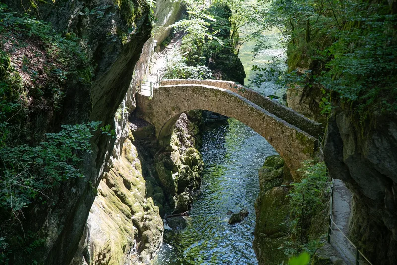
Here the Areuse rushes between limestone cliffs, from rapid to waterfall. It started cutting its gorge about 10,000 years ago, when glacier deposits pushed it out of its old bed.
Getting there on foot
Sentier des Gorges de l'Areuse3 h 00From Noiraigue to Boudry
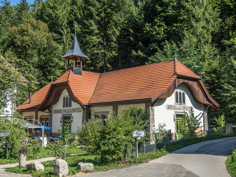
The La Truite building is on record as early as 1811; it officially became a hotel, under that name, in 1897-1898. Trains also stop at Champ-du-Moulin, if you want to cut the hike in two.
Getting there on foot
Sentier des Gorges de l'Areuse3 h 00From Noiraigue to Boudry
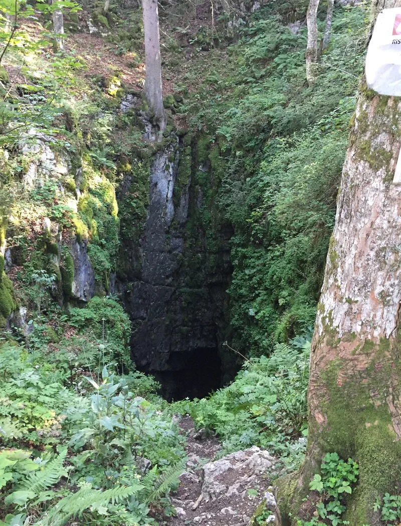
A hole 30 m deep with a small glacier at the bottom: the snow that piles up there in winter turns to ice.
Getting there on foot
Chemin de Chasseral3 h 50Loop from Chasseral, Hôtel
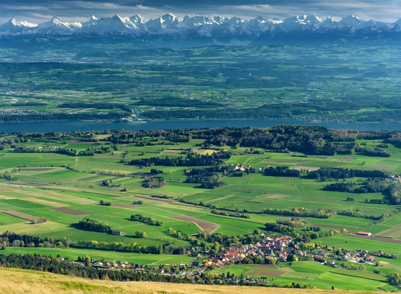
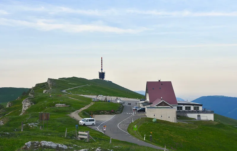
A big antenna has stood on it since 1970. On a clear day, from the top of this range, more than 25 km long, the view runs from the Franches-Montagnes over the Swiss Plateau to the Alps.
Getting there on foot
Chemin de Chasseral3 h 50Loop from Chasseral, Hôtel
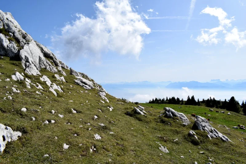
1,679 m: the highest summit of the Swiss Jura. The rare large-flowered sandwort grows on its rocks, and the ridge looks out over the Plateau, Lake Geneva and the Alps.
Getting there on foot
Mont Tendre: Au sommet du Jura5 h 00From Le Sentier to Montricher
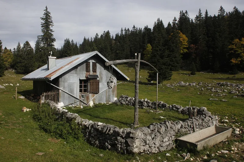
The hut stands on the Mont Tendre range, a land of pastures lined with dry-stone walls and dotted with summer pasture chalets. Up on these ridges there are no streams, so most chalets have a stone cistern, filled by rain off their big roofs, to water the cattle.
Getting there on foot
Mont Tendre: Au sommet du Jura5 h 00From Le Sentier to Montricher
Mills built underground, in a cave in Le Locle, where a torrent turned the wheels. Hans Christian Andersen described them in 1836. Open all year.
Our nearest hike, the Creux du Van, is 10.5 km away.
Galleries of stalactites and stalagmites, where the Orbe comes back out of the ground. The biggest chamber, the “Cathedral”, is nearly 35 m high.
Our nearest hike, Mont Tendre, is 11 km away.
They call it the “Siberia of Switzerland”: on 12 January 1987, it recorded -41.8 °C. Nearby, the water of Lac des Taillères flows underground all the way to the Areuse.
Our nearest hike, the Creux du Van, is 9.2 km away.
Ranked by hikers' reviews on this site.
Rating = average of the diamonds given by hikers, from 1 to 5. A hike joins the ranking once it has 5 reviews, each checked before it goes online.
When things flower, when the animals show up: the mountains, month by month.
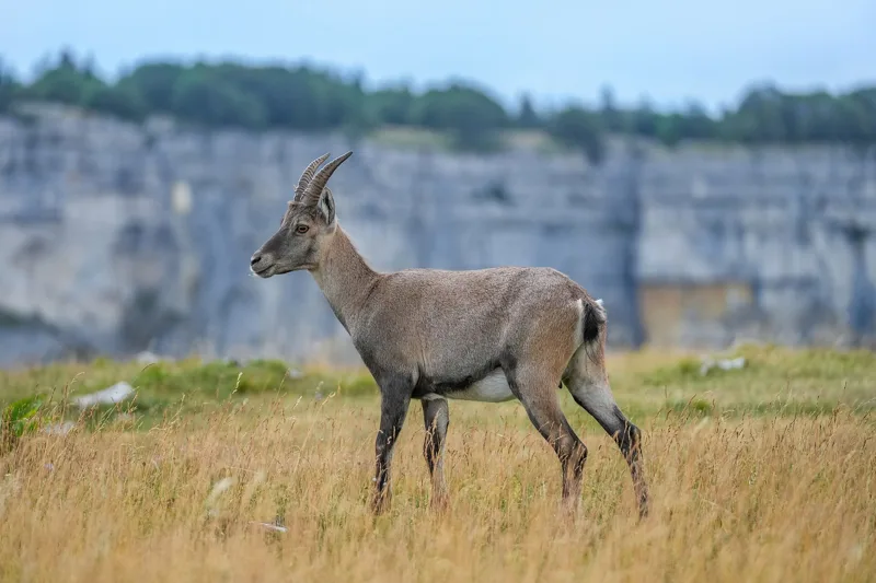
13 ibex were released here in the late 1960s, then 5 more from Valais in 2005. The young are born in June. They are wild: watch them from a distance.
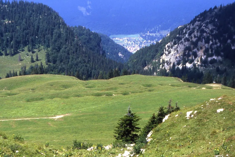
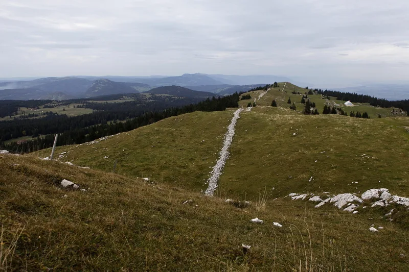
In the heart of the range, dozens of sinkholes line up in the marl hollows, something rare in the Jura. The photo shows one of these rows, looking north from the Chasseral.
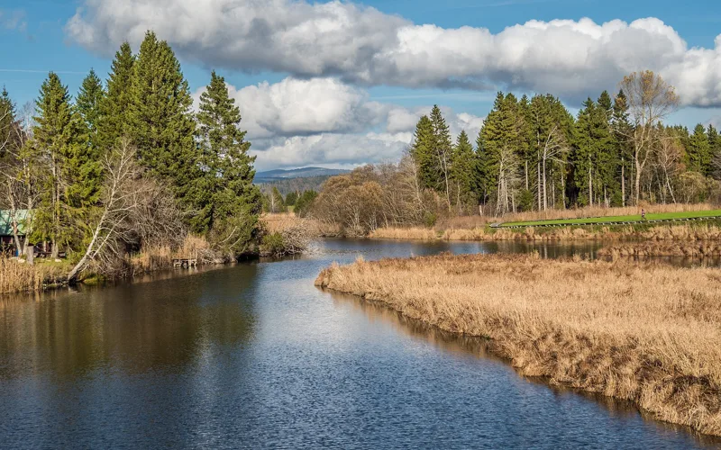
At the start, near Le Sentier, the Orbe winds through a wetland of national importance before Lac de Joux. For part of the year, sinks on the north shore carry the lake water underground to the source of the Orbe, at Vallorbe.
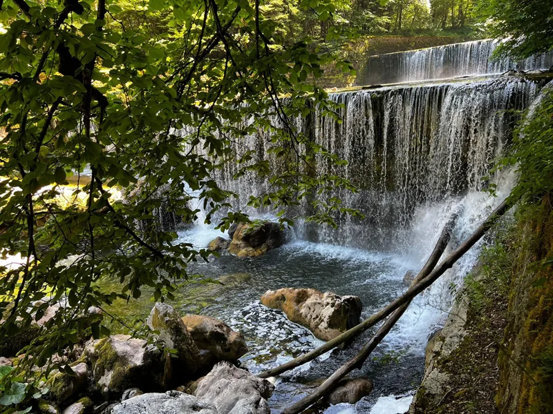
In the gorge, the Areuse flows freely along most of its course, between rapids and waterfalls. Its clean water is home to plenty of aquatic life, including salmonids.
Local specialities with an official designation.
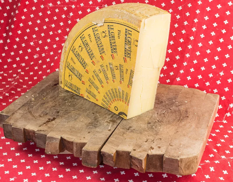
A raw-milk cheese, made and matured in the canton of Neuchâtel and the French-speaking part of the canton of Bern, among others. In 2013, the Métairie de la Petite Douanne, on the Chasseral loop, still made it up on the summer pasture.
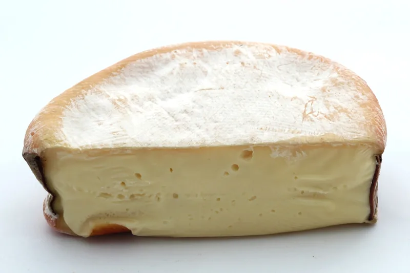
The cheese of the Vallée de Joux and the foot of the Vaud Jura, made from September to March. It gets a spruce strap, then goes into its spruce box. The Mont Tendre hike starts in the Vallée de Joux.
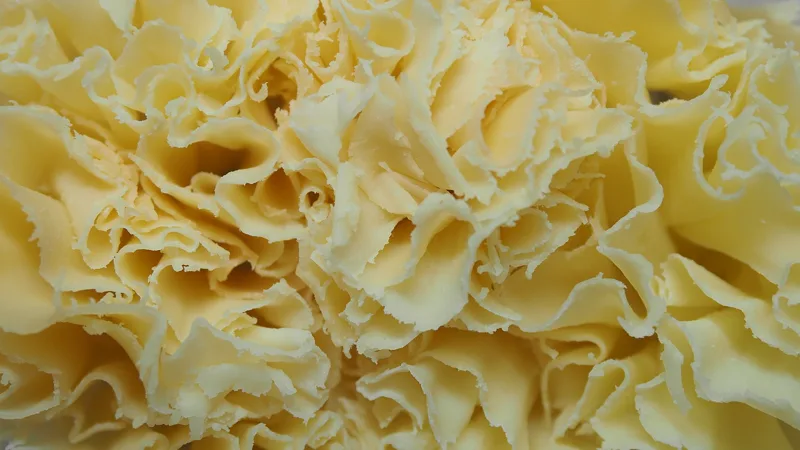
A raw-milk cheese from the canton of Jura and the Bernese Jura, made in a copper vat. You scrape it into rosettes with a girolle, invented in 1982.

Two thirds lean, one third fat: pork in a beef casing, straight for the saucisson, curved for the sausage. Both are made in the canton of Neuchâtel.
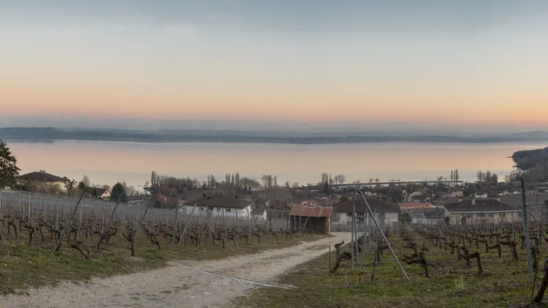
The canton's vineyards, along the lake. The Œil-de-Perdrix rosé is one of them. The Areuse gorge trail ends in the vineyards of Boudry, whose castle houses a museum of vines and wine.
Two hikes close together, the train or bus in between, and a good reason to do both.
None: both start from Noiraigue station. From Boudry, the tram takes you back to Neuchâtel; check the timetable on the day.
One landscape: the moraine of the old Creux du Van glacier pushed the Areuse aside and dammed the valley. Day one, the cirque; day two, the river in its gorge.
Train and bus from Boudry to the Chasseral hotel, via La Neuveville and Nods: about 1 h 30 to 1 h 40. The Nods bus only runs in season, at weekends and on public holidays. Check the timetable on the day.
The bus climbs from La Neuveville, one of the two towns that raised the money for the Chasseral chalet-hotel in 1879. That hotel is where the farm-to-farm loop starts.
The lifts and summer buses that take you to the start, with their dates.
In late autumn, some bridges or safety cables are taken down on hiking trails. In the Areuse gorge, the path can be slippery in the rain, and some sections can be dangerous in winter, with ice on the ground and icicles on the cliffs. Find out more
What happened where you're about to walk.
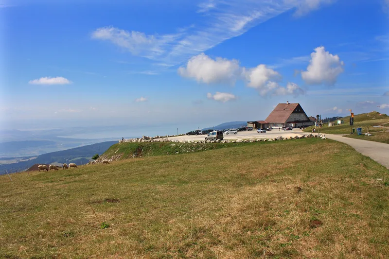
In 1879, La Neuveville and Saint-Imier raised the money and Lignières and Nods gave the timber: the Chasseral chalet-hotel went up. Gutted by fire, it was rebuilt in 1925. In the 1930s, the tarred road was built to give the unemployed work during the Depression.
Chemin de Chasseral3 h 50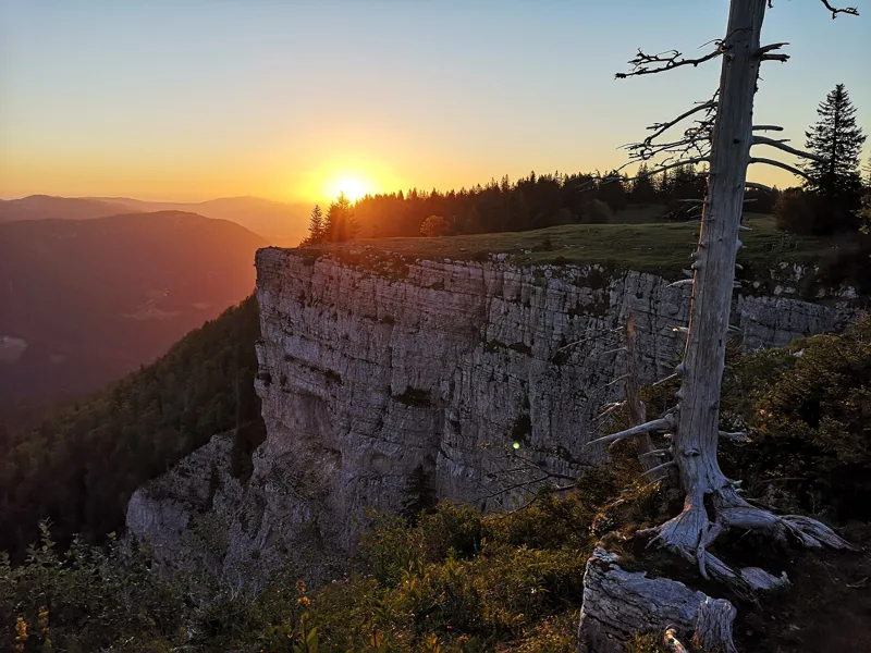
In 1876, the Club Jurassien bought the scree at the bottom of the cirque from the parish of Saint-Aubin, so that no tree would ever be cut there. It is considered the first nature reserve in Switzerland. The ibex came in the late 1960s, the lynx in 1974 and 1975.
Sentier du Creux du Van4 h 35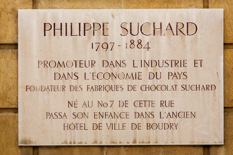
Hacked out with picks and shovels, the Gor de Brayes passage opened in 1875. In the crowd stood the chocolate maker Philippe Suchard. At Champ-du-Moulin, where he opened the Hôtel des Gorges in 1878, he offered a cup of chocolate and a loaf of bread to anyone who gave money for the trails.
Sentier des Gorges de l'Areuse3 h 00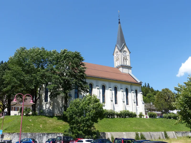
In Le Sentier, the church dates from 1612, rebuilt in 1725 and again in 1898. Watchmaking arrived in the 18th century; in 1833 the Le Coultre & Cie workshop was founded, and it became Jaeger-LeCoultre in 1937.
Mont Tendre: Au sommet du Jura5 h 00From shortest to longest.
4 hikes, from 3 h 00 to 5 h 00 of walking (official times): Sentier des Gorges de l'Areuse, Chemin de Chasseral, Sentier du Creux du Van and Mont Tendre: Au sommet du Jura.
Sentier des Gorges de l'Areuse: 3 h 00 of walking (official time), 11.9 km, 170 m of climbing.
Mont Tendre: Au sommet du Jura: 5 h 00 of walking (official time), 15.9 km, 760 m of climbing.
Stages officially rated technically easy: Chemin de Chasseral, Mont Tendre: Au sommet du Jura and Sentier du Creux du Van.
4 of the 4 hikes end at a public transport stop; each page shows the next departures from the finish.
Bob relies on the site's data and can be wrong. On the ground, the signposts come first. Emergency: 1414 (Rega) or 112.