
Crossing from Adelboden to Lenk over the Hahnenmoos
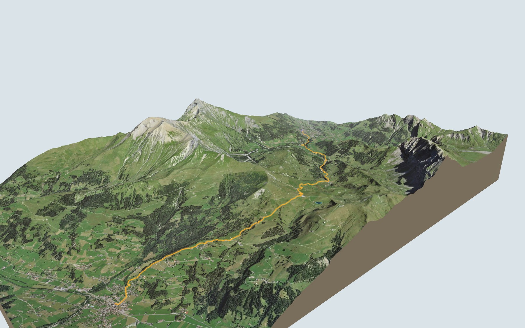
On this hike you switch valleys on foot: you leave Adelboden, at the very top of the Engstligental, cross the Hahnenmoos Pass and walk down to Lenk, at the very top of the Simmental. It is stage 15 of the Via Alpina, in its official direction. SwitzerlandMobility rates it difficult for fitness and easy for technique.
The path first drops to the Allebach stream, then climbs alongside the Gilsbach, past the hamlet of Gilbach and Bergläger, up to the Geilsbüel basin. After the pass, the old mule track heads for the Bühlberg, then it is all downhill to Brandegg and Lenk. The elevation profile shows you where the final descent gets steeper.
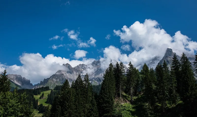
On both sides of the pass, the trail runs past moorland listed in Switzerland's federal inventories, and the view opens up to the Wildstrubel and Wildhorn massif. Around Lenk, you can add the Iffigsee-Rundweg, a loop starting from the Iffigenalp.
At the finish: Lenk station and the train towards Zweisimmen. Check the next departures from Lenk and plan your day before you set off. Looking for more in the area? See all hikes in the Bernese Oberland.
The story of the trail
What happened where you are going to walk, chapter by chapter.
A pass between two valleys
You start at 1,348 m in the centre of Adelboden and finish at 1,068 m in Lenk. In between: 13.9 km, plus 700 m of climbing and 1,000 m of descent according to SwitzerlandMobility. The highest point of the hike, 1,951 m, is close to the pass. SwitzerlandMobility gives 4 h 30 of walking time in this direction and 4 h 50 the other way.
After the village, you can stop at the Geilsbrüggli restaurant, roughly halfway, at the Berghotel Hahnenmoospass, right on the pass, and at the Bühlberg restaurant, where the steep descent begins. Bring something to drink, follow the signposts and check the conditions on the day.
Along the Gilsbach to Geilsbüel
From Adelboden bus station, the path goes past the swimming pool and down to the Allebach, which you cross on an old stone bridge. Near the big road bridge, a trail branches off towards the Gilsbach: from there the mountain stream keeps you company through open forest, away from the road.
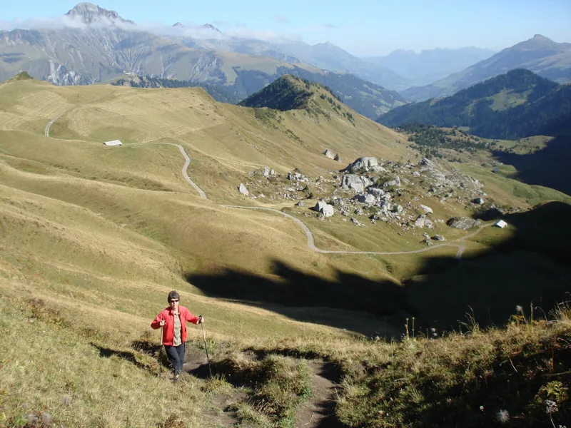
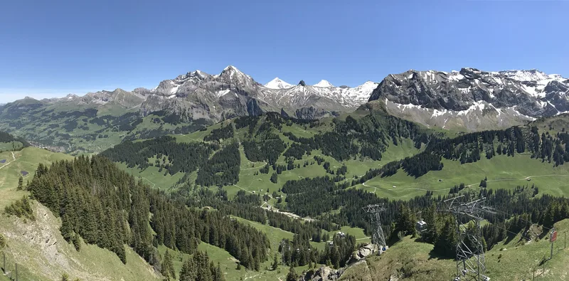
You pass the hamlet of Gilbach, then Bergläger, the middle station of the Sillerenbahn. The trail then climbs steadily into the Geilsbüel alpine basin. From there, the pass road and a few shortcuts across the meadows take you up to the Berghotel on the Hahnenmoos.
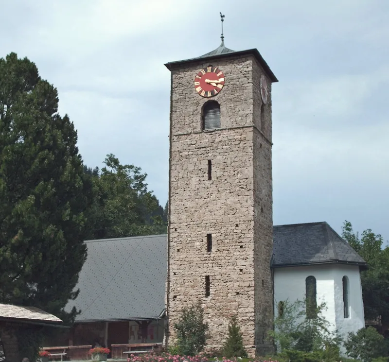
Adelboden, from church to resort
Adelboden built its own church before 1433, with an older tower that was originally secular. Thanks to an endowment set up by the community in 1433, the village became an independent parish in 1439. Back then, people lived from cattle farming, the summer pastures and the cattle trade.
Things changed with the carriage road to Frutigen in 1884, then the bus to Frutigen station from 1917. Adelboden has been a summer resort since the 1870s and a winter resort since 1901; the first hotel was built in 1887. As for the pass, a 17th-century document calls it the "Reyfstrasse", from the French "rive", shore: following the example of the lords of Bern, the local dignitaries of the upper valley liked a glass of wine from the shores of Lake Geneva, then largely Bernese.
Moorland of national importance
Above Geilsbüel, the trail runs along the "Moore oberhalb Geilsbüel", a 30.26 ha fen of national importance listed in the federal inventory. It also brushes past a small raised bog of national importance, the "Moor oberhalb Geilsbüel (Hahnenmoospass)". On the pass, you come across small mountain lakes and boggy areas.
After the pass, on the Lenk side, the trail passes close to a second fen of national importance, "Büelberg/Würtnere", covering 35.80 ha. From the pass, the view opens up to the Wildstrubel and Wildhorn massif and the green Upper Simmental.
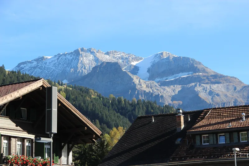
Lenk, the resort at the head of the Simmental
From the Bühlberg, the descent gets steep: a grassy slope down to the holiday settlement at Brandegg, then a path along the edge of the Sitewald, through flower meadows, down to the village. The Wildstrubel, to the south-east, is the highest point in the municipality of Lenk.
Lenk's church dates from 1505; destroyed in the village fire of 1878, it was replaced in 1881, then rebuilt in 1950. The spa, first licensed in 1689 for its sulphur and iron springs, grew between 1843 and 1900 into a spa resort with a grand hotel. The railway from Zweisimmen arrived in 1912: it is the train you take back from the station. Further down this page: the next departures.
In pictures
Hahnenmoos
Adelboden
Adelboden looking towards the Engstligenalp, September 2020
Adelboden church
Frutighaus in Adelboden (Ausserschwandstrasse 27), a typical farmhouse of the Frutigen region, built in the 18th century
View east from the Sillerenbühl, as far as the Wildstrubel
Wooden shingle roof, Alp Farni near Adelboden
The Regenboldshorn, a mountain near Lenk
The Wildstrubel seen from Lenk
Hiking signpost at Lenk station
The next few days
MeteoSwiss local forecast, updated every hour
Reading the MeteoSwiss forecast…
My day
Pick your day and start time: everything updates.
- Arrival at Lenk
- 13:00 4 h 30 of walking without breaks, starting at 08:30
The trail, kilometre by kilometre
Places are listed under the kilometre where you pass them. Drag along the profile: the marker moves on the 3D view too.
- under 10 %
- 10 to 20 %
- 20 to 30 %
- over 30 %
- fountain or water point
- toilets
Around the trail (250 m, OpenStreetMap, extract of 25/10/2026): 26 restaurants, 1 café, 7 fountains and water points, 12 toilets. Estimated time: the official walking time spread by effort (1 km on the flat counts as 100 m of climbing), start time set in “My day”.
Getting there and back
Back by public transport from the Lenk im Simmental stop
Next departures from Lenk im SimmentalReading the official timetable…
By car
Careful, this is one way: public transport back arrives in Lenk im Simmental, not in Adelboden. Plan to get back to your car by public transport, or park at the finish and take the train to the start.
- Sillerenbahnopen-air · paid640 m from the start
- Marktplatzopen-air390 m from the start
- Car park underground car park, Zelgstrassepaid80 m from the start
- Car park roadside, Zelgstrasse100 m from the start
Public car parks within 600 m of the start, according to OpenStreetMap: prices and number of spaces may have changed, check the signs on site.
Questions people ask
How long is the hike from Adelboden to the finish (Lenk)?
4 h 30 of walking according to SwitzerlandMobility, in this direction, not counting breaks. The other way: 4 h 50.
Is it hard?
SwitzerlandMobility rates this stage: fitness difficult, technique easy. It is 1,000 m of descent over 13.9 km.
Can I get back by public transport?
Yes. The Lenk im Simmental stop is at the finish. The next departures show live under “Getting there and back”.
Where can I eat on the way?
27 restaurants, cafés and huts within 250 m of the trail, including Adler, La Orquídea, S.Zimmer. Where they are and their opening hours: below the profile.
Is there water and are there toilets on the way?
7 fountains and water points and 12 toilets within 250 m of the trail (survey of 25/10/2026).
Can I download the track?
Yes, as a GPX file for your watch or map app: “Download the track” button at the top of the page.
More hikes within 10 km
Official SwitzerlandMobility stages that pass within 10 km of this trail. Each card says whether its page is already up.
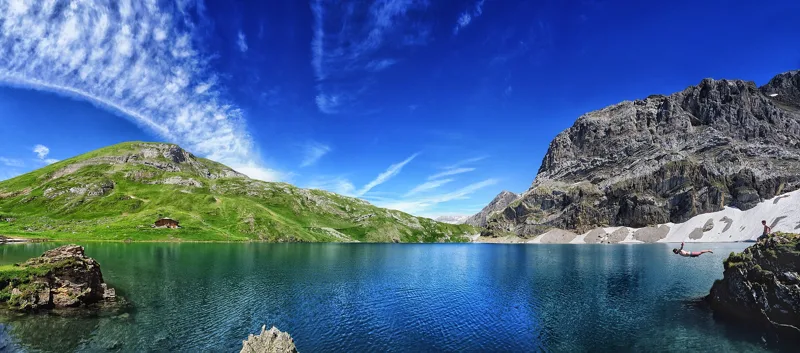 Lenk (Iffigenalp), loop4 h 25Iffigsee-Rundweg11.0kmDistance880mAscent880mDescentTechnical mediumFitness medium. See the hike
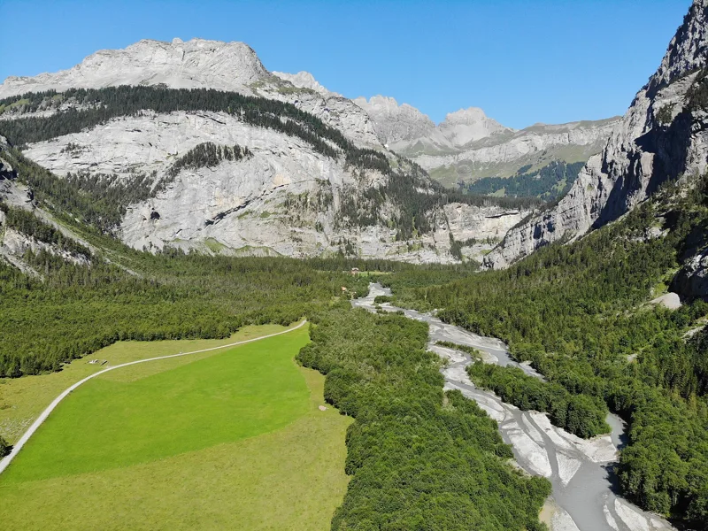 Kandersteg → Selden3 h 00Lötschberg-Panoramaweg, stage 211.0kmDistance460mAscent90mDescentTechnical mediumFitness medium. See the hike
- Kandersteg → Adelboden6 h 45Via Alpina, stage 1416.0kmDistance1,400mAscent1,250mDescentTechnical mediumFitness difficult. Page coming
- Elsigenalp → Adelboden3 h 15Höhenweg Elsigenalp–Adelboden10.0kmDistance400mAscent840mDescentTechnical mediumFitness medium. Page coming
- Lenk → Gstaad7 h 00Via Alpina, stage 1622.0kmDistance1,150mAscent1,200mDescentTechnical mediumFitness difficult. Page coming
- Lenk im Simmental, loop1 h 25Lenker Rundweg6.0kmDistance50mAscent50mDescentTechnical mediumFitness difficult. Page coming