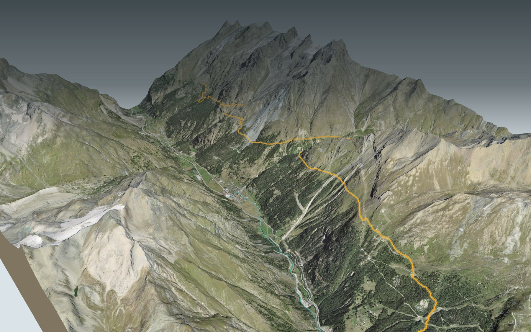

Hiking the Europaweg to Zermatt
The second of the two days on the Europaweg, the high trail between Grächen and Zermatt: you start at the Europahütte, above Randa, and follow the mountainside all the way to Zermatt. It's a long day, rated difficult for fitness and medium for technique. It is also stage 3 of the Swiss Tour Monte Rosa.
Within the first kilometre you cross the Charles Kuonen suspension bridge, high above the Grabengufer ravine. The trail then passes Springelboden, the Täschgufer, the Täschalp pastures and the hamlet of Tufteren before dropping down to Zermatt. The elevation profile shows you where it climbs again and where the descent begins.
Heads up: on 10 November 2026, one section of this trail was listed as closed and a diversion was reported because of rockfall, and the official information announced the trail's winter closure from 28 October. Read the chapter on trail conditions below before you set off. Fancy a short version down in the valley? Start from Täsch station: this starting point has its own colour in the 3D view and its own estimated time in Every way to Zermatt. For the bridge on its own, see the Randa Hängebrückenweg.
You finish in the heart of Zermatt, close to the station. Check the next trains and plan your day before you set off. Legs still fresh the next day? The 5-Seenweg Zermatt starts at Blauherd, above the village. See all hikes in Valais.
The story of the trail
What happened where you are going to walk, chapter by chapter.
A balcony above the Mattertal
You start at 2,264 m at the Europahütte and finish at 1,605 m in Zermatt. In between: 19.5 km, 1,000 m of climbing and 1,650 m of descent. The highest point, 2,348 m, comes around the 14th kilometre. Allow 6 h 45 of walking time in this direction and 7 h 30 the other way. The stage is rated difficult for fitness and medium for technique.
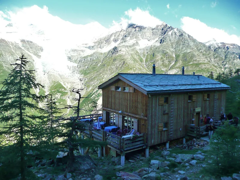
The Europaweg was created in 1997 by the municipalities of St. Niklaus, Grächen, Randa, Täsch and Zermatt. For food, there is the Europahütte at the start, the Täschalp Restaurant & Lodge at km 9.2, at 2,169 m, the Tufternhütte at km 15.5, and then the restaurants of Zermatt. Bring something to drink in between, and follow the signposts and the day's conditions.
The Charles Kuonen bridge
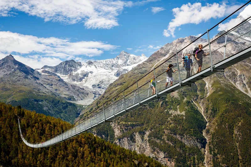
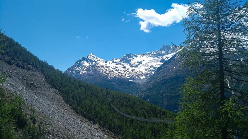
Before the end of the first kilometre, the trail crosses the Charles Kuonen suspension bridge, the longest pedestrian suspension bridge in the Alps. It spans the Grabengufer ravine, and its walkway is 65 cm wide. It is named after its main sponsor, Charles Kuonen, and it was inaugurated on 29 July 2017, after two and a half months of assembly.
It replaces an older bridge, closed in 2010 because of unstable ground; the new one runs lower down. The project cost 750,000 francs. Crossing takes just under ten minutes, on a grating deck: it helps to have a head for heights, and stay off the bridge during thunderstorms.
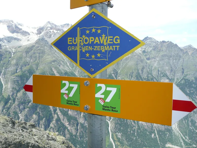
Rockfall: what has been reported
On 10 November 2026, the official trail information described it as only partly passable. The section from Springelboden to Eggenstadel, between Randa and Täsch, was listed as closed, with a marked detour from Springelboden via Attermenzen to Täsch, then the climb to Täschalp, where the regular route resumes. Because of rockfall, a diversion was also reported at the Täschgufer: from Bärgji you go down to Täsch, then back up to Täschalp. A taxi can be booked from Attermenzen to Täschalp.
The route on this page follows the official itinerary, which passes Springelboden around the 5th kilometre and the Täschgufer around the 7th. The official information also announced the trail's winter closure from 28 October: the bridge cannot be crossed in winter and reopens in spring. Before you go, check the day's conditions and follow the diversion signs.
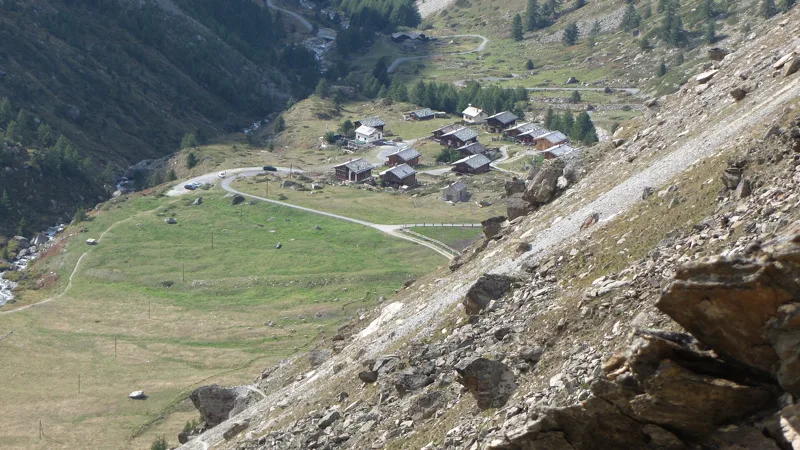
Täschalp, its pastures and its chapel
Around the 9th kilometre, the trail crosses the Täschalp, a hollow between the slopes of the Rothorn and the 4000-metre peaks of the Mischabel group. You'll find cows, alpine farming and a cheese dairy. A taxi comes up from Täsch three times a day.
The first chapel on the alp was probably built in 1654 at Stafulti; an avalanche destroyed it, and its foundations can still be seen. The second was swept away by an avalanche in the winter of 1915-1916. Today's chapel dates from 1922, and its feast is held every year on 6 August.
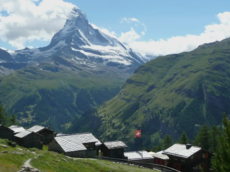
Tufteren, the Matterhorn, then Zermatt
In this direction you walk towards the Matterhorn, and you keep seeing its north face and the Hörnli ridge. Around the 15th kilometre you reach the hamlet of Tufteren, with its small wooden barns, the Gädini, set on stilts and round flat stones. Gnarled Swiss stone pines grow around it, and edelweiss grows close by, on the Flower Walk.
Then the long descent begins: the trail drops via Patrullarve, enters Zermatt around the 18th kilometre, goes through Oberhäusern, crosses the Matter Vispa and finishes close to the station. Further down this page: the next trains.
Every way to Zermatt
2 starting points to reach Zermatt. Pick yours: the 3D view shows it and “My day” recalculates.
Walking times without breaks. “Estimated” times are calculated on the terrain profile with a model fitted to the official stages; the shortest path may differ from the one on the yellow signposts: on the ground, follow the signs. Gradient: the steepest over 200 m of trail. Profiles share the same scale (length and altitude). Stations and car parks within 500 m of the start.
In pictures
The Charles Kuonen Suspension Bridge, Randa
The SkyWalk suspension bridge at Randa
The Europahütte
Old and new signposts of the Europaweg
Avalanche barriers on the Europaweg, from Grächen to Zermatt
Täschalp, Täsch (Valais)
Edelweiss on the Europaweg at Täschalp
A fox on the Europaweg, Zermatt
The hamlet of Tuftern above Zermatt
Central Zermatt and the Matter Vispa river, with the Matterhorn behind (August 2012)
Europaweg: Europahütte → Zermatt: when to go
Here the sun clears the ridge late, and the latest time to set off ranges from 13:37 in June to 8:58 in December.
- Sun at the start, mid-January
- from 11:29
- rises at 8:07, hidden by the ridge
- Leave by, for 6 h 45 of walking
- 9:24
- arrive 1 hour before sunset, at 17:09
| Month | Sun at the start | Leave by | In the sun, leaving at 9:00 | Bus |
|---|---|---|---|---|
| December | 11:36 → 16:43 | 8:58 | 41 % | |
| January | 11:29 → 17:09 | 9:24 | 53 % | |
| February | 10:52 → 17:54 | 10:09 | 69 % |
“In the sun”: the share of the path in sunlight under a clear sky, with the terrain worked out point by point. The path climbs to 2,348 m: today's snow and frost are in the weather and My day.
- Sun at the start, mid-April
- from 10:15
- rises at 6:43, hidden by the ridge
- Leave by, for 6 h 45 of walking
- 12:30
- arrive 1 hour before sunset, at 20:15
| Month | Sun at the start | Leave by | In the sun, leaving at 9:00 | Bus |
|---|---|---|---|---|
| March | 9:58 → 18:34 | 10:49 | 77 % | |
| April | 10:15 → 20:15 | 12:30 | 83 % | |
| May | 10:02 → 20:54 | 13:09 | 89 % |
“In the sun”: the share of the path in sunlight under a clear sky, with the terrain worked out point by point. The path climbs to 2,348 m: today's snow and frost are in the weather and My day.
- Sun at the start, mid-July
- from 10:02
- rises at 5:52, hidden by the ridge
- Leave by, for 6 h 45 of walking
- 13:32
- arrive 1 hour before sunset, at 21:17
| Month | Sun at the start | Leave by | In the sun, leaving at 9:00 | Bus |
|---|---|---|---|---|
| June | 9:49 → 21:22 | 13:37 | 92 % | |
| July | 10:02 → 21:17 | 13:32 | 90 % | |
| August | 10:18 → 20:39 | 12:54 | 84 % |
“In the sun”: the share of the path in sunlight under a clear sky, with the terrain worked out point by point. The path climbs to 2,348 m: today's snow and frost are in the weather and My day.
- Sun at the start, mid-October
- from 11:10
- rises at 7:46, hidden by the ridge
- Leave by, for 6 h 45 of walking
- 10:59
- arrive 1 hour before sunset, at 18:44
| Month | Sun at the start | Leave by | In the sun, leaving at 9:00 | Bus |
|---|---|---|---|---|
| September | 10:25 → 19:41 | 11:56 | 80 % | |
| October | 11:10 → 18:44 | 10:59 | 71 % | |
| November | 10:47 → 16:57 | 9:12 | 57 % |
“In the sun”: the share of the path in sunlight under a clear sky, with the terrain worked out point by point. The path climbs to 2,348 m: today's snow and frost are in the weather and My day.
The next few days
Local forecast, updated every hour
Reading the forecast…
My day
Pick your day and start time: everything updates.
- Arrival at Zermatt
- 15:15 6 h 45 of walking without breaks, starting at 08:30
The trail, kilometre by kilometre
From Europahütte
Places are listed under the kilometre where you pass them. Drag along the profile: the marker moves on the 3D view too.
- under 10 %
- 10 to 20 %
- 20 to 30 %
- over 30 %
- fountain or water point
- toilets
Around the trail (250 m): 55 restaurants, 7 cafés, 5 fountains and water points and 2 toilets. Estimated time: the official walking time spread by effort (1 km on the flat counts as 100 m of climbing), start time set in “My day”.
- under 10 %
- 10 to 20 %
- 20 to 30 %
- over 30 %
- fountain or water point
- toilets
Around the trail (250 m): 24 restaurants, 7 cafés, 5 fountains and water points and 7 toilets. Estimated time: the official walking time spread by effort (1 km on the flat counts as 100 m of climbing), start time set in “My day”.
Getting there and back
Back by public transport from the Zermatt stop
Next departures from ZermattReading the official timetable…
By car
From Europahütte
Careful, this is one way: public transport back arrives in Zermatt, not in Europahütte. Plan to get back to your car by public transport, or park at the finish and take public transport to the start.
Public car parks within 600 m of the start: prices and number of spaces may have changed, check the signs on site.
Careful, this is one way: public transport back arrives in Zermatt, not in Täsch. Plan to get back to your car by public transport, or park at the finish and take public transport to the start.
- Täscherhofpaid90 m from the start
- Station Täschor by public transport0 m from the start
The nearest car park and stop for this start. Check the signs on site for the price.
Questions people ask
How long is the hike from Europahütte to Zermatt?
6 h 45 of walking (official time), in this direction, not counting breaks. The other way: 7 h 30.
Is it hard?
Official rating for this stage: fitness difficult, technique medium. It is 1,650 m of descent over 19.5 km.
Can I get back by public transport?
Yes. The Zermatt stop is at the finish. The next departures show live under “Getting there and back”.
Where can I eat on the way?
63 places to eat within 250 m of the trail, including Europahütte, Täschalp Restaurant & Lodge, Tufternhütte. Where they are and their opening hours: below the profile.
Is there water and are there toilets on the way?
5 fountains and water points and 2 toilets within 250 m of the trail (survey of 25/10/2026).
Can I download the track?
Yes, as a GPX file for your watch or map app: “Download the track” button at the top of the page.
More hikes within 10 km
Official stages that pass within 10 km of this trail. Each card says whether its page is already up.
- © swisstopoZermatt, Furi → Zermatt1 h 10Furi-Weg5.0kmDistance20mAscent260mDescentTechnical difficultFitness medium. Official waymarked stage
- © swisstopoGrächen, loop3 h 50Zauberwasser-Weg Grächen14.0kmDistance440mAscent440mDescentTechnical easyFitness medium. Official waymarked stage
- © swisstopoGrächen → Gruben9 h 10Alpenpässe-Weg, stage 2122.0kmDistance1,950mAscent1,750mDescentTechnical mediumFitness difficult. Official waymarked stage
- © swisstopoSaas Fee → Grächen9 h 00Alpenpässe-Weg, stage 2020.0kmDistance1,300mAscent1,450mDescentTechnical mediumFitness difficult. Official waymarked stage
- © swisstopoSaas Fee → Grächen9 h 00Swiss Tour Monte Rosa, stage 120.0kmDistance1,300mAscent1,450mDescentTechnical mediumFitness difficult. Official waymarked stage
- © swisstopoGspon → Saas Fee5 h 50Alpenpässe-Weg, stage 1917.0kmDistance950mAscent1,000mDescentTechnical mediumFitness difficult. Official waymarked stage