
Hiking around the Gastlosen
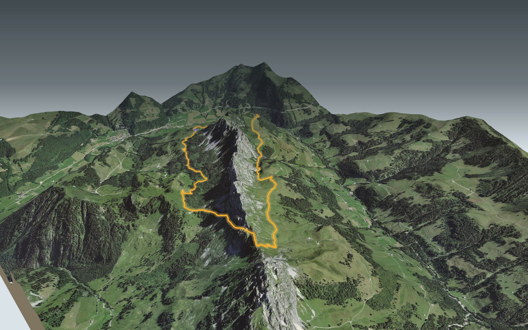
The Gastlosen are the chain of limestone peaks south of Jaun. On this loop, you start at the Musersbergli, at the top of the chairlift, pass the Chalet du Soldat, cross the ridge at the Wolfs Ort pass, then come back along the Bernese side and the Grat chalet. It is graded medium, for fitness as well as technique.
The path first drops a little through the pastures, then climbs through forest and alpine meadows to the Chalet du Soldat. After that it follows the slope, then reaches the ridge up to Wolfs Ort, the highest point. The elevation profile shows you where the real climbing is.
Three places to eat or drink: the Chalet du Soldat, the Grat chalet's buvette and the Musersbergli mountain hut, at the start and the finish. Before Wolfs Ort, on the ridge, the tourist description of the loop mentions an exposed section (read on 10.11.2026): go by the signposts and the conditions on the day, and plan your day before you set off.
To get up to the Musersbergli, take the bus to Jaun, Bergbahnen; from there, a short walk leads to the Gastlosenexpress chairlift. Check the next departures. Also in Gruyère: the Moléson ridge trail, and all the hikes in canton Fribourg.
The story of the trail
What happened where you are going to walk, chapter by chapter.
A loop across a cantonal border
You start at the Musersbergli, at 1,562 m, and come back to it. In between: 10.9 km, 780 m of climbing and the same going down. The official walking time is 4 h 00, whichever way round you go.
You ride up to the start on the Gastlosenexpress chairlift, opened in November 2011. Here the loop runs anticlockwise. Most of it lies in the Fribourg municipality of Jaun; on the ridge, shortly before the Wolfs Ort pass, it enters the Bernese municipality of Saanen, in the Abländschen area, then returns to the Fribourg side.
Via the Chalet du Soldat and Wolfs Ort
The path first heads down through the pastures, then becomes a mountain hiking trail and climbs through forest and alpine meadows. At km 3.4 you reach the Chalet du Soldat, at 1,752 m. There it turns left, follows the slope, then gains the Sattelspitzen ridge up to the Wolfs Ort pass: the highest point of the loop, at 1,927 m on the route.
On the far side, you go down through the Bernese pastures, follow the slope, then a stream. A track then climbs to the Grat chalet, at km 9.0, at 1,641 m. A descent through forest and pastures, then one last climb, bring you back to the Musersbergli.
A chalet built by the army
The Chalet du Soldat was never a dairy chalet. It was built for military purposes during the Second World War, at the instigation of the Swiss army and the mountain rifle battalion. Back then it was called the Chalet du Régiment, and it opened in 1945 as a training centre for the troops of canton Fribourg.
Later it opened up to other battalions, then to civilian climbers. Today it belongs to a private foundation, the Fondation chalet du Soldat de Fribourg, and has 80 beds in ten dormitories.
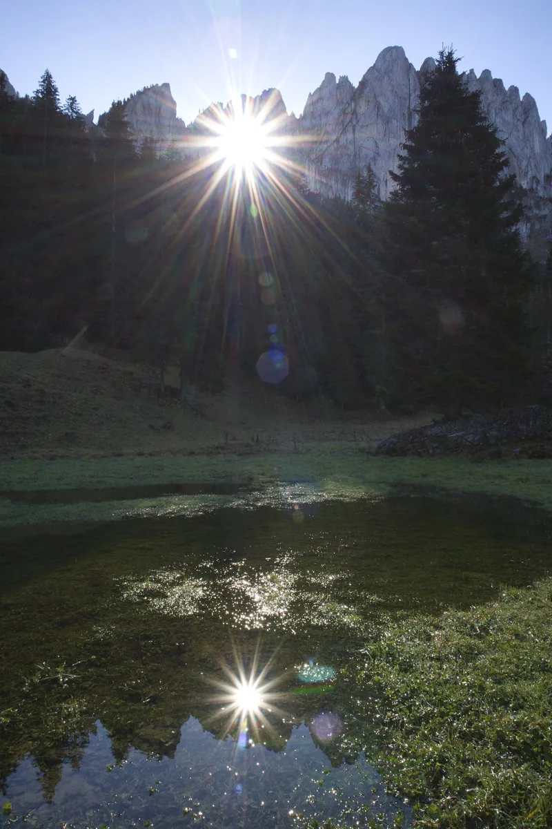
A tropical reef stood on end
The Gastlosen limestone formed 160 million years ago on a carbonate platform, like the ones you find today in the Bahamas. Over the last 30 million years it has been lifted and tilted upright: it now forms a slab resting on the flysch of the Upper Prealps, whose hills are more rounded. At the foot of the cliffs, many blocks have broken away through gravity and repeated freezing and thawing; water has carved grooves into them.
Close to the path, the Grossmutterloch, the 'grandmother's hole', goes right through the mountain. Legend says the devil, furious with his grandmother, threw her against the rock face. Geologists see it as the erosion of a fault that was already there.
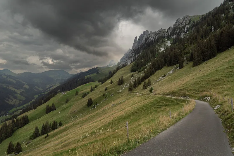
The 'inhospitable' mountains
The name Gastlosen can be translated as 'inhospitable'. In 1797 the writer Philippe-Sirice Bridel described them like this: 'Above Ablentsch rises an immense mass of rock, without a tree, without greenery, of the most frightful and most menacing kind!' They are also called the Dolomites of Saanen.
Jaun, Bellegarde in French, is the only German-speaking municipality in the Gruyère district; the hamlet of Abländschen, where the Bernese part of the loop runs, passed to Bern in 1555. At the end, the chairlift takes you back down to the valley. Further down the page you'll find where to eat and when the bus leaves.
In pictures
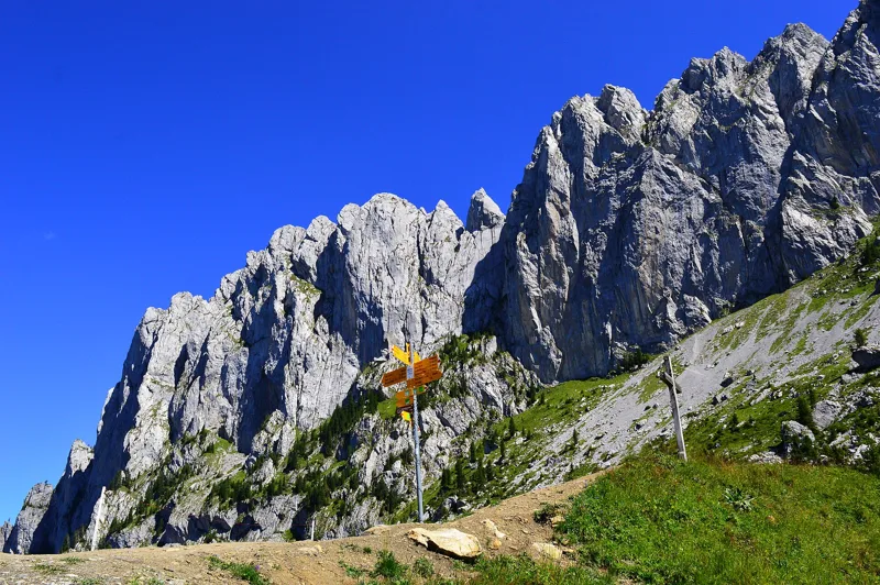
The Gastlosen near the Soldatenhaus
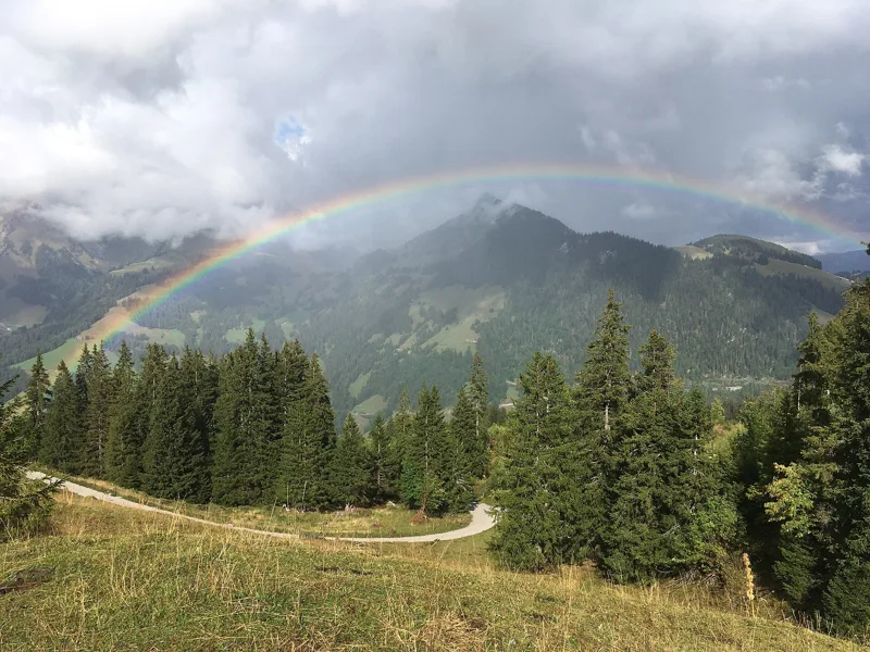
Rainbow over Jaun from the top of the Gastlosen Express
Sunlight through the Grossmutterloch near Unter Sattel
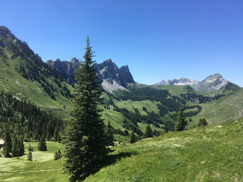
The Gastlosen seen from the Chalet du Soldat
The east side of the Gastlosen range, seen from the Grat chalet
The Gastlosen (right) and the Sattelspitzen (left), seen from the Jaun Pass
The Gastlosen limestone range, canton Fribourg
On the way to the Gastlosen, canton Fribourg
View of the Gastlosen
Salamander along the Gastlosen
What you see from the top
360° view from the highest point of the hike (1,927 m). 42 named peaks, including Petite Bosse, 87.3 km away. Swipe to look around.
Gastlosen Tour: when to go
The latest time to set off ranges from 16:26 in June to 11:44 in December.
- Sun at the start, mid-January
- from 13:29
- rises at 8:11, hidden by the ridge
- Leave by, for 4 h 00 of walking
- 12:09
- arrive 1 hour before sunset, at 17:09
| Month | Sun at the start | Leave by | In the sun, leaving at 9:00 | Bus |
|---|---|---|---|---|
| December | 13:24 → 16:44 | 11:44 | 40 % | |
| January | 13:29 → 17:09 | 12:09 | 42 % | |
| February | 12:23 → 17:55 | 12:55 | 50 % |
“In the sun”: the share of the path in sunlight under a clear sky, with the terrain worked out point by point. The path climbs to 1,927 m: today's snow and frost are in the weather and My day.
- Sun at the start, mid-April
- from 7:02
- rises at 6:44, hidden by the ridge
- Leave by, for 4 h 00 of walking
- 15:18
- arrive 1 hour before sunset, at 20:18
| Month | Sun at the start | Leave by | In the sun, leaving at 9:00 | Bus |
|---|---|---|---|---|
| March | 7:14 → 18:36 | 13:36 | 56 % | |
| April | 7:02 → 20:18 | 15:18 | 75 % | |
| May | 6:25 → 20:58 | 15:58 | 90 % |
“In the sun”: the share of the path in sunlight under a clear sky, with the terrain worked out point by point. The path climbs to 1,927 m: today's snow and frost are in the weather and My day.
- Sun at the start, mid-July
- from 6:31
- rises at 5:53, hidden by the ridge
- Leave by, for 4 h 00 of walking
- 16:21
- arrive 1 hour before sunset, at 21:21
| Month | Sun at the start | Leave by | In the sun, leaving at 9:00 | Bus |
|---|---|---|---|---|
| June | 6:21 → 21:26 | 16:26 | 97 % | |
| July | 6:31 → 21:21 | 16:21 | 93 % | |
| August | 6:47 → 20:42 | 15:42 | 82 % |
“In the sun”: the share of the path in sunlight under a clear sky, with the terrain worked out point by point. The path climbs to 1,927 m: today's snow and frost are in the weather and My day.
- Sun at the start, mid-October
- from 11:22
- rises at 7:48, hidden by the ridge
- Leave by, for 4 h 00 of walking
- 13:45
- arrive 1 hour before sunset, at 18:45
| Month | Sun at the start | Leave by | In the sun, leaving at 9:00 | Bus |
|---|---|---|---|---|
| September | 7:27 → 19:44 | 14:44 | 58 % | |
| October | 11:22 → 18:45 | 13:45 | 52 % | |
| November | 12:51 → 16:58 | 11:58 | 46 % |
“In the sun”: the share of the path in sunlight under a clear sky, with the terrain worked out point by point. The path climbs to 1,927 m: today's snow and frost are in the weather and My day.
The next few days
Local forecast, updated every hour
Reading the forecast…
My day
Pick your day and start time: everything updates.
- Arrival at Jaun, Musersbergli
- 12:30 4 h 00 of walking without breaks, starting at 08:30
The trail, kilometre by kilometre
Places are listed under the kilometre where you pass them. Drag along the profile: the marker moves on the 3D view too.
- under 10 %
- 10 to 20 %
- 20 to 30 %
- over 30 %
- fountain or water point
- toilets
Around the trail (250 m): 2 restaurants and 2 fountains and water points. Estimated time: the official walking time spread by effort (1 km on the flat counts as 100 m of climbing), start time set in “My day”.
Getting there and back
Jaun, Musersbergli, 1,562 m
By car
Park in Jaun, Musersbergli. It's a loop: you walk back to where you started, and so to your car.
Public car parks within 600 m of the start: prices and number of spaces may have changed, check the signs on site.
Questions people ask
How long does the loop from Jaun, Musersbergli take?
4 h 00 of walking (official time), in this direction, not counting breaks. The other way: 4 h 00.
Is it hard?
Official rating for this stage: fitness medium, technique medium. It is 780 m of climbing over 10.9 km.
Where can I eat on the way?
4 places to eat within 250 m of the trail, including Chalet Du Soldat, Chalet Grat, Bärghus Gastlosen. Where they are and their opening hours: below the profile.
Is there water and are there toilets on the way?
2 fountains and water points and 0 toilets within 250 m of the trail (survey of 25/10/2026).
Can I download the track?
Yes, as a GPX file for your watch or map app: “Download the track” button at the top of the page.
More hikes within 10 km
Official stages that pass within 10 km of this trail. Each card says whether its page is already up.
- Jaun → Soldatenhaus2 h 40Freiburger Voralpenweg, stage 46.0kmDistance800mAscent70mDescentTechnical easyFitness medium. Official waymarked stage
- © swisstopoSoldatenhaus → Château-d'Oex8 h 00Freiburger Voralpenweg, stage 524.0kmDistance1,100mAscent1,850mDescentTechnical mediumFitness difficult. Official waymarked stage
- Jaun → Gruyères6 h 00Alpenpanorama-Weg, stage 2122.0kmDistance500mAscent780mDescentTechnical easyFitness difficult. Official waymarked stage
- Schwarzsee → Jaun4 h 10Alpenpanorama-Weg, stage 2012.0kmDistance700mAscent740mDescentTechnical easyFitness medium. Official waymarked stage
- Schwarzsee → Jaun4 h 10Freiburger Voralpenweg, stage 312.0kmDistance700mAscent740mDescentTechnical easyFitness medium. Official waymarked stage
- Zweisimmen, Sparenmoos, loop4 h 45Hundsrügg-Panoramaweg15.0kmDistance780mAscent780mDescentTechnical mediumFitness medium. Official waymarked stage