
From Kandersteg to Adelboden over the Bunderchrinde
A proper pass crossing: you leave Kandersteg, climb towards the cliffs of the Lohner to the Bunderchrinde pass, then drop down the other side to Adelboden. This is stage 14 of the Via Alpina, the route that crosses the northern Swiss Alps in 20 one-day stages. It is rated difficult for fitness and medium for technique.
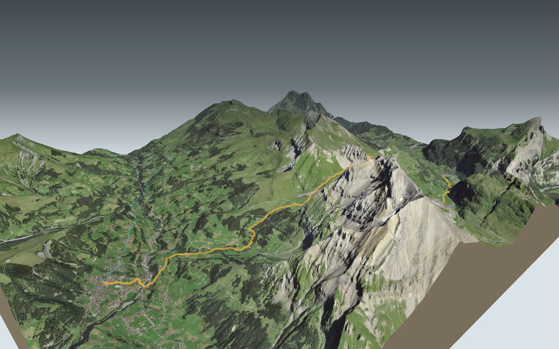
From the station the path goes through Kandersteg, crosses the Kander and runs past the international Scout centre. Then it climbs towards the Bergrestaurant Lohner and Usser Üschene, before a last slope through scree up to the pass. The elevation profile shows you where it gets steepest.
Want a shorter version? The start from Elsigbach, a bus stop north-east of Adelboden, reaches the village without crossing the pass: its colour in the 3D view and its estimated time are under all starting points. And the stage before, from Griesalp to Kandersteg over the Hohtürli, ends right where this one begins.
At the bottom: Adelboden and its church, built before 1433. Check the next departures and plan your day before you set off. The next day, the Via Alpina carries on from Adelboden to Lenk. Looking for more in the area? See all hikes in the Bernese Oberland.
The story of the trail
What happened where you are going to walk, chapter by chapter.
A pass between two valleys
You start at Kandersteg station, at 1,171 m, and finish in Adelboden village, at 1,348 m. In between: 16.2 km, 1,400 m of climbing and 1,250 m of descent, with the highest point at 2,383 m, on the Bunderchrinde. Allow 6 h 45 of walking time in this direction and 6 h 35 the other way.
The terrain is partly exposed and the path is marked white-red: you need to be sure-footed and wear good hiking boots. Patches of snow can cover parts of the path; follow the signposts and check the conditions on the day.
Kandersteg, the tunnel village
Kandersteg has only been a municipality in its own right since 1909; before that it was tied to Kandergrund. Tourism grew with the early days of mountaineering, from 1850 on: five hotels opened between 1855 and 1890, and there were nineteen by 1913. Building the Lötschberg railway, from 1906 to 1913, briefly sent the population soaring.
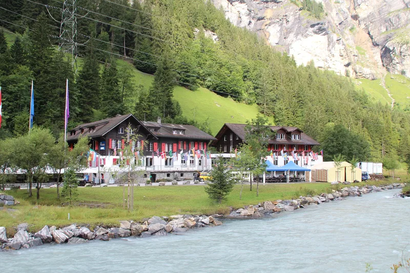
More than 3,000 tunnel workers lived in the village at the time. In 1908, so that the workers' children could go to school, the temperance society "La Temperanza" ran classes and provided simple housing for the families; a chalet was built on the banks of the Kander. Left empty once the tunnel opened, it was spotted in 1922 by the Swiss Chief Scout, Walther von Bonstetten. The international Scout centre opened there on 21 May 1923; your path runs right past it, just after the bridge over the Kander.
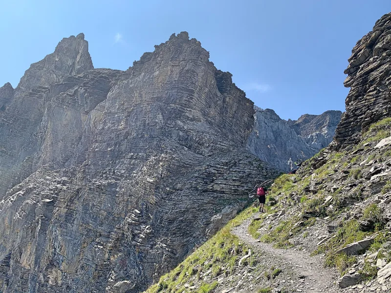
Below the Lohner, up to the Bunderchrinde
After Eggeschwand the climb begins in earnest. The path passes close to the Bergrestaurant Lohner, then through Usser Üschene, climbing towards the steep cliffs of the Lohner. Higher up, at Alpschelen, the alpine hut sells drinks to take away, but only while the cattle are up on the pasture, from early July to the end of August.
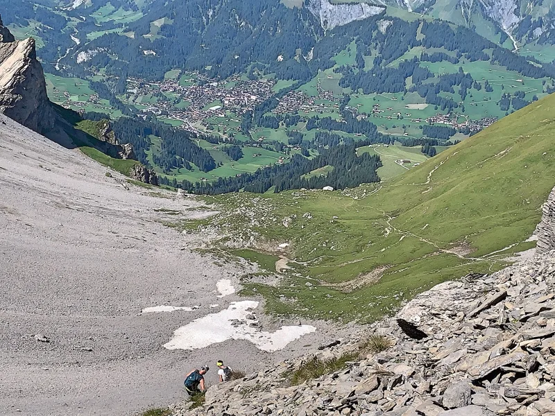
The last slope climbs through scree to the Bunderchrinde pass. At the top, the view drops down into the Adelboden valley, where the stage ends.
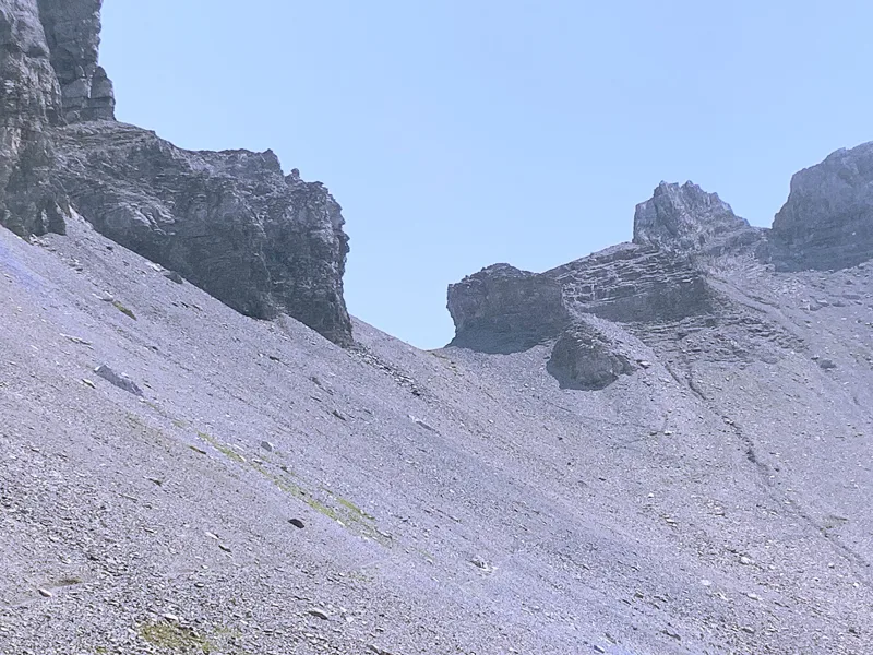
Limestone, scree and ibex
At the pass the rock is a siliceous limestone from the early Cretaceous, the Helvetic Kieselkalk, which forms brown rock walls. It holds fossil sponges, crinoids, brachiopods and sea urchins. Lower down, on the Kandersteg side, the path crosses a dark grey, almost black limestone that weathers yellowish: it dates from the late Jurassic and the very start of the Cretaceous.
Elsewhere you walk mostly on scree, on moraine left by the glaciers and on stream deposits. Keep your eyes open: if you look closely, you may see ibex.
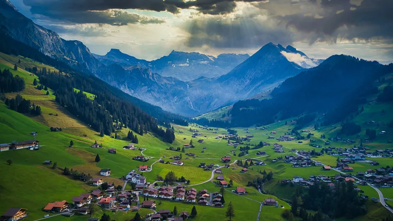
Bonderalp, the Entschlige and Adelboden
The descent on the other side is a long one. It goes through the Bonderalp, where there is a restaurant, then past Ahorni and through Bonderlen. At the bottom you cross the Entschlige, then a final climb takes you through Oey and Mühleport up to the village.
Adelboden was cleared and settled late. The village built its church before 1433 and became a parish in 1439. The road to Frutigen opened in 1884, the bus to Frutigen station in 1917, and tourism took off: the first hotel dates from 1887, and Adelboden has been a winter resort since 1901. Further down this page: the next departures.
Every way to Adelboden
2 starting points to reach Adelboden. Pick yours: the 3D view shows it and “My day” recalculates.
Walking times without breaks. “Estimated” times are calculated on the terrain profile with a model fitted to the official stages; the shortest path may differ from the one on the yellow signposts: on the ground, follow the signs. Gradient: the steepest over 200 m of trail. Profiles share the same scale (length and altitude). Stations and car parks within 500 m of the start.
In pictures
Adelboden seen from the Bunderchrinde pass
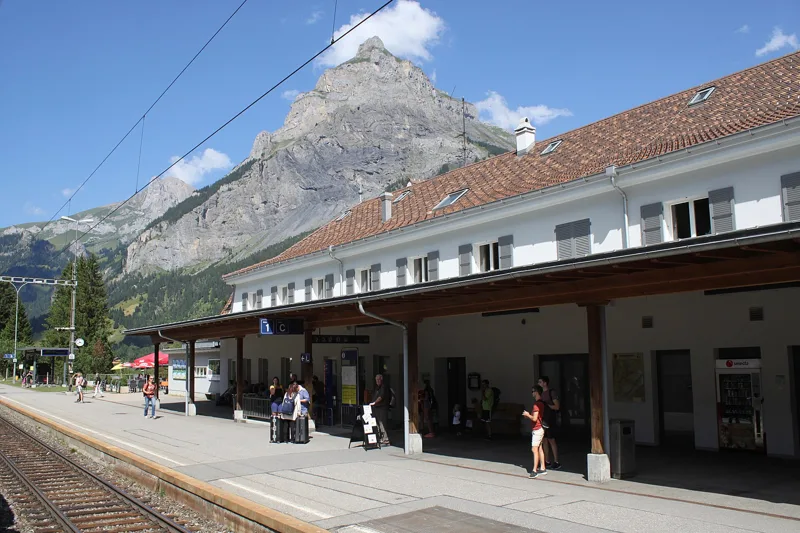
Kandersteg railway station, with the Bire in the background
Kandersteg International Scout Centre
Bunderchrinde, the last stretch before the top of the pass
The notch of the Bunderchrinde, in the centre of the picture
A curious cow on the approach to the Bunderchrinde pass
From the Bonderalp, looking down into the Bondertal and its waterfall
Adelboden, looking towards the Engstligenalp
The 15th-century church of Adelboden
Kandersteg → Adelboden: when to go
Public transport serves the start every day of the year, according to the official timetable. The latest time to set off ranges from 13:39 in June to 8:57 in December.
- Public transport to the start
- every day
- 53 to 73 arrivals a day
- first arrival 0:45, 0:46 or 5:47
- last 23:47
- Sun at the start, mid-January
- from 12:07
- rises at 8:09, hidden by the ridge
- Leave by, for 6 h 45 of walking
- 9:23
- arrive 1 hour before sunset, at 17:08
| Month | Sun at the start | Leave by | In the sun, leaving at 9:00 | Transport |
|---|---|---|---|---|
| December | 12:14 → 16:42 | 8:57 | 26 % | every day |
| January | 12:07 → 17:08 | 9:23 | 37 % | every day |
| February | 10:53 → 17:54 | 10:09 | 60 % | every day |
“In the sun”: the share of the path in sunlight under a clear sky, with the terrain worked out point by point. The path climbs to 2,383 m: today's snow and frost are in the weather and My day.
- Public transport to the start
- every day
- 53 to 85 arrivals a day
- first arrival 0:46
- last 23:47
- Sun at the start, mid-April
- from 8:27
- rises at 6:43, hidden by the ridge
- Leave by, for 6 h 45 of walking
- 12:31
- arrive 1 hour before sunset, at 20:16
| Month | Sun at the start | Leave by | In the sun, leaving at 9:00 | Transport |
|---|---|---|---|---|
| March | 9:18 → 18:34 | 10:49 | 76 % | every day |
| April | 8:27 → 20:16 | 12:31 | 88 % | every day |
| May | 7:18 → 20:56 | 13:11 | 100 % | every day |
“In the sun”: the share of the path in sunlight under a clear sky, with the terrain worked out point by point. The path climbs to 2,383 m: today's snow and frost are in the weather and My day.
- Public transport to the start
- every day
- 84 to 91 arrivals a day
- first arrival 0:46
- last 23:47
- Sun at the start, mid-July
- from 7:21
- rises at 5:51, hidden by the ridge
- Leave by, for 6 h 45 of walking
- 13:34
- arrive 1 hour before sunset, at 21:19
| Month | Sun at the start | Leave by | In the sun, leaving at 9:00 | Transport |
|---|---|---|---|---|
| June | 7:12 → 21:24 | 13:39 | 100 % | every day |
| July | 7:21 → 21:19 | 13:34 | 100 % | every day |
| August | 7:54 → 20:40 | 12:55 | 95 % | every day |
“In the sun”: the share of the path in sunlight under a clear sky, with the terrain worked out point by point. The path climbs to 2,383 m: today's snow and frost are in the weather and My day.
- Public transport to the start
- every day
- 53 to 91 arrivals a day
- first arrival 0:45, 0:46 or 0:59
- last 23:47
- Sun at the start, mid-October
- from 11:07
- rises at 7:47, hidden by the ridge
- Leave by, for 6 h 45 of walking
- 10:59
- arrive 1 hour before sunset, at 18:44
| Month | Sun at the start | Leave by | In the sun, leaving at 9:00 | Transport |
|---|---|---|---|---|
| September | 8:43 → 19:42 | 11:57 | 77 % | every day |
| October | 11:07 → 18:44 | 10:59 | 63 % | every day |
| November | 11:21 → 16:57 | 9:12 | 48 % | every day |
“In the sun”: the share of the path in sunlight under a clear sky, with the terrain worked out point by point. The path climbs to 2,383 m: today's snow and frost are in the weather and My day.
The next few days
Local forecast, updated every hour
Reading the forecast…
My day
Pick your day and start time: everything updates.
- Arrival at Adelboden
- 15:15 6 h 45 of walking without breaks, starting at 08:30
The trail, kilometre by kilometre
From Kandersteg
Places are listed under the kilometre where you pass them. Drag along the profile: the marker moves on the 3D view too.
- under 10 %
- 10 to 20 %
- 20 to 30 %
- over 30 %
- fountain or water point
- toilets
Around the trail (250 m): 24 restaurants, 1 café, 9 fountains and water points and 9 toilets. Estimated time: the official walking time spread by effort (1 km on the flat counts as 100 m of climbing), start time set in “My day”.
- under 10 %
- 10 to 20 %
- 20 to 30 %
- over 30 %
- fountain or water point
- toilets
Around the trail (250 m): 10 restaurants, 4 fountains and water points and 5 toilets. Estimated time: the official walking time spread by effort (1 km on the flat counts as 100 m of climbing), start time set in “My day”.
Getting there and back
Back by public transport from the Adelboden, Post stop
Next departures from Adelboden, PostReading the official timetable…
By car
From Kandersteg
Careful, this is one way: public transport back arrives in Adelboden, Post, not in Kandersteg. Plan to get back to your car by public transport, or park at the finish and take public transport to the start.
- Car park open-air, Umfahrungsstrassepaid110 m from the start
- Car park open-air, Aeussere Dorfstrassepaid200 m from the start
- Car park, Oeschistrassefree250 m from the start
Public car parks within 600 m of the start: prices and number of spaces may have changed, check the signs on site.
Careful, this is one way: public transport back arrives in Adelboden, Post, not in Elsigbach. Plan to get back to your car by public transport, or park at the finish and take public transport to the start.
- Car parkpaid20 m from the start
- Stop Elsigbachor by public transport10 m from the start
The nearest car park and stop for this start. Check the signs on site for the price.
Questions people ask
How long is the hike from Kandersteg to Adelboden?
6 h 45 of walking (official time), in this direction, not counting breaks. The other way: 6 h 35.
Is it hard?
Official rating for this stage: fitness difficult, technique medium. It is 1,400 m of climbing over 16.2 km.
Can I get back by public transport?
Yes. The Adelboden, Post stop is at the finish. The next departures show live under “Getting there and back”.
Where can I eat on the way?
25 places to eat within 250 m of the trail, including Schweizerhof, Adler, CAFE RESTAURANT AU VIEUX CHALET & Hotel. Where they are and their opening hours: below the profile.
Is there water and are there toilets on the way?
9 fountains and water points and 9 toilets within 250 m of the trail (survey of 25/10/2026).
Can I download the track?
Yes, as a GPX file for your watch or map app: “Download the track” button at the top of the page.
More hikes within 10 km
Official stages that pass within 10 km of this trail. Each card says whether its page is already up.
 Crans-Montana → Leukerbad7 h 40Walliser Sonnenweg, stage 124.0kmDistance1,150mAscent1,250mDescentTechnical mediumFitness difficult. See the hike
- © swisstopoElsigenalp → Adelboden3 h 15Höhenweg Elsigenalp–Adelboden10.0kmDistance400mAscent840mDescentTechnical mediumFitness medium. Official waymarked stage
- © swisstopoKandersteg, Bahnhof, loop0 h 55Wageti-Rundweg4.0kmDistance30mAscent30mDescentTechnical easyFitness medium. Official waymarked stage
- © swisstopoKiental → Kandersteg6 h 30Lötschberg-Panoramaweg, stage 120.0kmDistance1,150mAscent950mDescentTechnical mediumFitness difficult. Official waymarked stage
- © swisstopoKandersteg, Bahnhof, loop0 h 50Oeschigässli-Kander-Rundweg3.0kmDistance40mAscent40mDescentTechnical mediumFitness medium. Official waymarked stage
- © swisstopoSelden → Lauchernalp5 h 00Lötschberg-Panoramaweg, stage 311.0kmDistance1,300mAscent720mDescentTechnical mediumFitness difficult. Official waymarked stage