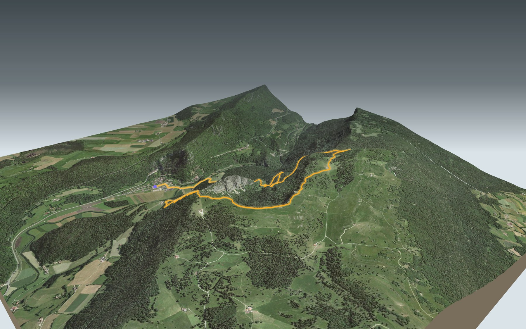

Hiking around the Creux du Van
The Creux du Van is the huge limestone cirque above the Val-de-Travers. This loop starts at Noiraigue station, climbs to the rim of the cliff, follows it, then drops back down past the Ferme Robert. It is rated medium for fitness and easy for technique.
You cross the Areuse, head up to Les Oeillons, then the Sentier des Quatorze Contours takes you to the Dos d'Âne and the rim of the cirque. The high point, at 1,458 m, is near Le Soliat. The elevation profile shows you where the climb is steepest.
On the way back you pass the Grand Vy, go down to the Ferme Robert and rejoin Noiraigue near the Areuse Gorge. Still got energy? The Sentier des Gorges de l'Areuse also starts in Noiraigue, and the Chemin de Chasseral takes you elsewhere in the Jura.
Noiraigue has a railway station: check the next trains and plan your day before you set off. Looking for more in the area? See all hikes in the Jura.
The story of the trail
What happened where you are going to walk, chapter by chapter.
A loop from the station and back
You start at Noiraigue station, at 729 m, and finish there too. In between: 14.6 km, 780 m of climbing and the same of descent, with a high point at 1,458 m. Allow 4 h 35 of walking, whichever way round you go.
This is official route 286, the Sentier du Creux du Van. In July 2020 the cantons of Neuchâtel and Vaud announced rope barriers to close off about half of the cliff-top path and let the trampled plants grow back. Respect them, and follow the signposts and the conditions on the day.
Les Oeillons and the Fourteen Bends
Shortly after the start, the path crosses the Areuse, then climbs to Les Oeillons, the first place to eat after the start.
Next, the Sentier des Quatorze Contours climbs to the Dos d'Âne, a ridge, then on to the rim of the cirque. Up there the path follows the cliff and passes near Le Soliat, where the loop reaches its highest point.
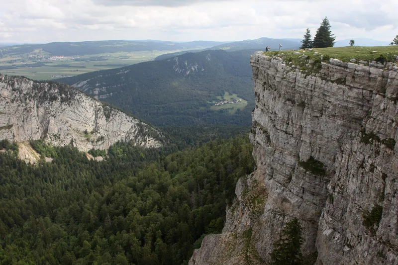
A cirque carved by water and ice
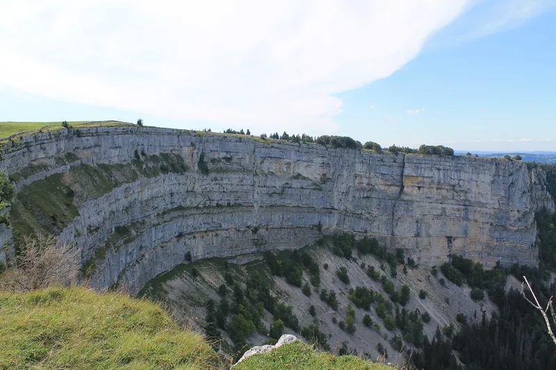
The Creux du Van is an erosion window: the rock has been worn away down to layers of Malm and Dogger. Water first cut along a major fault, then a local glacier enlarged and widened the cirque. Scree fringes the foot of the limestone walls.
The glacier's moraine pushed the Areuse northwards and dammed the valley, so for a while a lake formed in the Val-de-Travers. Under the scree, measurements have confirmed permafrost, one of the lowest still active in the early 2000s.
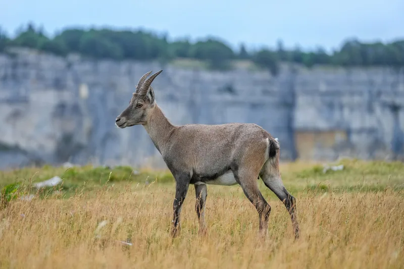
Switzerland's first nature reserve
In 1876 the Club Jurassien bought part of the cirque, the scree at its foot, from the parish of Saint-Aubin to make it a reserve where no tree would ever be felled. It is considered Switzerland's first nature reserve. A decree of 1960 formally created the Neuchâtel reserve and banned all hunting; the area is also a federal hunting-free zone.
At the end of the 1960s, 13 ibex were released here; in 2005, 5 more from the Valais strengthened the colony. The lynx was reintroduced in 1974 and 1975. In 2012 the canton counted 90 species of nesting birds here, including the peregrine falcon and the wallcreeper, as well as the Apollo butterfly. The ibex are wild animals: watch them from a distance.
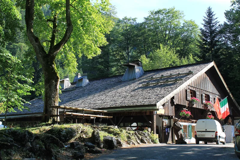
Grand Vy, Ferme Robert and Noiraigue
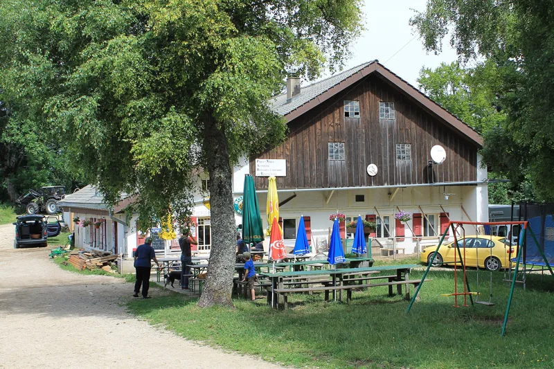
After the rim, the path reaches the Grand Vy, at 1,382 m, at km 7.7, where there is a restaurant. It then heads down past La Combettaz and the Châble de l'Eau to the Ferme Robert, at 970 m, at km 12.2: the last place to eat before Noiraigue.
The final stretch touches the Areuse Gorge and passes near Le Furcil. When the railway was built, beds of marl were uncovered at Noiraigue and worked by three lime and cement factories from 1861 to 1934; the tunnels of the Le Furcil factory were later used to grow button mushrooms, from 1935 to 1989. The village has had a station since 1860: the loop ends there, and further down this page you'll find the next departures.
In pictures
Creux du Van
Creux du Van, Les Oeillons
The Dos d'Âne at the Creux du Van.
The cliff of the Creux du Van.
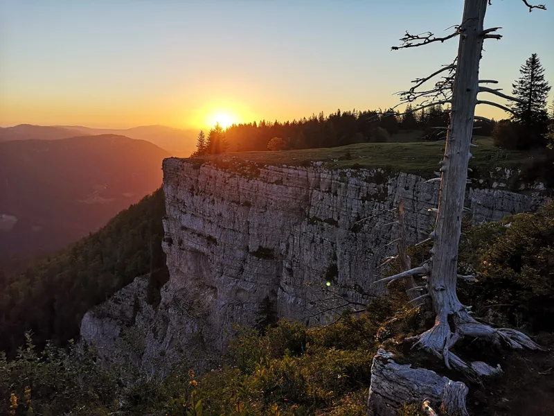
The Creux du Van at sunrise.
Wild female Alpine ibex at the Creux du Van.
The Ponts-de-Martel valley seen from the Creux du Van.
Creux du Van, the Ferme Robert
The back of the Ferme Robert.
The Areuse at Noiraigue.
What you see from the top
360° view from Le Soliat (1,458 m). 26 named peaks, including Mont Blanc, 122.6 km away. Swipe to look around.
Sentier du Creux du Van: when to go
Public transport serves the start every day of the year, according to the official timetable. Here the sun clears the ridge late, and the latest time to set off ranges from 15:55 in June to 11:09 in December.
- Public transport to the start
- every day
- 43 to 59 arrivals a day
- first arrival 0:03 or 6:53
- last 23:53
- Sun at the start, mid-January
- from 10:28
- rises at 8:14, hidden by the ridge
- Leave by, for 4 h 35 of walking
- 11:35
- arrive 1 hour before sunset, at 17:10
| Month | Sun at the start | Leave by | In the sun, leaving at 9:00 | Transport |
|---|---|---|---|---|
| December | 13:40 → 16:44 | 11:09 | 26 % | every day |
| January | 10:28 → 17:10 | 11:35 | 32 % | every day |
| February | 8:56 → 17:57 | 12:22 | 58 % | every day |
“In the sun”: the share of the path in sunlight under a clear sky, with the terrain worked out point by point. The path climbs to 1,458 m: today's snow and frost are in the weather and My day.
- Public transport to the start
- every day
- 44 to 59 arrivals a day
- first arrival 0:03
- last 23:53
- Sun at the start, mid-April
- from 7:54
- rises at 6:46, hidden by the ridge
- Leave by, for 4 h 35 of walking
- 14:46
- arrive 1 hour before sunset, at 20:21
| Month | Sun at the start | Leave by | In the sun, leaving at 9:00 | Transport |
|---|---|---|---|---|
| March | 7:38 → 18:38 | 13:03 | 94 % | every day |
| April | 7:54 → 20:21 | 14:46 | 100 % | every day |
| May | 7:50 → 21:01 | 15:26 | 100 % | every day |
“In the sun”: the share of the path in sunlight under a clear sky, with the terrain worked out point by point. The path climbs to 1,458 m: today's snow and frost are in the weather and My day.
- Public transport to the start
- every day
- 44 to 59 arrivals a day
- first arrival 0:03
- last 23:53
- Sun at the start, mid-July
- from 8:03
- rises at 5:53, hidden by the ridge
- Leave by, for 4 h 35 of walking
- 15:50
- arrive 1 hour before sunset, at 21:25
| Month | Sun at the start | Leave by | In the sun, leaving at 9:00 | Transport |
|---|---|---|---|---|
| June | 7:58 → 21:30 | 15:55 | 100 % | every day |
| July | 8:03 → 21:25 | 15:50 | 100 % | every day |
| August | 7:58 → 20:45 | 15:10 | 100 % | every day |
“In the sun”: the share of the path in sunlight under a clear sky, with the terrain worked out point by point. The path climbs to 1,458 m: today's snow and frost are in the weather and My day.
- Public transport to the start
- every day
- 44 to 59 arrivals a day
- first arrival 0:03 or 0:05
- last 23:53
- Sun at the start, mid-October
- from 9:01
- rises at 7:51, hidden by the ridge
- Leave by, for 4 h 35 of walking
- 13:12
- arrive 1 hour before sunset, at 18:47
| Month | Sun at the start | Leave by | In the sun, leaving at 9:00 | Transport |
|---|---|---|---|---|
| September | 7:55 → 19:46 | 14:11 | 97 % | every day |
| October | 9:01 → 18:47 | 13:12 | 65 % | every day |
| November | 9:24 → 16:59 | 11:24 | 36 % | every day |
“In the sun”: the share of the path in sunlight under a clear sky, with the terrain worked out point by point. The path climbs to 1,458 m: today's snow and frost are in the weather and My day.
The next few days
Local forecast, updated every hour
Reading the forecast…
My day
Pick your day and start time: everything updates.
- Arrival at Noiraigue
- 13:05 4 h 35 of walking without breaks, starting at 08:30
The trail, kilometre by kilometre
Places are listed under the kilometre where you pass them. Drag along the profile: the marker moves on the 3D view too.
- under 10 %
- 10 to 20 %
- 20 to 30 %
- over 30 %
- fountain or water point
- toilets
Around the trail (250 m): 4 restaurants, 4 fountains and water points and 3 toilets. Estimated time: the official walking time spread by effort (1 km on the flat counts as 100 m of climbing), start time set in “My day”.
Getting there and back
Back by public transport from the Noiraigue, gare stop
Next departures from Noiraigue, gareReading the official timetable…
By car
Park in Noiraigue. It's a loop: you walk back to where you started, and so to your car.
- Parking des Courtonsopen-air · paid120 m from the start
- Parking du Devinsopen-air · paid430 m from the start
- Car park open-air, Rue du Templefree20 m from the start
- Car park open-air, Rue des Tilleulspaid20 m from the start
Public car parks within 600 m of the start: prices and number of spaces may have changed, check the signs on site.
Questions people ask
How long does the loop from Noiraigue take?
4 h 35 of walking (official time), in this direction, not counting breaks. The other way: 4 h 35.
Is it hard?
Official rating for this stage: fitness medium, technique easy. It is 780 m of climbing over 14.6 km.
Can I get back by public transport?
Yes. The Noiraigue, gare stop is at the finish. The next departures show live under “Getting there and back”.
Where can I eat on the way?
4 places to eat within 250 m of the trail, including L'Auberge de Noiraigue, La Grand Vy, Grand Vy. Where they are and their opening hours: below the profile.
Is there water and are there toilets on the way?
4 fountains and water points and 3 toilets within 250 m of the trail (survey of 25/10/2026).
Can I download the track?
Yes, as a GPX file for your watch or map app: “Download the track” button at the top of the page.
More hikes within 10 km
Official stages that pass within 10 km of this trail. Each card says whether its page is already up.
- Noiraigue → La Combaz5 h 10Jura-Höhenweg, stage 1017.0kmDistance950mAscent440mDescentTechnical easyFitness difficult. Official waymarked stage
- Vue des Alpes → Noiraigue6 h 45Jura-Höhenweg, stage 922.0kmDistance860mAscent1,400mDescentTechnical easyFitness difficult. Official waymarked stage
- Travers, loop2 h 10Chemin de l'Areuse9.0kmDistance50mAscent50mDescentTechnical easyFitness difficult. Official waymarked stage
- La Brévine → Môtiers4 h 10La Vy aux Moines15.0kmDistance400mAscent700mDescentTechnical easyFitness medium. Official waymarked stage
- La Combaz → Ste-Croix4 h 25Jura-Höhenweg, stage 1114.0kmDistance640mAscent800mDescentTechnical easyFitness medium. Official waymarked stage
- Les Hauts Geneveys → La Sagne3 h 50Sentier des Statues12.0kmDistance680mAscent600mDescentTechnical easyFitness medium. Official waymarked stage