
Walking the Schwyberg loop
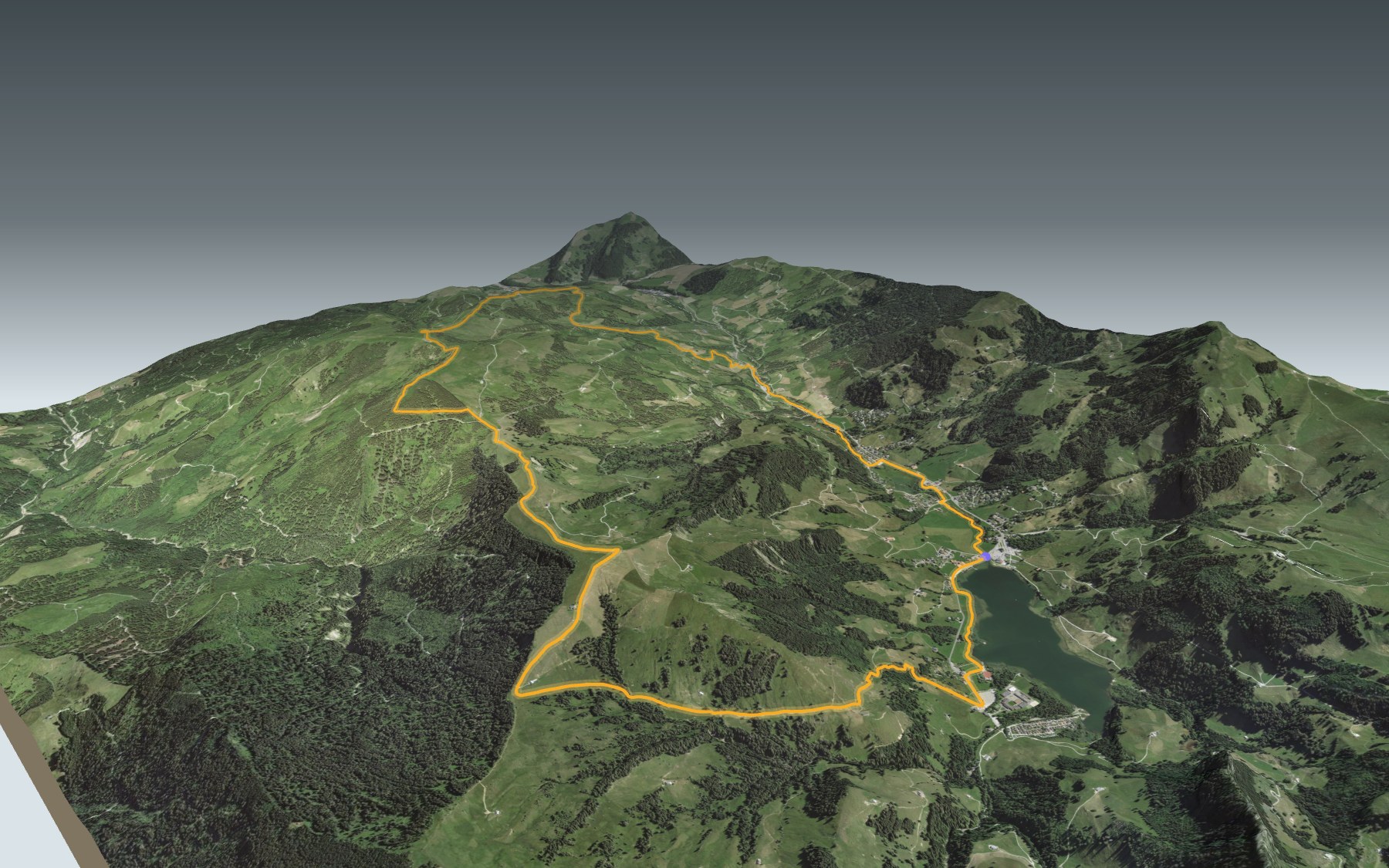
The big Schwarzsee loop, from the lake French speakers call Lac Noir: you start on the shore, climb onto the Schwyberg ridge, follow it to Gross Schwyberg, then head down via the Gurli and back to the lake along the Warme Sense. It is rated difficult for fitness and medium for technique: 18.3 km, 900 m of climbing and the same going down.
The first stretch follows the shore to Schwarzsee Bad. Then the climb crosses the Guglerenvorsass pastures and tackles the Fuchses Schwyberg ridge. The Schwyberg summit, at 1,645 m, is the highest point of the loop. The elevation profile shows you where it gets steepest.
Two stops up high: the Gross Schwyberg alp, just past the summit, and the Berghaus Gurli, a little lower. The path then drops towards the hamlet of Holzena, then Lichtena. The Breccaschlund-Panoramaweg also ends at the Gypsera, your starting point.
The Schwarzsee, Gypsera and Schwarzsee, Campus bus stops are along the route. Check the next departures and plan your day before you set off. Fancy something else nearby? All the hikes in Fribourg and Gruyère.
The story of the trail
What happened where you are going to walk, chapter by chapter.
From the lake to the ridge and back
You start at 1,046 m, on the shore of the Schwarzsee (Lac Noir in French), and that is where you finish. In between: 18.3 km, 900 m of climbing and 900 m of descent. Allow 5 h 45 of walking, whichever way round you go.
The path first follows the shore, passes the Schwarzseeturm, a wildlife-watching tower, then Schwarzsee Bad. It climbs through the Guglerenvorsass pastures to the Fuchses Schwyberg hut, at 1,555 m, and follows the ridge to the Schwyberg summit, at 1,645 m. After the Gross Schwyberg alp, the descent runs via the Berghaus Gurli, the hamlet of Holzena and Lichtena.
A lake born from a landslide
The Schwarzsee formed around 5000 to 4000 BC, after landslides at the foot of the Kaiseregg. It covers 0.45 km². A text from 1355 calls it "zem swartzen sew". In the Middle Ages it belonged to the lordships of Bellegarde (Jaun) and Planfayon (Plaffeien). Its outflow is the Warme Sense, the river you walk beside at the end of the loop.
Tourism began with sulphur water. Peter Schuwey found a spring in 1717 and built the first bath house in 1784. A landslide destroyed it completely in 1804; the brothers Jakob and Franz Blanc rebuilt it in 1810, where the Hotel Bad stands today. A road was built in 1826. The Gypsera takes its name from the local gypsum deposits: the inn, near the old gypsum mill where the lake drains, has been run since the early 20th century. And why "black"? Legend has it that the giant Gargantua washed his feet in the lake.
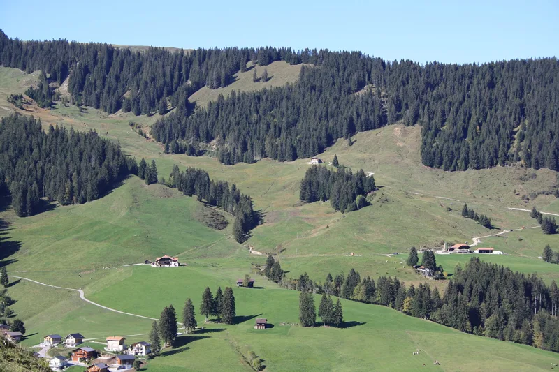
Along the back of the Schwyberg
Between the Fuchses Schwyberg ridge and Gross Schwyberg, the view goes a long way: the summit of the Kaiseregg, and even the Poya bridge in Fribourg. From the alp, you look north over the city and countryside of Fribourg to the lakes of Murten, Neuchâtel and Biel, with the Jura range and the Chasseral on the horizon. To the east you can pick out the Gantrisch range and, behind it, the Bernese Alps.
The Gross Schwyberg alp, at 1,591 m, serves food in summer and you can stay the night: its dormitory sleeps up to 30 people. It has almost a hundred years of history behind it; on site you can learn about the Schwyberg mountain cooperative, on a mountain once called Schweinsberg; not far from the hut, a plaque remembers the mule "Wolf". Every autumn, at the désalpe, hundreds of cows and goats come back down to the valley after four months on the pastures above the lake.
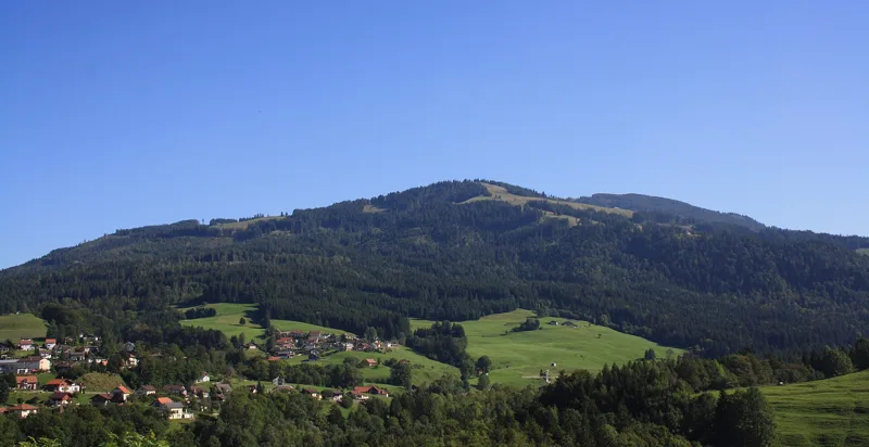
Flysch and slipping ground
For a good part of the way, the rock is Gurnigel flysch: limy sandstones, sometimes breccias or conglomerates, alternating with thin layers of marl. These rocks were laid down between the Maastrichtian, at the end of the Cretaceous, and the Lutetian, in the Eocene. The geological map shows several landslide and subsidence zones along the route.
The lake, the Berghaus Gurli and the return along the Warme Sense are inside the Gantrisch Nature Park, a park of national importance. Shortly before the end, the path crosses the Rohrmoos, listed in the federal inventory of fens of national importance.
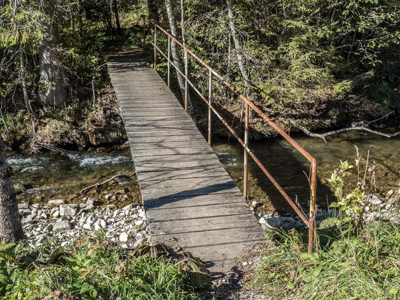
Back along the Warme Sense
After the alp, an easy descent leads to the Berghaus Gurli, at 1,422 m, a mountain restaurant facing the Fribourg and Bernese Alps. The path then follows the signs to the hamlet of Holzena and on to Lichtena.
The last section, up and down, follows the Warme Sense upstream through Tromooserli and Rohrmatta, back to the lake and the Gypsera. There are plenty of benches along the way for a breather. Several bus stops lie along the route; further down the page you will find the next departures.
In pictures
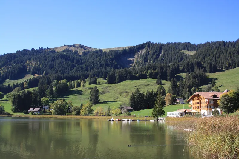
The Schwarzsee (Lac Noir) and the Schwyberg
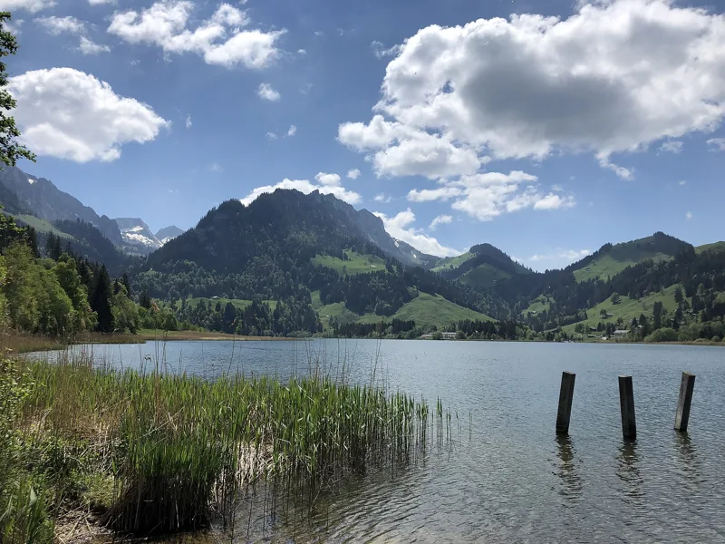
The Schwarzsee (Lac Noir) from its north-east shore, 17 May 2020
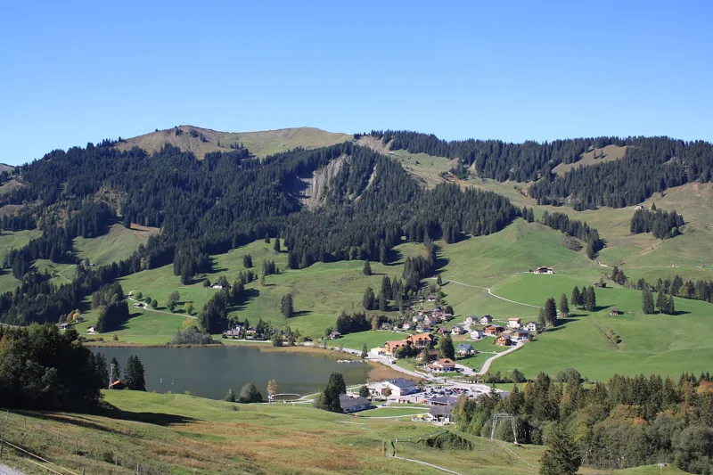
The hamlet of Schwarzsee, the lake and the Schwyberg
The Schwyberg
The Schwyberg
The Schwyberg seen from Plasselb
The Schwarzsee (Lac Noir)
The Schwarzsee (Lac Noir) on a Sunday afternoon walk
Tromooserli footbridge over the Warme Sense, Schwarzsee
Burstera footbridge over the Warme Sense, Schwarzsee
What you see from the top
360° view from Schwyberg (1,645 m). 22 named peaks, including Finsteraarhorn, 68 km away. Swipe to look around.
The Schwyberg loop from the Schwarzsee (Lac Noir): when to go
The bus runs up to the start every day of the year, according to the official timetable. The latest time to set off ranges from 14:41 in June to 9:58 in December.
- Bus to the start
- every day
- 42 to 62 buses a day
- first bus 5:53, 6:22 or 6:53
- last 23:04 or 23:30
- Sun at the start, mid-January
- from 10:43
- rises at 8:11, hidden by the ridge
- Leave by, for 5 h 45 of walking
- 10:24
- arrive 1 hour before sunset, at 17:09
| Month | Sun at the start | Leave by | In the sun, leaving at 9:00 | Bus |
|---|---|---|---|---|
| December | 11:04 → 16:43 | 9:58 | 88 % | every day |
| January | 10:43 → 17:09 | 10:24 | 88 % | every day |
| February | 9:51 → 17:55 | 11:10 | 92 % | every day |
“In the sun”: the share of the path in sunlight under a clear sky, with the terrain worked out point by point. The path climbs to 1,645 m: today's snow and frost are in the weather and My day.
- Bus to the start
- every day
- 58 to 62 buses a day
- first bus 5:53 or 6:22
- last 23:30
- Sun at the start, mid-April
- from 8:32
- rises at 6:44, hidden by the ridge
- Leave by, for 5 h 45 of walking
- 13:33
- arrive 1 hour before sunset, at 20:18
| Month | Sun at the start | Leave by | In the sun, leaving at 9:00 | Bus |
|---|---|---|---|---|
| March | 8:28 → 18:36 | 11:51 | 100 % | every day |
| April | 8:32 → 20:18 | 13:33 | 100 % | every day |
| May | 7:09 → 20:58 | 14:13 | 100 % | every day |
“In the sun”: the share of the path in sunlight under a clear sky, with the terrain worked out point by point. The path climbs to 1,645 m: today's snow and frost are in the weather and My day.
- Bus to the start
- every day
- 58 to 62 buses a day
- first bus 5:53 or 6:22
- last 23:30
- Sun at the start, mid-July
- from 6:58
- rises at 5:52, hidden by the ridge
- Leave by, for 5 h 45 of walking
- 14:36
- arrive 1 hour before sunset, at 21:21
| Month | Sun at the start | Leave by | In the sun, leaving at 9:00 | Bus |
|---|---|---|---|---|
| June | 6:43 → 21:26 | 14:41 | 100 % | every day |
| July | 6:58 → 21:21 | 14:36 | 100 % | every day |
| August | 7:55 → 20:42 | 13:57 | 100 % | every day |
“In the sun”: the share of the path in sunlight under a clear sky, with the terrain worked out point by point. The path climbs to 1,645 m: today's snow and frost are in the weather and My day.
- Bus to the start
- every day
- 50 to 62 buses a day
- first bus 5:53, 6:22 or 6:53
- last 23:04 or 23:30
- Sun at the start, mid-October
- from 9:44
- rises at 7:48, hidden by the ridge
- Leave by, for 5 h 45 of walking
- 12:00
- arrive 1 hour before sunset, at 18:45
| Month | Sun at the start | Leave by | In the sun, leaving at 9:00 | Bus |
|---|---|---|---|---|
| September | 8:59 → 19:44 | 12:59 | 100 % | every day |
| October | 9:44 → 18:45 | 12:00 | 91 % | every day |
| November | 9:53 → 16:58 | 10:13 | 90 % | every day |
“In the sun”: the share of the path in sunlight under a clear sky, with the terrain worked out point by point. The path climbs to 1,645 m: today's snow and frost are in the weather and My day.
The next few days
Local forecast, updated every hour
Reading the forecast…
My day
Pick your day and start time: everything updates.
- Arrival at Schwarzsee
- 14:15 5 h 45 of walking without breaks, starting at 08:30
The trail, kilometre by kilometre
Places are listed under the kilometre where you pass them. Drag along the profile: the marker moves on the 3D view too.
- under 10 %
- 10 to 20 %
- 20 to 30 %
- over 30 %
- fountain or water point
- toilets
Around the trail (250 m): 5 restaurants, 3 cafés, 1 fountain or water point and 2 toilets. Estimated time: the official walking time spread by effort (1 km on the flat counts as 100 m of climbing), start time set in “My day”.
Getting there and back
Back by public transport from the Schwarzsee, Gypsera stop
Next departures from Schwarzsee, GypseraReading the official timetable…
By car
Park in Schwarzsee. It's a loop: you walk back to where you started, and so to your car.
Public car parks within 600 m of the start: prices and number of spaces may have changed, check the signs on site.
Questions people ask
How long does the loop from Schwarzsee take?
5 h 45 of walking (official time), in this direction, not counting breaks. The other way: 5 h 45.
Is it hard?
Official rating for this stage: fitness difficult, technique medium. It is 900 m of climbing over 18.3 km.
Can I get back by public transport?
Yes. The Schwarzsee, Gypsera stop is at the finish. The next departures show live under “Getting there and back”.
Where can I eat on the way?
11 places to eat within 250 m of the trail, including SchwarzseeStärn, Gypsera, Hostellerie am Schwarzsee. Where they are and their opening hours: below the profile.
Is there water and are there toilets on the way?
1 fountain or water point and 2 toilets within 250 m of the trail (survey of 25/10/2026).
Can I download the track?
Yes, as a GPX file for your watch or map app: “Download the track” button at the top of the page.
More hikes within 10 km
Official stages that pass within 10 km of this trail. Each card says whether its page is already up.
- Guggisberg → Schwarzsee4 h 50Alpenpanorama-Weg, stage 1916.0kmDistance660mAscent740mDescentTechnical easyFitness medium. Official waymarked stage
- Plaffeien → Schwarzsee2 h 45Freiburger Voralpenweg, stage 210.0kmDistance340mAscent140mDescentTechnical easyFitness easy. Official waymarked stage
- Schwarzsee, loop1 h 00Schwarzsee Rundweg4.0kmDistance50mAscent50mDescentTechnical mediumFitness difficult. Official waymarked stage
- Schwarzsee → Jaun4 h 10Alpenpanorama-Weg, stage 2012.0kmDistance700mAscent740mDescentTechnical easyFitness medium. Official waymarked stage
- Schwarzsee → Jaun4 h 10Freiburger Voralpenweg, stage 312.0kmDistance700mAscent740mDescentTechnical easyFitness medium. Official waymarked stage
- Plaffeien (Zollhaus) → Gurnigelbad7 h 00Gantrisch-Panoramaweg21.0kmDistance1,300mAscent1,000mDescentTechnical easyFitness difficult. Official waymarked stage