
Crossing the Randa suspension bridge on foot
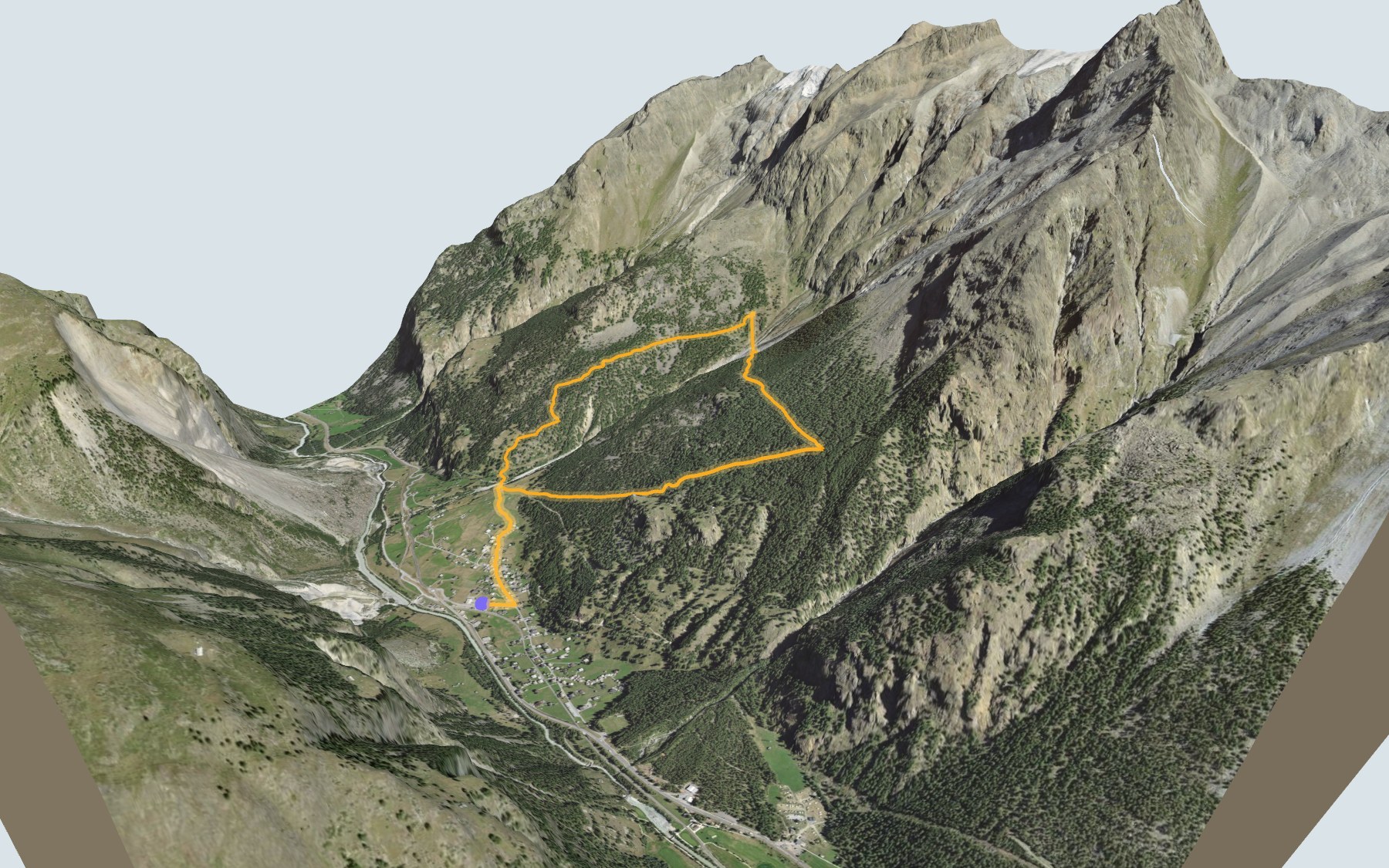
A short loop, but a steep one: you start in the village of Randa, in the valley that leads to Zermatt, climb through the forest to the Charles Kuonen suspension bridge, cross it, then walk back down to the village on the other side of the Grabengufer. SwitzerlandMobility rates it medium for both fitness and technique.
The climb goes through the Walden area and past the Hotschugga viewpoint before reaching the bridge. Zermatt Tourism calls it the longest pedestrian suspension bridge in the Alps. It helps to have a head for heights. The elevation profile shows you where it gets steepest.
Before you set off, check the status of the bridge and the trail with the municipality of Randa and on the Europaweg website, and look at the conditions on the day: you cross the bridge on foot, on a see-through grid floor. Plan your day to work out when to start.
On the way back, the loop passes St. Sebastian's church again and ends at Randa station. Check the next departures from Randa. In the same valley, there's the 5-Seenweg above Zermatt; further east there's the Gemsweg in Saas-Fee. See all hikes in Valais.
The story of the trail
What happened where you are going to walk, chapter by chapter.
One loop, one bridge at the top
You start in Randa at 1,410 m and finish there too. In between: 7.0 km, 700 m of climbing and the same amount of descent according to SwitzerlandMobility, which gives 3 h 10 of walking time in either direction. The highest point, at 2,084 m, is right at the end of the bridge.
For food, everything is in the village: the Hotel Klein Matterhorn Restaurant at the start, then Treff 494 and Restaurant Ulpenrose just after. Higher up you won't pass any other place to eat near the path, so bring food and something to drink. On the way, follow the signposts and check the conditions on the day.
Through the larches to the bridge
The path leaves the village and climbs into a larch forest. For most of the climb it runs through the Walden area, and after about two kilometres it passes the Hotschugga viewpoint. Then it comes out onto the bridge, which it crosses roughly halfway round the loop.
The bridge is four hundred and ninety-four metres long, up to eighty-five metres above the Grabengufer, with a walkway 65 cm wide. It is made of steel cable and wire mesh, so you can see straight down through it. Allow just under ten minutes to cross. It helps to have a head for heights, and stay off the bridge in a thunderstorm. Halfway across, you get a view of the Weisshorn.
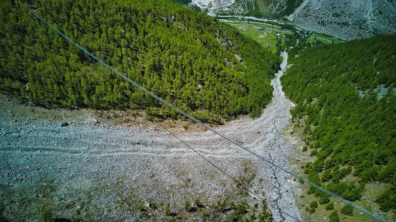
A bridge to stitch the Europaweg back together
The bridge is part of the Europaweg; this two-day trail between Grächen and Zermatt was created in 1997 by the municipalities of St. Niklaus, Grächen, Randa, Täsch and Zermatt. In 2010 the existing suspension bridge at the Grabengufer, above Randa, was damaged and then closed. Hikers had to take a tiring detour or give up on the trek before the end.
Geological reports showed that a new bridge could be built a little lower down, between Lärchberg and Höüschbiel. The bridge was to cost 750,000 Swiss francs and the municipalities were looking for sponsors to fund it: an individual could sponsor one metre of bridge for 1,000 francs and get a small plaque with their name on it. The bridge is named after its main sponsor, Charles Kuonen. The Swiss company swissrope built it in two and a half months, and it opened in 2017. After the bridge, you can make a detour to the Europahütte mountain hut.
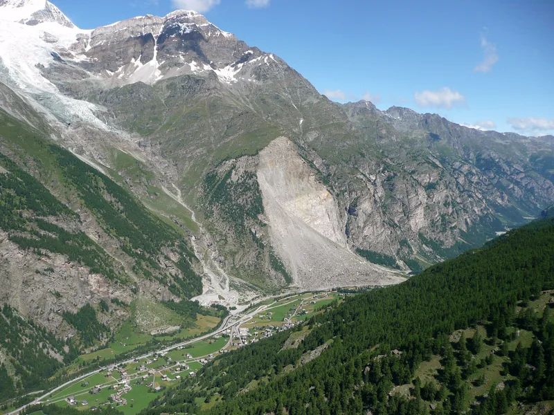
When the mountain came down
In 1991, three rockslides broke away from the Längenfluhberg: about 15 million m³ of rock on 18 April, 100,000 m³ on 21 April and 33 million m³ on 9 May. The Vispa river was dammed, and part of the village flooded in July and August 1991. No one was hurt, but 35 sheep and seven horses died. The rockslide also buried the hamlet of Unterlerch. In the local dialect, "Gufer" means a scree slope: the debris cone is called the Grossgufer.
The municipality of Randa tells this story in an exhibition opened on 6 October 2018, in an old village barn whose windows, doors and floors were redone entirely in larch. It points out that the larch, "the pioneer tree of the Alps", is now growing back over the huge debris cones. Earlier still, Randa was hit several times by ice falls from the Bies glacier, notably in 1636, 1720, 1737 and 1819.
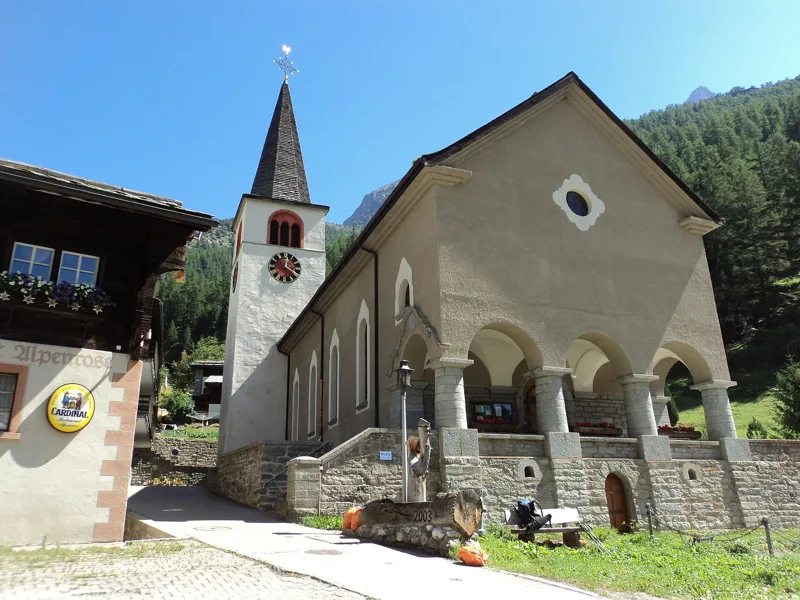
Back to St. Sebastian's
The descent brings you back to the village past the spots called Gere and Jungholz. The loop passes St. Sebastian's church just after the start and again near the end. The church dates from 1716, was enlarged in 1927 and houses a precious Baroque high altar by Anton Sigristen.
Randa, on the road to Zermatt, opened up to tourism after 1850: the first hotel dates from 1860-1861, and the village soon had nearly thirty mountain guides. The municipality notes that the summit of the Dom is the highest point of its territory, and counts the Dom and the Weisshorn among the best-known 4000ers of the Valais Alps. The loop ends near Randa station; further down the page you'll find the next departures.
In pictures
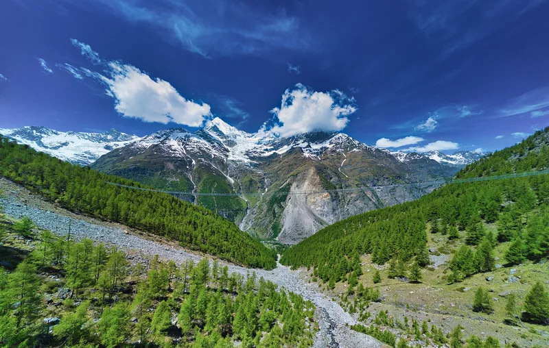
Panorama of the Charles Kuonen suspension bridge, with the Weisshorn in the background
The Charles Kuonen suspension bridge above Randa (VS)
The 494 m suspension bridge at Randa (SWISSROPE SkyWalk Randa)
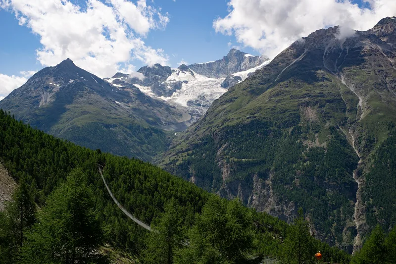
The Charles Kuonen suspension bridge, Randa
The Charles Kuonen pedestrian suspension bridge
Swiss chalet near the Charles Kuonen suspension bridge
The Randa rockslide, seen from the Europaweg
The Randa rockslide seen from the Europaweg, with the Weisshorn above
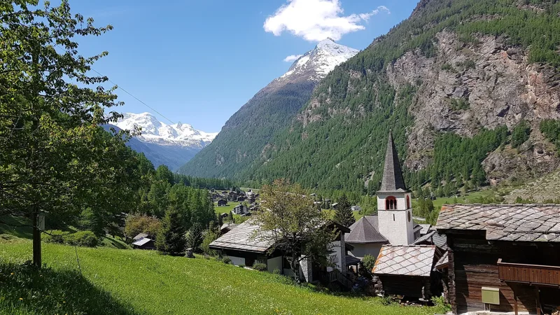
St. Sebastian's church in Randa (Mattertal), Valais
The village of Randa in Valais, with its church
The next few days
MeteoSwiss local forecast, updated every hour
Reading the MeteoSwiss forecast…
My day
Pick your day and start time: everything updates.
- Arrival at Randa
- 11:40 3 h 10 of walking without breaks, starting at 08:30
The trail, kilometre by kilometre
Places are listed under the kilometre where you pass them. Drag along the profile: the marker moves on the 3D view too.
- under 10 %
- 10 to 20 %
- 20 to 30 %
- over 30 %
- fountain or water point
- toilets
Around the trail (250 m, OpenStreetMap, extract of 25/10/2026): 3 restaurants, 0 cafés, 5 fountains and water points, 3 toilets. Estimated time: the official walking time spread by effort (1 km on the flat counts as 100 m of climbing), start time set in “My day”.
Getting there and back
Back by public transport from the Randa, Bahnhof stop
Next departures from Randa, BahnhofReading the official timetable…
By car
Careful, this is one way: public transport back arrives in Randa, Bahnhof, not in Randa. Plan to get back to your car by public transport, or park at the finish and take the train to the start.
- Randaopen-air · paid250 m from the start
- Car park, Bahnhofstrassepaid50 m from the start
- Car park underground car park, Bahnhofstrassepaid70 m from the start
- Car park, Dorfstrassepaid140 m from the start
Public car parks within 600 m of the start, according to OpenStreetMap: prices and number of spaces may have changed, check the signs on site.
Questions people ask
How long is the hike from Randa to the finish (Randa)?
3 h 10 of walking according to SwitzerlandMobility, in this direction, not counting breaks. The other way: 3 h 10.
Is it hard?
SwitzerlandMobility rates this stage: fitness medium, technique medium. It is 700 m of climbing over 7.0 km.
Can I get back by public transport?
Yes. The Randa, Bahnhof stop is at the finish. The next departures show live under “Getting there and back”.
Where can I eat on the way?
3 restaurants, cafés and huts within 250 m of the trail, including Hotel Klein Matterhorn Restaurant, Treff 494, Restaurant Ulpenrose. Where they are and their opening hours: below the profile.
Is there water and are there toilets on the way?
5 fountains and water points and 3 toilets within 250 m of the trail (survey of 25/10/2026).
Can I download the track?
Yes, as a GPX file for your watch or map app: “Download the track” button at the top of the page.
More hikes within 10 km
Official SwitzerlandMobility stages that pass within 10 km of this trail. Each card says whether its page is already up.
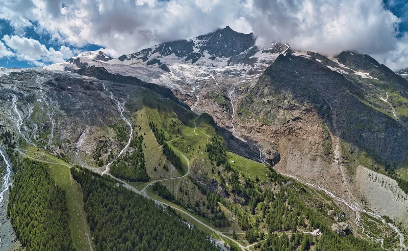 Saas-Fee, Hannig → Saas-Fee2 h 20Gemsweg Saas-Fee8.0kmDistance190mAscent720mDescentTechnical mediumFitness medium. See the hike
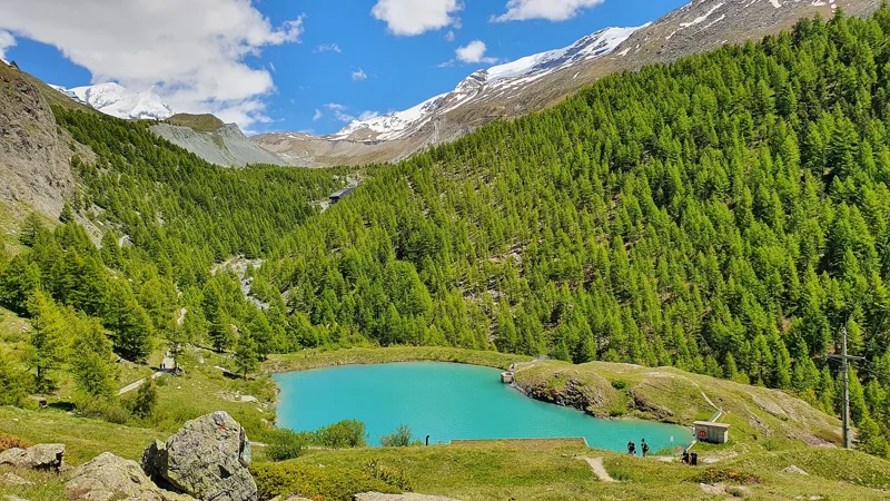 Zermatt, Blauherd → Zermatt, Sunnegga3 h 155-Seenweg Zermatt11.0kmDistance380mAscent660mDescentTechnical mediumFitness medium. See the hike
- Europahütte → Zermatt6 h 45Swiss Tour Monte Rosa, stage 319.0kmDistance1,000mAscent1,650mDescentTechnical mediumFitness difficult. Page coming
- Grächen → Europahütte7 h 10Swiss Tour Monte Rosa, stage 217.0kmDistance1,700mAscent1,050mDescentTechnical mediumFitness difficult. Page coming
- Grächen → Gruben9 h 10Alpenpässe-Weg, stage 2122.0kmDistance1,950mAscent1,750mDescentTechnical mediumFitness difficult. Page coming
- Grächen, loop3 h 50Zauberwasser-Weg Grächen14.0kmDistance440mAscent440mDescentTechnical easyFitness medium. Page coming