
From Gampel to Ausserberg, high above the Rhone
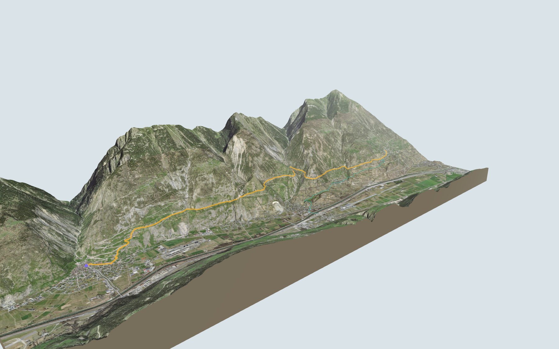
This is stage 3 of SwitzerlandMobility's Walliser Sonnenweg. You start in Gampel, on the banks of the Lonza, and climb along the north side of the Rhone valley to Ausserberg. There's a lot more up than down. SwitzerlandMobility rates the stage medium for fitness and easy for technique.
After Steg and Hohtenn, the path follows the stages of the BLS "Lötschberger Südrampe" hike: the Bärgbeizli Rarnerchumma, the Bietschtal, Riedgarto, then Ausserberg. Along the way you cross several suonen, the old irrigation channels of the Valais. The elevation profile shows you where it climbs.
Want a shorter version? Walk up from Raron station: this starting point has its own colour in the 3D view and an estimated time under all starting points. Curious about more irrigation channels? Have a look at the Grand Bisse d'Ayent or the bisses from Vercorin to Grimentz.
At the finish: Ausserberg, a village scattered across the slope, with a station on the Lötschberg line since 1913. Check the next departures from Ausserberg and plan your day before you set off. Looking for more in the area? See all hikes in Valais.
The story of the trail
What happened where you are going to walk, chapter by chapter.
Twelve kilometres along the north side of the valley
You start at 642 m in Gampel and finish at 1,019 m in Ausserberg. In between: 12.0 km, plus 620 m of climbing and 240 m of descent according to SwitzerlandMobility. It gives 3 h 45 of walking time in this direction and 3 h 20 the other way. The highest point of the route is at 1,028 m.
You cross the Lonza right at the start, then the village of Steg, and reach Hohtenn after a little over a kilometre. The path then follows the Stägeru irrigation channel to the Jolital, passes the Bärgbeizli Rarnerchumma halfway, crosses the Bietschtal, then goes near Riedgarto and St. German before entering Ausserberg. For food, there is the Restaurant Hohe Tenne right next to the path near Hohtenn, the Bärgbeizli Rarnerchumma halfway, and a restaurant called "Bahnhof" shortly before the finish. On the way, follow the signposts and check the conditions on the day.
A railway that made the villages grow
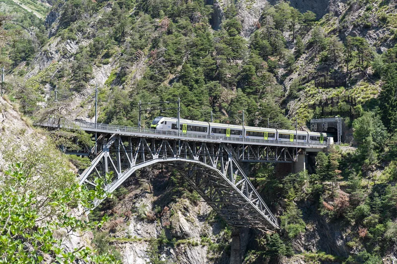
The Bern-Lötschberg-Simplon company (BLS) was founded in 1906 to build the Bernese Alpine railway from Frutigen to Brig. The Lötschberg tunnel was completed in 1913. The south ramp is marked by major bridge works, most of them rebuilt by 1992 for double track. A little past halfway, in the Bietschtal, you cross the Bietschbach just a few metres from the railway.
You can read the construction work in the census figures: Gampel went from 531 inhabitants in 1900 to 2,086 in 1910, while the Lötschberg tunnel was being built; Hohtenn from 170 to 499, while the line was being built; Ausserberg from 398 to 1,020, before falling back to 458 in 1920. The stations of Hohtenn and Ausserberg date from 1913.
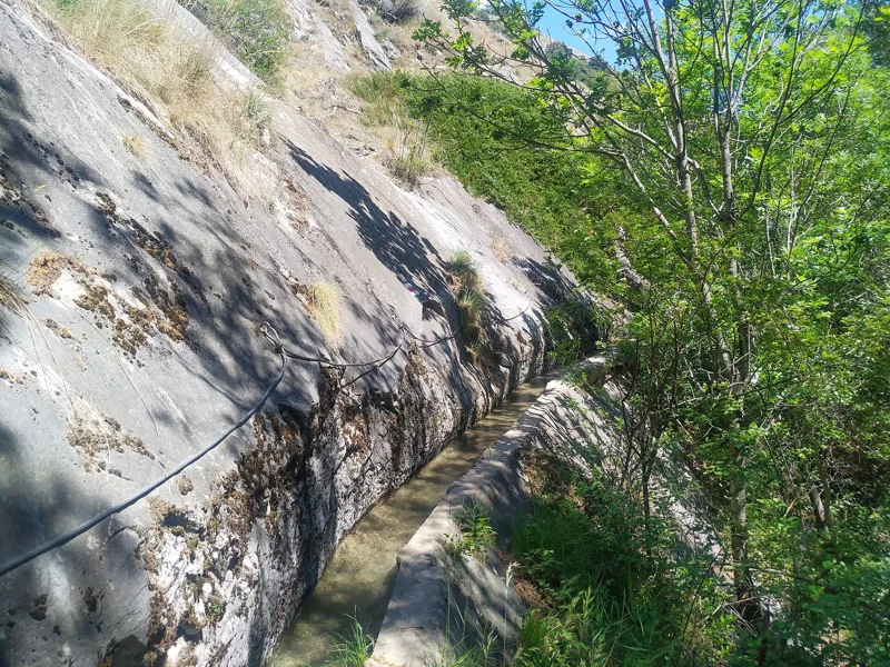
Suonen to water the slopes
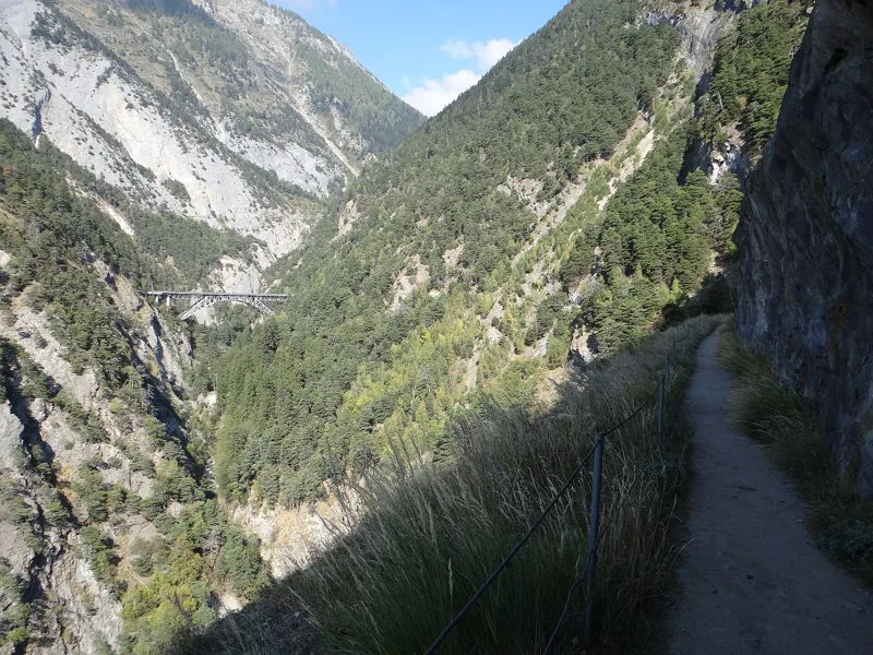
On this side of the valley, only the irrigation channels, the suonen, make the land farmable. The word comes from the Old High German "suoha", meaning furrow or ditch, and most suonen date from the late Middle Ages. Here they carry glacier water from the Bietschbach, which comes down from the Bietschhorn area.
Towards the end, from Riedgarto to around St. German, the path follows the Manera, and it crosses the Undra at the finish. In 1965, Ernst Lautenschlager wrote in "Les Alpes", the Swiss Alpine Club magazine, that the Manera brings water from the Bietsch valley to the slopes of St. German, that the oldest document on a water right of the Undra dates from 1377, and that the Undra runs through Trogdorf, the centre of Ausserberg, where it once supplied drinking water.
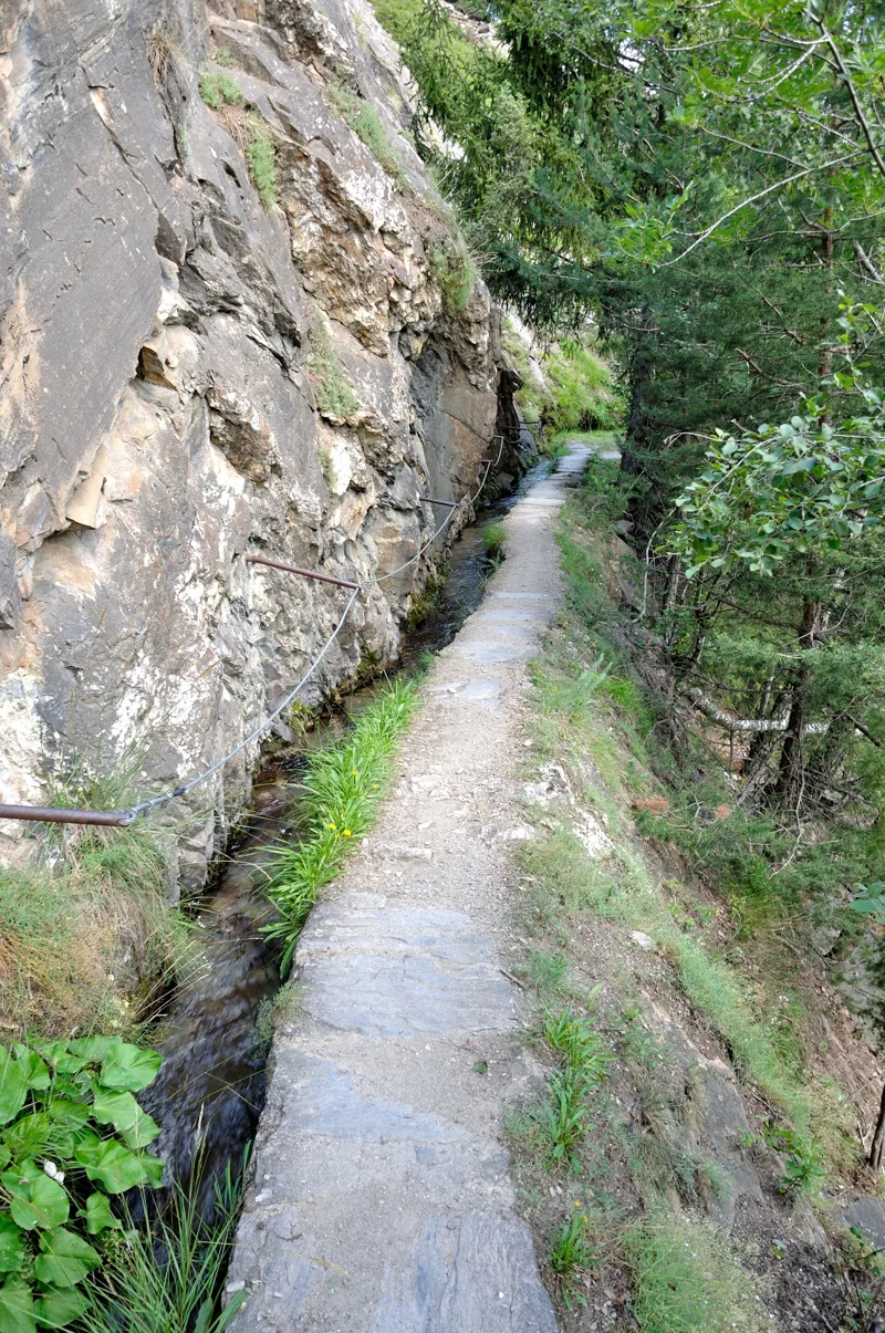
A steppe below the rocks
Through the whole middle part of the walk, roughly from the Jolital to St. German, the path crosses the "Raron – Heidnischbiel" landscape, listed in the Federal Inventory of Landscapes and Natural Monuments: rocky south-facing slopes, among the driest regions in Switzerland, and a Valais rocky steppe where you find Montpellier fenugreek (Trigonella monspeliaca), highly endangered, Valais wormwood (Artemisia vallesiaca) and Cavanilles' oat grass (Trisetum cavanillesii), threatened with extinction.
Among the reptiles, you find the asp viper, endangered, and, among the birds that come here to breed, the hoopoe, rare and endangered; the insects feed bats such as Savi's pipistrelle. The sides of the Bietschbach gorge and the Rarnerchumma hollow are mostly black Lower Dogger shale. In 1965, Lautenschlager also noted common wall lizards, green lizards and the praying mantis around Ausserberg.
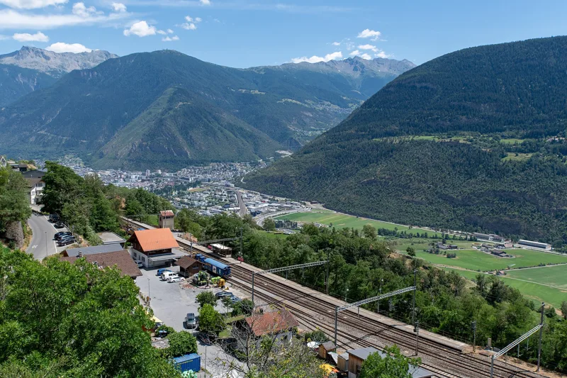
Ausserberg, the end of the stage
Ausserberg is a scattered village on the north side of the Rhone valley, between the Baltschiederbach and the Bietschhorn; its centre is called Trogdorf. It first appears in 1378 as "Leucrun" and has kept many old buildings. It has had a station on the Lötschberg line since 1913.
This is where stage 3 ends. Stage 4 of the Walliser Sonnenweg continues from Ausserberg to Brig. To get back, the rest of the page shows the next departures.
Every way up to the top
2 starting points to reach Ausserberg. Pick yours: the 3D view shows it and “My day” recalculates.
Walking times without breaks. “Estimated” times are calculated on the swisstopo profile with a model fitted to the official SwitzerlandMobility stages; the shortest path may differ from the one on the yellow signposts: on the ground, follow the signs. Gradient: the steepest over 200 m of trail. Profiles share the same scale (length and altitude). Stations and car parks within 500 m of the start, according to OpenStreetMap.
In pictures
A BLS RABe 528 on the Bietschtal viaduct
The BLS viaduct in the Bietschtal
Cable-secured path along the Stägeru Suone
Rock tunnel near the Bietschtal bridge and Riedgarto
Picnic tables and signpost at Riedgarto
Hiking the Lötschberg Südrampe at St. German
Hiking the Lötschberg Südrampe at Ausserberg
Ausserberg railway station
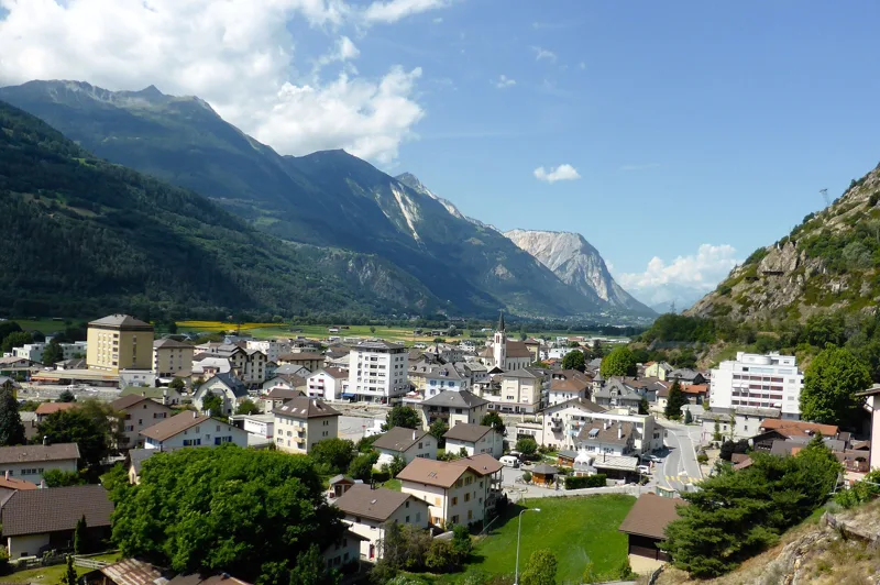
A view of the village of Gampel
Hohtenn, Valais
The next few days
MeteoSwiss local forecast, updated every hour
Reading the MeteoSwiss forecast…
My day
Pick your day and start time: everything updates.
- Arrival at Ausserberg
- 12:15 3 h 45 of walking without breaks, starting at 08:30
The trail, kilometre by kilometre
Places are listed under the kilometre where you pass them. Drag along the profile: the marker moves on the 3D view too.
- under 10 %
- 10 to 20 %
- 20 to 30 %
- over 30 %
- fountain or water point
- toilets
Around the trail (250 m, OpenStreetMap, extract of 25/10/2026): 8 restaurants, 2 cafés, 17 fountains and water points, 1 toilet. Estimated time: the official walking time spread by effort (1 km on the flat counts as 100 m of climbing), start time set in “My day”.
Getting there and back
Back by public transport from the Ausserberg, Dorf stop
Next departures from Ausserberg, DorfReading the official timetable…
By car
Careful, this is one way: public transport back arrives in Ausserberg, Dorf, not in Gampel. Plan to get back to your car by public transport, or park at the finish and take the train to the start.
- Milimattu, Feuerwehrlokalopen-air · paid200 m from the start
- Parkplatz Regionalschuleopen-air · paid · 40 spaces400 m from the start
- Car park open-air, Fabrikstrassepaid40 m from the start
- Car park open-air, Kellereigassepaid150 m from the start
Public car parks within 600 m of the start, according to OpenStreetMap: prices and number of spaces may have changed, check the signs on site.
Questions people ask
How long is the hike from Gampel to the finish (Ausserberg)?
3 h 45 of walking according to SwitzerlandMobility, in this direction, not counting breaks. The other way: 3 h 20.
Is it hard?
SwitzerlandMobility rates this stage: fitness medium, technique easy. It is 620 m of climbing over 12.0 km.
Can I get back by public transport?
Yes. The Ausserberg, Dorf stop is at the finish. The next departures show live under “Getting there and back”.
Where can I eat on the way?
10 restaurants, cafés and huts within 250 m of the trail, including Mineur, Stocker's Steak House, Steakhous Stocker. Where they are and their opening hours: below the profile.
Is there water and are there toilets on the way?
17 fountains and water points and 1 toilet within 250 m of the trail (survey of 25/10/2026).
Can I download the track?
Yes, as a GPX file for your watch or map app: “Download the track” button at the top of the page.
More hikes within 10 km
Official SwitzerlandMobility stages that pass within 10 km of this trail. Each card says whether its page is already up.
- Leukerbad → Gampel7 h 25Walliser Sonnenweg, stage 224.0kmDistance1,000mAscent1,700mDescentTechnical easyFitness difficult. Page coming
- Ausserberg → Brig5 h 00Walliser Sonnenweg, stage 417.0kmDistance540mAscent880mDescentTechnical easyFitness medium. Page coming
- Birgisch → Eggen3 h 45Walliser Steppen- und Föhrenweg11.0kmDistance640mAscent680mDescentTechnical mediumFitness medium. Page coming
- Brandalp → Eischoll3 h 00Suonenweg Brandalp–Eischoll10.0kmDistance320mAscent700mDescentTechnical mediumFitness medium. Page coming
- Bitsch → Lalden2 h 25Rotten-Weg Bitsch–Lalden10.0kmDistance20mAscent60mDescentTechnical mediumFitness difficult. Page coming
- Moosalp, Chalte Brunne, loop1 h 55Moosalp Panoramaweg6.0kmDistance280mAscent280mDescentTechnical easyFitness easy. Page coming