
Hiking up La Berra from La Valsainte
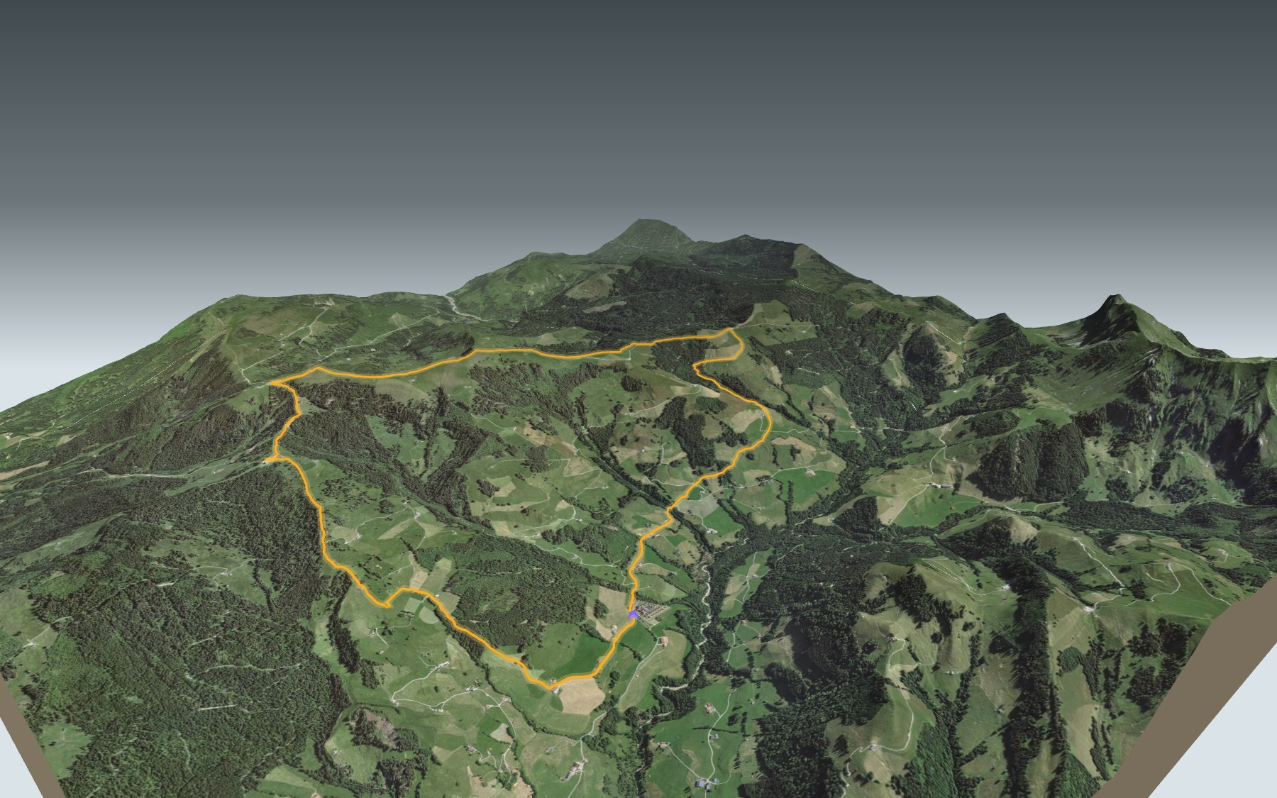
A loop in the Fribourg Prealps that starts and ends at La Valsainte, near the Carthusian monastery. You climb to the top of La Berra, at 1,719 m, the highest point of the route, then come down by a different path. It's rated medium for fitness and for technique.
The climb takes you past Les Curtils, La Cierne and Les Botteys to the Les Allières restaurant. Higher up, the Chalet de La Berra tells you the summit is close. After that you pass near Le Bi Gîte, the Parc des Fayes and the Hauta Chia mountain café, before heading down via Planfèche and Les Mossettes. The elevation profile shows you where the climb is steepest.
The path crosses the Gruyère Pays-d'Enhaut Regional Nature Park. Around the summit it runs through the La Berra wildlife quiet zone: from 1 December to 30 June, stay on the signed paths and keep your dog on a lead. In the same Prealps, the Schwyberg and the Gastlosen Tour are in 3D too.
On the way back you walk right past the La Valsainte monastery: it can't be visited, only the public chapel and a kiosk are open to the public. La Pinte des Mossettes is the last stop before the finish. Check the next departures and plan your day before you set off. Looking for more in the area? All hikes in Fribourg and the Gruyère.
The story of the trail
What happened where you are going to walk, chapter by chapter.
A loop around La Berra
You start at La Valsainte, at 1,016 m, and finish there too. In between: 13.9 km, 820 m of climbing and the same again downhill. The highest point, at 1,719 m, is the summit of La Berra. Allow 4 h 35 of walking, whichever way round you go.
You set off from the La Valsainte, Couvent bus stop. The climb goes past Les Curtils, La Cierne and Les Botteys, then through Le Craux Derrey, up to the Les Allières restaurant, at 1,487 m. On the way, follow the signposts and check the conditions on the day.
The summit, above the Chalet de La Berra
Above Les Allières, the path passes near La Montagnetta and reaches the Chalet de La Berra, at 1,635 m. The Le Brand - La Berra gondola arrives close by. The summit, at 1,719 m, comes just after.
Around the summit, until just past the Parc des Fayes, the path crosses the La Berra wildlife quiet zone, set up by an ordinance of the canton of Fribourg dated 11 November 2013. From 1 December to 30 June, access is allowed only on the ski runs and on the signed paths and routes, and dogs must be kept on a lead.
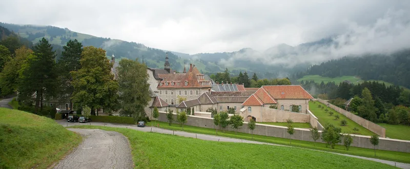
The Valley of All Saints
La Valsainte was originally called the Valley of All Saints. The Carthusian monastery was founded in 1295 by Girard I and Girard II of Corbières and richly endowed with land and rights, mainly in the Javroz valley, where it also held criminal jurisdiction. A fire destroyed it completely in 1381. Bought back in 1454 by the House of Gruyère, it passed to Fribourg in 1553.
Fribourg tried to close it from the 16th century onwards; the pope approved its closure in 1778. From 1791, Trappist monks who had fled France took refuge there. The Carthusians came back in the 19th century, and the monastery was rebuilt between 1863 and 1868. Today it is the last Carthusian monastery in Switzerland; in 2012 it had seven fathers and eight brothers.
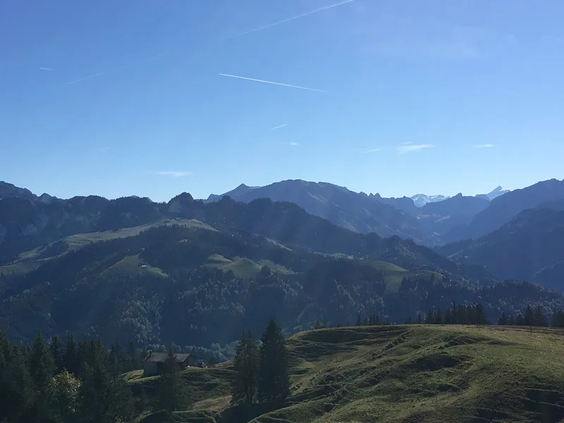
Sandstone from an ancient ocean
La Berra belongs to the Gurnigel nappe: sedimentary rocks from the Cretaceous and Paleogene, formed in an ancient ocean, the Piemont-Liguria Ocean. The path runs over the Gurnigel flysch, calcareous sandstones, sometimes as breccia or conglomerate, alternating with thin layers of marl. In places it also crosses deposits left by the retreating glaciers of the last ice age.
The path crosses the Gruyère Pays-d'Enhaut Regional Nature Park, which spreads over the cantons of Vaud, Fribourg and Bern. It was awarded the label of park of national importance in 2012, and again in 2022.
Back via Les Mossettes and the monastery
From the summit, the path passes near Le Bi Gîte and the Parc des Fayes, then through Le Creux d'Enfer, to the Hauta Chia mountain café, at 1,459 m. It then drops via La Guisolanda, Les Plans and Planfèche down to Les Mossettes. La Pinte des Mossettes, at 1,075 m, is the last stop before the finish.
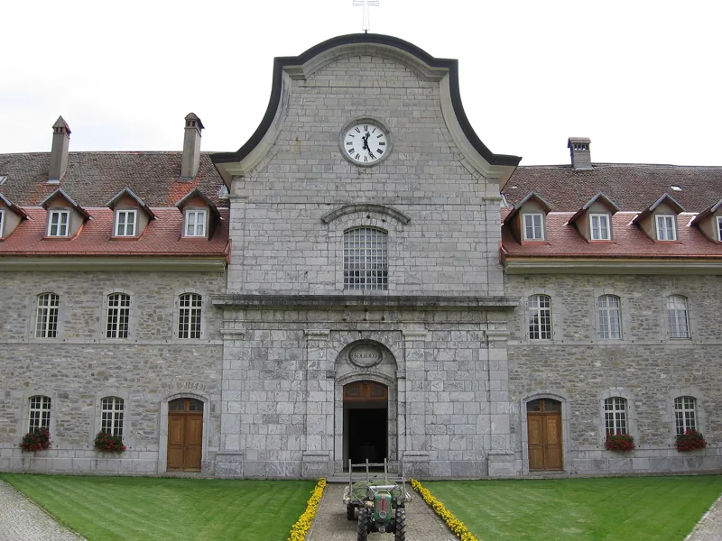
Just before the finish you walk past the monastery, listed in the Federal Inventory of Swiss Heritage Sites of national importance. It stands among the pastures, on a terrace that gave the enclosure its shape; its workshops, large vegetable gardens and many fruit trees reflect the hermit life of the monks. The monastery can't be visited: only the public chapel and a kiosk are open to the public. Further down the page you'll find the next bus departures.
In pictures
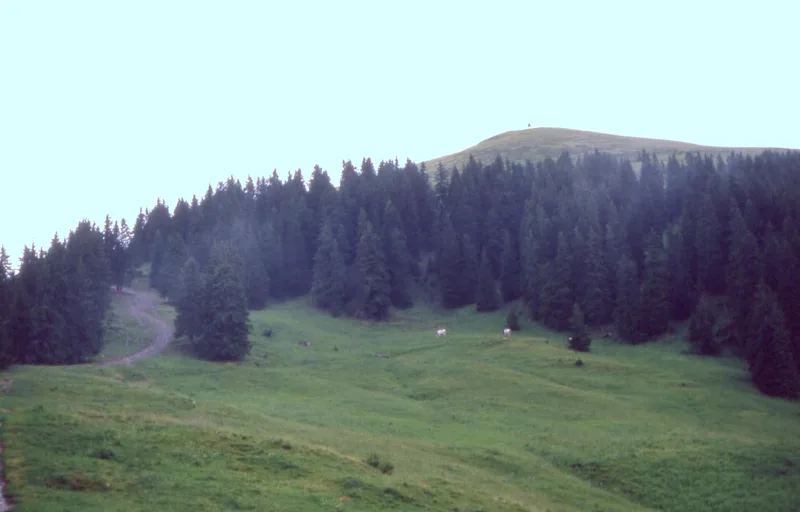
The summit of La Berra seen from the west: a grazed mountain pasture below the top, and the triangulation point marker on the summit
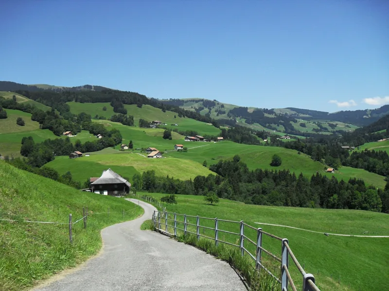
Looking towards La Valsainte
The La Valsainte Carthusian monastery
Signpost at the Gîte d'Allières
Signpost at La Berra (Chalet)
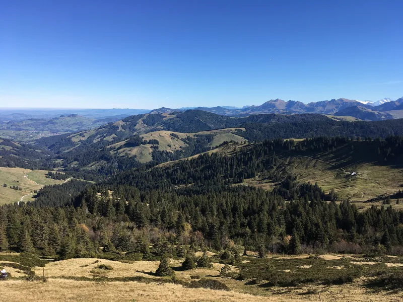
View from the top of La Berra towards the north-east
View from La Berra westwards over the Lac de la Gruyère
The mountains to the east, on the way down from La Berra
Cattle at La Valsainte
Main building and church entrance of the La Valsainte Carthusian monastery
La Valsainte Charterhouse from the west
What you see from the top
360° view from La Berra (1,719 m). 24 named peaks, including Mont Blanc, 96.9 km away. Swipe to look around.
La Berra par la Valsainte: when to go
The bus runs up to the start every day from 13 December 2026 to 19 March 2027 and from 7 May to 29 October 2027 (and 60 other days), according to the official timetable. The latest time to set off ranges from 15:51 in June to 11:09 in December.
- Bus to the start
- daily, 13 Dec to 28 Feb
- and also 8 other days
- 3 to 7 buses a day
- first bus 6:48 or 10:23
- last 16:30 or 18:23
- Sun at the start, mid-January
- from 10:31
- rises at 8:11, hidden by the ridge
- Leave by, for 4 h 35 of walking
- 11:35
- arrive 1 hour before sunset, at 17:10
| Month | Sun at the start | Leave by | In the sun, leaving at 9:00 | Bus |
|---|---|---|---|---|
| December | 10:33 → 16:44 | 11:09 | 92 % | 27 of 31 days |
| January | 10:31 → 17:10 | 11:35 | 91 % | every day |
| February | 8:51 → 17:55 | 12:20 | 97 % | every day |
“In the sun”: the share of the path in sunlight under a clear sky, with the terrain worked out point by point. The path climbs to 1,719 m: today's snow and frost are in the weather and My day.
- Bus to the start
- daily, 7 May to 31 May
- and also 50 other days
- 3 to 7 buses a day
- first bus 6:48 or 10:23
- last 16:30, 17:23 or 18:23
- Sun at the start, mid-April
- from 7:30
- rises at 6:44, hidden by the ridge
- Leave by, for 4 h 35 of walking
- 14:43
- arrive 1 hour before sunset, at 20:18
| Month | Sun at the start | Leave by | In the sun, leaving at 9:00 | Bus |
|---|---|---|---|---|
| March | 7:58 → 18:36 | 13:01 | 100 % | 25 of 31 days |
| April | 7:30 → 20:18 | 14:43 | 100 % | 22 of 30 days |
| May | 6:45 → 20:58 | 15:23 | 100 % | 28 of 31 days |
“In the sun”: the share of the path in sunlight under a clear sky, with the terrain worked out point by point. The path climbs to 1,719 m: today's snow and frost are in the weather and My day.
- Bus to the start
- every day
- 4 to 7 buses a day
- first bus 6:48 or 10:23
- last 17:23 or 18:23
- Sun at the start, mid-July
- from 6:43
- rises at 5:53, hidden by the ridge
- Leave by, for 4 h 35 of walking
- 15:47
- arrive 1 hour before sunset, at 21:22
| Month | Sun at the start | Leave by | In the sun, leaving at 9:00 | Bus |
|---|---|---|---|---|
| June | 6:33 → 21:26 | 15:51 | 100 % | every day |
| July | 6:43 → 21:22 | 15:47 | 100 % | every day |
| August | 7:15 → 20:42 | 15:07 | 100 % | every day |
“In the sun”: the share of the path in sunlight under a clear sky, with the terrain worked out point by point. The path climbs to 1,719 m: today's snow and frost are in the weather and My day.
- Bus to the start
- daily, 1 Sept to 29 Oct
- and also 21 other days
- 4 to 7 buses a day
- first bus 6:48 or 10:23
- last 17:23 or 18:23
- Sun at the start, mid-October
- from 9:03
- rises at 7:49, hidden by the ridge
- Leave by, for 4 h 35 of walking
- 13:10
- arrive 1 hour before sunset, at 18:45
| Month | Sun at the start | Leave by | In the sun, leaving at 9:00 | Bus |
|---|---|---|---|---|
| September | 8:15 → 19:44 | 14:09 | 100 % | every day |
| October | 9:03 → 18:45 | 13:10 | 99 % | 29 of 31 days |
| November | 9:43 → 16:58 | 11:23 | 95 % | 21 of 30 days |
“In the sun”: the share of the path in sunlight under a clear sky, with the terrain worked out point by point. The path climbs to 1,719 m: today's snow and frost are in the weather and My day.
The next few days
Local forecast, updated every hour
Reading the forecast…
My day
Pick your day and start time: everything updates.
- Arrival at Charmey, La Valsainte
- 13:05 4 h 35 of walking without breaks, starting at 08:30
The trail, kilometre by kilometre
Places are listed under the kilometre where you pass them. Drag along the profile: the marker moves on the 3D view too.
- under 10 %
- 10 to 20 %
- 20 to 30 %
- over 30 %
- fountain or water point
- toilets
Around the trail (250 m): 3 restaurants. Estimated time: the official walking time spread by effort (1 km on the flat counts as 100 m of climbing), start time set in “My day”.
Getting there and back
Back by public transport from the La Valsainte, Couvent stop
Next departures from La Valsainte, CouventReading the official timetable…
By car
Park in Charmey, La Valsainte. It's a loop: you walk back to where you started, and so to your car.
- Car park, Route de la Valsainte20 m from the start
Public car parks within 600 m of the start: prices and number of spaces may have changed, check the signs on site.
Questions people ask
How long does the loop from Charmey, La Valsainte take?
4 h 35 of walking (official time), in this direction, not counting breaks. The other way: 4 h 35.
Is it hard?
Official rating for this stage: fitness medium, technique medium. It is 820 m of climbing over 13.9 km.
Can I get back by public transport?
Yes. The La Valsainte, Couvent stop is at the finish. The next departures show live under “Getting there and back”.
Where can I eat on the way?
6 places to eat within 250 m of the trail, including Les Allières, Chalet de La Berra, Le Bi Gîte. Where they are and their opening hours: below the profile.
Is there water and are there toilets on the way?
0 fountains and water points and 0 toilets within 250 m of the trail (survey of 25/10/2026).
Can I download the track?
Yes, as a GPX file for your watch or map app: “Download the track” button at the top of the page.
More hikes within 10 km
Official stages that pass within 10 km of this trail. Each card says whether its page is already up.
- Jaun → Gruyères6 h 00Alpenpanorama-Weg, stage 2122.0kmDistance500mAscent780mDescentTechnical easyFitness difficult. Official waymarked stage
- Schwarzsee, loop1 h 00Schwarzsee Rundweg4.0kmDistance50mAscent50mDescentTechnical mediumFitness difficult. Official waymarked stage
- Schwarzsee → Jaun4 h 10Alpenpanorama-Weg, stage 2012.0kmDistance700mAscent740mDescentTechnical easyFitness medium. Official waymarked stage
- Schwarzsee → Jaun4 h 10Freiburger Voralpenweg, stage 312.0kmDistance700mAscent740mDescentTechnical easyFitness medium. Official waymarked stage
- Rossens FR → Corbières3 h 50Sentier du Lac de la Gruyère, stage 314.0kmDistance460mAscent460mDescentTechnical easyFitness medium. Official waymarked stage
- Guggisberg → Schwarzsee4 h 50Alpenpanorama-Weg, stage 1916.0kmDistance660mAscent740mDescentTechnical easyFitness medium. Official waymarked stage