
Five lakes facing the Matterhorn
The trail links five mountain lakes above Zermatt: the Stellisee, Grindjisee, Grünsee, Moosjisee and Leisee. It goes down more than it goes up, with two climbs: up towards the Fluhalp, then from the hamlet of Findeln to Sunnegga. SwitzerlandMobility rates it medium for both fitness and technique.
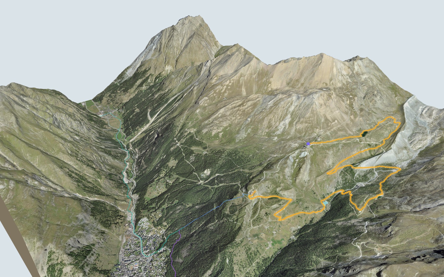
From Zermatt, the funicular takes you up to Sunnegga, then a gondola drops you at Blauherd. The path reaches the Stellisee, passes close to the Fluhalp, drops gently to the Grindjisee and the Grünsee, runs past the Moosjisee and through the hamlet of Findeln before climbing back up to the Leisee. The elevation profile shows you where it goes down and where it climbs.
Rather walk up? Two other starting points, Täsch and the Legendär stop, start lower down and climb: each starting point has its own colour in the 3D view and an estimated time under all starting points. Further down the valley, in Randa, the suspension bridge trail is another idea for a day out.
At the finish: Sunnegga and the funicular back down to Zermatt. Check the next departures from Sunnegga and plan your day before you set off. Looking for more in the area? See all hikes in Valais.
The story of the trail
What happened where you are going to walk, chapter by chapter.
Five lakes, from Blauherd to Sunnegga
You start at 2,579 m at Blauherd and finish at 2,300 m at Sunnegga. In between: 11.3 km, plus 380 m of climbing and 660 m of descent according to SwitzerlandMobility, which gives 3 h 15 of walking time in this direction and 3 h 35 the other way. The highest point, 2,616 m, is near the Fluhalp; the lowest, 2,130 m, is near Findeln.
The lakes come in this order: the Stellisee, Grindjisee, Grünsee, Moosjisee and Leisee. For food, there's the Blue Lounge at the start, the Berghaus Fluhalp near the Stellisee, the Grünsee lodge by the third lake, then the restaurants of Findeln, shortly before the finish. On the way, follow the signposts and check the conditions on the day.
The Stellisee and the Grindjisee
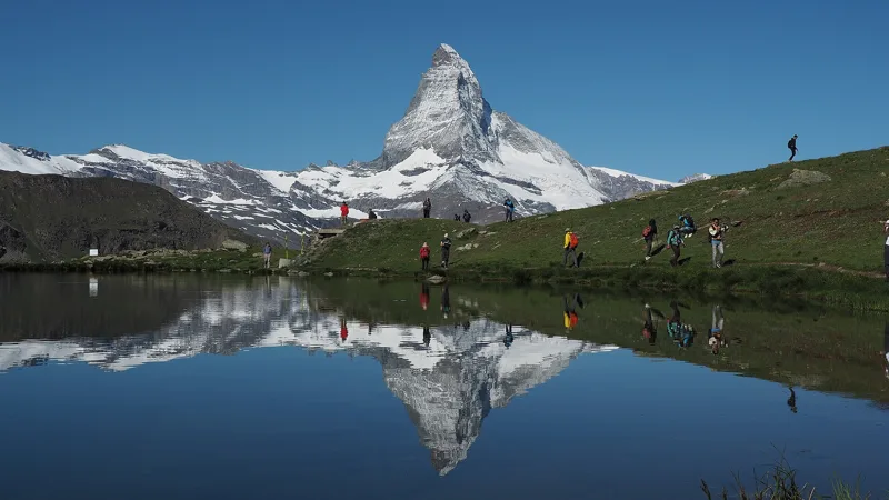
You reach the Stellisee just after the first kilometre, on an almost flat path. With its two big boulders in the middle of the water and its clear reflection of the Matterhorn, it's a popular photo spot. The Berghaus Fluhalp, at 2,604 m, is close by.
The trail then drops gently to the Grindjisee, at around kilometre 5. It's a small lake with surprisingly rich moorland flora and rare flowers: a stop for anyone who loves plants.
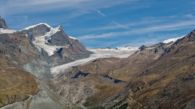
The Grünsee and the Findel Glacier
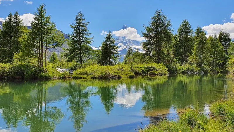
The path crosses to the other side of the valley to reach the Grünsee, at around kilometre 7, through a former glacial area. Swiss stone pines grow there despite the scree and sand. With a bit of luck, you'll come across black-nosed Valais sheep. The Grünsee lodge, a stone's throw from the path, looks out from the Matterhorn to the Weisshorn.
Higher up the valley, the Findel Glacier keeps shrinking. GLAMOS, the Swiss glacier monitoring network, has been tracking its snout since 1885: of the 30 measurements published between 1990 and 2024, 29 show the glacier retreating.
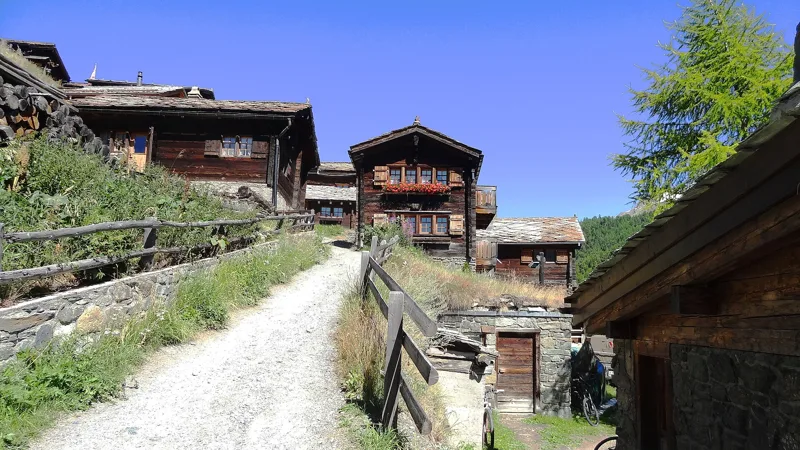
The Moosjisee and the hamlet of Findeln
At around kilometre 9, the Moosjisee is a reservoir fed by glaciers, which is why its water is milky white. The water is used to generate power and make artificial snow.
The path then heads for Findeln. Families from Zermatt spent the summer here growing grain and grazing their cattle, and rye and barley were sown here until the end of the Second World War. According to Zermatt Tourism, these were once the highest rye fields in the Alps. The chapel of St James the Elder holds a late-Gothic winged altarpiece. Another photo subject: the barns perched on stone slabs, to keep the mice out, with the Matterhorn behind.
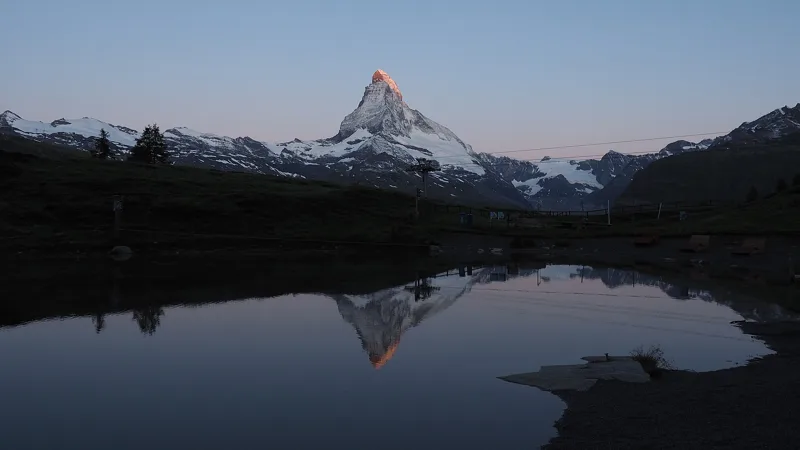
The Leisee, then Sunnegga
One last climb takes you to the Leisee, the fifth lake, shortly before the finish. Children love splashing around in it. Sunnegga is just a short walk away, and the Leisee-Shuttle also runs up to the station.
The Matterhorn is reflected in three of the five lakes. The mountain was first climbed on 14 July 1865 by Edward Whymper and six companions; four of them died on the way down. At Sunnegga, the funicular takes you back to Zermatt: further down this page, the next departures.
Every way to Zermatt, Sunnegga
3 starting points to reach Zermatt, Sunnegga. Pick yours: the 3D view shows it and “My day” recalculates.
Walking times without breaks. “Estimated” times are calculated on the swisstopo profile with a model fitted to the official SwitzerlandMobility stages; the shortest path may differ from the one on the yellow signposts: on the ground, follow the signs. Gradient: the steepest over 200 m of trail. Profiles share the same scale (length and altitude). Stations and car parks within 500 m of the start, according to OpenStreetMap.
In pictures
The Stellisee and the Matterhorn
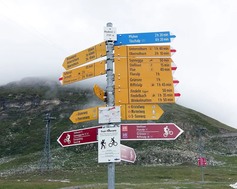
Hiking signs at Blauherd, Zermatt
The trail between Blauherd and the Stellisee, Zermatt
The Grindjisee and the Matterhorn (Zermatt, Valais)
The Findel Glacier (centre), 2026
View from the Grünsee area towards the Strahlhorn, in summer
The Moosjisee (Zermatt, Valais)
The centre of Findeln, in summer
The Leisee and the Matterhorn, Zermatt (July 2019)
Restaurant Sunnegga
The next few days
MeteoSwiss local forecast, updated every hour
Reading the MeteoSwiss forecast…
My day
Pick your day and start time: everything updates.
- Arrival at Zermatt, Sunnegga
- 11:45 3 h 15 of walking without breaks, starting at 08:30
The trail, kilometre by kilometre
Places are listed under the kilometre where you pass them. Drag along the profile: the marker moves on the 3D view too.
- under 10 %
- 10 to 20 %
- 20 to 30 %
- over 30 %
- fountain or water point
- toilets
Around the trail (250 m, OpenStreetMap, extract of 25/10/2026): 5 restaurants, 0 cafés, 1 fountain or water point, 4 toilets. Estimated time: the official walking time spread by effort (1 km on the flat counts as 100 m of climbing), start time set in “My day”.
Getting there and back
Back by public transport from the Sunnegga stop
Next departures from SunneggaReading the official timetable…
By car
Careful, this is one way: public transport back arrives in Sunnegga, not in Zermatt, Blauherd. Plan to get back to your car by public transport, or park at the finish and take the train to the start.
Public car parks within 600 m of the start, according to OpenStreetMap: prices and number of spaces may have changed, check the signs on site.
Questions people ask
How long is the hike from Zermatt, Blauherd to the finish (Zermatt, Sunnegga)?
3 h 15 of walking according to SwitzerlandMobility, in this direction, not counting breaks. The other way: 3 h 35.
Is it hard?
SwitzerlandMobility rates this stage: fitness medium, technique medium. It is 660 m of descent over 11.3 km.
Can I get back by public transport?
Yes. The Sunnegga stop is at the finish. The next departures show live under “Getting there and back”.
Where can I eat on the way?
6 restaurants, cafés and huts within 250 m of the trail, including Blue Lounge, Fluhalp, Grünsee Mountain Lodge. Where they are and their opening hours: below the profile.
Is there water and are there toilets on the way?
1 fountain or water point and 4 toilets within 250 m of the trail (survey of 25/10/2026).
Can I download the track?
Yes, as a GPX file for your watch or map app: “Download the track” button at the top of the page.
More hikes within 10 km
Official SwitzerlandMobility stages that pass within 10 km of this trail. Each card says whether its page is already up.
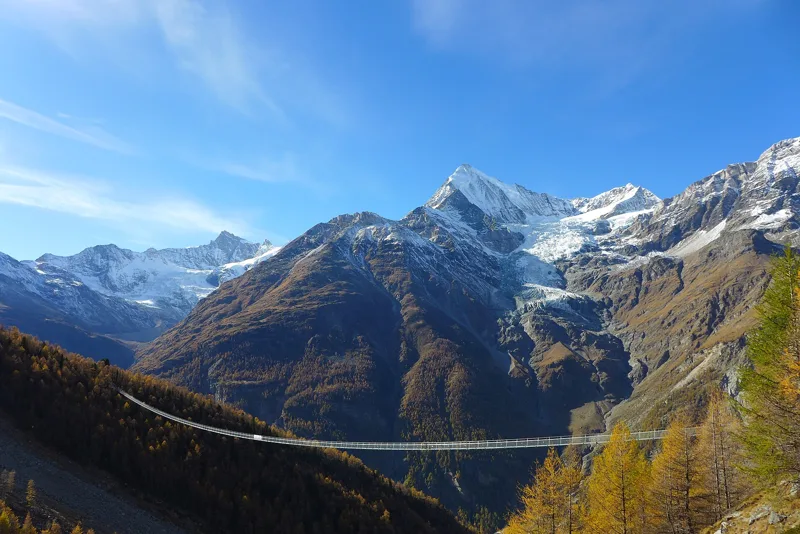 Randa, loop3 h 10Randa Hängebrückenweg7.0kmDistance700mAscent700mDescentTechnical mediumFitness medium. See the hike
- Europahütte → Zermatt6 h 45Swiss Tour Monte Rosa, stage 319.0kmDistance1,000mAscent1,650mDescentTechnical mediumFitness difficult. Page coming
- Zermatt, Furi → Zermatt1 h 10Furi-Weg5.0kmDistance20mAscent260mDescentTechnical difficultFitness medium. Page coming
- Grächen → Europahütte7 h 10Swiss Tour Monte Rosa, stage 217.0kmDistance1,700mAscent1,050mDescentTechnical mediumFitness difficult. Page coming