
From Rossinière to Rochers de Naye via the Col de Chaude
A big day on the Via Alpina: you leave the Pays-d'Enhaut at Rossinière, on the banks of the Sarine, and finish at Rochers de Naye station, high above Montreux. Two climbs, a valley in between, and the cog railway to take you back down. It is rated difficult for fitness and medium for technique.
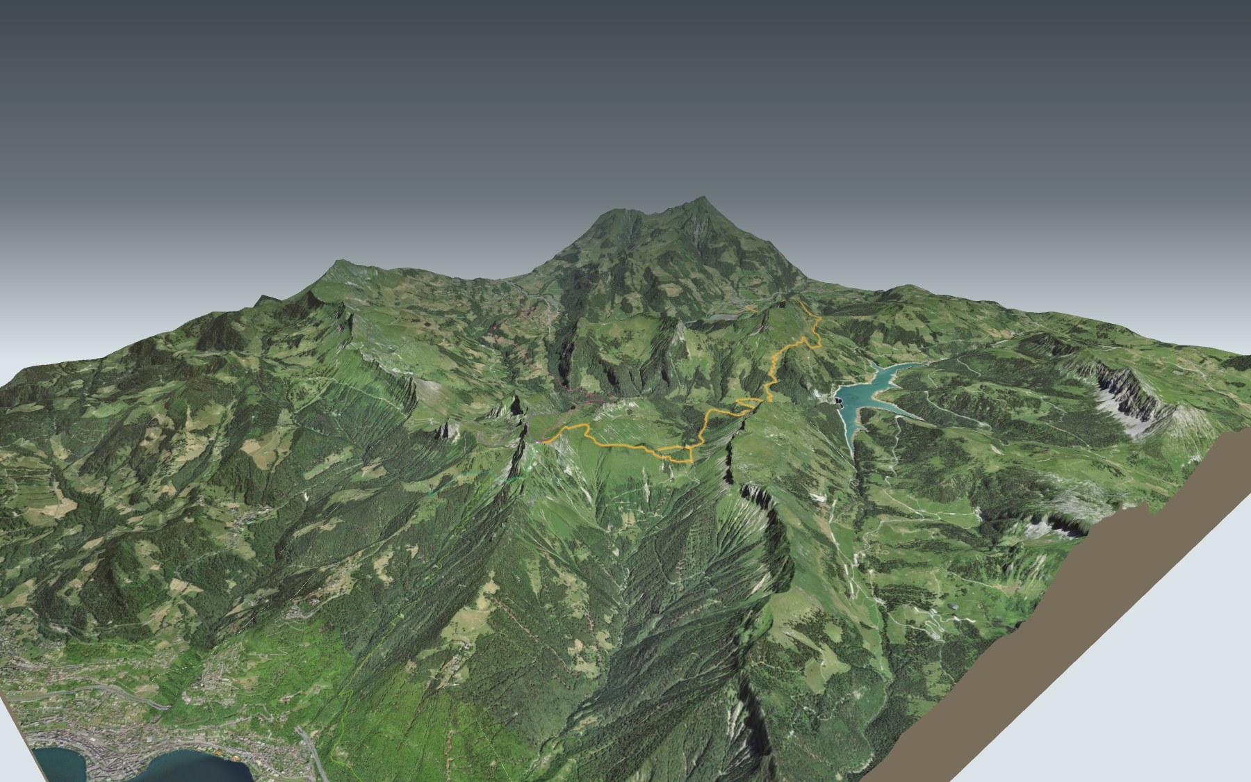
After the Sarine, the path climbs steeply through the Les Traverses forest, passes near the Col de Sonlomont and heads up to Linderrey. Then it drops to the Hongrin river and La Vuichoude d'en Bas, where you can see the dam, before climbing again to the Col de Chaude. The elevation profile shows you both climbs.
Not up for the whole day? Start from Les Sciernes, Villeneuve, Jaman or Le Paccot instead: each starting point has its own colour in the 3D view and its own estimated time in the list of starting points. The next Via Alpina stage runs down to Montreux: the Rochers-de-Naye page describes it on the way up.
At the top: the La Rambertia alpine garden just before the station, and the cog railway down to Montreux. Check the next trains and plan your day before you set off. Looking for more in the area? See all hikes in the Vaud Alps.
The story of the trail
What happened where you are going to walk, chapter by chapter.
Two climbs, one valley
You start at 892 m in Rossinière and finish at 1,970 m, at Rochers de Naye station. In between: 18.3 km, 1,850 m of climbing and 780 m of descent. Allow 7 h 20 of walking time in this direction, 6 h 15 the other way.
This is stage 19 of the Via Alpina, walked in its official direction. The path first climbs to Linderrey, around the 8th kilometre, drops down to the Hongrin river, then climbs again to Rochers de Naye station. Follow the signposts and check the conditions on the day.
Rossinière, the Grand Chalet and the Sarine
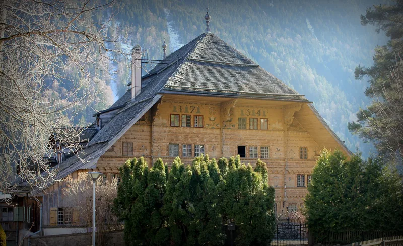
Close to the start stands the Grand Chalet of Rossinière, built between 1752 and 1756: it is one of the largest chalets in Switzerland. The painter Balthus lived there until 2001.
Just after the start, you cross the Sarine on the edge of the Lac du Vernex reservoir, created in 1973.
From Les Traverses to the Hongrin
In the Les Traverses forest, the slope gets much steeper, and a few sections fitted with cables help you through. Higher up, you pass La Bacu, then go near the Col de Sonlomont and climb on to Linderrey.
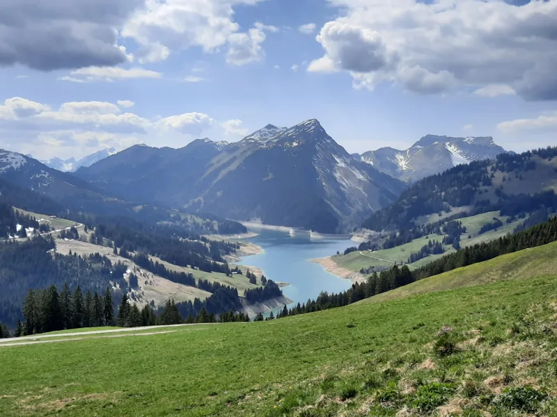
Next, a long descent brings you to the Hongrin river at La Vuichoude d'en Bas. From there you can see the double arch of the Hongrin dam. It was built in 1969 and is fed by the Hongrin river; water from Lake Geneva is also pumped up into it from the power stations at Veytaux.
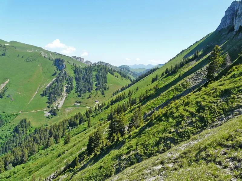
Col de Chaude, a cheese-making alp
The second climb takes you past La Vuichoude d'en Haut, then the Chalet du Col de Chaude, before the pass. The alp makes more than 450 wheels of L'Etivaz AOP cheese each season, and you can get something to eat there in the summer season.
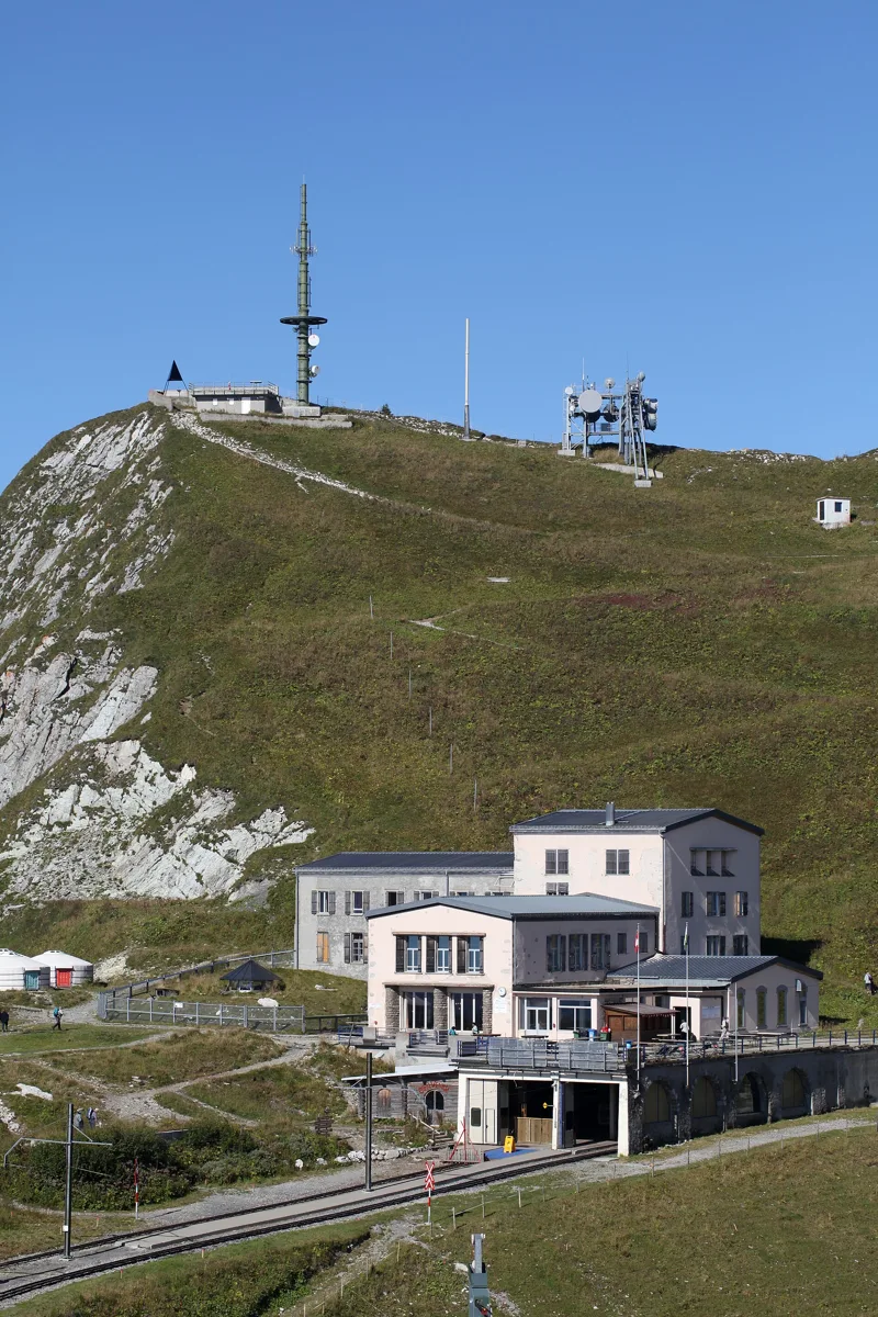
La Rambertia, then the train
After the Col de Chaude, the last climb goes through Plan d'Areine and runs alongside the La Rambertia alpine garden just before the station. Founded in 1896, it grows about 1,000 plant species and opens from mid-June to October, weather permitting.
At Rochers de Naye station, you take the cog railway, opened on 27 July 1892, down to Montreux. Further down this page: where to eat at the top and when the next train leaves.
Every way up to the top
5 starting points to reach Rochers de Naye. Pick yours: the 3D view shows it and “My day” recalculates.
Walking times without breaks. “Estimated” times are calculated on the terrain profile with a model fitted to the official stages; the shortest path may differ from the one on the yellow signposts: on the ground, follow the signs. Gradient: the steepest over 200 m of trail. Profiles share the same scale (length and altitude). Stations and car parks within 500 m of the start.
In pictures
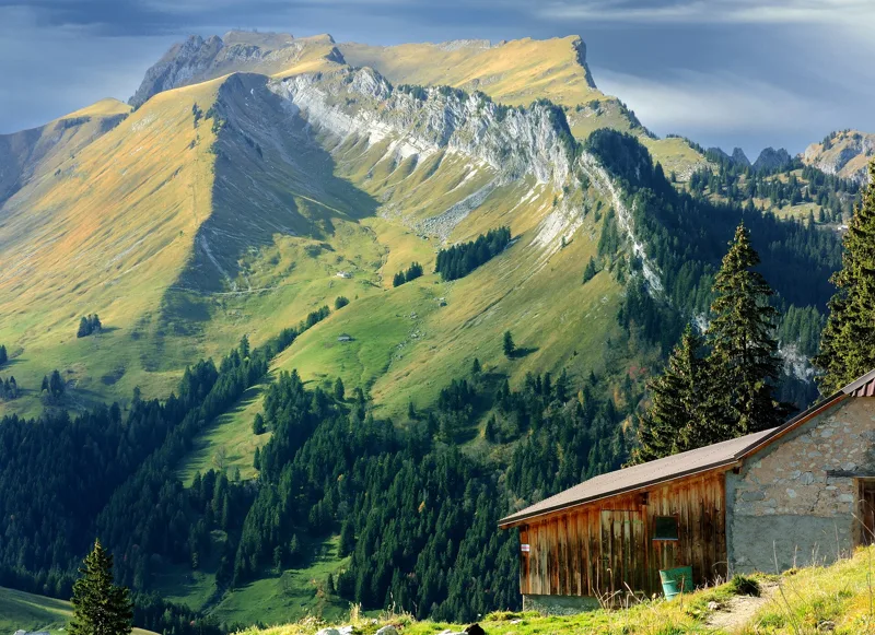
Rochers de Naye from Linderrey, above the Hongrin valley and Lac de l'Hongrin
The Route de la Gare road bridge over the Sarine, Rossinière
The village of Rossinière, with Lac du Vernex in the background
The Grand Chalet in Rossinière
The Hongrin dam, seen on a hike
Lac de l'Hongrin from the Col de Chaude - Rochers de Naye trail
Col de Chaude
The alpine garden at Rochers de Naye
The station and summit of Rochers de Naye
Lake Geneva seen from Rochers de Naye
What you see from the top
360° view from Rochers de Naye (1,987 m). 39 named peaks, including Mont Blanc, 67.1 km away. Swipe to look around.
Rossinière → Rochers de Naye: when to go
Public transport serves the start every day of the year, according to the official timetable. The latest time to set off ranges from 13:06 in June to 8:25 in December.
- Public transport to the start
- every day
- 35 to 37 arrivals a day
- first arrival 0:46, 0:47 or 4:33
- last 23:11 or 23:47
- Sun at the start, mid-January
- from 12:33
- rises at 8:11, hidden by the ridge
- Leave by, for 7 h 20 of walking
- 8:51
- arrive 1 hour before sunset, at 17:11
| Month | Sun at the start | Leave by | In the sun, leaving at 9:00 | Transport |
|---|---|---|---|---|
| December | → 16:45 | 8:25 | 56 % | every day |
| January | 12:33 → 17:11 | 8:51 | 59 % | every day |
| February | 8:45 → 17:56 | 9:36 | 80 % | every day |
“In the sun”: the share of the path in sunlight under a clear sky, with the terrain worked out point by point. The path climbs to 1,987 m: today's snow and frost are in the weather and My day.
- Public transport to the start
- every day
- 37 arrivals a day
- first arrival 0:47
- last 23:47
- Sun at the start, mid-April
- from 7:25
- rises at 6:45, hidden by the ridge
- Leave by, for 7 h 20 of walking
- 11:59
- arrive 1 hour before sunset, at 20:19
| Month | Sun at the start | Leave by | In the sun, leaving at 9:00 | Transport |
|---|---|---|---|---|
| March | 7:35 → 18:37 | 10:17 | 85 % | every day |
| April | 7:25 → 20:19 | 11:59 | 96 % | every day |
| May | 7:06 → 20:58 | 12:38 | 100 % | every day |
“In the sun”: the share of the path in sunlight under a clear sky, with the terrain worked out point by point. The path climbs to 1,987 m: today's snow and frost are in the weather and My day.
- Public transport to the start
- every day
- 37 arrivals a day
- first arrival 0:47
- last 23:47
- Sun at the start, mid-July
- from 7:12
- rises at 5:54, hidden by the ridge
- Leave by, for 7 h 20 of walking
- 13:01
- arrive 1 hour before sunset, at 21:21
| Month | Sun at the start | Leave by | In the sun, leaving at 9:00 | Transport |
|---|---|---|---|---|
| June | 7:04 → 21:26 | 13:06 | 100 % | every day |
| July | 7:12 → 21:21 | 13:01 | 100 % | every day |
| August | 7:24 → 20:42 | 12:22 | 99 % | every day |
“In the sun”: the share of the path in sunlight under a clear sky, with the terrain worked out point by point. The path climbs to 1,987 m: today's snow and frost are in the weather and My day.
- Public transport to the start
- every day
- 35 to 37 arrivals a day
- first arrival 0:47
- last 23:11 or 23:47
- Sun at the start, mid-October
- from 9:01
- rises at 7:49, hidden by the ridge
- Leave by, for 7 h 20 of walking
- 10:26
- arrive 1 hour before sunset, at 18:46
| Month | Sun at the start | Leave by | In the sun, leaving at 9:00 | Transport |
|---|---|---|---|---|
| September | 8:03 → 19:44 | 11:24 | 90 % | every day |
| October | 9:01 → 18:46 | 10:26 | 81 % | every day |
| November | 9:03 → 16:59 | 8:39 | 58 % | every day |
“In the sun”: the share of the path in sunlight under a clear sky, with the terrain worked out point by point. The path climbs to 1,987 m: today's snow and frost are in the weather and My day.
The next few days
Local forecast, updated every hour
Reading the forecast…
My day
Pick your day and start time: everything updates.
- Arrival at Rochers de Naye
- 15:50 7 h 20 of walking without breaks, starting at 08:30
The trail, kilometre by kilometre
From Rossinière
Places are listed under the kilometre where you pass them. Drag along the profile: the marker moves on the 3D view too.
- under 10 %
- 10 to 20 %
- 20 to 30 %
- over 30 %
- fountain or water point
- toilets
Around the trail (250 m): 2 restaurants and 5 fountains and water points. Estimated time: the official walking time spread by effort (1 km on the flat counts as 100 m of climbing), start time set in “My day”.
- under 10 %
- 10 to 20 %
- 20 to 30 %
- over 30 %
- fountain or water point
- toilets
Around the trail (250 m): 2 restaurants. Estimated time: the official walking time spread by effort (1 km on the flat counts as 100 m of climbing), start time set in “My day”.
- under 10 %
- 10 to 20 %
- 20 to 30 %
- over 30 %
- fountain or water point
- toilets
Around the trail (250 m): 3 restaurants. Estimated time: the official walking time spread by effort (1 km on the flat counts as 100 m of climbing), start time set in “My day”.
- under 10 %
- 10 to 20 %
- 20 to 30 %
- over 30 %
- fountain or water point
- toilets
Around the trail (250 m): 2 restaurants and 1 fountain or water point. Estimated time: the official walking time spread by effort (1 km on the flat counts as 100 m of climbing), start time set in “My day”.
- under 10 %
- 10 to 20 %
- 20 to 30 %
- over 30 %
- fountain or water point
- toilets
Around the trail (250 m): 11 restaurants, 3 cafés, 15 fountains and water points and 6 toilets. Estimated time: the official walking time spread by effort (1 km on the flat counts as 100 m of climbing), start time set in “My day”.
Getting there and back
Back by public transport from the Rochers-de-Naye stop
Next departures from Rochers-de-NayeReading the official timetable…
By car
From Rossinière
Careful, this is one way: public transport back arrives in Rochers-de-Naye, not in Rossinière. Plan to get back to your car by public transport, or park at the finish and take public transport to the start.
- Car park open-air, Route de la Frassefree330 m from the start
- Car park open-air, Chemin de l'Eglisefree400 m from the start
- Car park, Rue de la Placette230 m from the start
Public car parks within 600 m of the start: prices and number of spaces may have changed, check the signs on site.
Careful, this is one way: public transport back arrives in Rochers-de-Naye, not in Paccot. Plan to get back to your car by public transport, or park at the finish and take public transport to the start.
- Station Paccotor by public transport0 m from the start
The nearest car park and stop for this start. Check the signs on site for the price.
Careful, this is one way: public transport back arrives in Rochers-de-Naye, not in Jaman. Plan to get back to your car by public transport, or park at the finish and take public transport to the start.
- Station Jamanor by public transport0 m from the start
The nearest car park and stop for this start. Check the signs on site for the price.
Careful, this is one way: public transport back arrives in Rochers-de-Naye, not in Les Sciernes. Plan to get back to your car by public transport, or park at the finish and take public transport to the start.
- Station Les Sciernesor by public transport0 m from the start
The nearest car park and stop for this start. Check the signs on site for the price.
Careful, this is one way: public transport back arrives in Rochers-de-Naye, not in Villeneuve VD. Plan to get back to your car by public transport, or park at the finish and take public transport to the start.
- Car parkfree40 m from the start
- Station Villeneuve VDor by public transport0 m from the start
The nearest car park and stop for this start. Check the signs on site for the price.
Questions people ask
How long is the hike from Rossinière to Rochers de Naye?
7 h 20 of walking (official time), in this direction, not counting breaks. The other way: 6 h 15.
Is it hard?
Official rating for this stage: fitness difficult, technique medium. It is 1,850 m of climbing over 18.3 km.
Can I get back by public transport?
Yes. The Rochers-de-Naye stop is at the finish. The next departures show live under “Getting there and back”.
Where can I eat on the way?
2 places to eat within 250 m of the trail: Les Jardins de la Tour, L'alpin. Where they are and their opening hours: below the profile.
Is there water and are there toilets on the way?
5 fountains and water points and 0 toilets within 250 m of the trail (survey of 25/10/2026).
Can I download the track?
Yes, as a GPX file for your watch or map app: “Download the track” button at the top of the page.
More hikes within 10 km
Official stages that pass within 10 km of this trail. Each card says whether its page is already up.
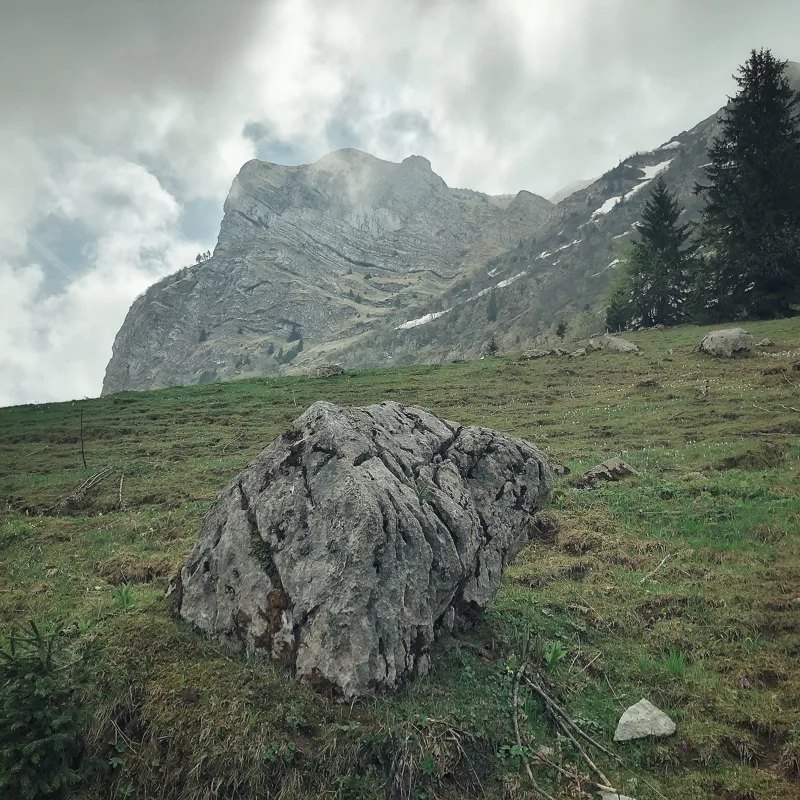 Moléson-sur-Gruyères, Plan Francey → Le Moléson, station supérieure du téléphérique3 h 00Sentier de la crête du Moléson8.0kmDistance720mAscent240mDescentTechnical mediumFitness medium. See the hike
- © swisstopoRossinière → Allières4 h 30Le Grand Tour des Vanils13.0kmDistance820mAscent700mDescentTechnical mediumFitness medium. Official waymarked stage
- © swisstopoRougemont → Rossinière3 h 50Chemin de la Sarine au Pays-d'Enhaut14.0kmDistance360mAscent460mDescentTechnical easyFitness medium. Official waymarked stage
- © swisstopoL'Etivaz → Rossinière3 h 40Via Alpina, stage 1814.0kmDistance320mAscent580mDescentTechnical easyFitness medium. Official waymarked stage
- © swisstopoMontbovon, loop4 h 00L’Intyamon de Montbovon à la Brâ10.0kmDistance780mAscent780mDescentTechnical mediumFitness medium. Official waymarked stage
- © swisstopoSoldatenhaus → Château-d'Oex8 h 00Freiburger Voralpenweg, stage 524.0kmDistance1,100mAscent1,850mDescentTechnical mediumFitness difficult. Official waymarked stage