
From the top of Pilatus to Langis
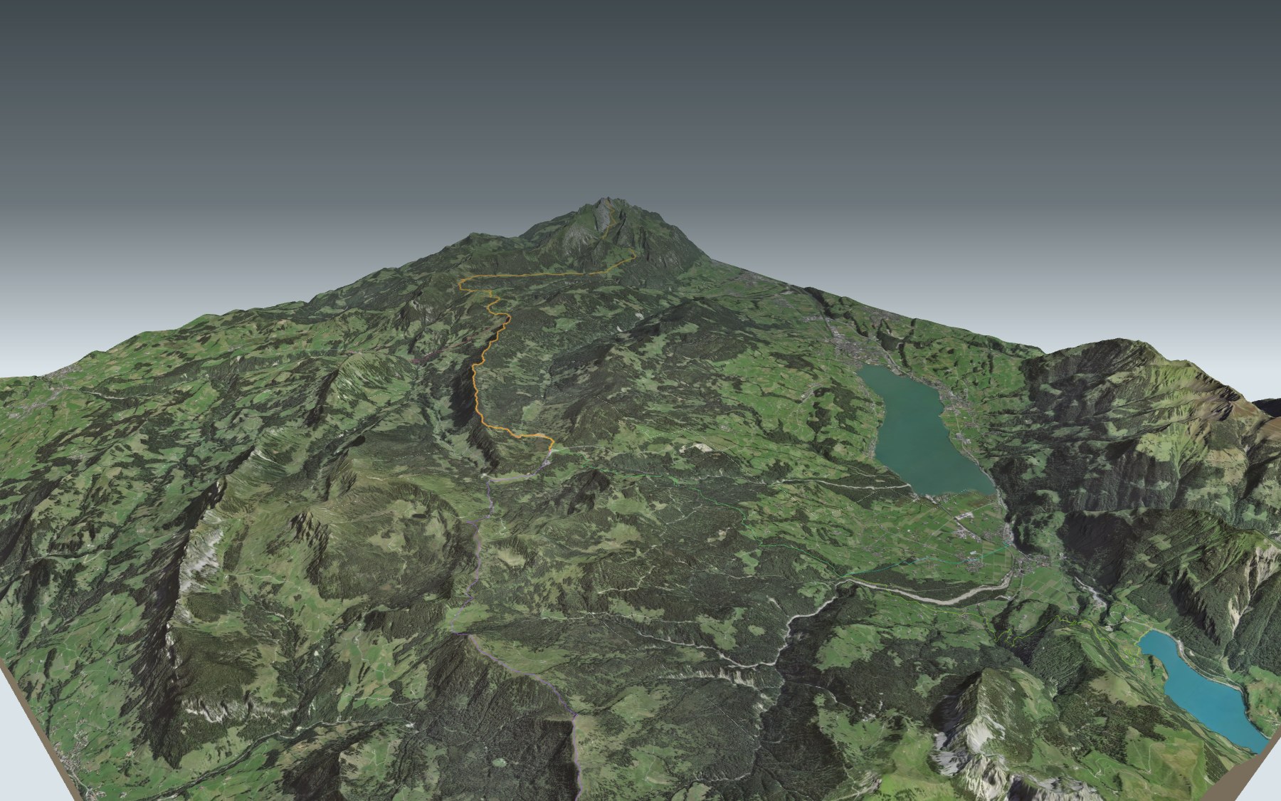
The first stage of the Obwaldner Höhenweg starts at the top: you ride the cogwheel railway from Alpnachstad up to Pilatus Kulm, and that's where you set off on foot for Langis. It's a big day, rated difficult for fitness and medium for technique: first a long descent, then a climb back up and a profile that keeps going up and down until the finish.
From Pilatus Kulm the path drops through the Laub and past Fräkmünt to the Lütholdsmatt pasture, the lowest point of the day. It then climbs again through Balismatt and Wängen to the Chrüzliegg, then follows the Schlieregrat to the Bärnerstig. The elevation profile shows you where it goes up and where it goes down.
Rather go up than down? Start from Giswil or Kaiserstuhl, by train, or from Sörenberg or Gfellen, by bus: these starting points climb to Langis, and the one from Gfellen joins the path just after the Chrüzliegg. Each starting point has its own colour in the 3D view and its own estimated time in the list of starting points. Another descent from a summit ends in Sörenberg: Brienzer Rothorn → Sörenberg.
At the finish you'll find the Bergrestaurant Schwendi-Kaltbad, then the Berghotel Langis and the Langis bus stop. Check the next departures from Langis and plan your day before you go. Fancy something else nearby? All the hikes in Central Switzerland.
The story of the trail
What happened where you are going to walk, chapter by chapter.
Down first, then the ridges
You start at 2,064 m, at Pilatus Kulm, and finish at 1,443 m, in Langis. In between: 22.5 km, 1,050 m of climbing and 1,650 m of descent. Allow 7 h 10 of walking in this direction and 7 h 50 the other way.
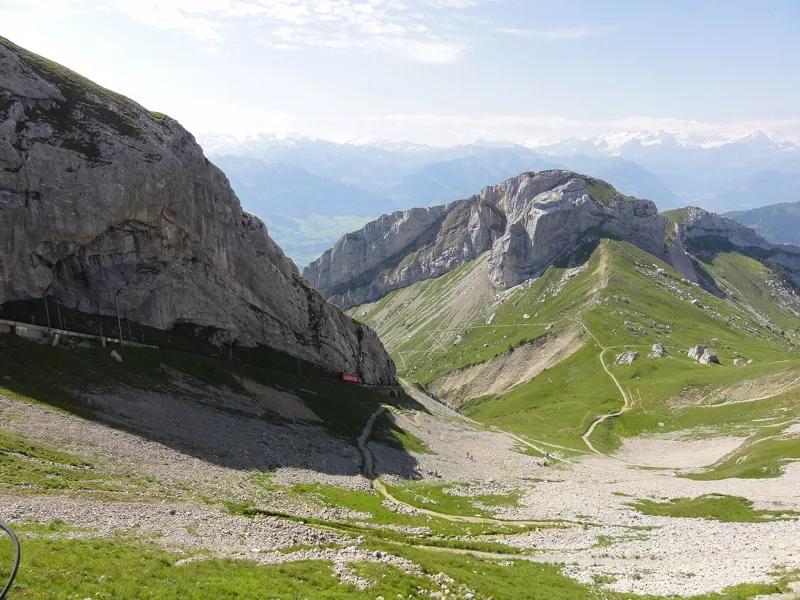
The first section only goes down: through the Laub, then past Fräkmünt, you reach the Lütholdsmatt pasture, at 1,182 m, at km 5.8, the lowest point of the route. The path then climbs again through Balismatt and Wängen to the Chrüzliegg, then follows the Schlieregrat to the Bärnerstig. After Lütholdsmatt, the next place to eat is Schwendi-Kaltbad, at km 21.7: bring enough to drink and eat. On the higher sections, snowfields are possible into the summer: follow the signposts and check the conditions on the day.
The world's steepest cogwheel railway
To reach the start, you take the Pilatusbahn from Alpnachstad. When the engineer Eduard Locher came up with the idea of a line to the summit, he met with plenty of scepticism. It opened all the same on 4 June 1889, running on steam, and switched to electricity on 15 May 1937. It is the steepest cogwheel railway in the world: its ‘Locher system’ grips a rack laid in the middle of the track from both sides.
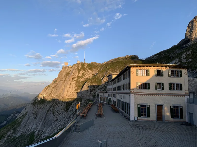
Hotel Pilatus-Kulm opened in 1890, along with the arrival of the railway, in the historicist style. Its formal dining hall is named after Queen Victoria: in the summer of 1868 she had stayed at its neighbour, the Hotel Bellevue, after riding up Pilatus on a mule. You can also reach the summit from Kriens, by gondola to Fräkmüntegg and then by the ‘Dragon Ride’ cable car.
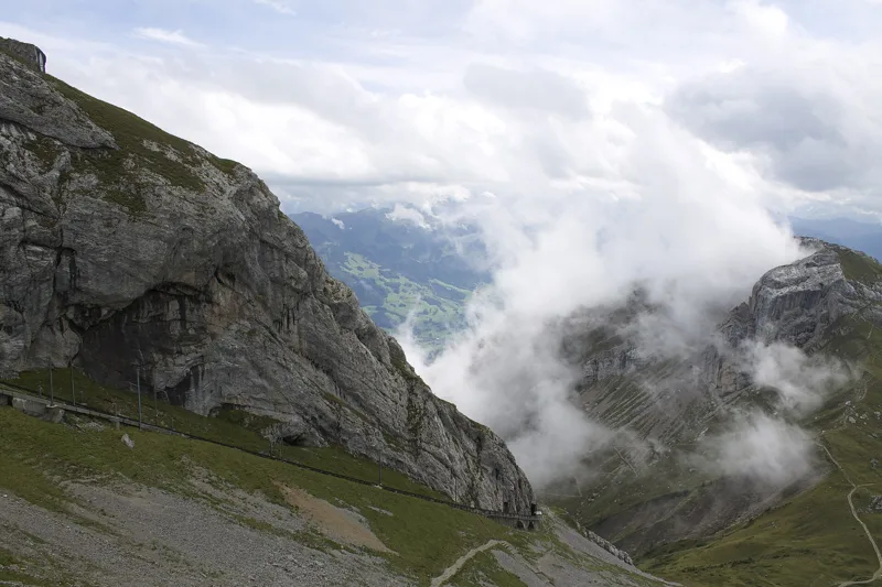
The broken mountain and its dragon
In the Middle Ages, Pilatus was called Mons fractus, the broken mountain. Two pastures, one on each side of the massif, are still called Fräkmünt, and you walk past one of them. It was also called Mons pileatus, from the Latin pila, a pillar: the mountain bristling with rock pillars. The link with Pontius Pilate only came later.
Hardly any other Swiss mountain has as many legends. The best known: in the summer of 1421, a huge dragon is said to have crashed so close to the farmer Stämpfli that he fainted. When he came to, he is said to have found a dragon stone, whose healing power was officially confirmed in 1509. You can see the stone at the Natural History Museum in Lucerne.
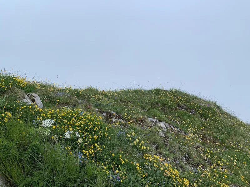
From summit limestone to the Glaubenberg moors
The summit of Pilatus is made of a pale, cliff-forming limestone, the Schrattenkalk, from the middle Cretaceous. The foot of a long rock face, from Fräkmünt to the Trochemattsattel, marks where this limestone chain was pushed over the flysch. On the Obwalden side, the slope is green and has few rocks, on softer ground. Pilatus is also home to a large colony of ibex, around a hundred animals.
Shortly after Lütholdsmatt you enter the Glaubenberg moorland, the largest in Switzerland, and you stay in it all the way to Langis. Heavy rainfall on impermeable flysch has created a high density of raised bogs and fens here. The woods of Wängen and Balismatt are bog forests covered with mountain pines and peat moss, and the area is home to species that have become rare, such as the capercaillie and the lynx.
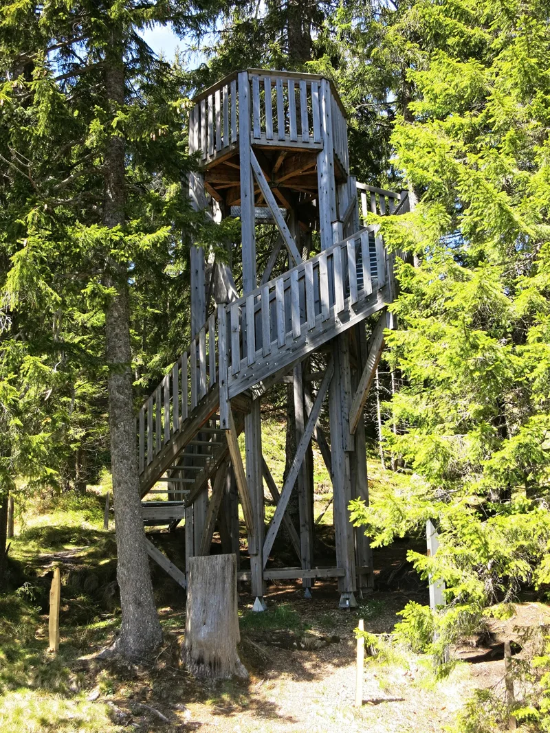
Schwendi-Kaltbad, the old spa, then Langis
At the Bärnerstig, you cross an old historic pass into the Entlebuch. Further on, near the Bäerenturm tower, you reach Schwendi-Kaltbad, at 1,441 m. It used to be a well-known spa resort, with mud and sulphur baths. Next to the former spa house, a small chapel hosts services and weddings in summer.
Between Schwendi-Kaltbad and Langis, the path runs inside the area of the moorland's largest raised bog, listed in the federal inventory of raised bogs. One last stretch takes you to the Berghotel Langis, at 1,448 m, and the Langis bus stop. Further down the page you'll find the next departures. The next stage of the Obwaldner Höhenweg continues from Langis to Schönbüel.
Every way to Langis
5 starting points to reach Langis. Pick yours: the 3D view shows it and “My day” recalculates.
Walking times without breaks. “Estimated” times are calculated on the terrain profile with a model fitted to the official stages; the shortest path may differ from the one on the yellow signposts: on the ground, follow the signs. Gradient: the steepest over 200 m of trail. Profiles share the same scale (length and altitude). Stations and car parks within 500 m of the start.
In pictures
Facade of Hotel Pilatus-Kulm (opened 1890) at Pilatus Kulm in early morning light, with the rocks of the summit ridge behind.
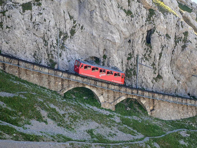
A Pilatusbahn Bhe 1/2 railcar on the viaduct below Pilatus Kulm, running downhill.
A train of the Pilatus cogwheel railway making its way up the mountain in summer.
Stairway to the summit cross of Oberhaupt, one of the summits of Pilatus, right next to the hotels at Pilatus Kulm.
Pilatus Kulm, from Oberhaupt to Tomlishorn.
Paraglider on Mount Pilatus.
Flowering alpine meadow on the summit of Oberhaupt, Pilatus, in fog.
View north from the summit of Oberhaupt, Pilatus, through drifting clouds towards Lucerne.
Pilatus, Switzerland, 2011.
The Bäerenturm on Glaubenberg-Langis, near Sarnen.
What you see from the top
360° view from Oberhaupt (2,064 m). 29 named peaks, including Finsteraarhorn, 50.1 km away. Swipe to look around.
Pilatus Kulm → Langis: when to go
Public transport serves the start every day until 11 April 2027 and from 14 April 2027, according to the official timetable. The latest time to set off ranges from 13:13 in June to 8:28 in December.
- Public transport to the start
- every day
- 31 arrivals a day
- first arrival 9:04
- last 16:34
- Sun at the start, mid-January
- from 9:20
- rises at 8:08, hidden by the ridge
- Leave by, for 7 h 10 of walking
- 8:54
- arrive 1 hour before sunset, at 17:04
| Month | Sun at the start | Leave by | In the sun, leaving at 9:00 | Transport |
|---|---|---|---|---|
| December | 9:06 → 16:38 | 8:28 | 80 % | every day |
| January | 9:20 → 17:04 | 8:54 | 87 % | every day |
| February | 9:06 → 17:51 | 9:41 | 91 % | every day |
“In the sun”: the share of the path in sunlight under a clear sky, with the terrain worked out point by point. The path climbs to 2,064 m: today's snow and frost are in the weather and My day.
- Public transport to the start
- daily, 14 Apr to 31 May
- and also 42 other days
- 31 to 55 arrivals a day
- first arrival 8:39 or 9:04
- last 16:34, 17:34 or 18:09
- Sun at the start, mid-April
- from 6:51
- rises at 6:39, hidden by the ridge
- Leave by, for 7 h 10 of walking
- 12:05
- arrive 1 hour before sunset, at 20:15
| Month | Sun at the start | Leave by | In the sun, leaving at 9:00 | Transport |
|---|---|---|---|---|
| March | 8:36 → 18:32 | 10:22 | 95 % | every day |
| April | 6:51 → 20:15 | 12:05 | 96 % | 28 of 30 days |
| May | 5:54 → 20:55 | 12:45 | 98 % | every day |
“In the sun”: the share of the path in sunlight under a clear sky, with the terrain worked out point by point. The path climbs to 2,064 m: today's snow and frost are in the weather and My day.
- Public transport to the start
- every day
- 55 arrivals a day
- first arrival 8:39
- last 18:09
- Sun at the start, mid-July
- from 5:49
- rises at 5:47
- Leave by, for 7 h 10 of walking
- 13:09
- arrive 1 hour before sunset, at 21:19
| Month | Sun at the start | Leave by | In the sun, leaving at 9:00 | Transport |
|---|---|---|---|---|
| June | 5:35 → 21:23 | 13:13 | 98 % | every day |
| July | 5:49 → 21:19 | 13:09 | 97 % | every day |
| August | 6:26 → 20:39 | 12:29 | 97 % | every day |
“In the sun”: the share of the path in sunlight under a clear sky, with the terrain worked out point by point. The path climbs to 2,064 m: today's snow and frost are in the weather and My day.
- Public transport to the start
- every day
- 14 to 55 arrivals a day
- first arrival 8:39, 9:04, 9:09 or 9:12
- last 16:34, 16:39, 16:47 or 18:09
- Sun at the start, mid-October
- from 9:13
- rises at 7:45, hidden by the ridge
- Leave by, for 7 h 10 of walking
- 10:31
- arrive 1 hour before sunset, at 18:41
| Month | Sun at the start | Leave by | In the sun, leaving at 9:00 | Transport |
|---|---|---|---|---|
| September | 7:15 → 19:40 | 11:30 | 92 % | every day |
| October | 9:13 → 18:41 | 10:31 | 90 % | every day |
| November | 8:44 → 16:53 | 8:43 | 85 % | every day |
“In the sun”: the share of the path in sunlight under a clear sky, with the terrain worked out point by point. The path climbs to 2,064 m: today's snow and frost are in the weather and My day.
The next few days
Local forecast, updated every hour
Reading the forecast…
My day
Pick your day and start time: everything updates.
- Arrival at Langis
- 15:40 7 h 10 of walking without breaks, starting at 08:30
The trail, kilometre by kilometre
From Alpnachstad (Pilatus)
Places are listed under the kilometre where you pass them. Drag along the profile: the marker moves on the 3D view too.
- under 10 %
- 10 to 20 %
- 20 to 30 %
- over 30 %
- fountain or water point
- toilets
Around the trail (250 m): 4 restaurants and 1 toilet. Estimated time: the official walking time spread by effort (1 km on the flat counts as 100 m of climbing), start time set in “My day”.
- under 10 %
- 10 to 20 %
- 20 to 30 %
- over 30 %
- fountain or water point
- toilets
Around the trail (250 m): 4 restaurants, 4 fountains and water points and 2 toilets. Estimated time: the official walking time spread by effort (1 km on the flat counts as 100 m of climbing), start time set in “My day”.
- under 10 %
- 10 to 20 %
- 20 to 30 %
- over 30 %
- fountain or water point
- toilets
Around the trail (250 m): 3 restaurants, 3 fountains and water points and 2 toilets. Estimated time: the official walking time spread by effort (1 km on the flat counts as 100 m of climbing), start time set in “My day”.
- under 10 %
- 10 to 20 %
- 20 to 30 %
- over 30 %
- fountain or water point
- toilets
Around the trail (250 m): 3 restaurants and 2 toilets. Estimated time: the official walking time spread by effort (1 km on the flat counts as 100 m of climbing), start time set in “My day”.
- under 10 %
- 10 to 20 %
- 20 to 30 %
- over 30 %
- fountain or water point
- toilets
Around the trail (250 m): 2 restaurants, 3 fountains and water points and 4 toilets. Estimated time: the official walking time spread by effort (1 km on the flat counts as 100 m of climbing), start time set in “My day”.
Getting there and back
Back by public transport from the Langis stop
Next departures from LangisReading the official timetable…
By car
From Alpnachstad (Pilatus)
Careful, this is one way: public transport back arrives in Langis, not in Pilatus Kulm. Plan to get back to your car by public transport, or park at the finish and take public transport to the start.
Public car parks within 600 m of the start: prices and number of spaces may have changed, check the signs on site.
Careful, this is one way: public transport back arrives in Langis, not in Giswil. Plan to get back to your car by public transport, or park at the finish and take public transport to the start.
- Car parkpaid100 m from the start
- Station Giswilor by public transport0 m from the start
The nearest car park and stop for this start. Check the signs on site for the price.
Careful, this is one way: public transport back arrives in Langis, not in Talstation Sessellift Sörenbergplatz-Steinetli. Plan to get back to your car by public transport, or park at the finish and take public transport to the start.
- Car parkfree80 m from the start
- Stop Sörenberg Platzor by public transport90 m from the start
The nearest car park and stop for this start. Check the signs on site for the price.
Careful, this is one way: public transport back arrives in Langis, not in Talstation Skilift Gfellen-Finsterwald. Plan to get back to your car by public transport, or park at the finish and take public transport to the start.
- Car park70 m from the start
- Stop Gfellenor by public transport70 m from the start
The nearest car park and stop for this start. Check the signs on site for the price.
Careful, this is one way: public transport back arrives in Langis, not in Kaiserstuhl. Plan to get back to your car by public transport, or park at the finish and take public transport to the start.
- Car park40 m from the start
- Station Kaiserstuhlor by public transport0 m from the start
The nearest car park and stop for this start. Check the signs on site for the price.
Questions people ask
How long is the hike from Pilatus Kulm to Langis?
7 h 10 of walking (official time), in this direction, not counting breaks. The other way: 7 h 50.
Is it hard?
Official rating for this stage: fitness difficult, technique medium. It is 1,650 m of descent over 22.5 km.
Can I get back by public transport?
Yes. The Langis stop is at the finish. The next departures show live under “Getting there and back”.
Where can I eat on the way?
4 places to eat within 250 m of the trail, including Pilatus Kulm, Lütholdsmatt, Bergrestaurant Schwendi-Kaltbad. Where they are and their opening hours: below the profile.
Is there water and are there toilets on the way?
0 fountains and water points and 1 toilet within 250 m of the trail (survey of 25/10/2026).
Can I download the track?
Yes, as a GPX file for your watch or map app: “Download the track” button at the top of the page.
More hikes within 10 km
Official stages that pass within 10 km of this trail. Each card says whether its page is already up.
- Bürgenstock, loop1 h 25Felsenweg Bürgenstock5.0kmDistance190mAscent190mDescentTechnical easyFitness easy. Official waymarked stage
- © swisstopoLangis → Schönbüel (OW)6 h 35Obwaldner Höhenweg, stage 220.0kmDistance1,250mAscent680mDescentTechnical mediumFitness difficult. Official waymarked stage
- Luzern → Alpnachstad6 h 45Waldstätterweg, stage 421.0kmDistance1,000mAscent1,000mDescentTechnical mediumFitness difficult. Official waymarked stage
- Alpnachstad → Bürgenstock5 h 15Waldstätterweg, stage 516.0kmDistance900mAscent460mDescentTechnical mediumFitness difficult. Official waymarked stage
- Sarnen → Alpnach Dorf1 h 45Wichelsee-Weg7.0kmDistance30mAscent50mDescentTechnical mediumFitness difficult. Official waymarked stage
- Stans → Flüeli-Ranft4 h 50ViaJacobi, stage 717.0kmDistance740mAscent480mDescentTechnical easyFitness medium. Official waymarked stage