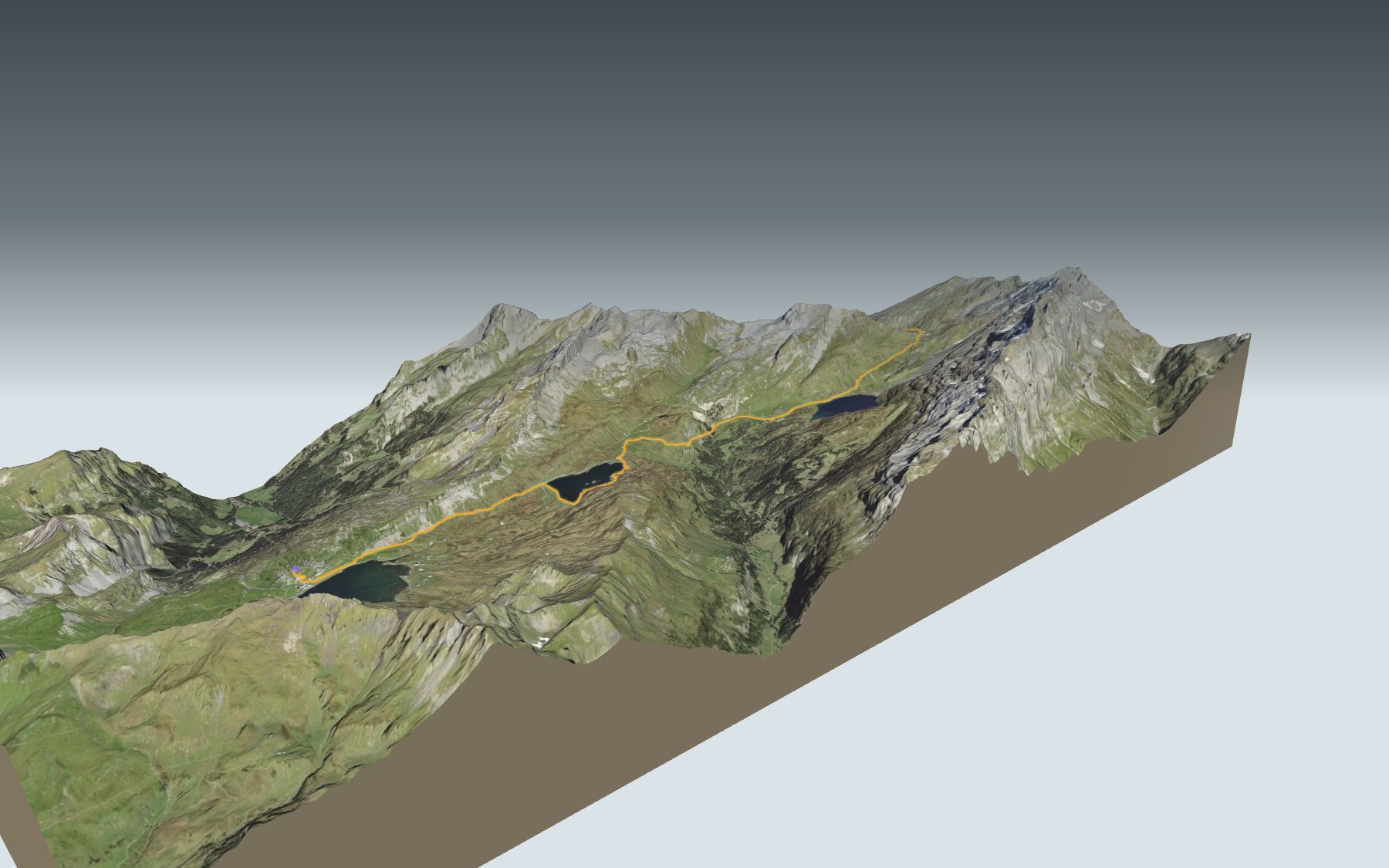

Four lakes between Obwalden and Engelberg
The name says it all: four lakes, the Melchsee, the Tannensee, the Engstlensee and the Trübsee, linked by a single trail. You start at Melchsee-Frutt and finish at the Trübsee, above Engelberg. Along the way you cross three cantons: Obwalden, Bern, then Nidwalden at the Jochpass. The route is rated medium, both for fitness and for technique.
The first kilometres stay at roughly the same altitude, past the Müllerenhütte and the Tannensee, as far as the Tannalp. Then the trail drops to the Engstlenalp and runs along the Engstlensee. That is where the real climb of the day begins, up to the Jochpass, before the descent to the Trübsee. The elevation profile shows you where it climbs.
You're spoilt for choice when it comes to food: Frutt o Bene at the start, the Berggasthaus Tannalp, the Hotel Engstlenalp and the Alphütte Rossboden along the way, then the Berghaus Jochpass at the pass. Still, carry something to drink for the climb to the Jochpass.
At the Trübsee, the gondola takes you back down to Engelberg. Check the next departures and plan your day before you set off. Fancy something else nearby? All the hikes in Central Switzerland.
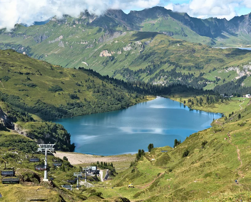
The story of the trail
What happened where you are going to walk, chapter by chapter.
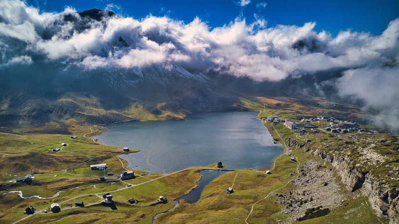
Four lakes, one pass
You start at 1,926 m in Melchsee-Frutt and finish at 1,783 m at the Trübsee. In between: 14.9 km, 620 m of climbing and 760 m of descent. The official walking time is 4 h 35 in this direction and 4 h 45 the other way. The highest point, at 2,210 m, is at the Jochpass.
The trail begins at the Melchsee, with its little chapel by the water. It then passes the Müllerenhütte and reaches the Tannensee around the 4th kilometre. The Berggasthaus Tannalp follows at km 5.6, at 1,973 m. Shortly afterwards, you enter the canton of Bern.
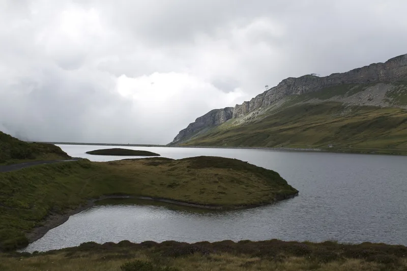
The Tannensee, a lake held back by a dam
The Tannensee is a reservoir. Its earth dam, built in 1958, holds back the water of several streams; it belongs to the Elektrizitätswerk Obwalden. The lake serves as a store for the Melchsee, the starting point of the water for the Hugschwendi power station.
In 2009, the flood overflow structure was renovated because of cracks and damage to the concrete.
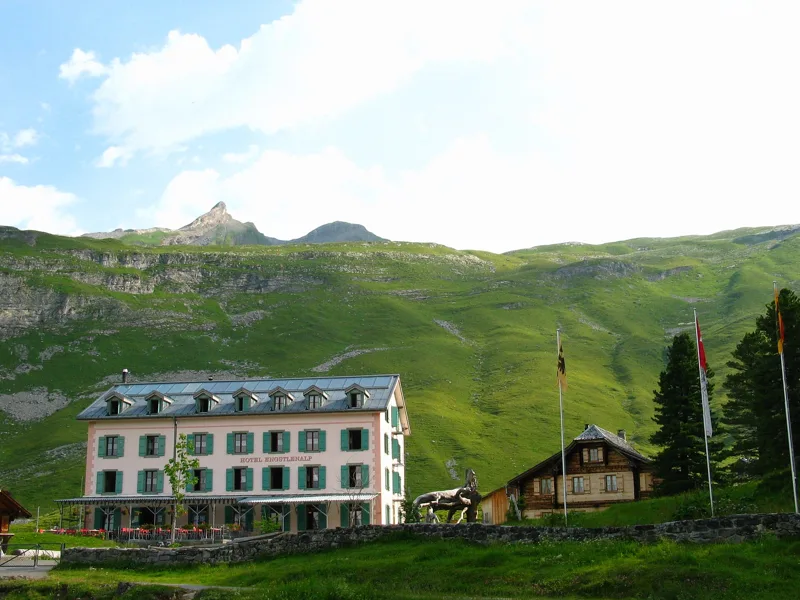
Engstlenalp, a hotel from 1892
Up on the alp, the Hotel Engstlenalp dates back to 1892; today it is run by the fourth generation. In its dining room, scholars, farmers and craftsmen once sat together at one table.
You reach it at km 8.3, at 1,835 m, and the Alphütte Rossboden follows at km 8.5. It is the last place to eat before the pass.
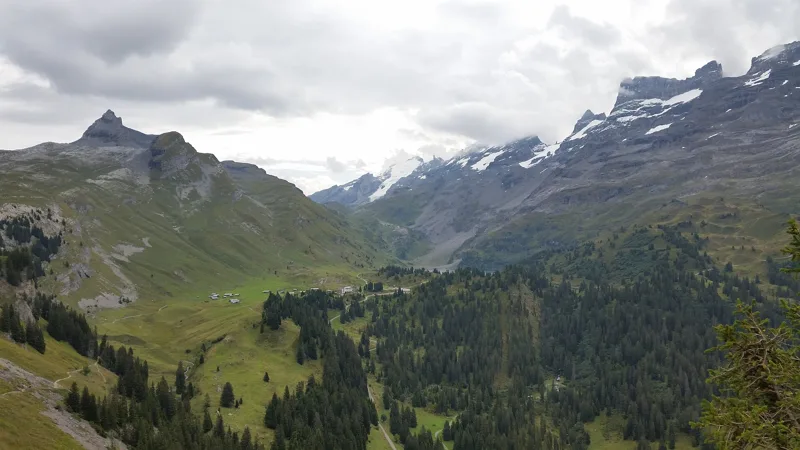
The Engstlensee, a nature reserve
In the 10th kilometre, the trail runs along the Engstlensee, a lake rich in fish. The lake and its surroundings form the Engstlensee-Jungibächi-Achtelsass nature reserve, whose protection plan was adopted by the canton of Bern on 3 December 2012. The plan also marks out a wildlife rest area: stay on the trail.
On the Obwalden side, in the municipality of Kerns, the Melchsee also has its fen of national importance, with wet meadows and sedges.
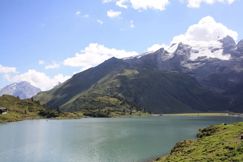
Jochpass and Trübsee, then the gondola
From the Engstlensee, the trail climbs to the Jochpass. At the pass, at km 12.1, the Berghaus Jochpass stands at 2,205 m; this is where you cross into the canton of Nidwalden. The ski lift from the Trübsee to the Jochpass opened in winter 1943; from summer 1944 it carried visitors up to the pass on single chairs. In 1987, its bottom station burnt down after a lightning strike.
The descent leads to the Trübsee, filled with emerald-green glacier water, which you can also explore by rowing boat. The aerial cableway from Gerschnialp to the Trübsee opened on 23 December 1927. Today, the Titlis Xpress gondola links the Trübsee with Engelberg; further down the page you'll find the next departures.
In pictures
Lake Melchsee; on the left edge, the nationally important Melchsee fen
The Tannensee, a reservoir in the canton of Obwalden
The Tannensee (OW), with the Engstlensee (BE) in the background
Engstlenalp
Hotel Engstlenalp, municipality of Innertkirchen, canton of Bern
The Engstlensee, with the Titlis in the centre
The Engstlensee seen from above, from the Jochpass viewpoint
From the Jochpass to the Trübsee, Engelberg
The Trübsee and the Titlis
The Trübsee in the evening light, looking east-north-east
Vier-Seen-Wanderung: when to go
Public transport serves the start every day from 12 December 2026 to 4 April 2027 and from 12 June to 17 October 2027 (and 5 other days), according to the official timetable: that's the season to do this hike without a car. The latest time to set off ranges from 15:48 in June to 11:04 in December.
- Public transport to the start
- daily, 12 Dec to 28 Feb
- 545 to 749 arrivals a day
- first arrival 8:20 or 8:45
- last 17:49, 21:35 or 22:19
- Sun at the start, mid-January
- from 8:56
- rises at 8:08, hidden by the ridge
- Leave by, for 4 h 35 of walking
- 11:30
- arrive 1 hour before sunset, at 17:05
| Month | Sun at the start | Leave by | In the sun, leaving at 9:00 | Transport |
|---|---|---|---|---|
| December | 8:53 → 16:39 | 11:04 | 55 % | 20 of 31 days |
| January | 8:56 → 17:05 | 11:30 | 64 % | every day |
| February | 8:13 → 17:51 | 12:16 | 95 % | every day |
“In the sun”: the share of the path in sunlight under a clear sky, with the terrain worked out point by point. The path climbs to 2,210 m: today's snow and frost are in the weather and My day.
- Public transport to the start
- daily, 1 Mar to 4 Apr
- 545 to 749 arrivals a day
- first arrival 8:20 or 8:45
- last 17:49, 21:35 or 22:19
- Sun at the start, mid-April
- from 7:36
- rises at 6:40, hidden by the ridge
- Leave by, for 4 h 35 of walking
- 14:39
- arrive 1 hour before sunset, at 20:14
| Month | Sun at the start | Leave by | In the sun, leaving at 9:00 | Transport |
|---|---|---|---|---|
| March | 7:28 → 18:32 | 12:57 | 98 % | every day |
| April | 7:36 → 20:14 | 14:39 | 100 % | 4 of 30 days |
| May | 6:50 → 20:54 | 15:19 | 100 % | off season |
“In the sun”: the share of the path in sunlight under a clear sky, with the terrain worked out point by point. The path climbs to 2,210 m: today's snow and frost are in the weather and My day.
- Public transport to the start
- daily, 12 Jun to 31 Aug
- 475 arrivals a day
- first arrival 8:45
- last 17:39
- Sun at the start, mid-July
- from 6:46
- rises at 5:48, hidden by the ridge
- Leave by, for 4 h 35 of walking
- 15:43
- arrive 1 hour before sunset, at 21:18
| Month | Sun at the start | Leave by | In the sun, leaving at 9:00 | Transport |
|---|---|---|---|---|
| June | 6:30 → 21:23 | 15:48 | 100 % | 19 of 30 days |
| July | 6:46 → 21:18 | 15:43 | 100 % | every day |
| August | 7:21 → 20:38 | 15:03 | 100 % | every day |
“In the sun”: the share of the path in sunlight under a clear sky, with the terrain worked out point by point. The path climbs to 2,210 m: today's snow and frost are in the weather and My day.
- Public transport to the start
- daily, 1 Sept to 17 Oct
- and also 5 other days
- 475 arrivals a day
- first arrival 8:45
- last 17:39
- Sun at the start, mid-October
- from 8:25
- rises at 7:45, hidden by the ridge
- Leave by, for 4 h 35 of walking
- 13:06
- arrive 1 hour before sunset, at 18:41
| Month | Sun at the start | Leave by | In the sun, leaving at 9:00 | Transport |
|---|---|---|---|---|
| September | 7:41 → 19:40 | 14:05 | 100 % | every day |
| October | 8:25 → 18:41 | 13:06 | 99 % | 21 of 31 days |
| November | 8:09 → 16:54 | 11:19 | 81 % | 1 of 30 days |
“In the sun”: the share of the path in sunlight under a clear sky, with the terrain worked out point by point. The path climbs to 2,210 m: today's snow and frost are in the weather and My day.
The next few days
Local forecast, updated every hour
Reading the forecast…
My day
Pick your day and start time: everything updates.
- Arrival at Engelberg (Trübsee)
- 13:05 4 h 35 of walking without breaks, starting at 08:30
The trail, kilometre by kilometre
Places are listed under the kilometre where you pass them. Drag along the profile: the marker moves on the 3D view too.
- under 10 %
- 10 to 20 %
- 20 to 30 %
- over 30 %
- fountain or water point
- toilets
Around the trail (250 m): 5 restaurants, 4 fountains and water points and 8 toilets. Estimated time: the official walking time spread by effort (1 km on the flat counts as 100 m of climbing), start time set in “My day”.
Getting there and back
Back by public transport from the Trübsee stop
Next departures from TrübseeReading the official timetable…
By car
Careful, this is one way: public transport back arrives in Trübsee, not in Melchsee-Frutt. Plan to get back to your car by public transport, or park at the finish and take public transport to the start.
- Car park open-air, Fruttstrassepaid300 m from the start
- Car park open-air, Engelsburg100 m from the start
- Car park, Frutt190 m from the start
Public car parks within 600 m of the start: prices and number of spaces may have changed, check the signs on site.
Questions people ask
How long is the hike from Melchsee-Frutt to Engelberg (Trübsee)?
4 h 35 of walking (official time), in this direction, not counting breaks. The other way: 4 h 45.
Is it hard?
Official rating for this stage: fitness medium, technique medium. It is 760 m of descent over 14.9 km.
Can I get back by public transport?
Yes. The Trübsee stop is at the finish. The next departures show live under “Getting there and back”.
Where can I eat on the way?
5 places to eat within 250 m of the trail, including Frutt o Bene, Berggasthaus Tannalp, Hotel Engstlenalp. Where they are and their opening hours: below the profile.
Is there water and are there toilets on the way?
4 fountains and water points and 8 toilets within 250 m of the trail (survey of 25/10/2026).
Can I download the track?
Yes, as a GPX file for your watch or map app: “Download the track” button at the top of the page.
More hikes within 10 km
Official stages that pass within 10 km of this trail. Each card says whether its page is already up.
- Hasliberg, Reuti → Engstlenalp6 h 50ViaBerna, stage 1819.0kmDistance1,500mAscent720mDescentTechnical mediumFitness difficult. Official waymarked stage
- Engelberg → Engstlenalp5 h 10ViaSbrinz, stage 213.0kmDistance1,300mAscent440mDescentTechnical mediumFitness difficult. Official waymarked stage
- Melchsee-Frutt → Engelberg6 h 20Nidwaldner Höhenweg, stage 321.0kmDistance640mAscent1,550mDescentTechnical mediumFitness difficult. Official waymarked stage
- Engelberg → Engstlenalp5 h 00Via Alpina, stage 812.0kmDistance1,300mAscent440mDescentTechnical mediumFitness difficult. Official waymarked stage
- Engstlenalp → Meiringen7 h 00Via Alpina, stage 922.0kmDistance740mAscent1,950mDescentTechnical mediumFitness difficult. Official waymarked stage
- Storeggpass → Melchsee-Frutt4 h 35Nidwaldner Höhenweg, stage 213.0kmDistance900mAscent760mDescentTechnical mediumFitness difficult. Official waymarked stage