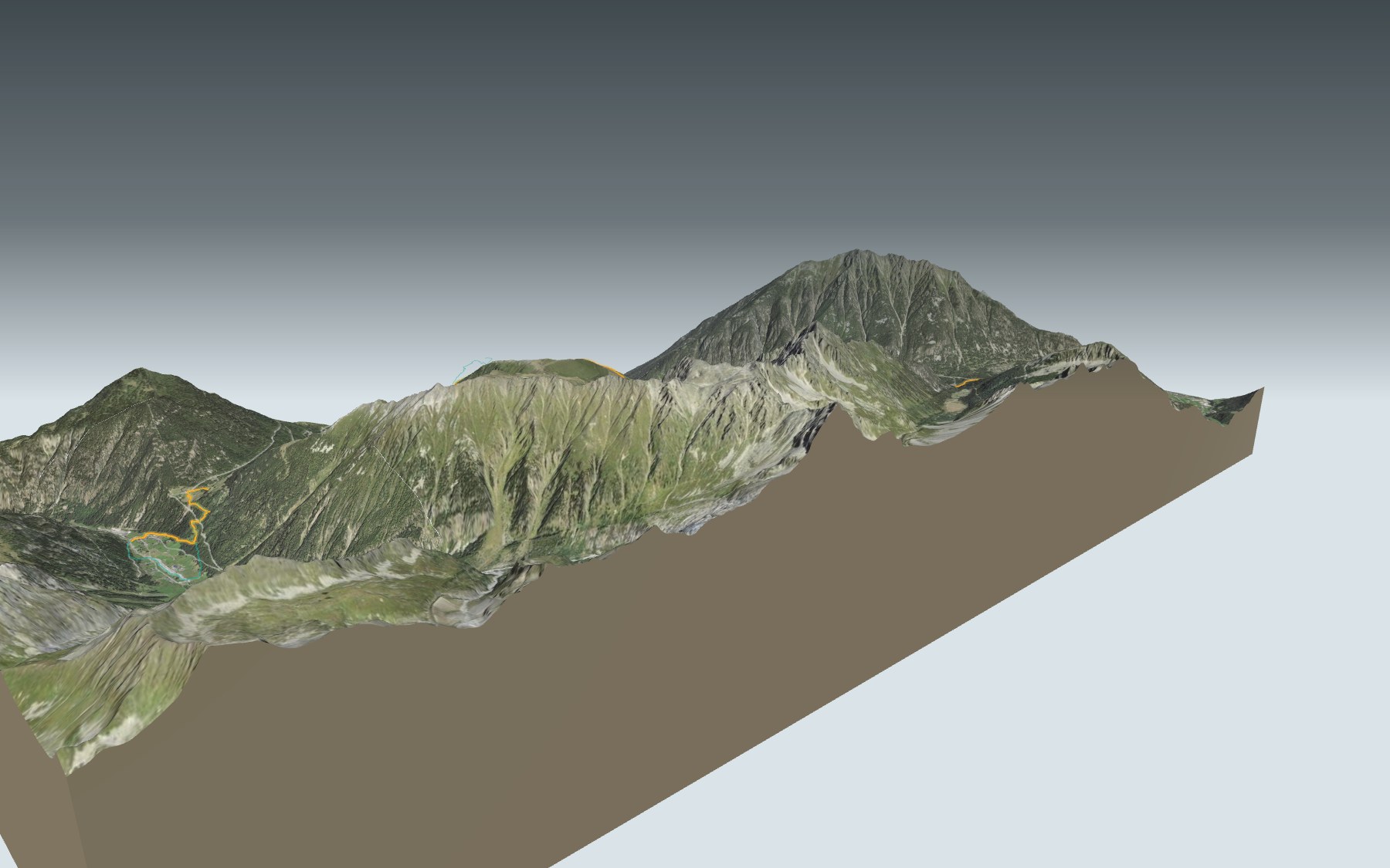

From Champex to Trient via the Bovine pasture
A day in three parts: once over the Col de Champex, just above the lake, you first head down, then you climb for a long time up to the Bovine pasture, and finally you drop over the Col de la Forclaz to Trient. The path follows the same key points as the classic Tour du Mont-Blanc, the route via Bovine. It's rated difficult for fitness and medium for technique.
You pass through Champex d'en Haut and Champex d'en Bas and stop at the Plan de l'Au café, then the big climb begins, up the Combe des Vernes to the Alpage de Bovine. The high point comes just after. The elevation profile shows you where it gets steepest.
Coming from the Rhône valley? Another starting point climbs from Martigny-Expo and joins the path shortly before Bovine: it has its own colour in the 3D view and an estimated time under all starting points. The day before, the stage from La Fouly to Champex-Lac ends on the shore of the same lake, and in the same area the Sentier du Balcon du Mont-Blanc climbs from Finhaut to the Emosson dam.
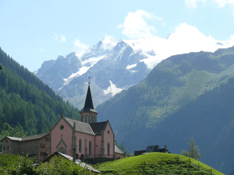
At the finish: Trient and its pink church, beside the river of the same name. Check the next departures from Trient and plan your day before you set off. Looking for more in the area? See all hikes in Valais.
The story of the trail
What happened where you are going to walk, chapter by chapter.
Down, up, and down again
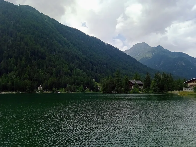
You start at 1,467 m, on the shore of Lake Champex, and finish at 1,280 m, in Trient. In between: 16.3 km, 880 m of climbing and 1,050 m of descent. The official walking time is 5 h 30 in this direction and 5 h 40 the other way.
Once over the Col de Champex, just above the lake, the path goes down to Plan de l'Au, at 1,330 m, at km 4.7. From there it climbs almost in one go to the Alpage de Bovine, at 1,978 m, at km 9.4, and just after that reaches the highest point of the day, at 2,049 m. The end is a long descent: the Col de la Forclaz at km 14.0, then Trient.
The Champex hamlets, then the pasture
Around Champex, the hotel trade got going around 1850. From the lakeshore, the path crosses the Col de Champex and passes Champex d'en Haut, crosses the Durnand d'Arpette stream, then goes through Champex d'en Bas. The Plan de l'Au café is the last place to eat before Bovine.
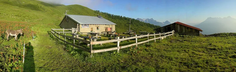
Higher up, the path climbs the Combe des Vernes, crosses the Durnand de la Jure stream and heads up to the Alpage de Bovine. Champex-Lac, Champex d'en Haut, Plan-de-l'Au, Bovine, Col de la Forclaz: these are also the key points of the classic Tour du Mont-Blanc from Champex-Lac, the big loop around the massif through three countries.
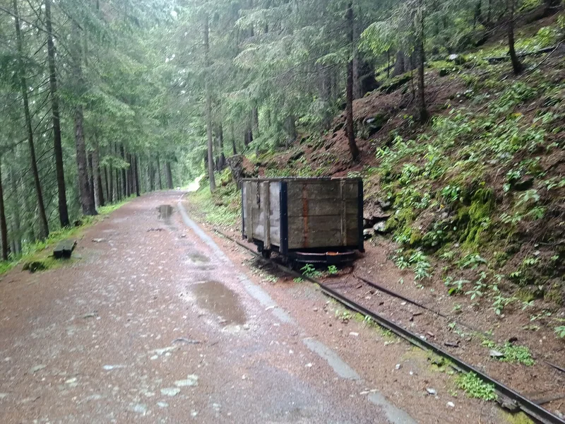
Trient ice set off from the pass
The Col de la Forclaz lies at 1,527 m, between the Mont de l'Arpille and the Croix des Prélayes. It links Martigny with Chamonix via Trient, Vallorcine and the Col des Montets. A first road crossed the pass in 1824; today's road dates from 1957.
Towards the end of the 1880s, 10 to 15 big carts left the pass every day, taking between 20,000 and 30,000 kilos of ice blocks from the Trient Glacier down to Martigny. One train a week carried it on to Paris, Lyon and Marseille. In 1893, ice-making machines drove the business into bankruptcy. The Bisse du Trient trail, which runs from the pass towards the glacier tongue, follows an old path once used to transport those blocks; today the bisse waters the meadows and vineyards of Martigny-Combe.
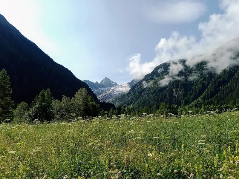
A garden at the start, a shrinking glacier
At the start, a stone's throw from the path, the Flore-Alpe botanical garden began life as a private alpine garden, built in 1927. In 2024 it held around 4,000 plant species, half of them from Switzerland and Valais, and welcomed visitors every day from May to October. It will celebrate its centenary in 2027.
The Trient Glacier is closely watched: its front has been measured since 1879. From the 2012 measurement to the 2024 one, every published measurement shows a retreat.
Trient, the village with the pink church
Trient used to be part of Martigny-Combe: its people voted to separate in 1899 and the municipality officially came into being in 1900. They lived from livestock and worked the ice of the Trient Glacier in the second half of the 19th century. Summer tourism grew here between 1870 and 1906, with seven hotels built.
The church dates from 1893. Repainted in 2011, its pink colour has made it a symbol of the region. From here the Tour du Mont-Blanc carries on towards the Col de la Balme; you can call it a day. Further down the page you'll find the next departures from Trient.
Every way to Trient
2 starting points to reach Trient. Pick yours: the 3D view shows it and “My day” recalculates.
Walking times without breaks. “Estimated” times are calculated on the terrain profile with a model fitted to the official stages; the shortest path may differ from the one on the yellow signposts: on the ground, follow the signs. Gradient: the steepest over 200 m of trail. Profiles share the same scale (length and altitude). Stations and car parks within 500 m of the start.
In pictures
Lake Champex, Orsières (Valais)
Flore-Alpe alpine botanical garden
The Bovine high mountain pasture
Hiking up to the Bovine high mountain pasture, with a view of Martigny
Trient, on the way up to the Col de la Forclaz
The Col de la Forclaz, Trient (Valais)
Small wagon along the Bisse du Trient, Trient (Valais)
The Trient Glacier seen from the Trient valley (Valais)
Saint-Bernard's church in Trient (Valais)
Trient (Valais)
Champex → Trient: when to go
The bus runs up to the start every day of the year, according to the official timetable. Here the sun clears the ridge late, and the latest time to set off ranges from 14:54 in June to 10:16 in December.
- Bus to the start
- every day
- 10 to 28 buses a day
- first bus 5:59, 6:52 or 6:55
- last 20:03, 20:17 or 21:39
- Sun at the start, mid-January
- from 9:06
- rises at 8:10, hidden by the ridge
- Leave by, for 5 h 30 of walking
- 10:42
- arrive 1 hour before sunset, at 17:12
| Month | Sun at the start | Leave by | In the sun, leaving at 9:00 | Bus |
|---|---|---|---|---|
| December | 8:57 → 16:46 | 10:16 | 42 % | every day |
| January | 9:06 → 17:12 | 10:42 | 51 % | every day |
| February | 8:44 → 17:57 | 11:27 | 70 % | every day |
“In the sun”: the share of the path in sunlight under a clear sky, with the terrain worked out point by point. The path climbs to 2,049 m: today's snow and frost are in the weather and My day.
- Bus to the start
- every day
- 10 to 26 buses a day
- first bus 5:59 or 6:52
- last 20:03, 20:17 or 21:39
- Sun at the start, mid-April
- from 9:07
- rises at 6:45, hidden by the ridge
- Leave by, for 5 h 30 of walking
- 13:48
- arrive 1 hour before sunset, at 20:18
| Month | Sun at the start | Leave by | In the sun, leaving at 9:00 | Bus |
|---|---|---|---|---|
| March | 8:26 → 18:37 | 12:07 | 91 % | every day |
| April | 9:07 → 20:18 | 13:48 | 95 % | every day |
| May | 8:53 → 20:56 | 14:26 | 98 % | every day |
“In the sun”: the share of the path in sunlight under a clear sky, with the terrain worked out point by point. The path climbs to 2,049 m: today's snow and frost are in the weather and My day.
- Bus to the start
- every day
- 10 to 12 buses a day
- first bus 5:59 or 6:52
- last 20:03, 20:17 or 21:39
- Sun at the start, mid-July
- from 8:59
- rises at 5:55, hidden by the ridge
- Leave by, for 5 h 30 of walking
- 14:50
- arrive 1 hour before sunset, at 21:20
| Month | Sun at the start | Leave by | In the sun, leaving at 9:00 | Bus |
|---|---|---|---|---|
| June | 8:52 → 21:24 | 14:54 | 100 % | every day |
| July | 8:59 → 21:20 | 14:50 | 100 % | every day |
| August | 9:05 → 20:41 | 14:11 | 96 % | every day |
“In the sun”: the share of the path in sunlight under a clear sky, with the terrain worked out point by point. The path climbs to 2,049 m: today's snow and frost are in the weather and My day.
- Bus to the start
- every day
- 10 to 13 buses a day
- first bus 5:59, 6:52 or 6:55
- last 20:03, 20:17 or 21:39
- Sun at the start, mid-October
- from 9:08
- rises at 7:48, hidden by the ridge
- Leave by, for 5 h 30 of walking
- 12:16
- arrive 1 hour before sunset, at 18:46
| Month | Sun at the start | Leave by | In the sun, leaving at 9:00 | Bus |
|---|---|---|---|---|
| September | 9:06 → 19:44 | 13:14 | 90 % | every day |
| October | 9:08 → 18:46 | 12:16 | 77 % | every day |
| November | 8:36 → 17:00 | 10:30 | 60 % | every day |
“In the sun”: the share of the path in sunlight under a clear sky, with the terrain worked out point by point. The path climbs to 2,049 m: today's snow and frost are in the weather and My day.
The next few days
Local forecast, updated every hour
Reading the forecast…
My day
Pick your day and start time: everything updates.
- Arrival at Trient
- 14:00 5 h 30 of walking without breaks, starting at 08:30
The trail, kilometre by kilometre
From Champex
Places are listed under the kilometre where you pass them. Drag along the profile: the marker moves on the 3D view too.
- under 10 %
- 10 to 20 %
- 20 to 30 %
- over 30 %
- fountain or water point
- toilets
Around the trail (250 m): 9 restaurants, 4 cafés, 11 fountains and water points and 5 toilets. Estimated time: the official walking time spread by effort (1 km on the flat counts as 100 m of climbing), start time set in “My day”.
- under 10 %
- 10 to 20 %
- 20 to 30 %
- over 30 %
- fountain or water point
- toilets
Around the trail (250 m): 22 restaurants, 8 cafés, 28 fountains and water points and 5 toilets. Estimated time: the official walking time spread by effort (1 km on the flat counts as 100 m of climbing), start time set in “My day”.
Getting there and back
Back by public transport from the Trient, Betty stop
Next departures from Trient, BettyReading the official timetable…
By car
From Champex
Careful, this is one way: public transport back arrives in Trient, Betty, not in Champex. Plan to get back to your car by public transport, or park at the finish and take public transport to the start.
- Car park open-air, Route de l'Adrayfree220 m from the start
- Car park open-air, Chemin du Revers du Léfree500 m from the start
- Car park open-air, Route du Signalfree630 m from the start
- Car park, Route du Lac30 m from the start
Public car parks within 600 m of the start: prices and number of spaces may have changed, check the signs on site.
Careful, this is one way: public transport back arrives in Trient, Betty, not in Martigny-Expo. Plan to get back to your car by public transport, or park at the finish and take public transport to the start.
- Car parkpaid60 m from the start
- Station Martigny-Expoor by public transport0 m from the start
The nearest car park and stop for this start. Check the signs on site for the price.
Questions people ask
How long is the hike from Champex to Trient?
5 h 30 of walking (official time), in this direction, not counting breaks. The other way: 5 h 40.
Is it hard?
Official rating for this stage: fitness difficult, technique medium. It is 1,050 m of descent over 16.3 km.
Can I get back by public transport?
Yes. The Trient, Betty stop is at the finish. The next departures show live under “Getting there and back”.
Where can I eat on the way?
14 places to eat within 250 m of the trail, including Le Cabanon, Au Rendez-Vous, Au vieux Champex. Where they are and their opening hours: below the profile.
Is there water and are there toilets on the way?
11 fountains and water points and 5 toilets within 250 m of the trail (survey of 25/10/2026).
Can I download the track?
Yes, as a GPX file for your watch or map app: “Download the track” button at the top of the page.
More hikes within 10 km
Official stages that pass within 10 km of this trail. Each card says whether its page is already up.
- © swisstopoTrient → Lac d’Emosson7 h 00Alpenpässe-Weg, stage 3716.0kmDistance1,700mAscent1,000mDescentTechnical mediumFitness difficult. Official waymarked stage
- © swisstopoMartigny → Orsières6 h 00ViaFrancigena, stage 820.0kmDistance950mAscent520mDescentTechnical easyFitness difficult. Official waymarked stage
- © swisstopoOrsières → Bourg-St-Pierre4 h 25ViaFrancigena, stage 914.0kmDistance900mAscent180mDescentTechnical easyFitness difficult. Official waymarked stage
- © swisstopoLiddes → Orsières, La Douay4 h 00Chemin des villages et hameaux d'Entremont14.0kmDistance420mAscent900mDescentTechnical mediumFitness difficult. Official waymarked stage
- © swisstopoSt-Maurice → Martigny4 h 00ViaFrancigena, stage 716.0kmDistance280mAscent240mDescentTechnical easyFitness medium. Official waymarked stage
- © swisstopoMartigny (Col des Planches) → La Tzoumaz4 h 00Chemin des Bisses, stage 113.0kmDistance680mAscent380mDescentTechnical easyFitness medium. Official waymarked stage