
Walking opposite the 4000ers
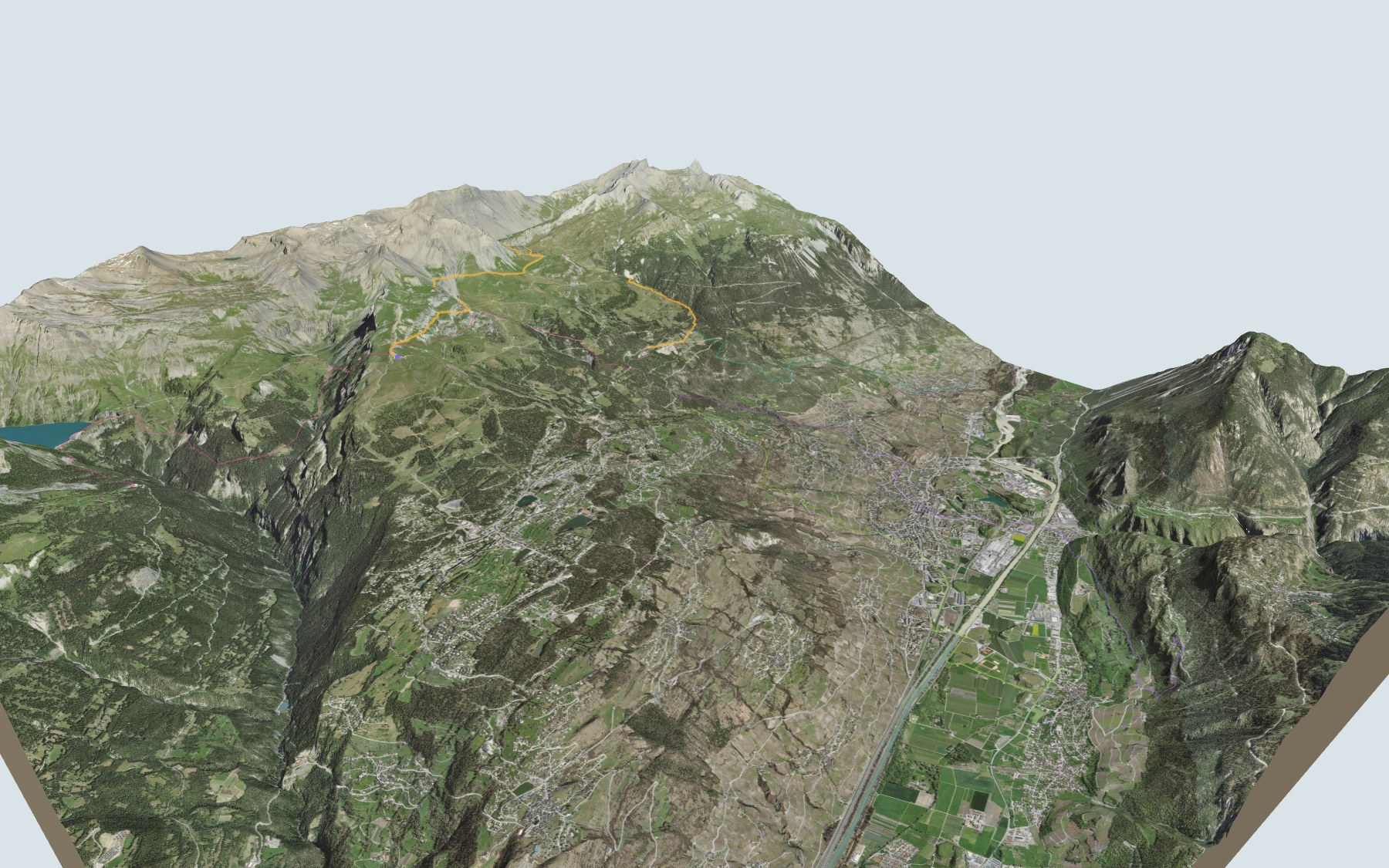
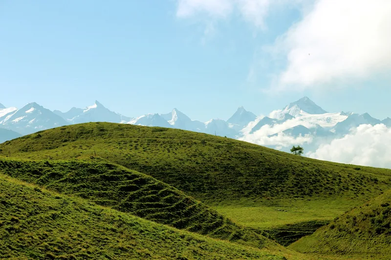
The name says it all: you get a view over the Rhône valley and the chain of 4000ers on the other side, with the Val d'Anniviers opposite and the Matterhorn in the background. You start at the top station of the Cry d'Er cable car, above Crans-Montana, and finish in Aminona. SwitzerlandMobility rates the route difficult for fitness and medium for technique.
The first third is fairly flat, then the path climbs to its highest point, just after La Vache Noire. After that comes a long descent: the Tièche valley, the Tsittoret bisse as far as the Cave du Sex, then the forest down to Aminona. The elevation profile shows you where the descent gets steeper.
Other paths climb to Aminona: from Salgesch, from Briey or from the valley station of the Chalais cable car; another one starts at Les Rousses, the Anzère, Les Rousses bus stop. Each start has its own colour in the 3D view and its estimated time under all starting points. Nearby, the Grand Bisse d'Ayent follows another 15th-century channel, and the Vercorin → Grimentz hike goes from village to village in the Val d'Anniviers, the valley you see opposite.
At the finish: the Restaurant du Centre d'Accueil d'Aminona and the bus back down towards Montana. Check the next departures from Aminona and plan your day before you set off. Fancy something else nearby? All hikes in Valais.
The story of the trail
What happened where you are going to walk, chapter by chapter.
A little climbing, then a long descent
You start at 2,255 m, at the top station of the Cry d'Er cable car, and finish at 1,518 m in Aminona. In between: 13.6 km, and 540 m of climbing and 1,300 m of descent according to SwitzerlandMobility. SwitzerlandMobility allows 4 h 30 of walking in this direction and 5 h 15 the other way. The highest point, at 2,398 m, comes just after La Vache Noire.
The hike comes in three parts: a fairly flat first third along the flanks of Bella Lui, a climb northwards to the highest point, on the slopes of Mont Bonvin, then, for the remaining two thirds, one long continuous descent. On the way, follow the signposts and check the conditions on the day.
From Les Violettes to the Tièche valley
At the start is the Club Cry d'Er. After about two kilometres, the path passes the Violettes restaurant, then runs very close to the Cabane des Violettes. It then passes near the Petit Mont Bonvin and reaches La Vache Noire, at 2,386 m, in the sixth kilometre. Next come the Alpage de Bèveron, the highest point and the Creux de la Tièche.
Next come open slopes scattered with large boulders above the tree line, then the Tsittoret bisse. The path passes near the Cabane de la Tièche and follows the bisse to the Cave du Sex, at 1,877 m, in the eleventh kilometre. From there it carries on through the forest to Aminona.
A Swiss Alpine Club hut since 1924
The Montana-Vermala section of the Swiss Alpine Club was founded in spring 1920 by a group of friends. The first Violettes hut was built in 1924, then replaced twenty years later by today's more comfortable hut. Today it is a mountain restaurant run by its hut keepers, with 24 beds.
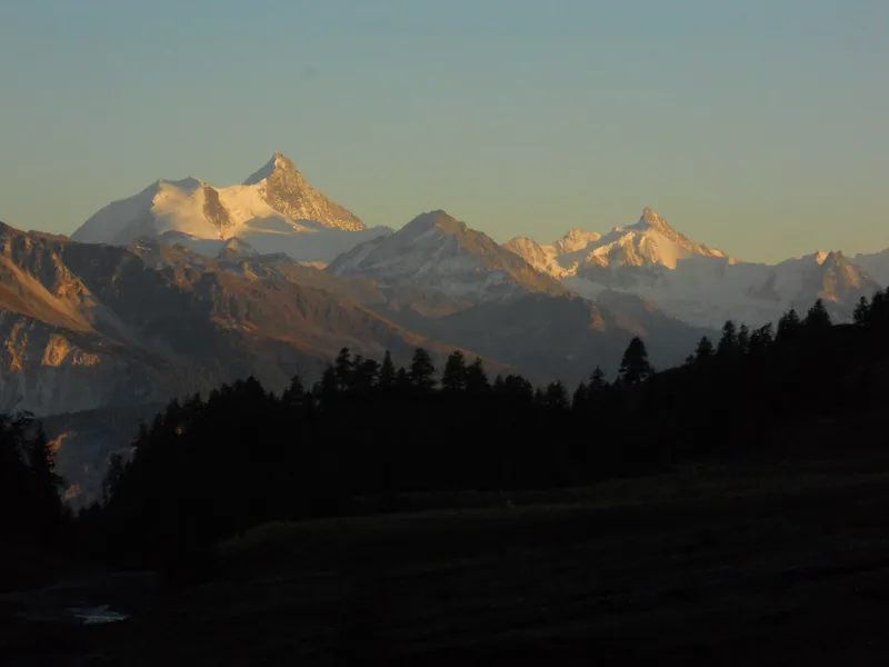
The hut stands on a rocky promontory above Montana. The view stretches from the Upper Valais to the Weisshorn and the Matterhorn, and on to the Grand Combin and Mont Blanc.
The Tsittoret bisse
A bisse is an irrigation channel. The Tsittoret bisse takes its water from the Tièche (Raspille) and, right after, makes a tumultuous drop over a rock face. It then runs towards the Cave du Sex, then Colombire, and ends at Les Barzettes. It still carries water along its whole length and irrigates the upper part of Mollens.
The bisse brings the water of the Raspille to the Noble Contrée and irrigates orchards and vineyards in the municipalities of Venthône, Randogne, Mollens, Miège, Sierre and Veyras; documents mention it from the 15th century. Further down, between Salgesch and Sierre, the Raspille forms the language border between German and French.
Marmots, scree and Aminona
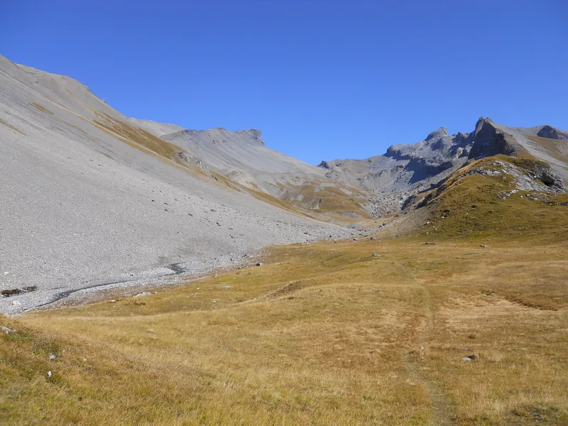
Under your feet, section by section, there are marls, claystones and limestones of the Sublage and Wildhorn nappes, then, after the Tièche, sandstones and marls of the Jägerchrüz nappe; elsewhere, scree and moraine. Bring binoculars to watch birds of prey and the many marmots on the rocky slopes.
Aminona was the mountain resort of the former municipality of Mollens, which merged in 2017 with Chermignon, Montana and Randogne to form Crans-Montana. Of the twenty-three residential towers planned in Aminona, only three were built, in 1972 and 1973. For the way back, the bus runs from Aminona to the top station of the funicular in Montana; further down the page you will find the next departures.
Every way to Crans-Montana, Aminona
5 starting points to reach Crans-Montana, Aminona. Pick yours: the 3D view shows it and “My day” recalculates.
Walking times without breaks. “Estimated” times are calculated on the swisstopo profile with a model fitted to the official SwitzerlandMobility stages; the shortest path may differ from the one on the yellow signposts: on the ground, follow the signs. Gradient: the steepest over 200 m of trail. Profiles share the same scale (length and altitude). Stations and car parks within 500 m of the start, according to OpenStreetMap.
In pictures
View towards the Weisshorn from around the Cave du Sex
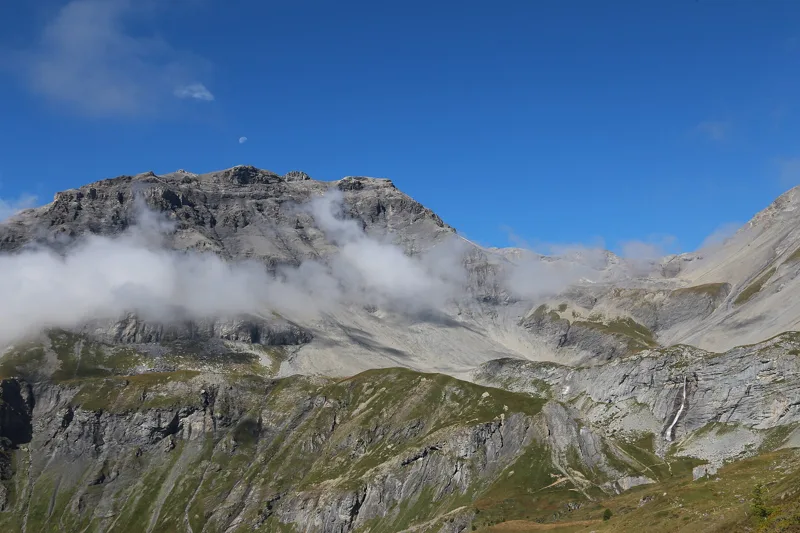
View towards Mont Bonvin from around Les Violettes
Mont Bonvin
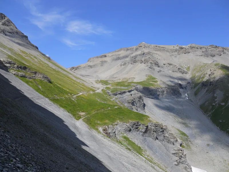
View above La Tièche
View from Hemointze du Plan towards the “Schwarzhorn pass”
Crans-Montana in July 2020
The next few days
MeteoSwiss local forecast, updated every hour
Reading the MeteoSwiss forecast…
My day
Pick your day and start time: everything updates.
- Arrival at Crans-Montana, Aminona
- 13:00 4 h 30 of walking without breaks, starting at 08:30
The trail, kilometre by kilometre
Places are listed under the kilometre where you pass them. Drag along the profile: the marker moves on the 3D view too.
- under 10 %
- 10 to 20 %
- 20 to 30 %
- over 30 %
- fountain or water point
- toilets
Around the trail (250 m, OpenStreetMap, extract of 25/10/2026): 9 restaurants, 0 cafés, 0 fountains and water points, 2 toilets. Estimated time: the official walking time spread by effort (1 km on the flat counts as 100 m of climbing), start time set in “My day”.
Getting there and back
Back by public transport from the Aminona stop
Next departures from AminonaReading the official timetable…
By car
Careful, this is one way: public transport back arrives in Aminona, not in Crans-Montana, Cry-d'Er. Plan to get back to your car by public transport, or park at the finish and take the train to the start.
Public car parks within 600 m of the start, according to OpenStreetMap: prices and number of spaces may have changed, check the signs on site.
Questions people ask
How long is the hike from Crans-Montana, Cry-d'Er to the finish (Crans-Montana, Aminona)?
4 h 30 of walking according to SwitzerlandMobility, in this direction, not counting breaks. The other way: 5 h 15.
Is it hard?
SwitzerlandMobility rates this stage: fitness difficult, technique medium. It is 1,300 m of descent over 13.6 km.
Can I get back by public transport?
Yes. The Aminona stop is at the finish. The next departures show live under “Getting there and back”.
Where can I eat on the way?
9 restaurants, cafés and huts within 250 m of the trail, including Club Cry d'Er, Cry d'Er, Violettes. Where they are and their opening hours: below the profile.
Is there water and are there toilets on the way?
0 fountains and water points and 2 toilets within 250 m of the trail (survey of 25/10/2026).
Can I download the track?
Yes, as a GPX file for your watch or map app: “Download the track” button at the top of the page.
More hikes within 10 km
Official SwitzerlandMobility stages that pass within 10 km of this trail. Each card says whether its page is already up.
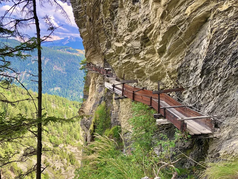 Tseuzier, Barrage → Arbaz, Etang-Long3 h 10Grand Bisse d'Ayent12.0kmDistance150mAscent620mDescentTechnical mediumFitness medium. See the hike
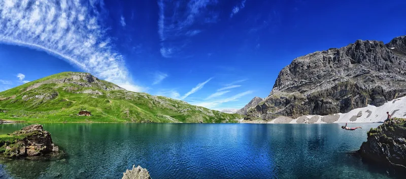 Lenk (Iffigenalp), loop4 h 25Iffigsee-Rundweg11.0kmDistance880mAscent880mDescentTechnical mediumFitness medium. See the hike
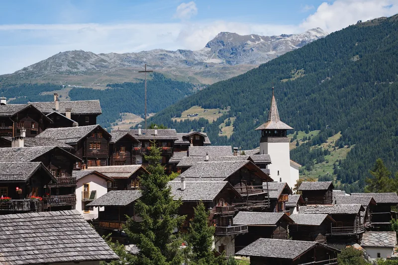 Vercorin → Grimentz5 h 25Chemin des Bisses, stage 717.0kmDistance900mAscent660mDescentTechnical easyFitness difficult. See the hike
- Crans-Montana → Leukerbad7 h 40Walliser Sonnenweg, stage 124.0kmDistance1,150mAscent1,250mDescentTechnical mediumFitness difficult. Page coming
- Inden → Miège3 h 10Über die Raspille11.0kmDistance300mAscent740mDescentTechnical mediumFitness medium. Page coming
- Venthône → Leuk4 h 00Chemin du vignoble, stage 412.0kmDistance400mAscent580mDescentTechnical easyFitness medium. Page coming