
Hiking up to Lac de Taney
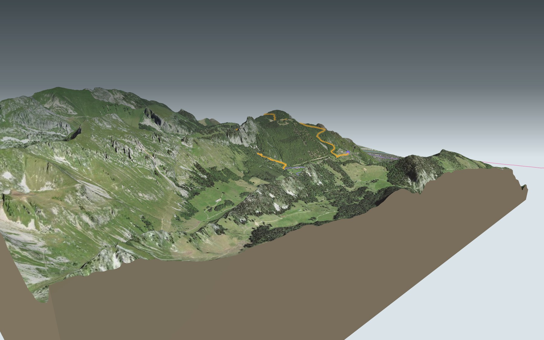
You start in Vésenand, on the east side of Miex, climb through the forest to the Prélagine pastures, follow Lac de Taney to the hamlet of the same name, then cross the Col de Taney and walk down to Le Flon, on the west side of the village. The trail is rated medium, both for fitness and for technique.
The first climb up to Prélagine is steep. Just after it, you pass the highest point of the day, at 1,496 m, then the trail drops towards the east end of the lake. You follow the north shore to Taney and come back along the south shore. The elevation profile shows you the opening climb and the final descent.
Rather start from the valley? Walk up from the station at Vouvry, Les Evouettes or Vionnaz to Le Flon, where the trail ends: each start has its own colour on the 3D map, and its estimated time is in the list of starting points. At Taney you also cross the Alpine Passes Trail, which stops there between Torgon and Saint-Gingolph.
In the hamlet of Taney, the Refuge La Vouivre and the Restaurant du Grammont are a few steps from the trail. Check the next departures and plan your day before you set off. Fancy another lake? Try the Tour du Lac de Moiry, or browse all the hikes in Valais.
The story of the trail
What happened where you are going to walk, chapter by chapter.
From Vésenand to Le Flon
You start at 969 m in Vésenand, on the east side of Miex, and finish at 1,074 m in Le Flon, on the west side of the village. In between: 8.4 km, 640 m of climbing and 540 m of descent, with a high point at 1,496 m. The official walking time is 3 h 00 in either direction.
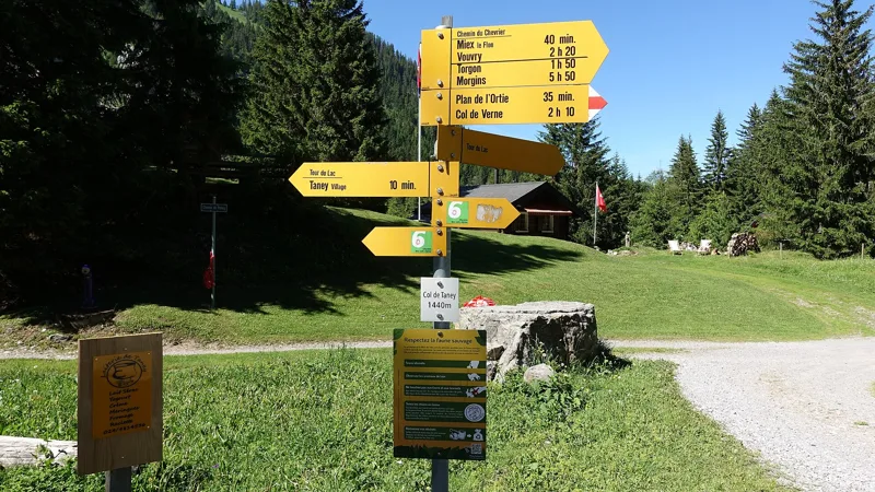
At the start, the Les Cornettes de Bise restaurant is right next to the trail. The next one is in the hamlet of Taney, around km 6.2: the Refuge La Vouivre and the Restaurant du Grammont, at 1,414 m. Take something to drink, and on the way, go by the signposts and the conditions on the day.
Through Prélagine to the lake
The first section climbs steeply through the forest. Around km 3 you reach the Prélagine pastures, and shortly after you pass the highest point of the day, at 1,496 m. The trail then drops back down towards the lake.
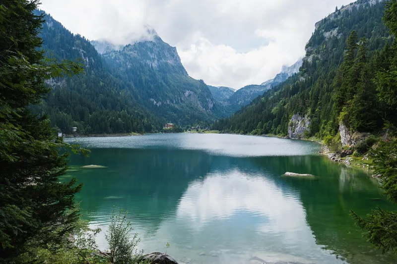
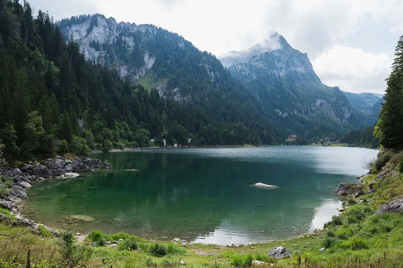
Around km 4.9 you reach the east end of Lac de Taney. You follow the north shore to the hamlet of Taney, at the west end, then come back along the south shore. You'll see the name written Taney or Tanay: both spellings are used.
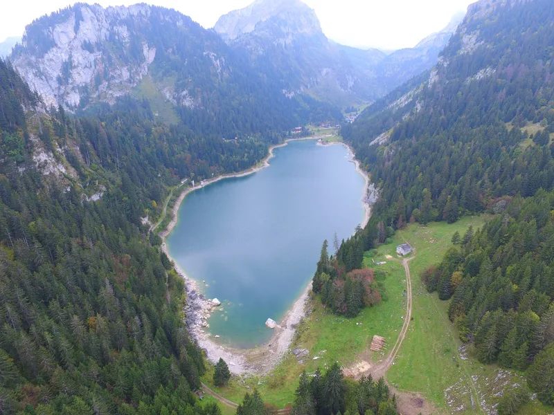
A lake carved by ice
The lake sits in a hollow deepened by glacial erosion, in the limestone and marl of the Préalpes médianes. It is a natural lake, but its level is regulated. No stream flows out of it: it has an overflow through the narrow notch that opens to the east, and part of its water drains into the karst system under the lake, feeding the springs of the Tové valley. To the north-west, the two symmetrical peaks of Les Jumelles tower over the lake.
The lake is an amphibian breeding site of national importance, home among others to the common toad. With a bit of luck, you'll spot alpine salamanders in the shade of the forest. On the limestone scree grows the Tanay orchid, found only in the western Prealps and first discovered here. Part of the climb and the start of the lake lie in the Taney wildlife quiet zone: from 1 December to 15 April, you're asked to stay on marked routes and keep your dog on a lead.
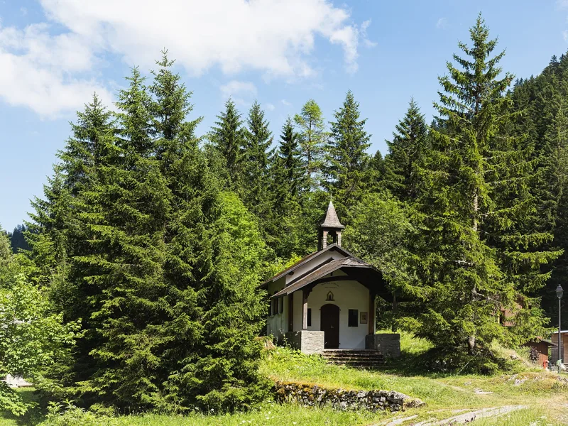
Caves, bears and summer meadows
The name Tanay comes from « tannes », the many caves in the rocks around the valley. Most of them were dens for cave bears, but the Creux rock shelter is thought to have been a hunting stop for Neanderthals, nearly 35,000 years ago: the only evidence of their presence in Valais.
West of the lake, small buildings and a chapel were used as mayens, the mid-season meadows: farmers from Vouvry and Miex stopped there with their cattle and brought the hay down to the village at the start of winter, until around 1960. Since 1901, water from the lake has been piped down to the Vouvry power station. In 1798, Vouvry became one municipality with Miex and Taney, and since 1965 the Taney area has been a federally protected site.
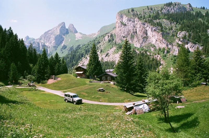
The pass and the old mule track
Along the south shore, the trail leaves the lake and climbs to the Col de Taney, around km 6.9, only slightly higher than the water. From there, an old mule track zigzags down through the forest, above the Rhône valley, to Le Flon at 1,074 m.
Near the finish, the Chardon Bleu restaurant is close to the trail. Further down the page you'll find the next departures from Miex.
Every way to Miex, Le Flon
4 starting points to reach Miex, Le Flon. Pick yours: the 3D view shows it and “My day” recalculates.
Walking times without breaks. “Estimated” times are calculated on the terrain profile with a model fitted to the official stages; the shortest path may differ from the one on the yellow signposts: on the ground, follow the signs. Gradient: the steepest over 200 m of trail. Profiles share the same scale (length and altitude). Stations and car parks within 500 m of the start.
In pictures
Lac de Taney seen from the north-east, framed by spruce trees
Lac de Taney from the eastern shore, with rocks in the foreground
Lac de Taney, with the village of Taney in the background
The Notre-Dame des Neiges chapel in Taney
Lac de Tanay from the air
Lac de Taney and Le Tâche seen from the hamlet of Taney
Lac de Taney and Le Tâche seen from the west
Lac de Taney, Valais
The Col de Taney, above Miex
Lac de Taney with Le Tâche, in June 2008
Chemin du Lac de Taney: when to go
The bus runs up to the start every day of the year, according to the official timetable. The latest time to set off ranges from 17:26 in June to 12:46 in December.
- Bus to the start
- every day
- 3 to 6 buses a day
- first bus 7:18, 8:18 or 9:18
- last 18:18
- Sun at the start, mid-January
- from 8:46
- rises at 8:12, hidden by the ridge
- Leave by, for 3 h 00 of walking
- 13:12
- arrive 1 hour before sunset, at 17:12
| Month | Sun at the start | Leave by | In the sun, leaving at 9:00 | Bus |
|---|---|---|---|---|
| December | 8:43 → 16:46 | 12:46 | 59 % | every day |
| January | 8:46 → 17:12 | 13:12 | 60 % | every day |
| February | 8:06 → 17:57 | 13:57 | 71 % | every day |
“In the sun”: the share of the path in sunlight under a clear sky, with the terrain worked out point by point. The path climbs to 1,496 m: today's snow and frost are in the weather and My day.
- Bus to the start
- every day
- 3 to 7 buses a day
- first bus 7:18, 8:18 or 9:18
- last 18:18 or 18:30
- Sun at the start, mid-April
- from 7:24
- rises at 6:46, hidden by the ridge
- Leave by, for 3 h 00 of walking
- 16:19
- arrive 1 hour before sunset, at 20:19
| Month | Sun at the start | Leave by | In the sun, leaving at 9:00 | Bus |
|---|---|---|---|---|
| March | 7:18 → 18:37 | 14:37 | 88 % | every day |
| April | 7:24 → 20:19 | 16:19 | 100 % | every day |
| May | 6:45 → 20:58 | 16:58 | 100 % | every day |
“In the sun”: the share of the path in sunlight under a clear sky, with the terrain worked out point by point. The path climbs to 1,496 m: today's snow and frost are in the weather and My day.
- Bus to the start
- every day
- 6 to 7 buses a day
- first bus 7:18, 8:18 or 9:18
- last 18:18 or 18:30
- Sun at the start, mid-July
- from 6:25
- rises at 5:55, hidden by the ridge
- Leave by, for 3 h 00 of walking
- 17:22
- arrive 1 hour before sunset, at 21:22
| Month | Sun at the start | Leave by | In the sun, leaving at 9:00 | Bus |
|---|---|---|---|---|
| June | 6:02 → 21:26 | 17:26 | 100 % | every day |
| July | 6:25 → 21:22 | 17:22 | 100 % | every day |
| August | 7:09 → 20:43 | 16:43 | 100 % | every day |
“In the sun”: the share of the path in sunlight under a clear sky, with the terrain worked out point by point. The path climbs to 1,496 m: today's snow and frost are in the weather and My day.
- Bus to the start
- every day
- 3 to 7 buses a day
- first bus 7:18, 8:18 or 9:18
- last 18:18 or 18:30
- Sun at the start, mid-October
- from 8:10
- rises at 7:50, hidden by the ridge
- Leave by, for 3 h 00 of walking
- 14:47
- arrive 1 hour before sunset, at 18:47
| Month | Sun at the start | Leave by | In the sun, leaving at 9:00 | Bus |
|---|---|---|---|---|
| September | 7:36 → 19:45 | 15:45 | 93 % | every day |
| October | 8:10 → 18:47 | 14:47 | 76 % | every day |
| November | 8:06 → 17:00 | 13:00 | 62 % | every day |
“In the sun”: the share of the path in sunlight under a clear sky, with the terrain worked out point by point. The path climbs to 1,496 m: today's snow and frost are in the weather and My day.
The next few days
Local forecast, updated every hour
Reading the forecast…
My day
Pick your day and start time: everything updates.
- Arrival at Miex, Le Flon
- 11:30 3 h 00 of walking without breaks, starting at 08:30
The trail, kilometre by kilometre
From Miex, Vesenand
Places are listed under the kilometre where you pass them. Drag along the profile: the marker moves on the 3D view too.
- under 10 %
- 10 to 20 %
- 20 to 30 %
- over 30 %
- fountain or water point
- toilets
Around the trail (250 m): 4 restaurants, 5 fountains and water points and 4 toilets. Estimated time: the official walking time spread by effort (1 km on the flat counts as 100 m of climbing), start time set in “My day”.
- under 10 %
- 10 to 20 %
- 20 to 30 %
- over 30 %
- fountain or water point
- toilets
Around the trail (250 m): 2 restaurants, 1 café, 8 fountains and water points and 2 toilets. Estimated time: the official walking time spread by effort (1 km on the flat counts as 100 m of climbing), start time set in “My day”.
- under 10 %
- 10 to 20 %
- 20 to 30 %
- over 30 %
- fountain or water point
- toilets
Around the trail (250 m): 4 restaurants, 4 fountains and water points and 2 toilets. Estimated time: the official walking time spread by effort (1 km on the flat counts as 100 m of climbing), start time set in “My day”.
- under 10 %
- 10 to 20 %
- 20 to 30 %
- over 30 %
- fountain or water point
- toilets
Around the trail (250 m): 2 restaurants, 2 cafés, 8 fountains and water points and 2 toilets. Estimated time: the official walking time spread by effort (1 km on the flat counts as 100 m of climbing), start time set in “My day”.
Getting there and back
Back by public transport from the Miex, Le Flon stop
Next departures from Miex, Le FlonReading the official timetable…
By car
From Miex, Vesenand
Careful, this is one way: public transport back arrives in Miex, Le Flon, not in Miex, Vesenand. Plan to get back to your car by public transport, or park at the finish and take public transport to the start.
- Car park open-air, Route de Vésenand50 m from the start
Public car parks within 600 m of the start: prices and number of spaces may have changed, check the signs on site.
Careful, this is one way: public transport back arrives in Miex, Le Flon, not in Vouvry. Plan to get back to your car by public transport, or park at the finish and take public transport to the start.
- Car park300 m from the start
- Station Vouvryor by public transport0 m from the start
The nearest car park and stop for this start. Check the signs on site for the price.
Careful, this is one way: public transport back arrives in Miex, Le Flon, not in Les Evouettes. Plan to get back to your car by public transport, or park at the finish and take public transport to the start.
- Car park100 m from the start
- Station Les Evouettesor by public transport0 m from the start
The nearest car park and stop for this start. Check the signs on site for the price.
Careful, this is one way: public transport back arrives in Miex, Le Flon, not in Vionnaz. Plan to get back to your car by public transport, or park at the finish and take public transport to the start.
- Station Vionnazor by public transport0 m from the start
The nearest car park and stop for this start. Check the signs on site for the price.
Questions people ask
How long is the hike from Miex, Vesenand to Miex, Le Flon?
3 h 00 of walking (official time), in this direction, not counting breaks. The other way: 3 h 00.
Is it hard?
Official rating for this stage: fitness medium, technique medium. It is 640 m of climbing over 8.4 km.
Can I get back by public transport?
Yes. The Miex, Le Flon stop is at the finish. The next departures show live under “Getting there and back”.
Where can I eat on the way?
4 places to eat within 250 m of the trail, including Les "Cornettes de Bise", Refuge La Vouivre, Restaurant du Grammont. Where they are and their opening hours: below the profile.
Is there water and are there toilets on the way?
5 fountains and water points and 4 toilets within 250 m of the trail (survey of 25/10/2026).
Can I download the track?
Yes, as a GPX file for your watch or map app: “Download the track” button at the top of the page.
More hikes within 10 km
Official stages that pass within 10 km of this trail. Each card says whether its page is already up.
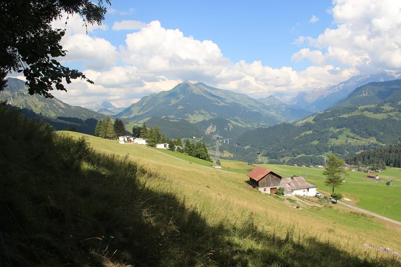 Aigle → Leysin3 h 10Tour des Alpes Vaudoises, stage 17.0kmDistance1,000mAscent10mDescentTechnical mediumFitness difficult. See the hike
- © swisstopoTorgon → Taney4 h 00Alpenpässe-Weg, stage 4210.0kmDistance950mAscent600mDescentTechnical mediumFitness difficult. Official waymarked stage
- © swisstopoTaney → St-Gingolph5 h 45Alpenpässe-Weg, stage 4316.0kmDistance760mAscent1,800mDescentTechnical mediumFitness difficult. Official waymarked stage
- © swisstopoMorgins → Torgon6 h 00Alpenpässe-Weg, stage 4118.0kmDistance1,000mAscent1,200mDescentTechnical mediumFitness difficult. Official waymarked stage
- © swisstopoTorgon, La Jorette, loop4 h 30Sentier des alpages de Vionnaz14.0kmDistance780mAscent780mDescentTechnical easyFitness medium. Official waymarked stage
- © swisstopoVevey → Aigle6 h 00ViaFrancigena, stage 525.0kmDistance220mAscent180mDescentTechnical easyFitness difficult. Official waymarked stage