
Hiking from Finhaut up to the Emosson dam
Mont Blanc isn't the goal here, it's the backdrop. You start at Finhaut station, in the upper Trient Valley, and climb to the Emosson dam, close to the French border. The highest point is the finish. SwitzerlandMobility rates it medium for fitness and easy for technique.
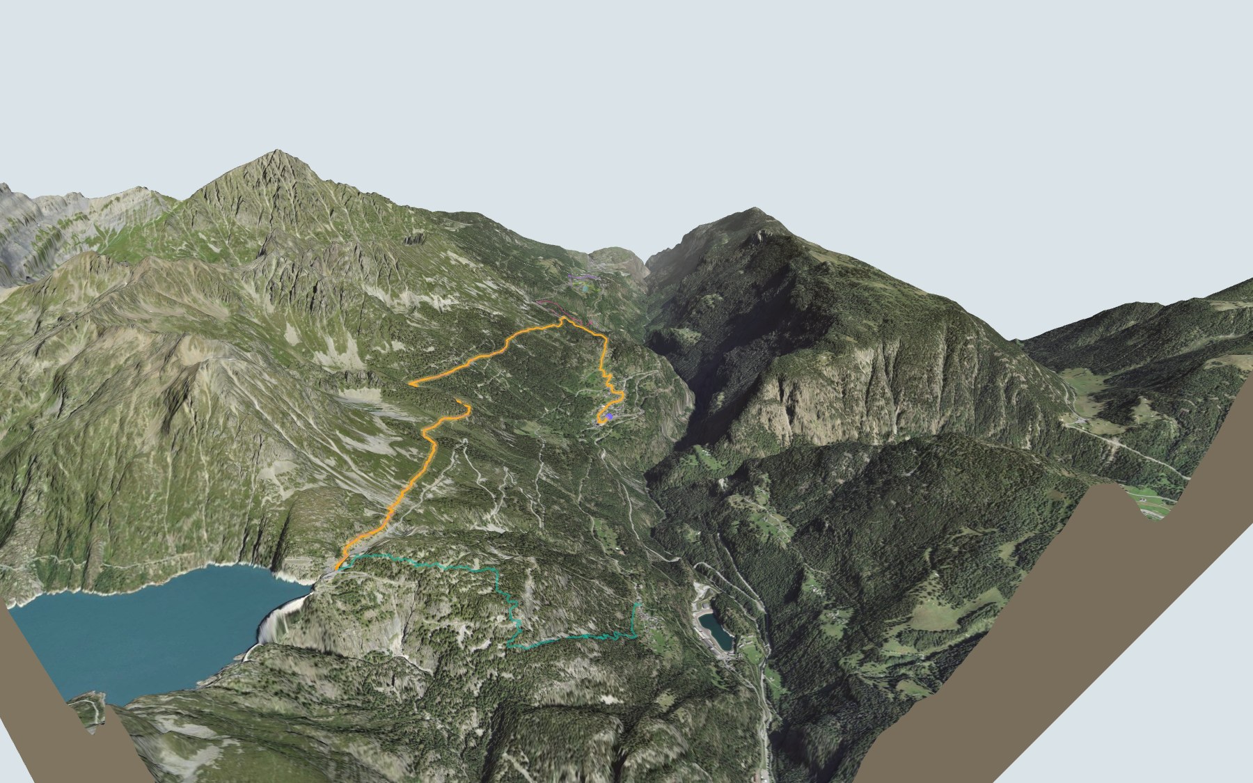
First you walk through the village, then the path leaves the houses via Les Marais, passes close to the Tête de la Boffa, Le Larzey and Fenestral, and finishes through the Gorge des Golettes, just below the dam. The elevation profile shows you where it gets steepest.
Want to start somewhere else? Walk up from Giétroz, a little higher than Finhaut, or from the stations at Les Marécottes, Le Trétien or La Médettaz, further down the valley: each starting point has its own colour in the 3D view and an estimated time under all starting points. Also in Valais, there's the hike from La Fouly to Champex-Lac.
At the top: Lac d'Emosson and the Restaurant du Barrage d'Émosson. To get back down, check the next departures from the Lac d'Emosson Minifunic stop and plan your day before you set off. Looking for more in the area? See all hikes in Valais.
The story of the trail
What happened where you are going to walk, chapter by chapter.
Climbing towards the border
You start at 1,224 m at Finhaut station and finish at 1,965 m at the Emosson dam. In between: 8.5 km, plus 880 m of climbing and 140 m of descent according to SwitzerlandMobility. It gives 3 h 15 of walking time in this direction, and 2 h 30 the other way, downhill.
At the start, as you walk through the village, you pass right by the Café de la Gare, the Café Le Rendez-vous, the Central and the Beau-Soleil. The next place to eat is the Restaurant du Barrage d'Émosson, at the finish, so bring something to drink. On the way, follow the signposts and check the conditions on the day.
Finhaut, from mountain pastures to tourism
Finhaut is a municipality in the upper Trient Valley, on the French-Swiss border; the hamlets of Giétroz and Le Châtelard belong to it. Its name appears as early as 1293, spelt Finyaux. Its economy was pastoral: Finhaut and Salvan fought for their mountain pastures against the people of Faucigny (Vallorcine, Chamonix), and their victory over Guillaume de Thoire at Emosson, in 1323, secured the pastures for them.
The cantonal road from Vernayaz to Chamonix via Finhaut, opened between 1855 and 1867, followed by the Martigny-Chamonix railway in 1906, brought an era of prosperity based on tourism. Trains still stop at Finhaut today, right where the trail begins.
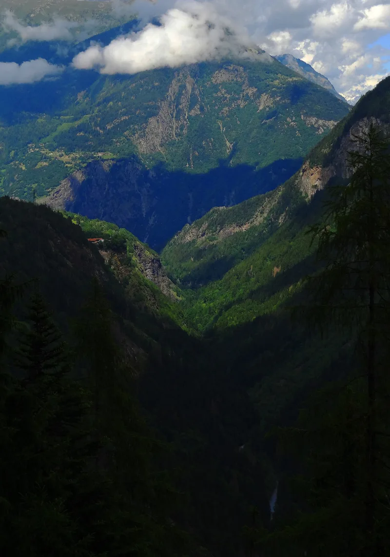
From Les Marais to the Gorge des Golettes
Leaving the village, the path climbs through Les Marais and passes close to the Tête de la Boffa. Higher up, it passes close to Le Larzey and Fenestral, and finishes through the Gorge des Golettes, just before the dam.
Away from the path, the funicular from Le Châtelard passes through Giétroz and arrives at the intermediate station at Les Montuires. Its operator, VerticAlp Emosson, describes it as one of the steepest in the world. The path takes its time.
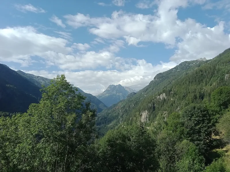
A granite about 307 million years old
Underfoot are the rocks of the Aiguilles Rouges massif: after the moraine around the village come Carboniferous and Permian sandstone, mudstone and conglomerate, then the Vallorcine granite, broken up by scree and moraine. This granite is about 307 million years old; it forms a narrow band running from Argentière, in the Chamonix valley, to Vernayaz. A description from 1872, in German, even calls it "Granit der Barberine".
Higher up, above Vieux-Emosson and away from the path, quartzite slabs hold footprints discovered on 23 August 1976 by the French geologist Georges Bronner. You can see tracks from 5 to 9 species, more than 230 million years old. They belong to primitive reptiles, archosaurs, the group that includes the ancestors of dinosaurs and crocodiles. The Natural History Museum of Geneva calls them the oldest footprints in Switzerland. The site has been protected since 1983, and the footprints are usually visible from mid-July.
Three dams and a border on the move
Lac d'Emosson hides another dam. The Barberine dam, built in the 1920s to help electrify the Swiss Federal Railways, now lies under water; in spring, when the water is low, its top reappears. The Vieux-Emosson dam followed in 1955, then the Emosson dam went into service in 1975, after eight years of work. Building it meant moving the border between France and Switzerland. According to Alpiq, which owns it in equal shares with EDF, it holds 225 million cubic metres of water, the second-largest reservoir in Switzerland.
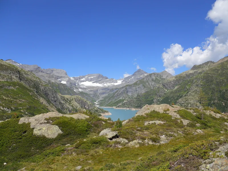
From the dam, the view opens up to the Mont Blanc massif, and the panorama on this page shows Mont Blanc on the horizon. Between the dam and Le Châtelard, there are three ways up and down: the Minifunic, a small narrow-gauge train and the funicular. Further down this page: the next departures from the Lac d'Emosson Minifunic stop.
Every way up to the top
5 starting points to reach Emosson, Barrage. Pick yours: the 3D view shows it and “My day” recalculates.
Walking times without breaks. “Estimated” times are calculated on the swisstopo profile with a model fitted to the official SwitzerlandMobility stages; the shortest path may differ from the one on the yellow signposts: on the ground, follow the signs. Gradient: the steepest over 200 m of trail. Profiles share the same scale (length and altitude). Stations and car parks within 500 m of the start, according to OpenStreetMap.
In pictures
The Emosson area, looking towards the Tour Sallière
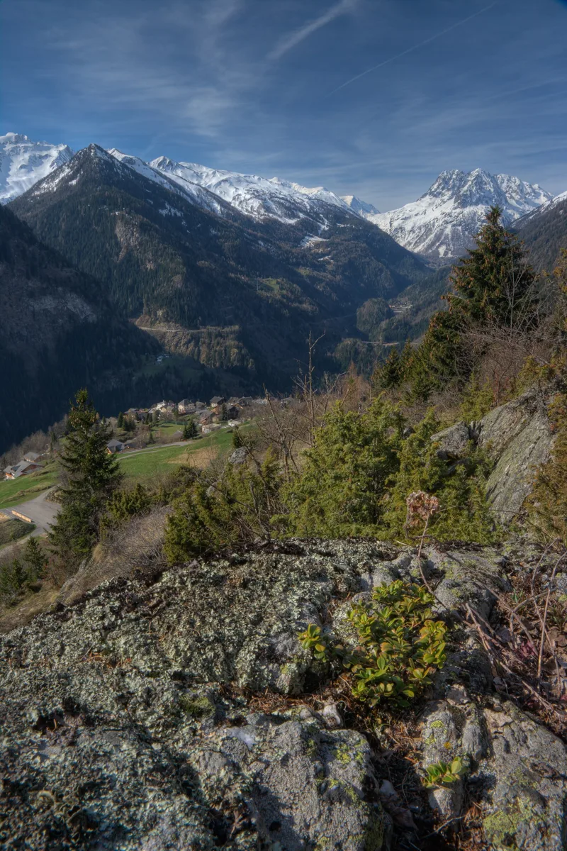
View from above Finhaut, in the Trient Valley
In Finhaut
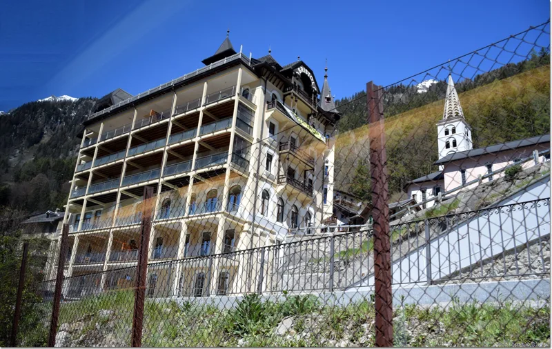
Hotel Bristol, Finhaut
The Aiguilles Rouges seen from the Trient Valley, Finhaut
The Le Trétien area in summer, looking towards Gueuroz
The next few days
MeteoSwiss local forecast, updated every hour
Reading the MeteoSwiss forecast…
My day
Pick your day and start time: everything updates.
- Arrival at Emosson, Barrage
- 11:45 3 h 15 of walking without breaks, starting at 08:30
The trail, kilometre by kilometre
Places are listed under the kilometre where you pass them. Drag along the profile: the marker moves on the 3D view too.
- under 10 %
- 10 to 20 %
- 20 to 30 %
- over 30 %
- fountain or water point
- toilets
Around the trail (250 m, OpenStreetMap, extract of 25/10/2026): 2 restaurants, 3 cafés, 13 fountains and water points, 2 toilets. Estimated time: the official walking time spread by effort (1 km on the flat counts as 100 m of climbing), start time set in “My day”.
Getting there and back
Back by public transport from the Lac d'Emosson Minifunic stop
Next departures from Lac d'Emosson MinifunicReading the official timetable…
By car
Careful, this is one way: public transport back arrives in Lac d'Emosson Minifunic, not in Finhaut. Plan to get back to your car by public transport, or park at the finish and take the train to the start.
- Car park roadside, Rue de la Gare20 m from the start
- Car park, Rue de la Gare40 m from the start
- Car park, Route du Village100 m from the start
- Car park open-air, Chemin de l'École120 m from the start
Public car parks within 600 m of the start, according to OpenStreetMap: prices and number of spaces may have changed, check the signs on site.
Questions people ask
How long is the hike from Finhaut to the finish (Emosson, Barrage)?
3 h 15 of walking according to SwitzerlandMobility, in this direction, not counting breaks. The other way: 2 h 30.
Is it hard?
SwitzerlandMobility rates this stage: fitness medium, technique easy. It is 880 m of climbing over 8.5 km.
Can I get back by public transport?
Yes. The Lac d'Emosson Minifunic stop is at the finish. The next departures show live under “Getting there and back”.
Where can I eat on the way?
5 restaurants, cafés and huts within 250 m of the trail, including Café de la Gare, Café Le Rendez-vous, Central. Where they are and their opening hours: below the profile.
Is there water and are there toilets on the way?
13 fountains and water points and 2 toilets within 250 m of the trail (survey of 25/10/2026).
Can I download the track?
Yes, as a GPX file for your watch or map app: “Download the track” button at the top of the page.
More hikes within 10 km
Official SwitzerlandMobility stages that pass within 10 km of this trail. Each card says whether its page is already up.
- Trient → Lac d’Emosson7 h 00Alpenpässe-Weg, stage 3716.0kmDistance1,700mAscent1,000mDescentTechnical mediumFitness difficult. Page coming
- Lac d’Emosson → Cab. de Salanfe5 h 50Alpenpässe-Weg, stage 3814.0kmDistance1,150mAscent1,150mDescentTechnical mediumFitness difficult. Page coming
- Champex → Trient5 h 30Alpenpässe-Weg, stage 3616.0kmDistance880mAscent1,050mDescentTechnical mediumFitness difficult. Page coming
- Van d’en Haut, loop4 h 25Sentier de Salanfe13.0kmDistance720mAscent720mDescentTechnical mediumFitness medium. Page coming
- St-Maurice → Martigny4 h 00ViaFrancigena, stage 716.0kmDistance280mAscent240mDescentTechnical easyFitness medium. Page coming
- Martigny → Orsières6 h 00ViaFrancigena, stage 820.0kmDistance950mAscent520mDescentTechnical easyFitness difficult. Page coming