
From the Val Ferret to Lac de Champex
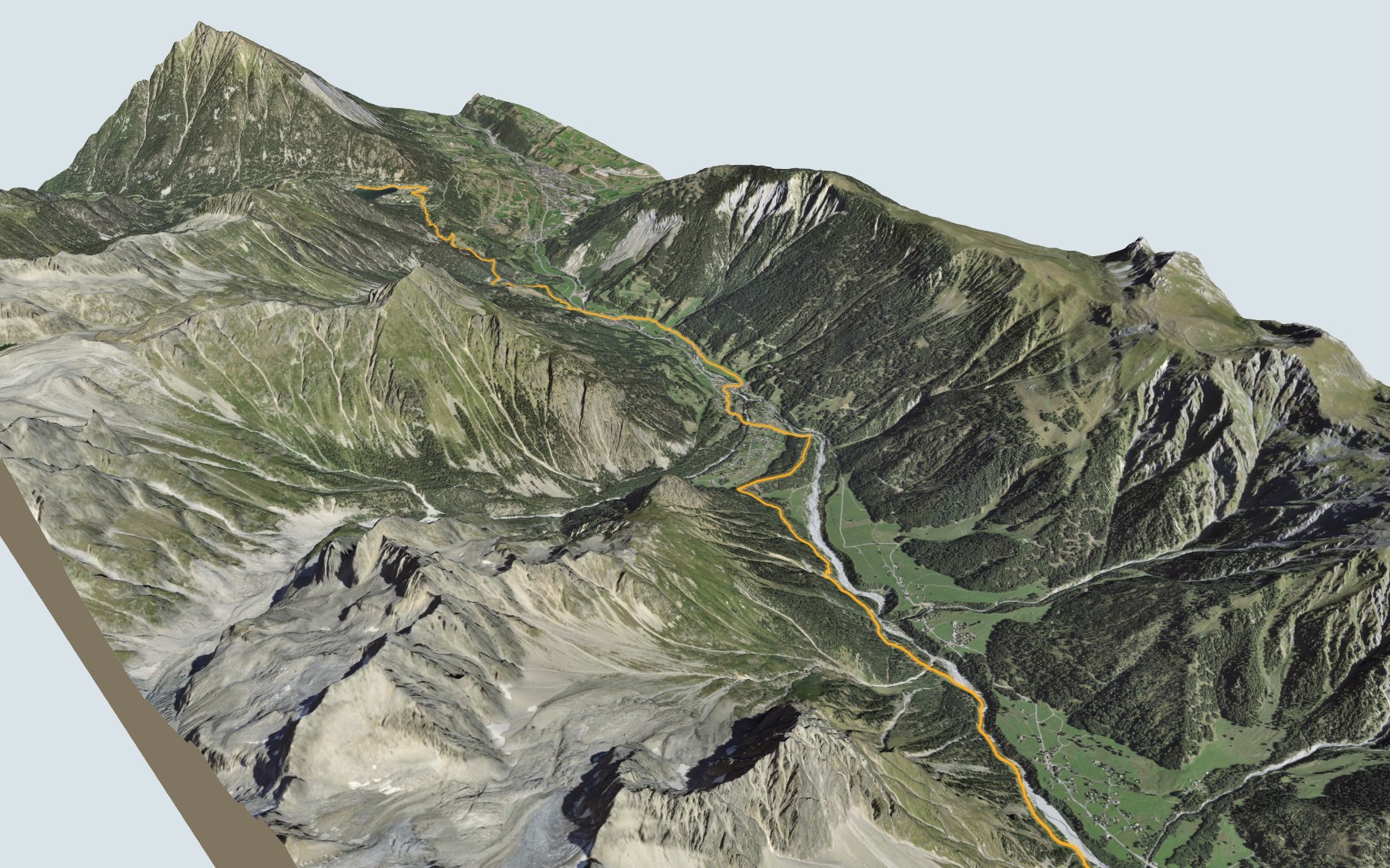
On this one you go down first and climb afterwards. You start in La Fouly, in the Val Ferret, walk down the valley as far as Issert, then head back up to Lac de Champex. SwitzerlandMobility lists it as stage 35 of the Alpenpässe-Weg and rates it medium for fitness and easy for technique.
The path passes close to Prayon, then goes through Praz-de-Fort and Les Arlaches, close to the Dranse de Ferret river, before reaching Issert. From there it climbs via Le Signal to Champex-Lac. The elevation profile shows you where the descent ends and the climb begins.
The Val Ferret and Champex-Lac are also both stages of the Tour du Mont Blanc. On the Alpenpässe-Weg, the stage before comes down from the Great St Bernard Pass and the next one carries on from Champex to Trient.
At the finish: the lake, the Flore-Alpe alpine botanical garden in the village, and the bus at the Champex, Lac stop. Check the next departures and plan your day before you set off. Looking for more in the area? See all hikes in Valais.
The story of the trail
What happened where you are going to walk, chapter by chapter.
Down first, then back up
You start at 1,600 m in La Fouly and finish at 1,467 m by Lac de Champex. In between: 15.2 km, plus 600 m of climbing and 740 m of descent according to SwitzerlandMobility. It gives 4 h 30 of walking time in this direction and 4 h 40 the other way.
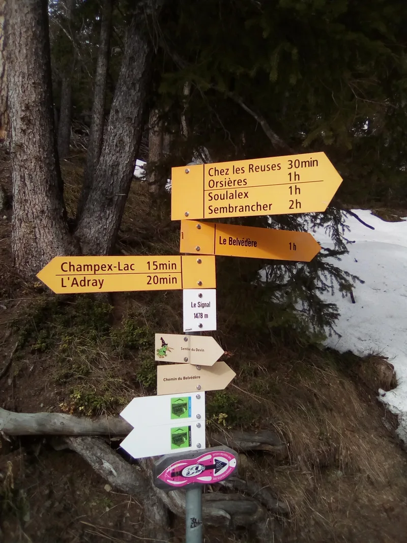
The path follows the Val Ferret down, passing close to Prayon, then through Praz-de-Fort and Les Arlaches, and close to the Dranse de Ferret. Along the way you pass Café La Kabana, then Croquenature; in Issert, the Restaurant du Châtelet is waiting for you at 1,053 m. Then the path climbs via Le Signal, home to the Belvédère restaurant, up to the lake. On the way, follow the signposts and check the conditions on the day.
One municipality, twelve villages
The whole route lies within the municipality of Orsières. It has two main valleys, the Val Ferret and the Champex valley, and twelve villages, including Champex, Ferret, Issert, La Fouly and Praz-de-Fort. From the 12th century Orsières came under the Count of Savoy, who in 1189 gave the Ferret forest to the brothers of Mont-Joux, at the Great St Bernard.
Locals mostly grew rye, which explains the large number of raccards (wooden granaries) and mills, and they raised livestock. The hotel trade began in the Champex area around 1850. La Fouly has been lived in all year round since 1965, when the road started being cleared in winter.
Moraine, scree and rhyolite
Underfoot it's mostly loose deposits: moraine, alluvium, scree and debris cones. Here and there, mainly between Issert and Champex, the bedrock shows through: fine blue-grey limestone, black clay shale and Breya rhyolite. This rock of volcanic origin dates from about 307 million years ago; you find it on the eastern side of the Mont Blanc massif, at the Catogne, La Breya and the Châtelet.
In Champex-Lac, the Flore-Alpe alpine botanical garden displays four thousand plant species, from the local flora, the neighbouring regions and the mountain ranges of Europe and other continents. It was laid out in 1927, so its centenary falls in 2027. The garden recommends June and July, when the colours are at their brightest.
The trails of the Val Ferret
The Val Ferret is a stage of both the Tour du Mont Blanc and the Tour du Saint-Bernard, and Champex-Lac is a main stage of the Tour du Mont Blanc in summer. For SwitzerlandMobility, this section is stage 35 of the Alpenpässe-Weg.
At the start, La Fouly has its own educational trail, "Mountaineering at UNESCO". The Pays du Saint-Bernard tourist office calls the village one of the birthplaces of Swiss mountaineering. Eight panels cover the history of mountaineering in the region, the role of mountain huts, the Darbellay family and climbers such as Jean Troillet and Nicole Berthod. The trail was completed in 2025, an initiative of the municipality of Orsières and the Regional Centre for Alpine Population Studies.
Champex-Lac, by the water
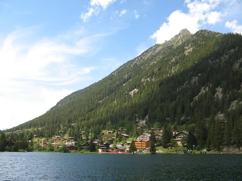
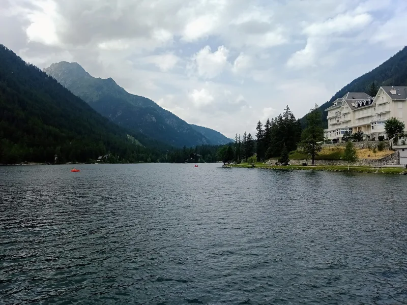
The final climb goes via Le Signal up to the village of Champex-Lac and its lake. The resort has a long tourist tradition: in the early 20th century, the first visitors helped it grow. In Champex there is also a Protestant chapel, built in 1935.
The route ends at the Champex, Lac bus stop. Further down this page: the next departures and the places to eat, including Au Rendez-Vous, right near the finish.
In pictures
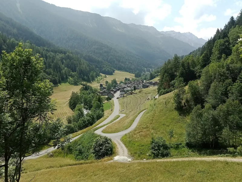
Issert seen from the Jureau stream, Orsières (Valais)
Chamois sculpture near Champex-Lac, Orsières (Valais)
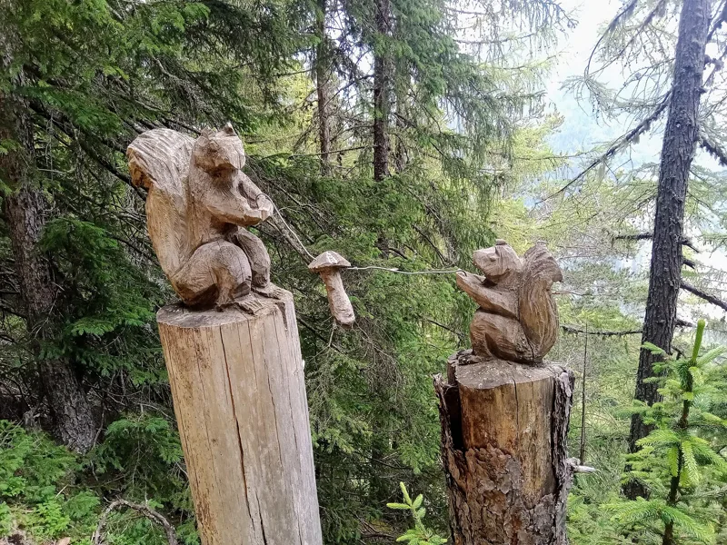
Squirrel sculptures near Champex-Lac, Orsières (Valais)
Marmot sculpture near Champex-Lac, Orsières (Valais)
Hiking trail signpost at Le Signal
Lac de Champex, Orsières (Valais)
Champex (Valais)
Fountain in Champex-Lac, Orsières (Valais)
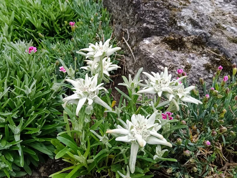
Edelweiss in Champex-Lac, Orsières (Valais)
Cornes d'Orant, a sculpture by Gaspard Delachaux in Champex, open-air exhibition "10 ans de sculpture", August 2013
The next few days
MeteoSwiss local forecast, updated every hour
Reading the MeteoSwiss forecast…
My day
Pick your day and start time: everything updates.
- Arrival at Champex-Lac
- 13:00 4 h 30 of walking without breaks, starting at 08:30
The trail, kilometre by kilometre
Places are listed under the kilometre where you pass them. Drag along the profile: the marker moves on the 3D view too.
- under 10 %
- 10 to 20 %
- 20 to 30 %
- over 30 %
- fountain or water point
- toilets
Around the trail (250 m, OpenStreetMap, extract of 25/10/2026): 12 restaurants, 2 cafés, 18 fountains and water points, 6 toilets. Estimated time: the official walking time spread by effort (1 km on the flat counts as 100 m of climbing), start time set in “My day”.
Getting there and back
Back by public transport from the Champex, Lac stop
Next departures from Champex, LacReading the official timetable…
By car
Careful, this is one way: public transport back arrives in Champex, Lac, not in La Fouly. Plan to get back to your car by public transport, or park at the finish and take the train to the start.
- Car park open-air, Route des Girollesfree520 m from the start
- Car park open-air, Route de Ferret20 m from the start
- Car park, Tsamodet50 m from the start
Public car parks within 600 m of the start, according to OpenStreetMap: prices and number of spaces may have changed, check the signs on site.
Questions people ask
How long is the hike from La Fouly to the finish (Champex-Lac)?
4 h 30 of walking according to SwitzerlandMobility, in this direction, not counting breaks. The other way: 4 h 40.
Is it hard?
SwitzerlandMobility rates this stage: fitness medium, technique easy. It is 740 m of descent over 15.2 km.
Can I get back by public transport?
Yes. The Champex, Lac stop is at the finish. The next departures show live under “Getting there and back”.
Where can I eat on the way?
14 restaurants, cafés and huts within 250 m of the trail, including Auberge des Glaciers, Edelweiss, Café La Kabana. Where they are and their opening hours: below the profile.
Is there water and are there toilets on the way?
18 fountains and water points and 6 toilets within 250 m of the trail (survey of 25/10/2026).
Can I download the track?
Yes, as a GPX file for your watch or map app: “Download the track” button at the top of the page.
More hikes within 10 km
Official SwitzerlandMobility stages that pass within 10 km of this trail. Each card says whether its page is already up.
- Col du Gd St-Bernard → La Fouly5 h 20Alpenpässe-Weg, stage 3416.0kmDistance680mAscent1,550mDescentTechnical mediumFitness difficult. Page coming
- Champex → Trient5 h 30Alpenpässe-Weg, stage 3616.0kmDistance880mAscent1,050mDescentTechnical mediumFitness difficult. Page coming
- Orsières → Bourg-St-Pierre4 h 25ViaFrancigena, stage 914.0kmDistance900mAscent180mDescentTechnical easyFitness difficult. Page coming
- Martigny → Orsières6 h 00ViaFrancigena, stage 820.0kmDistance950mAscent520mDescentTechnical easyFitness difficult. Page coming
- Liddes → Orsières, La Douay4 h 00Chemin des villages et hameaux d'Entremont14.0kmDistance420mAscent900mDescentTechnical mediumFitness difficult. Page coming
- Col du Grand-St-Bernard, loop5 h 00Les cols du Grand-St-Bernard12.0kmDistance1,050mAscent1,050mDescentTechnical mediumFitness difficult. Page coming