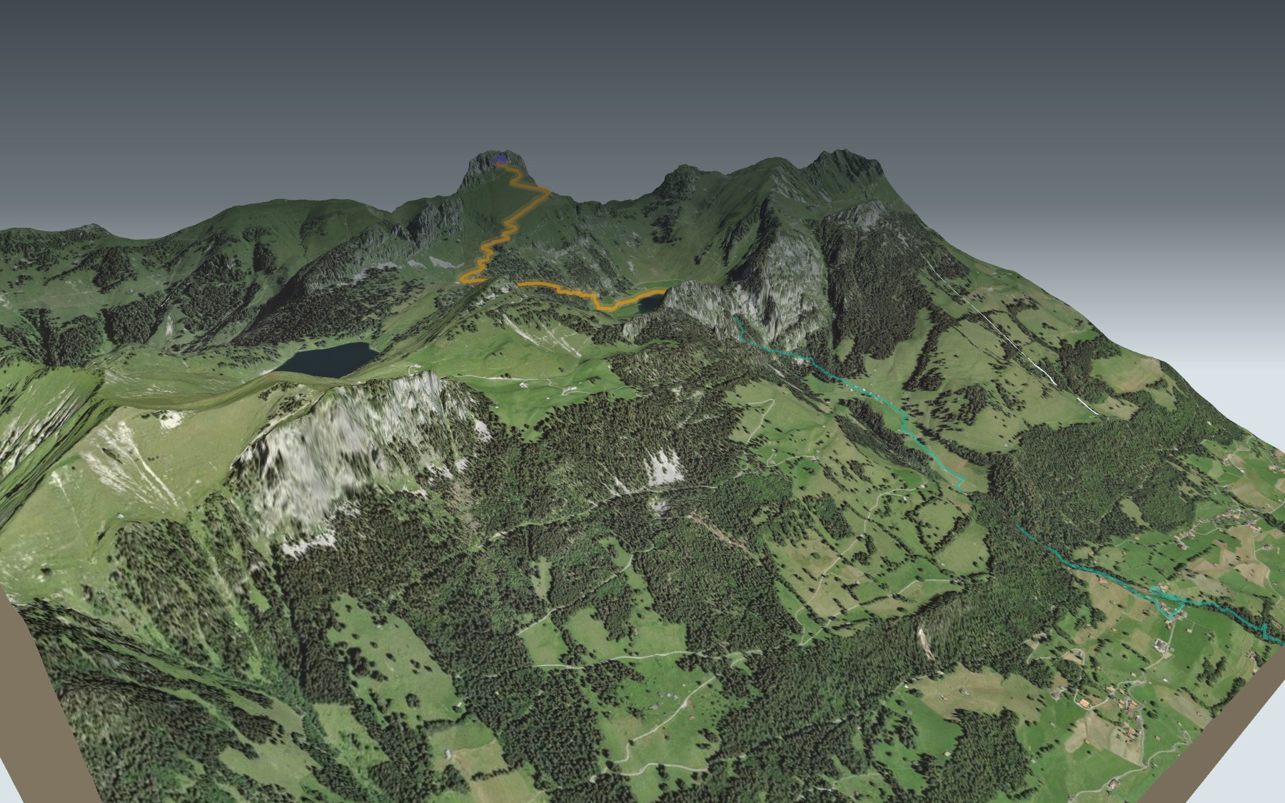

From the Stockhorn down to the lake, then Chrindi
The Stockhorn classic, and it's mostly downhill: you ride the cable car to the top station and walk back down to Chrindi, the middle station of the same line. It's a mountain trail, rated medium for both fitness and technique.
Before you set off, the panoramic platform in the north face is worth the detour. Then the path crosses the Stockefeld, passes the Oberstockenalp mountain inn, runs through open fir forest and past karst fields, and follows the shore of the Hinterstockensee. The elevation profile shows where the descent gets steeper, and the short climb at the end.
Fancy a longer walk? Another start climbs on foot from Erlenbach up to Chrindi: it has its own colour on the 3D map, and its estimated time is in the list of starting points. Across Lake Thun, the Niederhorn-Panoramaweg also starts from a summit served by a gondola.
At Chrindi, the restaurant is at the middle station, and the cabin takes you down to Erlenbach. Check how to get back and plan your day before you go. Want something else nearby? All the hikes in the Bernese Oberland.
The story of the trail
What happened where you are going to walk, chapter by chapter.
From station to station
You start at 2,137 m, at the top station of the Stockhorn cable car, and finish at 1,636 m, at Chrindi, its middle station. In between: 3.4 km, 50 m of climbing and 540 m of descent. Allow 1 h 10 of walking in this direction and 1 h 40 the other way, uphill.
At the start, the Stockhorn panorama restaurant. Around km 1.6, at 1,781 m, the Oberstockenalp mountain inn. At the finish, the Chrindi restaurant. This is a mountain trail: on the ground, follow the signposts and check the conditions on the day.
From the Stockefeld to the lake
Before you head off, go and see the panoramic platform in the Stockhorn's north face: the view drops down to Lake Thun and reaches all the way to the Jura. The first stretch of the descent crosses the Stockefeld, facing more than 200 peaks, from the Titlis to the Moléson. With a bit of luck, you'll spot chamois balancing on narrow rock ledges.
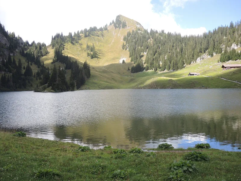
After the alpine meadows, the Oberstockenalp inn is the first stop. From there the landscape changes: the path goes through open fir forest, passes karst fields and reaches the Hinterstocken alp and its lake, the Hinterstockensee. A short climb then brings you to Chrindi. Along the way you pass a few posts of the nature trail « Lebensräume am Stockhorn » (habitats on the Stockhorn); its leaflet is free at the valley station.
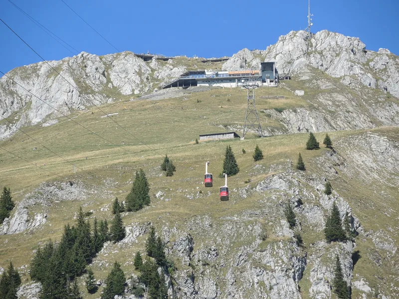
A building site stopped by the Confederation
The cable car company was founded in 1963 and building started the same year. A federal decree halted it at once: from 1964 to 1967, the valley station, the middle station and the pylons of the first section stood ready, but the cable had to wait. The first section opened in 1968, the second in 1969. At the top there was only an old mountain inn with about twenty places.
In the early 1970s the company was over-indebted and had to be refounded. The Stockhorn restaurant opened in the 1970s, and the panoramic platform in the north face was built and opened in 2013 and 2014. In 2018, after exactly 50 years, the first section, between Erlenbach and Chrindi, was completely overhauled.
Limestone, karst and ibex
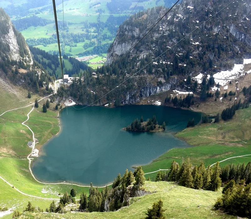
Under your feet are mostly limestones and marls of the Préalpes médianes, the middle Prealps, largely from the Late Jurassic and the Cretaceous. In the last part, the path enters a hollow that the geological map marks as a depression with no surface outflow, where scree alternates with limestone, with patches of moraine left as the glaciers retreated after their last great advance. The Hinterstockensee lies at the bottom of this hollow.
At the lake, you'll often see anglers trying to land a rainbow trout. And on 2 May 2022, the first ibex were released in the Stockhorn area to found a colony.
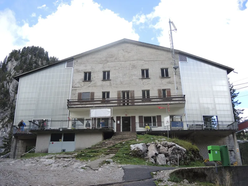
Chrindi, the middle station
Chrindi is the middle station: the upper line climbs to the Stockhorn, the lower one goes down to Erlenbach. The Chrindi restaurant, at the station, was extended between 1982 and 1985. The trail around the Hinterstockensee opened in 1989; in 2016 and 2017, the company started renting out all-terrain wheelchairs at Chrindi, for the « No Limits » lake circuit trail.
To get back, take the cabin down to Erlenbach, or ride back up to the Stockhorn. Further down the page you'll find where to eat and how to get home.
Every way to Mittelstation Chrindi
2 starting points to reach Mittelstation Chrindi. Pick yours: the 3D view shows it and “My day” recalculates.
Walking times without breaks. “Estimated” times are calculated on the terrain profile with a model fitted to the official stages; the shortest path may differ from the one on the yellow signposts: on the ground, follow the signs. Gradient: the steepest over 200 m of trail. Profiles share the same scale (length and altitude). Stations and car parks within 500 m of the start.
In pictures
The Hinterstockensee and the Cheibenhore
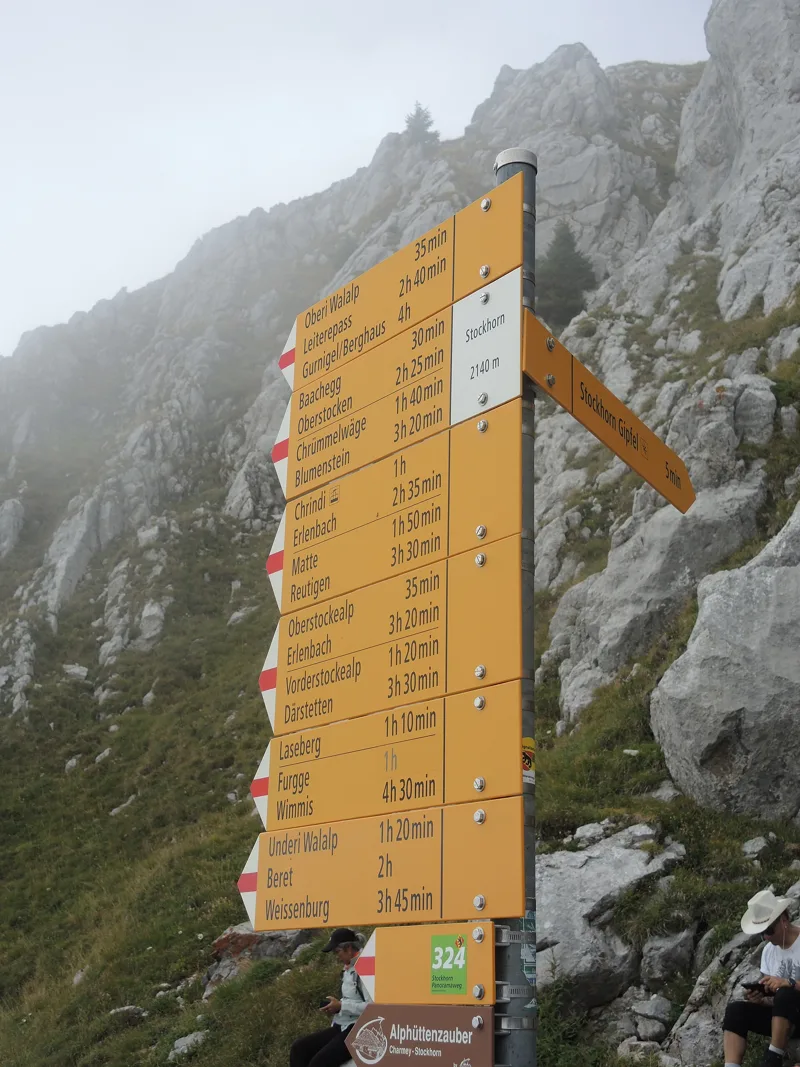
Hiking signpost on the Stockhorn, near the cable car's top station
Upper section of the Stockhorn cable car and its top station
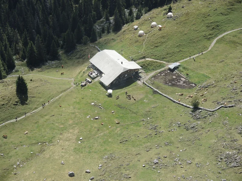
The Oberstockenalp seen from the Strüssligrat
Walpersbergflue and Mieschflue with Chrindi and the Hinterstockensee, seen from the Strüssligrat
The Hinterstockensee in spring, seen from the Stockhorn cable car
Hiking signpost at Hinterstockenalp
Chrindi, middle station of the Stockhorn cable car
Cabin of the upper section, between Chrindi and the Stockhorn
Hiking signpost at the Oberstockenalp
What you see from the top
360° view from Stockhorn (2,137 m). 38 named peaks, including Mont Blanc, 108.8 km away. Swipe to look around.
Stockhorn-Panoramaweg: when to go
Public transport serves the start every day until 23 November 2026, from 14 December 2026 to 21 March 2027 and from 24 April 2027, according to the official timetable. The latest time to set off ranges from 19:15 in June to 14:32 in December.
- Public transport to the start
- daily, 14 Dec to 28 Feb
- 15 arrivals a day
- first arrival 9:10
- last 16:10
- Sun at the start, mid-January
- from 8:30
- rises at 8:10, hidden by the ridge
- Leave by, for 1 h 10 of walking
- 14:58
- arrive 1 hour before sunset, at 17:08
| Month | Sun at the start | Leave by | In the sun, leaving at 9:00 | Transport |
|---|---|---|---|---|
| December | 8:28 → 16:42 | 14:32 | 82 % | 18 of 31 days |
| January | 8:30 → 17:08 | 14:58 | 79 % | every day |
| February | 7:54 → 17:54 | 15:44 | 82 % | every day |
“In the sun”: the share of the path in sunlight under a clear sky, with the terrain worked out point by point. The path climbs to 2,137 m: today's snow and frost are in the weather and My day.
- Public transport to the start
- daily, 24 Apr to 31 May
- and also 21 other days
- 15 to 17 arrivals a day
- first arrival 8:10 or 9:10
- last 16:10
- Sun at the start, mid-April
- from 7:07
- rises at 6:43, hidden by the ridge
- Leave by, for 1 h 10 of walking
- 18:07
- arrive 1 hour before sunset, at 20:17
| Month | Sun at the start | Leave by | In the sun, leaving at 9:00 | Transport |
|---|---|---|---|---|
| March | 6:53 → 18:35 | 16:25 | 88 % | 21 of 31 days |
| April | 7:07 → 20:17 | 18:07 | 91 % | 7 of 30 days |
| May | 7:10 → 20:57 | 18:47 | 94 % | every day |
“In the sun”: the share of the path in sunlight under a clear sky, with the terrain worked out point by point. The path climbs to 2,137 m: today's snow and frost are in the weather and My day.
- Public transport to the start
- every day
- 17 arrivals a day
- first arrival 8:10
- last 16:10
- Sun at the start, mid-July
- from 7:27
- rises at 5:51, hidden by the ridge
- Leave by, for 1 h 10 of walking
- 19:10
- arrive 1 hour before sunset, at 21:20
| Month | Sun at the start | Leave by | In the sun, leaving at 9:00 | Transport |
|---|---|---|---|---|
| June | 7:26 → 21:25 | 19:15 | 97 % | every day |
| July | 7:27 → 21:20 | 19:10 | 97 % | every day |
| August | 7:12 → 20:41 | 18:31 | 91 % | every day |
“In the sun”: the share of the path in sunlight under a clear sky, with the terrain worked out point by point. The path climbs to 2,137 m: today's snow and frost are in the weather and My day.
- Public transport to the start
- daily, 1 Sept to 23 Nov
- 17 to 18 arrivals a day
- first arrival 8:10
- last 16:10 or 16:40
- Sun at the start, mid-October
- from 8:03
- rises at 7:47, hidden by the ridge
- Leave by, for 1 h 10 of walking
- 16:34
- arrive 1 hour before sunset, at 18:44
| Month | Sun at the start | Leave by | In the sun, leaving at 9:00 | Transport |
|---|---|---|---|---|
| September | 7:28 → 19:43 | 17:33 | 88 % | every day |
| October | 8:03 → 18:44 | 16:34 | 73 % | every day |
| November | 7:50 → 16:57 | 14:47 | 85 % | 23 of 30 days |
“In the sun”: the share of the path in sunlight under a clear sky, with the terrain worked out point by point. The path climbs to 2,137 m: today's snow and frost are in the weather and My day.
The next few days
Local forecast, updated every hour
Reading the forecast…
My day
Pick your day and start time: everything updates.
- Arrival at Mittelstation Chrindi
- 09:40 1 h 10 of walking without breaks, starting at 08:30
The trail, kilometre by kilometre
From Stockhorn
Places are listed under the kilometre where you pass them. Drag along the profile: the marker moves on the 3D view too.
- under 10 %
- 10 to 20 %
- 20 to 30 %
- over 30 %
- fountain or water point
- toilets
Around the trail (250 m): 2 restaurants, 3 fountains and water points and 4 toilets. Estimated time: the official walking time spread by effort (1 km on the flat counts as 100 m of climbing), start time set in “My day”.
- under 10 %
- 10 to 20 %
- 20 to 30 %
- over 30 %
- fountain or water point
- toilets
Around the trail (250 m): 2 restaurants, 4 fountains and water points and 4 toilets. Estimated time: the official walking time spread by effort (1 km on the flat counts as 100 m of climbing), start time set in “My day”.
Getting there and back
Back by public transport from the Chrindi stop
Next departures from ChrindiReading the official timetable…
By car
From Stockhorn
Careful, this is one way: public transport back arrives in Chrindi, not in Stockhorn. Plan to get back to your car by public transport, or park at the finish and take public transport to the start.
Public car parks within 600 m of the start: prices and number of spaces may have changed, check the signs on site.
Careful, this is one way: public transport back arrives in Chrindi, not in Erlenbach. Plan to get back to your car by public transport, or park at the finish and take public transport to the start.
- Car park20 m from the start
- Station Erlenbachor by public transport0 m from the start
The nearest car park and stop for this start. Check the signs on site for the price.
Questions people ask
How long is the hike from Stockhorn to Mittelstation Chrindi?
1 h 10 of walking (official time), in this direction, not counting breaks. The other way: 1 h 40.
Is it hard?
Official rating for this stage: fitness medium, technique medium. It is 540 m of descent over 3.4 km.
Can I get back by public transport?
Yes. The Chrindi stop is at the finish. The next departures show live under “Getting there and back”.
Where can I eat on the way?
2 places to eat within 250 m of the trail: Stockhorn Panorama Restaurant, Berggasthaus Oberstockenalp. Where they are and their opening hours: below the profile.
Is there water and are there toilets on the way?
3 fountains and water points and 4 toilets within 250 m of the trail (survey of 25/10/2026).
Can I download the track?
Yes, as a GPX file for your watch or map app: “Download the track” button at the top of the page.
More hikes within 10 km
Official stages that pass within 10 km of this trail. Each card says whether its page is already up.
- Oey-Diemtigen → Grimmialp4 h 30Diemtigtaler Talwanderweg16.0kmDistance700mAscent130mDescentTechnical easyFitness medium. Official waymarked stage
- Oey-Diemtigen → Diemtigen, Riedli3 h 20Tschuggen-Alpwanderweg10.0kmDistance720mAscent400mDescentTechnical easyFitness medium. Official waymarked stage
- © swisstopoSpiez → Wattenwil6 h 00ViaJacobi, stage 1123.0kmDistance560mAscent520mDescentTechnical easyFitness difficult. Official waymarked stage
- Weissenburg → Oberwil2 h 00Leiternweide-Hängebrückenweg6.0kmDistance380mAscent320mDescentTechnical mediumFitness easy. Official waymarked stage
- Gurnigel, Berghaus → Wattenwil2 h 55Gürbe-Wildwasserweg11.0kmDistance50mAscent1,050mDescentTechnical mediumFitness difficult. Official waymarked stage
- © swisstopoSpiez → Thun3 h 50Panorama Rundweg Thunersee, stage 414.0kmDistance340mAscent340mDescentTechnical easyFitness medium. Official waymarked stage